Day 2: Bangkok

Jet lag mostly gone, we woke up this morning and had a lovely breakfast outside at the Peninsula’s riverfront restaurant. I caught up briefly with the hotel’s manager, a former colleague from Chicago, discussing his move to Bangkok two years ago and what it was like to live and work here. After breakfast, we studied a few maps, planned our day’s route, and set off for the Grand Palace.

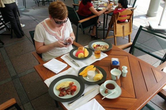
Fantastic breakfast with some of the most delicious mangoes we've had

The Peninsula has a ferry to shuttle guests across the Chao Phraya river; from connecting piers one can connect to the Skytrain or water taxis. Last time we visited Bangkok when we were deposited on the public pier to pick up the water taxi, if it had not been for a nice tourist telling us which boat to take, we might still be waiting there. No helpful maps or English signage on these little piers whatsoever! This time we were much more confident and successfully hopped aboard the Chao Phraya express boat bound for the pier nearest the Grand Palace.

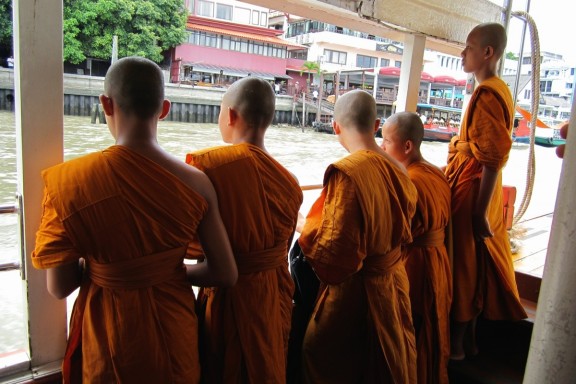
Monks watching the view from water taxi

There is a well-known scam in Bangkok where tourists, as they approach the Grand Palace, are told it is closed for the day and are offered trips to see other temples (which are disguised as trips to jewelry stores). Three years ago, there was a 50-50 chance the Palace was actually closed because a high-ranking Malaysian official was in town…or it was open as usual and we fell for the scam, because we never made it inside.

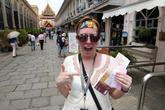
This time we were determined to get to the entrance gate without listening to a single person, and after meeting a couple from the UK also headed there, we successfully managed to get in. Public announcements at the gate loudly informed us that yes, the Palace was open every day, and no, do not trust anyone who tells you otherwise! Matt, however, was slightly disappointed that not one person tried to tell us the Palace was closed. 🙂

Well, look at that - we got in!


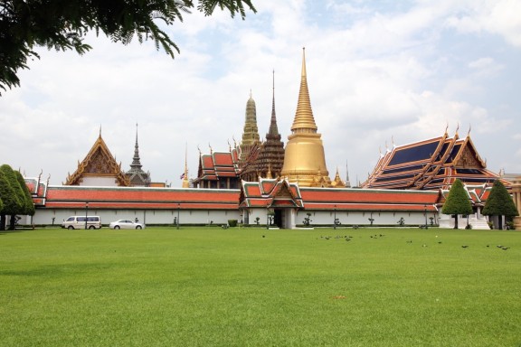
Grand Palace complex as seen from entrance gate

Established in 1782, the Grand Palace complex consists of the one-time royal residence, throne halls, government offices, and the famous Temple of the Emerald Buddha. Developed over 200 years, the Palace showcases many eclectic styles and is massive in scale, covering 218,000 square meters. Since 1925 the King and the Royal Family have not lived on the grounds, however, the Palace is still regularly used for official events, royal ceremonies, and state functions.

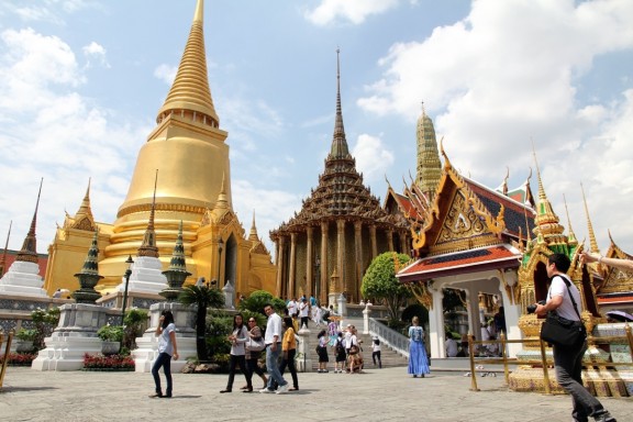
Grand Palace structures


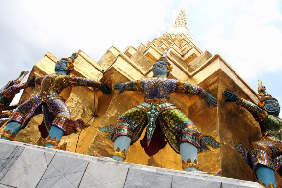
Matt posing with the statues

We toured a large section of the grounds, although not every hall was open to tourists, nor could photographs be taken inside most of the temples. The Temple of the Emerald Buddha was one of the most elaborate, golden, sparkliest, ornate temples we have seen, and we were amused to learn that the Emerald Buddha (in fact carved from jade) has three different ‘outfits’ for rainy/summer/winter seasons, which are changed in an official ceremony presided over by the King.

Incredible detail on everything


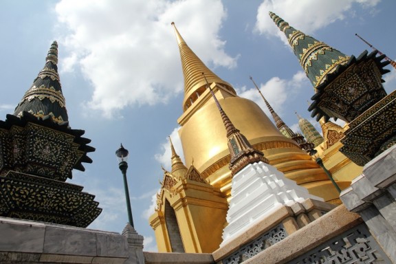
Phra Siratana Chedi in the background


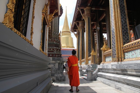
Monks touring the grounds


Phra Siratana Chedi stands out in all its golden-ness

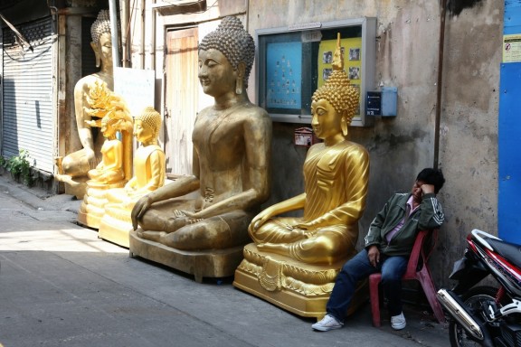
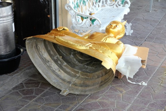
After stopping to rest and rehydrate (weather was, predictably, HOT AND HUMID), we left the Palace and walked east into the city toward an intriguing spot on our map labeled “Giant Swing”. Although we discovered the Giant Swing to be out of commission, along the way we observed store after store selling all manner of sizes of Buddhas, floral wreaths, and ceremonial offerings.

Napping with the Buddhas


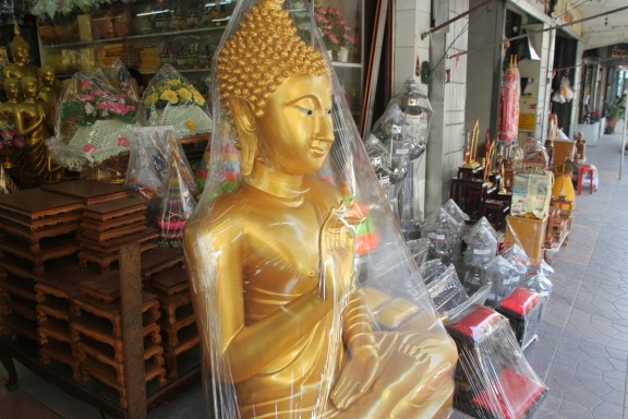
Posing in plastic


You mean they're not solid gold?

On we walked until we reached MBK Center, a gigantic eight-story, 2000-store mall where we had a lot fun shopping the last time we visited. We stopped by the huge food court for a mango-passion fruit-pineapple smoothie, then wandered through the sixth-floor bazaar loaded with Thai souvenirs, clothes, and trinkets where I successfully haggled for the Thai-style pants I wanted. A sign advertising Thai massages for ~$12/hour was too irresistible to pass up, so we stopped by a lovely spa for a little pampering.

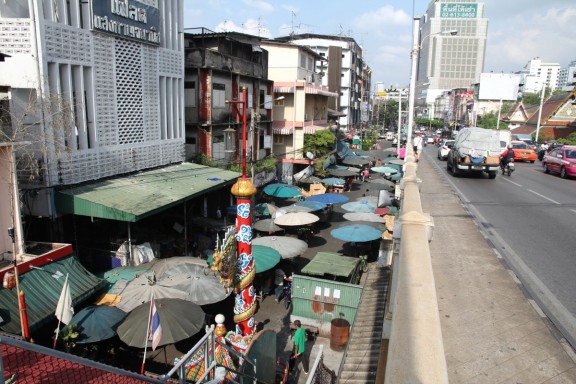
Walking to MBK (lots of food stalls set up below)

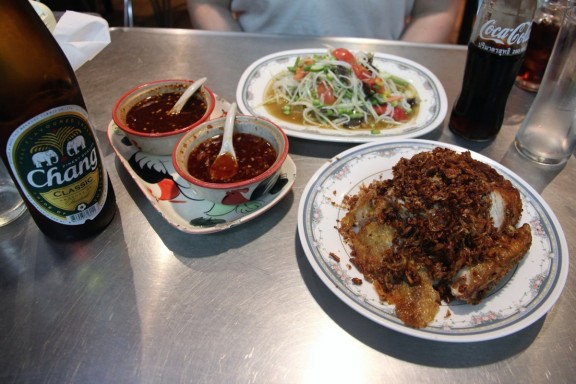
Dinner was at Soi Polo Chicken, an awesome restaurant we found last visit that was so delicious we had to return. We took the Skytrain to Lumphini Park, a beautiful green space in the middle of skyscrapers and crazy traffic, and used our memory to navigate our way back to the restaurant. The food was as good as we remembered – crispy chicken showered in fried garlic, sticky rice, and spicy som tum sua, green papaya salad with salted crab and Thai noodles. A fantastic meal for a crazy-reasonable $11.

Garlicky chicken, papaya salad, chili sauce to drench it all in, and Chang beer

Sweaty, tired, and pleased with the day’s events, we caught the ferry back to the Peninsula, took a swim in the beautiful pool, and called it a night.
Day 1: Bangkok

Here we go again! Matt and I are off on another Asia adventure; this time we’re traveling through Thailand (Bangkok), Cambodia (Phnom Penh and Siem Reap), and Hong Kong. Day one is all travel: Chicago-Hong Kong-Bangkok, with the gorgeous Peninsula Bangkok waiting for us at the end of our long day.

Trip itinerary


Free wi-fi at Hong Kong International Airport!


Entering Thailand!


Waiting to catch a taxi at Suvarnabhumi

We love comments! To leave them, click on the particular day’s post and look for the window at the bottom of the screen.

Enjoy the blog!

Day 15: Anchorage

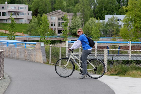
We woke up on our last day in Alaska to a beautiful blue-skied morning. Matt’s parents went to visit the Alaska Native Heritage Center, which provides an introduction to Alaska’s native people through interpretive displays, artifacts, photos, demonstrations, dances, storytelling, and films. Matt and I opted instead to bike along Anchorage’s Tony Knowles Coastal Trail, running 11 miles along the coast of Cook Inlet. After another delicious breakfast, we walked over to Pablo’s Bike Rental to pick up mountain bikes and a map.

Pablo (in the background) is not responsible if we get stomped by a moose on the trail


22 miles in three hours - can we do it?

The path was surprisingly quiet for a Saturday morning; there were a few other bikers and joggers around, but overall, we had the trail to ourselves. Keeping our eyes open for wildlife, we referred to the map for descriptions of various landmarks along the way. We stopped at Earthquake Park to read about the 1964 Good Friday earthquake; the biggest ever in North America at a magnitude of 9.2, it killed 131 people and flattened much of the region. The park is the site where the quake caused huge tracts of land to slide into Cook Inlet, destroying many homes; the majority of the deaths occurred due to the resulting tsunami that devastated Valdez and nearby coastal towns of Seward, Kodiak, and Chenega.

Ears back? You've angered the moose.


Commemorative sculptures and interactive displays explain the earthquake and its aftermath

The coastal trail runs past Anchorage’s Ted Stevens International Airport; at one point a jumbo jet flew so low over us that I actually ducked. 🙂

Part of the runway alignment system


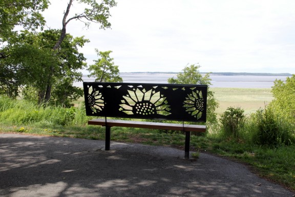
Neat bench design

The Anchorage Lightspeed Planet Walk runs from downtown to Kincaid Park at the end of the coastal trail; a scale model of the solar system, each station has a 3-D representation and information on the unique features of each planet. It is designed so a leisurely walking pace mimics the speed of light, i.e. the eight minutes it takes you to walk from the Sun station to the Earth station equals the eight minutes it takes for a light beam to travel from the sun to Earth. Similarly, it takes you and a light beam 5-1/2 hours to reach Pluto at Kincaid Park. When we passed Neptune we figured the trail end was near, but when the last half-mile of the trail turned out to be totally uphill, I gave up and let Matt ride ahead in search of Pluto. I rested in the grass until he returned, exhausted and disappointed in the lack of a Pluto station. Perhaps the project designers subscribe to the theory that Pluto is not a real planet after all.

They may have deep-sixed Pluto because Matt couldn't find it on the trail


Biking back toward downtown Anchorage

It took us just over 90 minutes of our three-hour rental time to make it to the end of the trail; the return trip was a little faster and we arrived back downtown about ten minutes early. We chatted for a while with Pablo and his brother about how they ended up in Alaska and how Pablo quit his job in the dull office building across the street and now greets his old coworkers when they look out the windows. Thankfully, they also convinced us to try their mother’s-secret-recipe smoked salmon quesadilla.

Returning the bikes


This was so delicious we went back later and had another one for dinner. YUM.

Posing with Pablo - Alaska's state flag painted on side of his trailer

On summer weekends, Anchorage has an enormous open-air market featuring over 300 vendors offering Alaskan-made crafts, ethnic imports, clothing, jewelry, music, and all sorts of food. Walking through downtown toward the market, we stopped to watch a live music performance and check out a few gift shops.

I did not see any live bears in Alaska, but this one was happy to pose with me.


We saw several excellent hula-hoopers around town

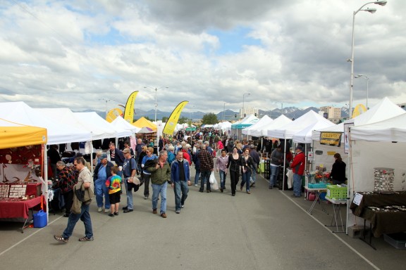
At the market, we wandered through the booths, admiring the beautiful art pieces and other crafts. It was crowded; occasionally an announcement came over a loudspeaker welcoming the arrival of another tour bus. We bought some locally-made tea and delicious kettle corn before meeting back up with Matt’s parents.

Anchorage's popular summer market


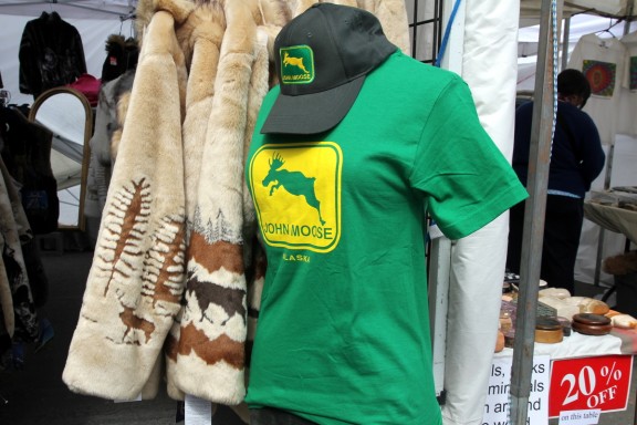
Took me a minute, but I was highly amused by this t-shirt


Live music and goofy shop names

After a quick stop back at the bike rental place for another smoked salmon quesadilla, we headed back to the guesthouse to get packed up. Matt and I walked to the nearby park for a few more holes of disc golf, then we said our goodbyes to Carly and left for the airport to catch our 11:30 PM red-eye back to Chicago. Matt’s parents leave tomorrow for a week in Denali National Park – here’s hoping for some clear views of Mount McKinley!

Alaska Airlines = good airline!

My Alaska highlights: sea kayaking and delicious halibut in Homer, disc golf and a beautiful bike ride in Anchorage, stunning glaciers and darling otters in Whittier, the moose who was kind enough to make an appearance even though all the bears stayed hidden, and spending so much lovely time with Matt’s parents, who I don’t see nearly enough. Rick and Mary, thanks for letting us tag along on your trip – it was fantastic. 🙂

Day 14: Whittier

Today’s agenda called for a timely wake up and departure from the Parkside Guest House in Anchorage to drive to Whittier and embark on a day cruise in the western reaches of Prince William Sound. The “timely” factor was largely because there is a giant 2.5 mile tunnel that one must pass through in order to drive to Whittier, and the railroad only opens it for inbound traffic 15 minutes every hour (on the half hour). Hence, we did not want to miss our boat waiting 45 minutes for the next tunnel opening.

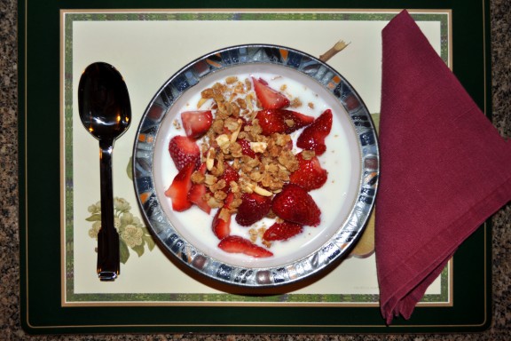
After enjoying another fantastic breakfast of granola and berries, we threw on a couple extra layers, grabbed our gloves and jackets, and piled in the van for the 90-minute drive to Whittier. We left about 30 minutes before the hard 8:30AM departure time Dad declared the night before, which put a smile on everybody’s face.

Heading south on Highway 1, the weather was mostly cloudy, with a few pockets of sun, but no rain. Rather than continue south on Highway 1 into the Kenai Peninsula, we turned at Portage Glacier Road and headed east for a couple miles until we approached the entrance to the Anton Anderson Memorial Tunnel.

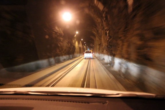
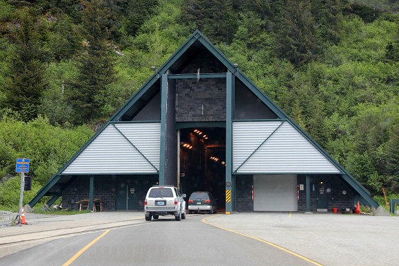
Longest highway tunnel in North America at 2.5 miles


Opened for one-way vehicle traffic in June 2000

Expecting to wait for an opening, we were pleasantly surprised when we found the tunnel was currently allowing traffic to proceed to Whittier as we arrived (the 9:30AM opening). After paying the $12 toll, we rolled on through. The inside of the tunnel is just one lonely lane for everybody — cars and trains. The inner walls are still exposed rock, but jet turbine engines near the start and end of the tunnel illustrate the technological improvements over the years.

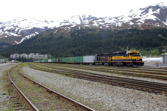
Train waits on opposite end of tunnel; abandoned Buckner army building sits in the distance

The port of Whittier was constructed under the supervision of the Corps of Engineers in 1942-43 to provide an all-weather terminal for the Alaska Railroad. During World War II, Whittier served as an all-weather railroad port that safeguarded the flow of military supplies, equipment, and personnel from tidewater to Anchorage and Fairbanks. The town — finally incorporated from an army base in 1969 — is still owned and operated by the Alaska Railroad and the Department of Defense. The entire town basically lives in one condo development (the Begich Towers, aka. the “city under one roof”, originally built in 1953 as a barracks).

Having arrived and checked in plenty early for our 12:30PM boat trip, we decided to explore Whittier on foot, including the nearby waterfalls, the train yard, the small boat harbor and a bunch of gift shops. If we had not been promised food on the boat, we would have most certainly tried the Kung-Pao Halibut available in one local eatery.

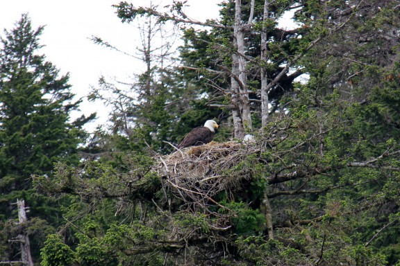
This eagle's nest is a permanent attraction in Whittier


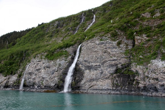
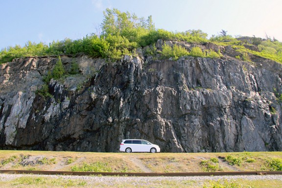
The area's geology is dominated by slate bedrock

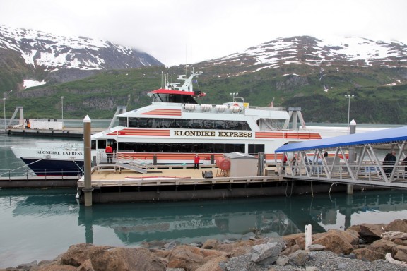
Eventually, it was time to board the ship, dubbed the Klondike Express. According to the tour company, it is the “fastest, most luxurious catamaran in Alaska.” I am dubious about this bit of puffery considering there are plenty of boats in Alaska, and the ship’s interior is basically a floating Denny’s. But don’t get me wrong, it was pretty nice.

By the time the boat finished boarding we were joined at our six-person table by a guy from Australia who was on vacation and another guy from Mexico who was on leave from his fishing job in Alaska due to injury. We were served a lunch of fish and chips as the boat pulled out of harbor and into open waters.

There has to be a faster catamaran somewhere in Alaska, right?


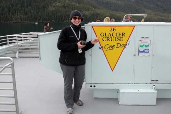
This tour is the "26 Glacier Cruise"... and there are, in fact, 26 glaciers

On our way out of Passage Canal into Prince William Sound, we sailed by a pod of Dall Porpoises who playfully swam right alongside the boat for several minutes, breaching the surface and diving back under the bow over and over.

Porpoise swims next to the boat

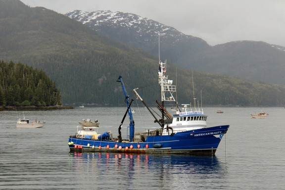
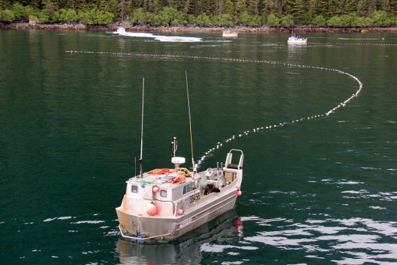
We sailed west beneath Esther Island and turned north through Esther Passage. The U.S. Forest Service Ranger on the boat described this area as ground zero of the salmon fishing industry (at least during this time of the year), as evidenced by an estimated 40-50 fishing boats in the vicinity. As a former fisherman himself, Ranger Jim offered some great play-by-play of the fishing methods on display.

Esther Passage fishing frezy


Long-net fishing method used by most boats in the area

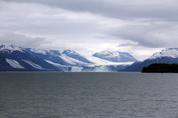
Upon our exit from Esther Passage, the cruise veered to the northeast and took a look at College Fjord, which derives its name from the fact that a couple of east coast exploring buddies who charted this area decided to name all the glaciers after universities (ie. Harvard, Yale, Dartmouth, Bryn Mawr, Wellesley, etc.)

Harvard Glacier (center) is the main attraction in College Fjord


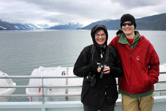
Chilling with Mom and the glaciers

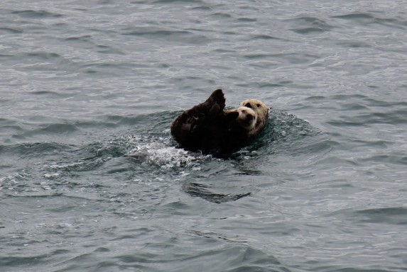
In addition to glaciers, the most common thing we saw on our day cruise was sea otters. We sailed by one large pod of otters in College Fjord that was at least a hundred or so in size. With their trademark floating-on-the-back posture, they look amusingly curious as Alaska’s fastest and most luxurious catamaran passes them by.

Mother clutches pup and prepares to dive as the boat approaches

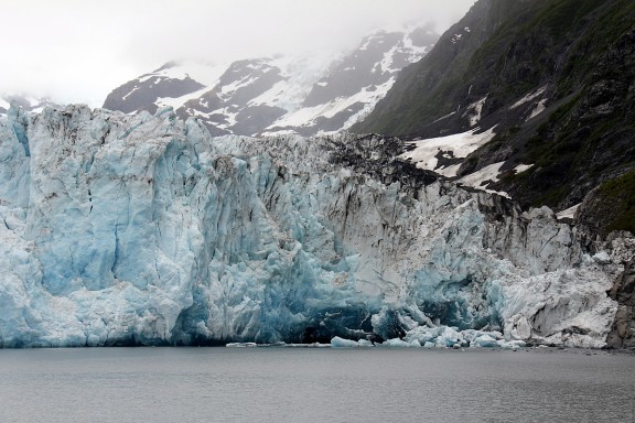
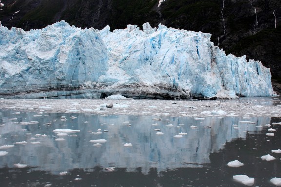
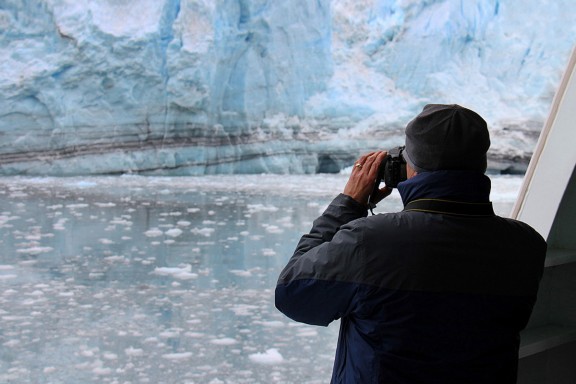
Exiting College Fjord, we turned to the northwest and ventured into Barry Arm, which then curved west into Harriman Fjord. Halfway into the fjord, we pulled up close and personal with the terminus of Surprise Glacier. Given that our Glacier Bay cruise stopped about four miles short of a glacier terminus, getting to within a couple football fields of this tidewater glacier was extremely cool. We saw several small chunks of the glacier calve during our 15-20 minutes in the area.

Many shades of blue ice


Cracks in the ice prompt calving


Mmmmm, there's a chocolate swirl in this glacier


The most impressive thing in Alaska so far

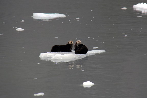
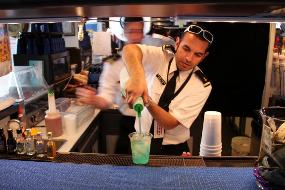
Near the glacier, there was plenty of ice floating in the water. First, this offered a chance for some otters to take a breather. Second, it provided the crew an opportunity to fish out a chunk of glacier ice (they actually did) and market a new drink at the bar — the authentic glacier ice margarita.

Otters on ice


Yeah, we bought a glacier ice margarita. And it was good.

After Surprise Glacier, we turned around and headed out of Barry Arm, taking in another trio of glaciers on the way (Cascade, Barry and Coxe). Impressive, but not as cool as Surprise Glacier. In order to not risk further glacial desensitization of his passengers, the captain sailed us back through Port Wells and into Passage Canal toward Whittier. We made one final pit stop at the Kittiwake Bird Rookery across the canal from Whittier, where thousands of Kittiwakes were nesting on the Cliffside.

Sometimes an Eagle crashes the party, but Kittiwakes have safety in numbers

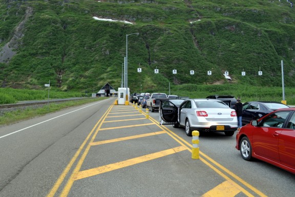
After the boat docked, we quickly made our way to the van and queued up for the 6PM tunnel opening to depart Whittier. Not long after that, we completed our second 15-minute drive thru Maynard Mountain and continued up Highway 1 toward Anchorage. There was a ton of RV and truck traffic heading the other direction, probably because it was Friday afternoon and everybody in Anchorage goes to the Kenai Peninsula to hang out for the weekend.

Lining up to leave Whittier


Tasty the second time too

Back in Anchorage, we made a second appearance at McGinley’s Pub for dinner, and returned to the Guest House. Since it feels like 5PM up here even when it’s closer to 9PM, Nicole and I walked down to the disc golf course and played a round of post-dinner disc golf. After that, we were finally prepared to check in for the night.
Day 13: Anchorage

Note: The blog is almost caught up — Days 12 and 13 posted today…

After another delicious breakfast at the Parkside Guest House, we decided to drive north to the Matanuska-Susitna (Mat-Su) Valley and visit the cities of Wasilla and Palmer.

Back to the awesome Parkside breakfasts

An hour drive north of Anchorage, the Mat-Su Valley gets its name from its two largest rivers and is bisected by the Parks and Glenn highways.

North to Wasilla and Palmer

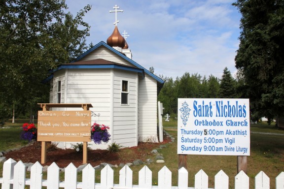
On the way, we stopped at Eklutna Historical Park — in the “blink-and-you’ll-miss-it” native village of Eklutna — to visit a cemetery in which each grave is enclosed by a highly decorated “spirit house” the size of a large dollhouse. This unique practice evolved from the melding of Athabascan and Russian Orthodox beliefs.

Yes we did. You are welcome.


Each spirit house was decorated different than the others

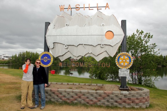
Our stop in Wasilla (home of Sarah Palin, for you non-politicos) was mostly just to say we were there; at a local park we posed for pictures in front of the city sign and noted the Iditarod Trail Headquarters.

Matt feels a general sense of exasperation in this city

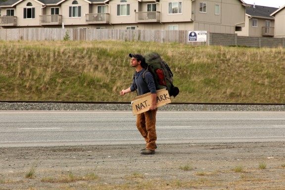
Lots of hitchhikers around; our minivan had room for two or three, I suppose

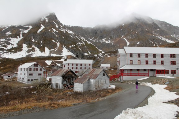
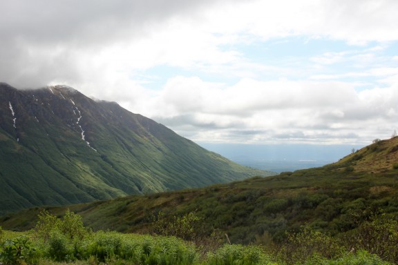
Forty miles northeast of Anchorage lies Palmer, a charming city that is one of Alaska’s major agricultural regions, thanks to its rich soil and long hours of summer sunlight. Looking for 100-pound cabbages? This is your place. Home to the Alaska State Fair, a musk ox farm, and an old gold mine, Palmer is lined on both sides by the Chugach mountain range. We drove up winding Hatcher Pass Road to Independence Mine State Historical Park, home to a long-dormant hard-rock gold mine that operated from 1938-51. Set in a “bowl” of rock and arctic tundra, the mine is built up into the hillside in a rather picturesque manner; we didn’t take the self-guided tour, but did stop to get some pictures.

Still some snow up here at Independence Mine


View from the east end of Hatcher Pass Road

Our next stop was the Palmer Visitor Center, where we talked to local guides about the city’s history and I browsed through a local cookbook offering recipes for moose, walrus, and salmonberry preparations, as well as the ubiquitous recipe for tater-tot casserole that seems to make an appearance in every one of these kind of cookbooks no matter where they’re from.

Mary getting some local historical information at the Palmer Visitor Center


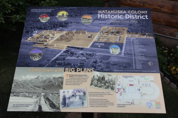
All about the Matanuska Colony

Lunch was at the In and Out Deli, a deli/grocery store recommended by one of the visitor center employees. Once fed, we drove back to Anchorage, bypassing Palmer’s animal refuge center even though I was running out of time to see a bear and could have done so here. (Would have felt like cheating anyways)

Recommended for its delicious sandwiches, the In and Out Deli did not disappoint

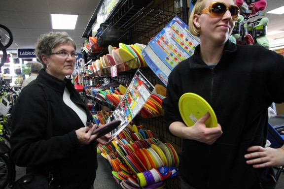
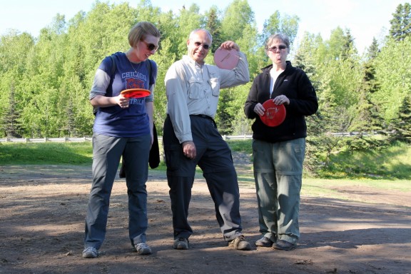
Matt had seen a disc-golf course in the park on our first night in Anchorage, and he convinced the rest of us to go buy discs and try it out. After deeming the discs at REI too expensive, we ended up at Play It Again Sports, where we learned that serious disc-golf players have separate discs for short/mid/long distances. We decided to start small and settled on one disc for each of us, choosing two short and two mid-distance ones.

45 minutes to pick out four discs. You'd think we were disc golf pros.

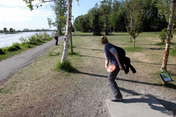
At Westchester Lagoon Park, there is a nine-hole disc golf course that is free to all. There are four courses found throughout Anchorage. Disc golf is incredibly popular here; it is played by hurling a smaller-than-a-Frisbee disc toward a basket, aiming for the fewest possible throws to get it in. Each hole averaged 250-300 feet, with tree and water hazards. After a few practice throws, we got down to business; it was harder than it looked, and it was fun to watch the other, more experienced players show off their skills.

It takes a special kind of skill to land your disc IN the tree.


All I cared about here was not throwing my disc into the lake.


This photo was better than the group shot taken moments later

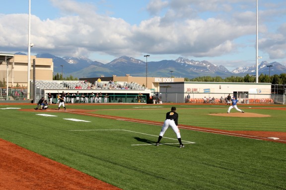
Reading the guidebooks, I learned that Anchorage had two summer collegiate baseball teams; after a quick Google search we discovered that the Anchorage Bucs were playing an evening game and decided to check it out. Matt’s parents dropped us off at Mulcahy Stadium, where we paid $5/ticket and took our seats directly behind home plate.

Best seats we'll ever get for five bucks


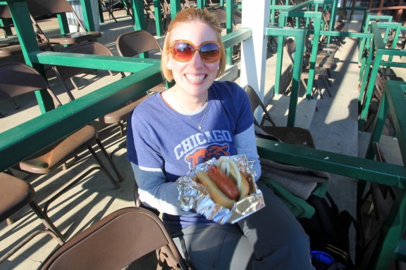
Reindeer sausage!

The crowd was small but pretty invested in the game, and we enjoyed the sunshine while rooting for the home team. Some well-known major leaguers have played for Anchorage’s two summer teams in the past: Mark McGwire, Dave Winfield, Randy Johnson, and Reggie Jackson, to name a few. The Bucs won handily, and we walked back to the guesthouse around 10 PM.

Baseball with a mountain backdrop


All alone in our section


Another beautiful sunset - note the time

Day 12: Homer/Anchorage

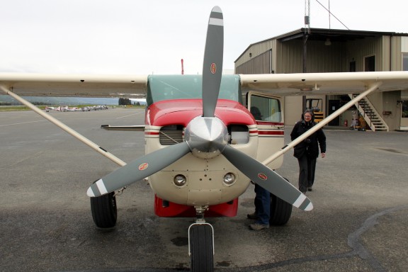
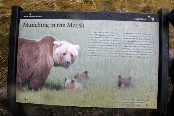
This morning Matt’s parents left early for their bear sightseeing excursion and after a slight weather delay, they boarded a tiny plane for the 35-minute flight to Lake Clark National Park located west of Homer across Cook Inlet. The weather was rainy, but after a beach landing (note the plane’s large, slightly under-inflated tires) and short walk, they viewed numerous bears grazing and walking through the marsh.

"Take us to the bears, please."


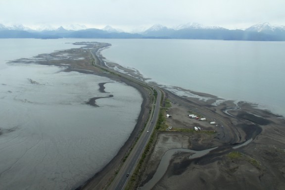
Aerial view of Homer Spit


Brown bears grazing in the marsh


They did see some bear cubs as well

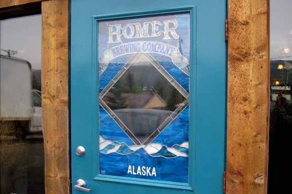
While Rick and Mary were out bear-viewing, Matt and I decided to do a little on-foot sightseeing. The Homer Brewing Company, located on the shore of Beluga Lake, was a 30-minute walk from our hotel. Matt sampled two of their offerings that he had not yet tried, as well as my two free samples (I am not a beer fan), and purchased a pint glass to take home.

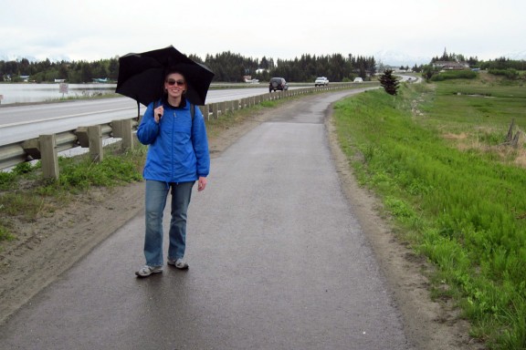
The only day we needed the umbrellas


Much smaller than the brewery in Juneau - their distribution is local only.


Our version of bear-viewing, complete with puffin, top hat, and banjo

After picking up some Alaskan-made salmonberry jam for my dad and making a pit stop at the post office, we walked back and had lunch at the Cosmic Kitchen, a eclectic little diner recommended by our water taxi driver. We sat outside and shared a delicious halibut caesar wrap while we waited for Rick and Mary to return from their trip.

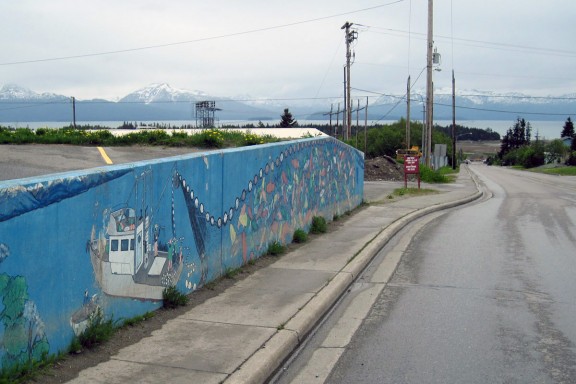
Cool fishing mural


Recommended as "best-kept secret in Homer"


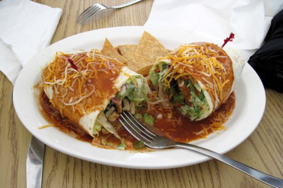
One more meal featuring halibut before we leave Homer

After Matt’s parents returned, we jumped in the minivan and stopped by the Pioneer Inn to pick up our bags. Then we hit the road for the 220-mile drive to Anchorage. Oh, but first we stopped at the local McDonald’s to settle Matt’s bet with his mom re: the price of an ice cream cone. Matt won and we discovered McDonald’s will dip your cones in chocolate here a la Dairy Queen. Nice.

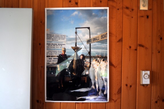
One last look at Amy and Rich (Pioneer Inn owners) in 1991 with the 85-lb halibut they caught


We got a late checkout, but missed the owners to say goodbye


Driving back through Kenai Peninsula


North on Highway 1

Back in the glorious luxury of the Parkside Guest House, we chatted a while with Carly about Homer and went to dinner at the FireTap Alehouse (thanks again, Paul, for the giftcard!). Over pizza and local Moose’s Tooth beer, we made plans for the next few days in Anchorage.

Alaskan Blues

Day 11: Homer

(THE WRITER RETURNS! 🙂 I’ll share writing duties with Matt for the last few days of the trip so we finish the blog before we forget everything we did. As of today, three new posts are up: Days 9, 10, and 11!)

This morning we had our supermarket cereal breakfast before driving to the Spit where Matt and I would depart on our half-day kayaking trip with True North Adventures. We dressed in layers anticipating a dreary day on the water, but the weather was sunny and pleasant, if a bit windy.

Blue skies with cirrus clouds and no rain on the Spit


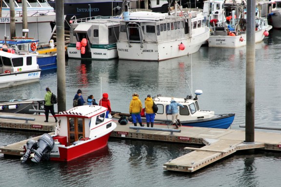
After checking in and signing a waiver that held us responsible if we got swept out to sea, we met our guide, Marin, and got suited up. The six of us on the trip were provided rain jackets, pants and boots. Once dressed, we walked down to the pier to wait for our water taxi. The boat that pulled up was comically tiny; Marin told us that it had been custom-built for its former 4’11”-tall owner. It was at this point that I wondered if I should have taken that Dramamine.

We'll be easy to spot if we fall overboard


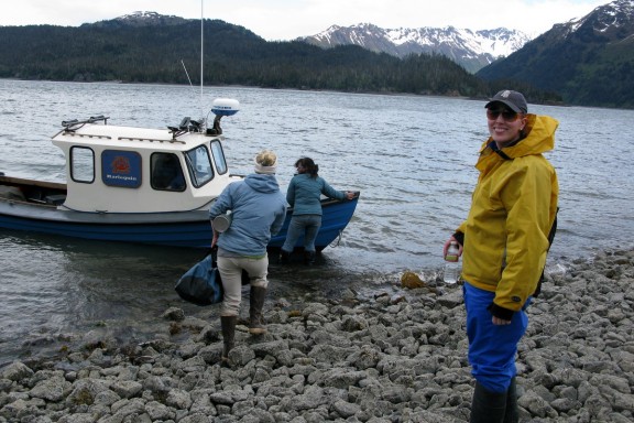
Our tiny taxi arrives


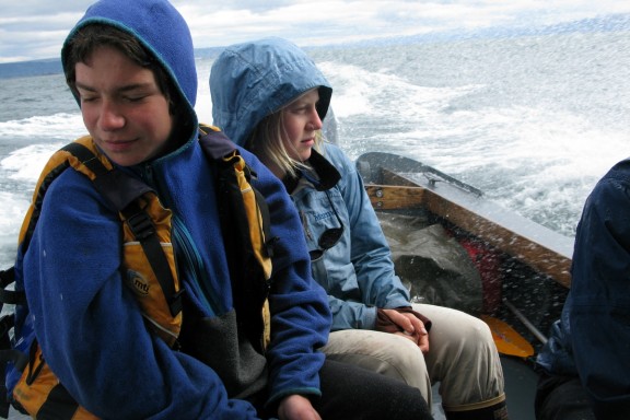
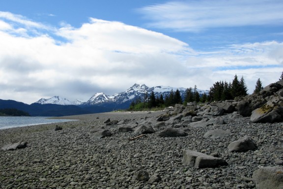
The trip across the bay to Yukon Island took about twenty minutes; the water was very choppy and the poor guys in the path of the spray got soaked. No seasickness, although I did concentrate pretty hard on the horizon straight ahead of me for most of the trip. Arriving on the beach, we unloaded our gear and marveled at the gorgeous mountain scenery.

Our guide Marin (right) tries to avoid the spray


Landing at Yukon Island


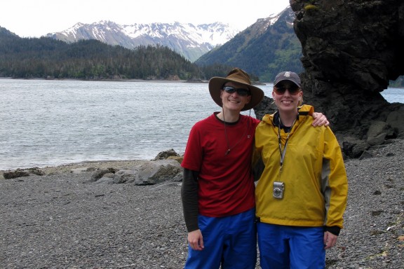
Beautiful view of Kachemak Bay Park mountains


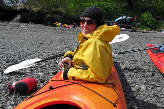
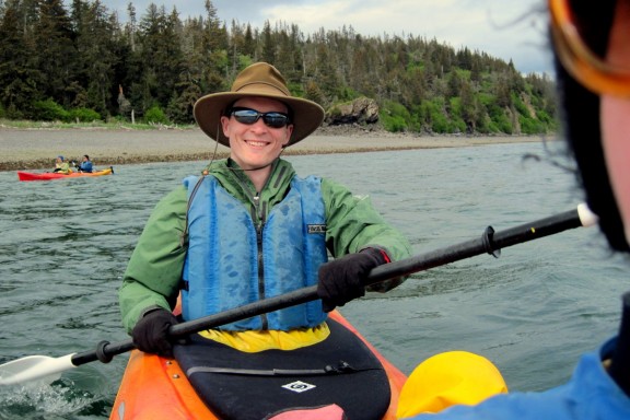
Marin gave us a lesson on paddling, steering, and what to do if we flipped over, then helped us adjust the pedals in our kayaks and showed us how to attach our splash skirts. Worn around our waists, the splash skirt forms a tight seal around the edges of cockpit and keeps water out of the kayak. If we flipped, however, it easily pops off allowing a quick exit. We hoped to not to test this first-hand. Neoprene gloves that attached to the paddle were also provided, which would help keep our hands protected from the cold water. Once we were clear on the basics, we pushed off and paddled around for a bit to get a feel for things. Matt sat in the back where he was responsible for steering; all I had to do was paddle.

Ready to go!


An awesome over-the-shoulder shot of expert-steerer Matt


Shortly after we set off the wind picked up a little, and after fifteen minutes we changed directions so we weren’t fighting the current so hard. We paddled for a half-hour, scanning the shore for wildlife but not seeing much. The wind continued to pick up, making the water pretty choppy, and after a while Matt remarked that we were going to have a tough time getting back to the beach in a timely fashion if we didn’t head back soon. As if on cue, Marin shouted to all of us to turn around; under calmer circumstances I think we would have paddled farther but she realized our time was running out and we would need more time to return.

Once we turned around, I realized just how windy it actually was; we weren’t being pushed backwards, but we had to paddle significantly harder to make even half the progress we’d made in the other direction. The large buoy in front of our beach was nowhere in sight; we cut a path away from the shore, put our heads down, and paddled. Hard. I was actually enjoying myself quite a bit, though Matt cursed a lot (this was probably because his other Alaska kayaking experience had been on glassy-calm water and he was not having as much fun here. :)) It was a workout, we were getting faces full of salt water, and there was no chance to idly look around for otters or birds, but we started counting 50 paddles at a time and eventually our beach came into view. When we came ashore, we looked back for the rest of the group and discovered that we had smoked them all – if it was a race, we’d have won by a mile. Just saying.

Not swept out to sea!


Once everyone made it back, we helped put all the gear and kayaks away and waited for our little water taxi. On the return trip, we came within a pretty close distance of an adorable otter, although he disappeared underwater before we could get a picture. Back on the Spit, we shed all the rain gear and met back up with Matt’s parents, who spent the morning checking out various shops in Homer and planning their bear excursion for Wednesday.

Boarding the taxi back to the Spit


Weather optimism: it may have been windy, but it wasn't raining!


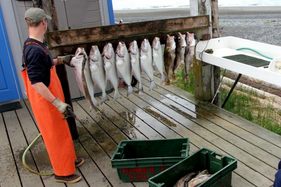
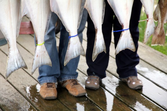
While Matt’s parents stopped to look in one more gallery before we headed back to the inn, Matt and I watched a charter fishing excursion unload its haul of halibut and cod. Each fish had a color-coded tag corresponding to the person who’d caught it, and the captain processed all the fish as desired (most people had it filleted and frozen to take home, but area restaurants would also happily prepare your catch for dinner, too).

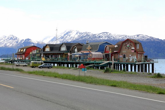
Whimsical buildings line the Spit


Seven halibut on the left, three cod on the right


Proudly posing with their catch


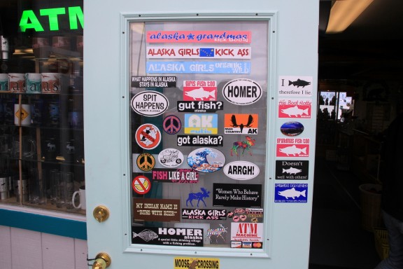
Homer attitude


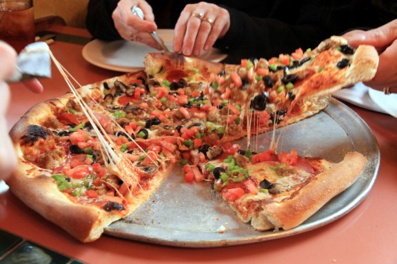
Back at the inn, Matt and I rested for a bit while his parents made a late-afternoon visit to the Pratt Museum a few blocks from our hotel. Later we all cleaned up and walked down the street to Don Jose’s Mexican Cantina and Pizza, where in the halibut capital of the world, we devoured a delicious pizza that had not a hint of seafood on it. After dinner, we visited a little with the inn’s owners before turning in for the night.
Pretty good pizza for a Mexican restaurant!


Our view from Pioneer Inn, plus evening yard chores for one of Amy & Rich's three sons

Day 10: Anchorage/Homer

The extended daylight hours that Anchorage (and the rest of Alaska) sees during the summer months are great. But while sunsets at 11:30PM are fantastic, waking up at 8AM to the kind of sunlight that hits Chicago around 11AM is a bit jarring. It gives you a momentary feeling you’ve badly overslept for something. Now I know why Carly keeps that skylight closed.

Since this is Anchorage and it really was 8AM, Nicole and I rolled out of bed, got dressed and headed downstairs for breakfast. Sitting on the counter was home-made granola, a giant tub of fresh berries, freshly-baked raisin bran scones and hot coffee. Awesome. This B&B is worth the price just for breakfast alone! Meanwhile, my parents had already spent an hour or two chatting with the other travelers in the dining room, who happened to be the owners of this B&B as well as Camp Denali (where Mom and Dad are staying next week).

With breakfast in the books, we loaded up the van for a two-day excursion to Homer. On our way out, Carly hooked us up with a copy of the “Milepost,” which is a mile-by-mile breakdown of everything to see, do and know as you drive Alaska’s highways. Whether you’re looking for a gift shop or the next gravel pullout to let faster traffic pass you, this phonebook-sized guide has you covered.

Heading down Highway 1 alongside the Alaska Railroad tracks next to Turnagain Arm


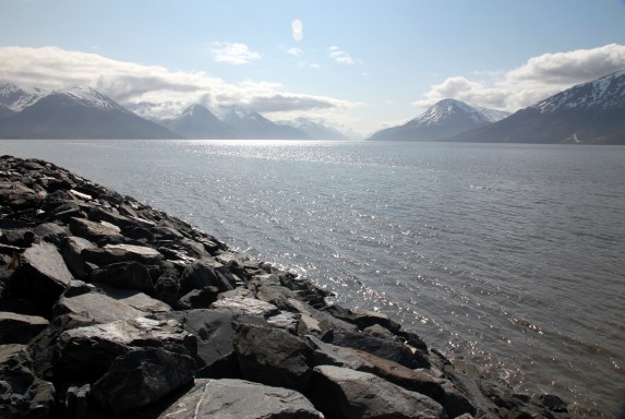
High tide and bright sunlight on Turnagain Arm

After leaving Anchorage, we entered Chugach National Forest and eventually turned the corner on the end of Turnagain Arm. At that point, Highway 1 (also known as Seward Highway until it becomes Sterling Highway later in the Kenai Peninsula) turns southwest and heads into the mountains.

Entering 5.4 million acre Chugach National Forest


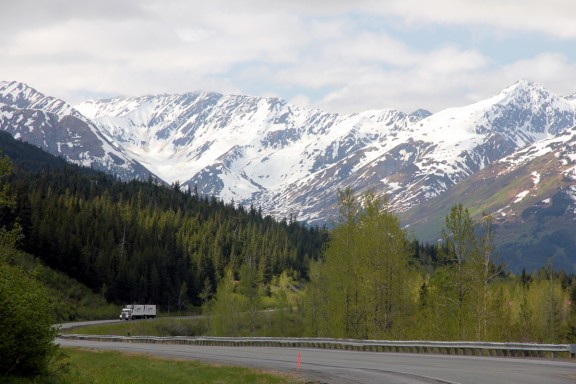
Heading into the mountains of the Kenai Peninsula


Welcome to Alaska, Nic

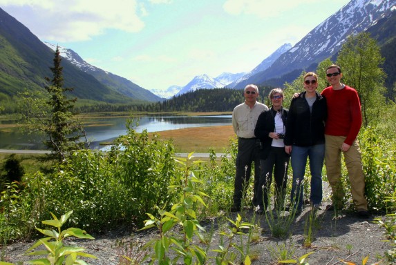
Continuing south, the scenery we encountered kept getting better and better. Mom noted the general absence of residences or cabins, which was nice. We stopped to see Sixmile Creek Canyon (watch your step near the edge!), Lower Summit Lake and Tern Lake (where Highway 9 splits off if you are heading east to Seward)

Stumbling into a postcard-quality scene near Summit Lake


Turn the other direction and this is the view


Group shot overlooking Tern Lake

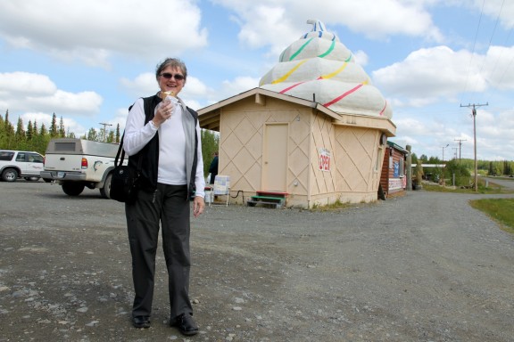
Sticking with Highway 1 and heading west, the mountains soon give way to Lake Kenai and the world-famous fishing rivers near Cooper Landing. Beyond the flurry of resorts and RV parks in that area, we entered Sterling, where we stopped at a gift shop (run by a guy with a taxidermy shop in back) and found a couple establishments selling ice cream and BBQ chicken for lunch (to supplement our car diet of peanut M&Ms and salmon jerky).

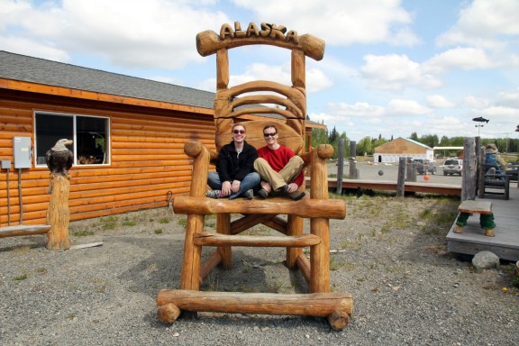
We found a nice chair at our lunch stop in Sterling


Mom wanted an ice cream cone for lunch, then this building appeared

After Sterling, we passed thru Soldotna, and turned south toward the smaller towns of Kasilof, Clam Gultch, Ninilchik, and Happy Valley — to name a few. Compared to the mountain views a couple hours earlier, this portion of the drive looked more like Northern Minnesota, except for the part when Mom finally spotted a moose.

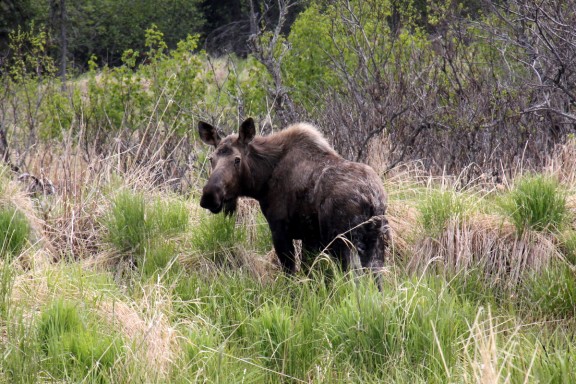
Moose munching away on the side of the road

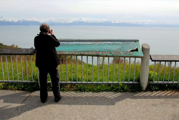
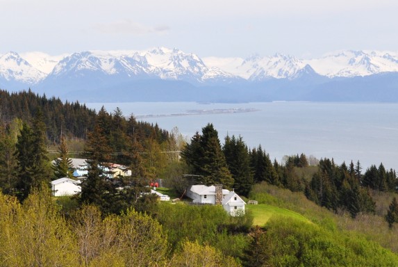
Finally, by late afternoon, we reached the outskirts of Homer and took in a sweeping panoramic view of Kachemak Bay, with Cook Inlet to the west, Kachemak Bay State Park to the south and the Homer Spit to the east.

Kachemak Bay panorama


Homer Spit, much farther away than it appears in this photo

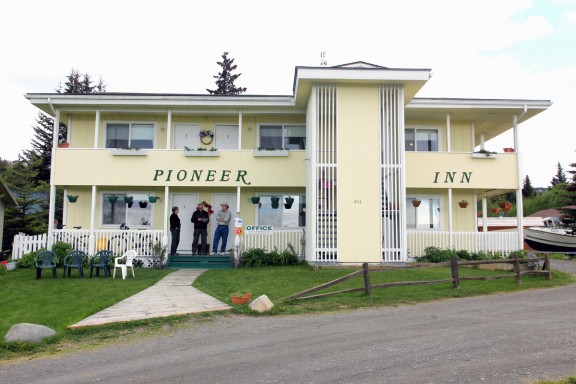
We drove the rest of the way into Homer — the Halibut fishing capital of the world — and promptly checked in at the Pioneer Inn. Owners Rich and Amy greeted us with smiles and showed us to our respective rooms.

Chatting with Rich outside the Pioneer Inn

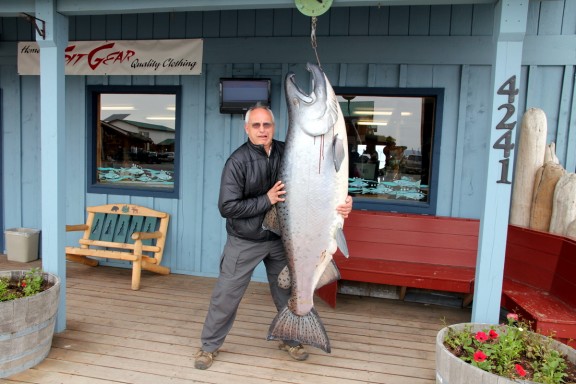
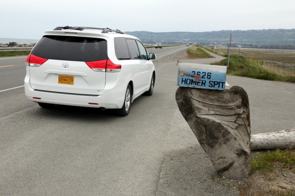
With clouds rolling in to end our sunny afternoon, we ventured down to the Homer Spit to find some dinner. It takes about 10-15 minutes to drive 4.5 miles out to the end of the spit where the boat harbor operates. Experts believe the Spit exists because of A. tidal swells in Kachemak Bay and Cook Inlet, or B. sediment from an ancient glacier. Whatever the explanation, tourism is alive and well at the end of the Spit, as a large number of restaurants and excursion companies, etc. occupy rows of weathered shacks built on stilts.

Homer Spit is like the Renaissance Festival of fishing


Who decided the blood would be a nice touch here?

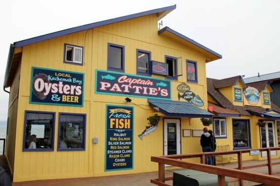
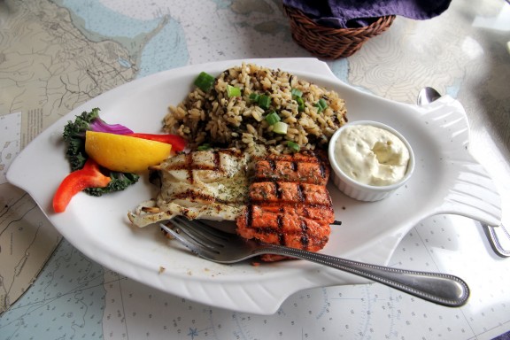
Based on a recommendation from our guidebooks, as well as Amy back at the Pioneer Inn, we settled on Captain Pattie’s for dinner, where we all ordered the fresh fish. Captain Pattie did not disappoint. The place also delivered on the finer details, with contour maps as table decor, fish-shaped plates and local Homer Brewing Company beers on tap.

I think this place sells fish


Best halibut I've had in Alaska

After dinner, Nicole and I sought out a couple different options for sea kayaking from companies operating on the Spit, while Mom and Dad investigated the popular Bear sightseeing trips. When we each gathered enough information, we drove off the Spit (past the semi-junkyard of old boat parts) and stopped by the local Safeway grocery store to pick up some breakfast food, taking advantage of the fact that Mom and Dad’s room at the Inn has a full kitchen. Upon our return to the Pioneer Inn, we briefly reviewed our plans for Tuesday, and then hit the hay shortly thereafter.

Leaving the Spit for the day

Day 9: Juneau/Anchorage

Today was another travel day with a 12:35PM flight from Juneau to Anchorage on our itinerary. But I was not about to leave Alaska’s state capital without a final shot of that delicious salmon hash breakfast in the hotel café. Even Mom ordered it this time instead of her usual bowl of oatmeal. That is quite an endorsement.

We packed up easily after breakfast, largely because we barely unpacked for our one-night stay. Upon leaving the hotel, we hailed a cab for the airport rather than test our wits against Juneau’s bus system a final time (which would have been more difficult without express buses running on the weekend). During the twenty-minute trip to the airport, our taxi driver told us about his experience driving in Juneau, hauling around celebrities like the Deadliest Catch guys (they are rowdy when drunk, shocking) and Randy Travis (or some other famous country singer). We arrived at the airport with plenty of time to sail thru security and relax.

Preparing Alaska Air flight 65 to Anchorage


From Juneau (on the right) to Anchorage (on the left)

About two hours and 600 air miles later, we landed in Anchorage. At the baggage claim, we found Nicole waiting for us. She arrived an hour earlier after her morning flight from Chicago. With the whole gang together, we proceeded to the rental car area, picked up our Toyota Sienna and hit the road. No word on whether a 1991 Ford Aerostar was available.

The Parkside Bed and Breakfast in downtown Anchorage is about a 10 minute drive from the airport. We successfully navigated ourselves to the right address despite the city’s odd penchant for splitting up normal traffic flows into one-way streets (maybe it’s a snow-removal thing?).

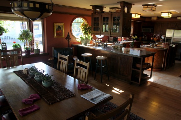
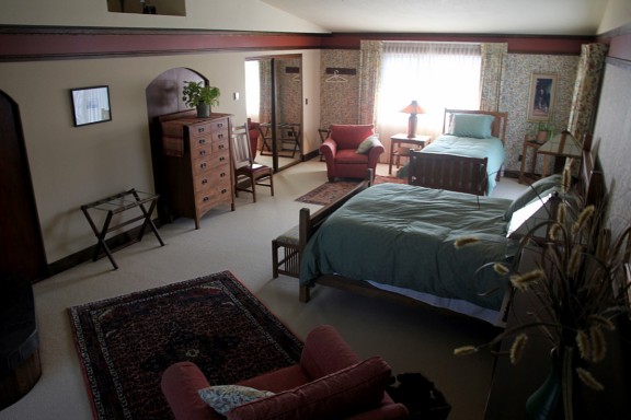
Upon arrival, we were given an introductory tour by our friendly hostess Carly. I have not stayed in many B&Bs before, but I think we found the Ritz Carlton of B&Bs. Both our rooms were on the second floor along with an inviting common room area. Mom and Dad’s room was the size of a small auditorium. The custom-designed kitchen on the first floor was straight out of an interior design magazine.

Parkside B&B kitchen and dining room area


Mom and Dad, think this room will be large enough?


Nicole joins the party!

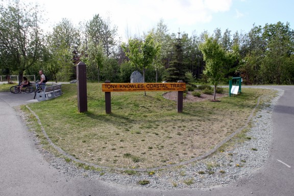
After getting settled, we decided to take advantage of the great weather and walk a mile or two along the Tony Knowles Coastal Trail, which is an 11-mile, paved bike trail that runs along the Knik Arm of the Cook Inlet, from downtown to the airport.

Knowles was Mayor of Anchorage from '81-'87 and Governor of Alaska from '94-'02


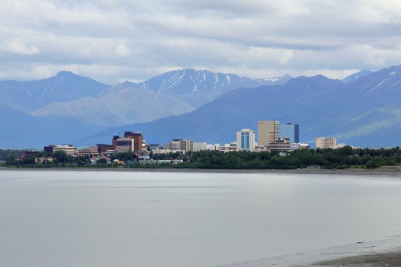
Dad looks south across the Knik Arm of Cook Inlet


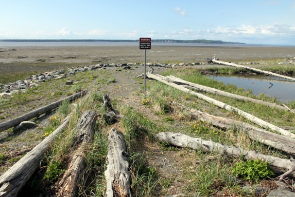
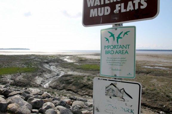
Mud flats exposed during low tide can behave like quicksand


Where are the unimportant birds supposed to go?

The pleasant walk north along the coast deposited us onto 5th and L in downtown Anchorage. As luck would have it, it was only a couple more blocks to McGinley’s Irish Pub on 7th and G, where we intended to start using the various Anchorage restaurant gift cards my uncle had given my parents (Thanks, Paul!). Having eaten salmon for nearly every meal the past week, I actually enjoyed the opportunity to go Irish for a meal.

Delicious hot corned beef sandwich

After dinner, we strolled back thru Delany Park to the Parkside and marveled at how bright it was outside for the late evening hour. Apparently, there were other guests (actually, the owners) staying at the B&B (the place can accommodate up to about 15 people in 5 or 6 rooms), but they were out and none of them ventured up to the common room, so we had the entire second floor to ourselves.

Whatever. I played baseball in a yard filled with trees all the time as a kid.


Relaxing at the Parkside, researching the Kenai Peninsula

After an hour or two of drinking tea and perusing guide books for information about tomorrow’s agenda (a drive through the Kenai Peninsula to Homer), everybody went to sleep, save myself. I blogged a bit and finally turned in at about 3AM, which you’d never guess by looking out the windows. Can you be a night owl if it never gets dark?

11:30PM sunset from Parkside's north-facing windows

Day 8: Glacier Bay/Juneau

With a half-day remaining in Glacier Bay, today’s plans were dictated by what could be done before our late-afternoon flight back to Juneau. Last night, I checked with the front desk and decided to team up with another lodge guest who wanted to go sea kayaking, but needed a second person to get a rental. Meanwhile, Mom and Dad plotted a hike on the nearby Forest Loop Trail. (We briefly considered a whale-watching tour, but the outfit only offered an afternoon trip and it felt that was cutting it a bit too close for our 4:55PM flight. Oh whale.)

With our plans in motion, we all woke up and ate breakfast at the lodge. At roughly 9AM, I met Renee, my kayaking partner for the day who is from South Africa, lives in New Zealand, works as a software tester and is currently on a six-month vacation around the world. We walked down to the kayak rental office and a staff member got us ready to go.

Today's activity... sea kayaking


Let's get this boat afloat

The kayak rental company provided us all the necessary gear for the half-day kayak rental, including the rain pants, rain jacket, rubber boots, dry bags and, of course, the kayak, paddles, etc. The woman in charge gave us some tips on our planned route and reminded us how the tides would play. Then, she sent us on our way.

I’ve never been sea kayaking before, but Renee is an intermediate kayaker and knows what she’s doing. She kayaks all over the place when she travels, including plans to kayak downtown Manhattan (the Hudson River) in a couple weeks. After seeing how they handle, it is clear that a two-person sea kayak would be really hard to flip. I’d say two-person canoes are way more precarious.

Off to sail Glacier Bay


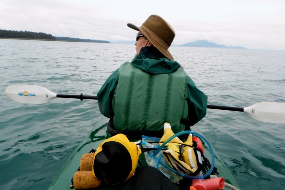
I paddle in the front and set the pace


Renee paddles in back and controls the rudder (with foot pedals)

We navigated southwest out of Bartlett Cove and followed the east shore of the Sitakaday Narrows. We approached Point Gustavus, but did not venture beyond into the Icy Strait (which just sounds menacing) where the kayak guide said we’d encounter a confluence of several bodies of water, tides, and other unpredictable things. Plus, it was time to pause for our half-way snack and turn around. I ate a bag of Peanut M&Ms and Renee busted out her GPS notification device to tell her people she was in a boat in the middle of the Sitakaday Narrows in Glacier Bay National Park. Neat-O.

On the way back in, we had better luck seeing wildlife, as a pod of 3 or 4 Harbor Porpoises surfaced near our kayak for a couple minutes. Also, paddling back north into Bartlett Cove was much easier because the tide was rolling in. For the last 45 minutes, we barely needed to dip our oars in the water. We returned to the lodge on schedule at 1PM, docked the kayak and shed our rental clothing.

Done and done


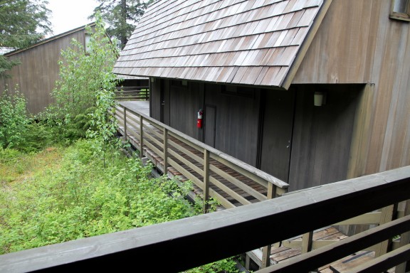
Our Glacier Bay cabin. Sparse outside, but nice and cozy inside.

With a checkout time of 2PM, we packed our bags and killed some time in the lodge before heading to the airport. Renee joined us in the lobby and swapped camping stories with Mom and Dad. We also grabbed a bite to eat. Before long, the shuttle van was ready and we were on the road. Our driver Aaron was losing his mind due to a hectic day, but he dropped us off with plenty of time to spare.

Mom and Dad give Renee the 4-1-1 on Yellowstone


Along the road back to the Gustavus airport

As noted upon our arrival, the Gustavus “airport” is definitely casual. Sometime if you’d like to hear a funny story, ask Mom about the restrooms.

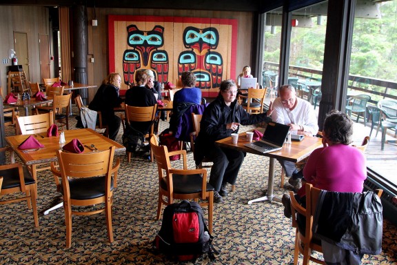
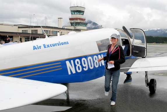
The Air Excursions office, one of only three airline buildings near the runway

Mom, Dad and I — plus an Air Excursions employee who actually helped check us in two days ago — comprised the four passengers on the flight back to Juneau. This time, our pilot was a young woman named Taylor who looked like she might still be gathering college credits, but flew like a seasoned pro.

Cabin view


Cool view of a river delta


Clear-cut valley, with evidence of previous years' harvest areas


Sorry Logan... Pilots with ponytails are more fun

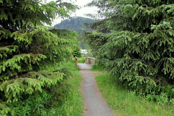
Back in cloudy and overcast Juneau, we were prepared for the transportation conundrums that our less-experienced selves faced a couple days ago. This time, rather than walking blindly toward the bus stop (me) or searching high and low for a taxi (parents), we immediately found the elusive wooden bridge thru the tress that marks the most direct path from Juneau Airport to Nugget Mall, the site of the regular service bus pickup on weekdays.

The secret path to Nugget Mall!


Parents waiting at the bus stop

A 30-minute bus ride later, we arrived steps from the front door of the ‘ol Westmark Baranof. Upon check-in, we were assigned a different room. Bad news is that it didn’t have nearly as cool a view as our front-facing room earlier in the week. Good news is that I got a real bed rather than a roll-away cot. I’ll take that trade, especially since it’s only for one night.

After passing on a Filipino Chicken place, dinner ended up being a delicious salmon meal at the Twisted Fish. Then I found a place selling ice cream sandwiches for a buck. It took four days, but I finally found the best value in the city. With nothing left to do in Alaska’s capital city, we returned to the hotel and retired for the night.
Back in Juneau, where the eagles roam. This one sat on that post for our entire dinner.