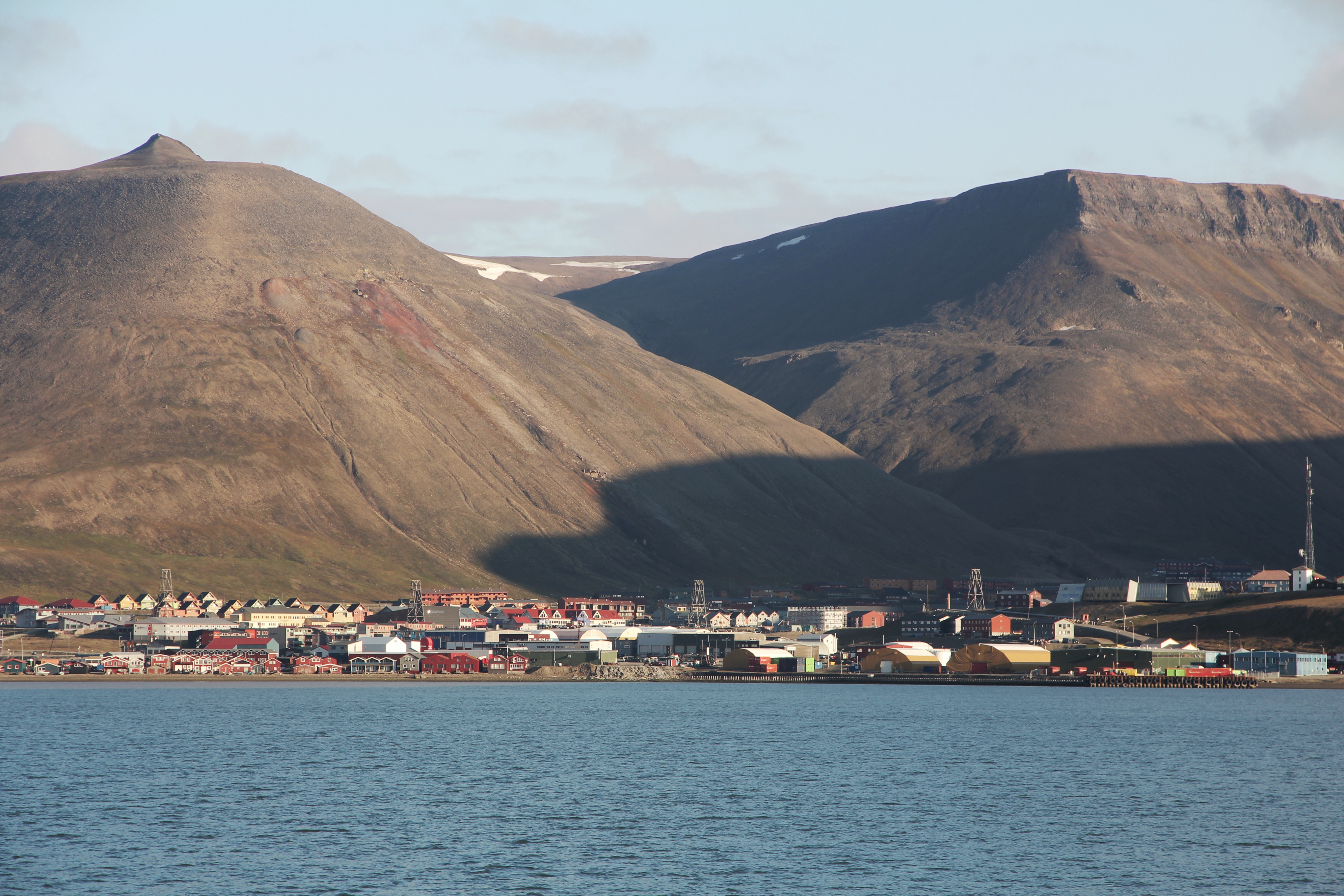
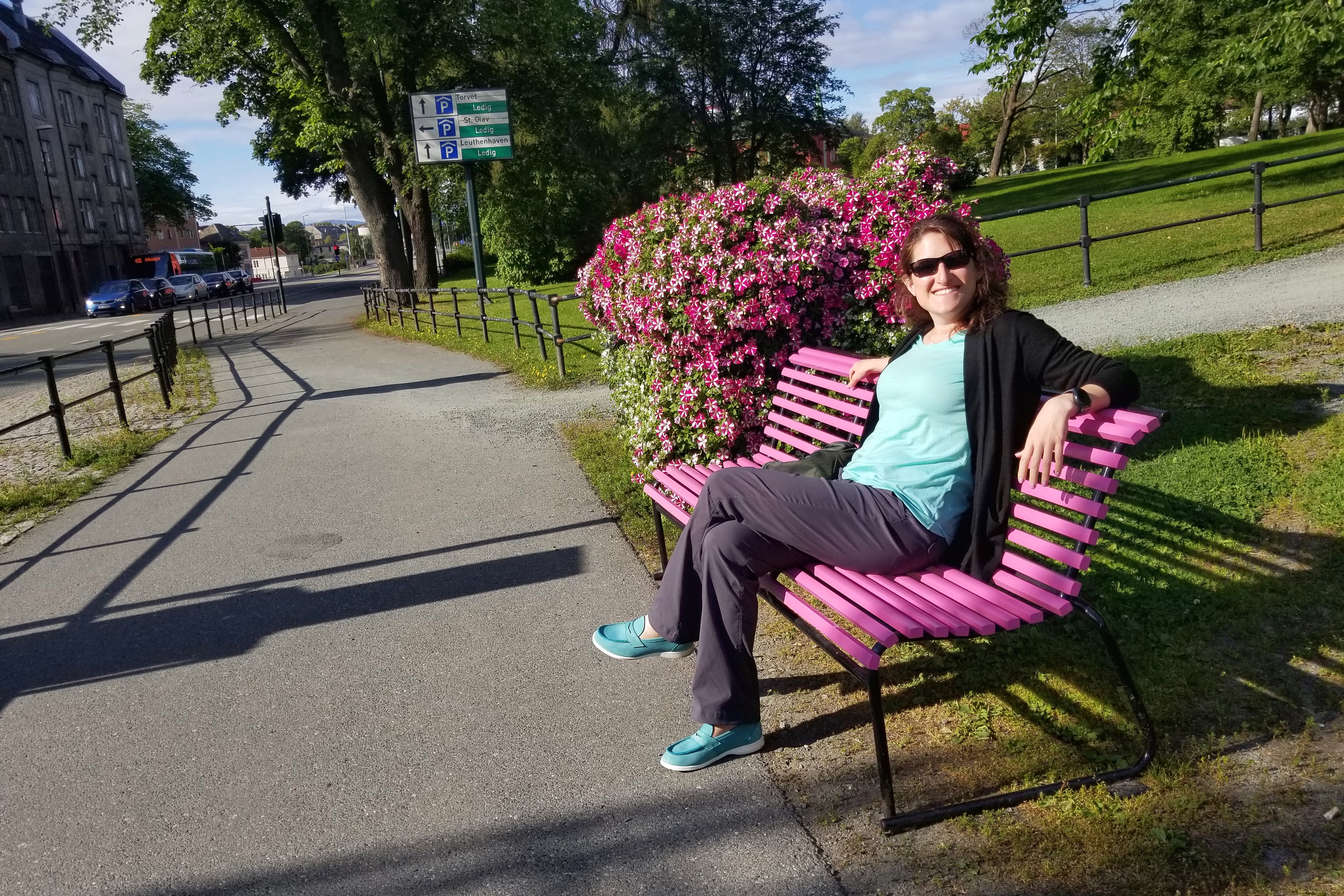
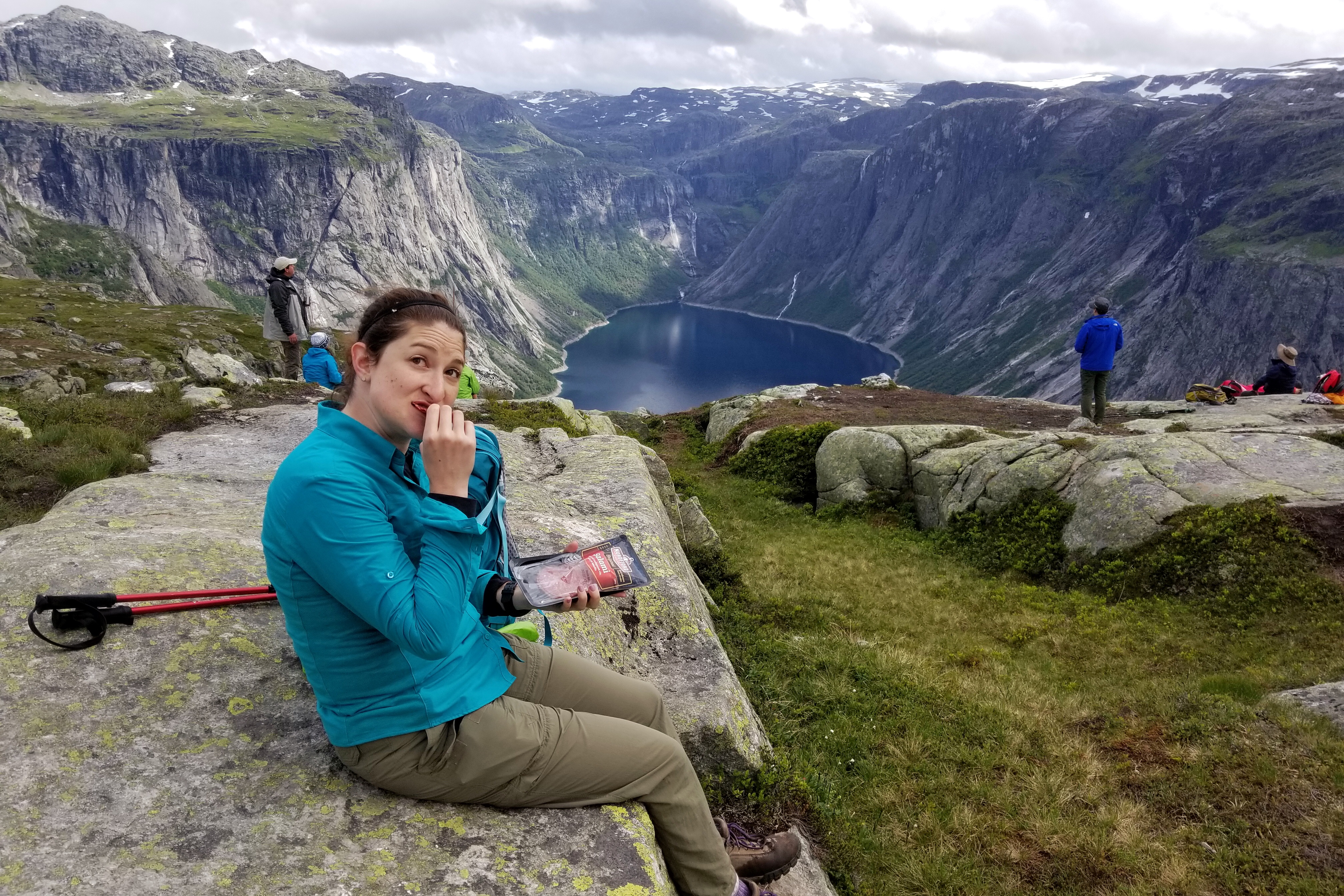
Day 13: Longyearbyen/Leknes

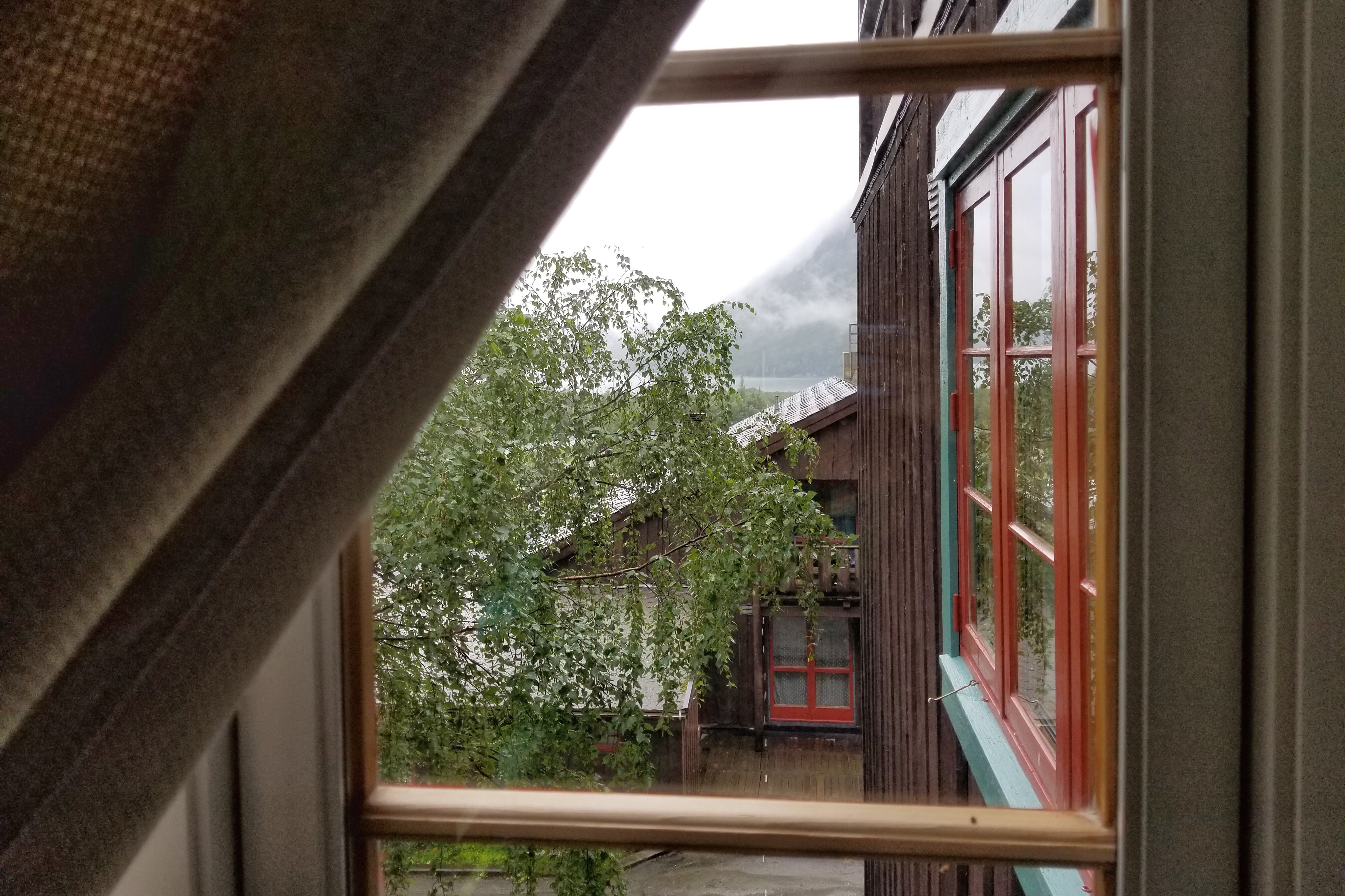
Other than the fact there was daylight all night, our last morning in Svalbard (or Spitsbergen if you’re Dutch and Grumant if you’re Russian) started out in a similar fashion to the rest of our Norway mornings. A little bit of rain, a little bit of breakfast, and double-checking our plans for the day.

Took this shot by the window at at 2:07am


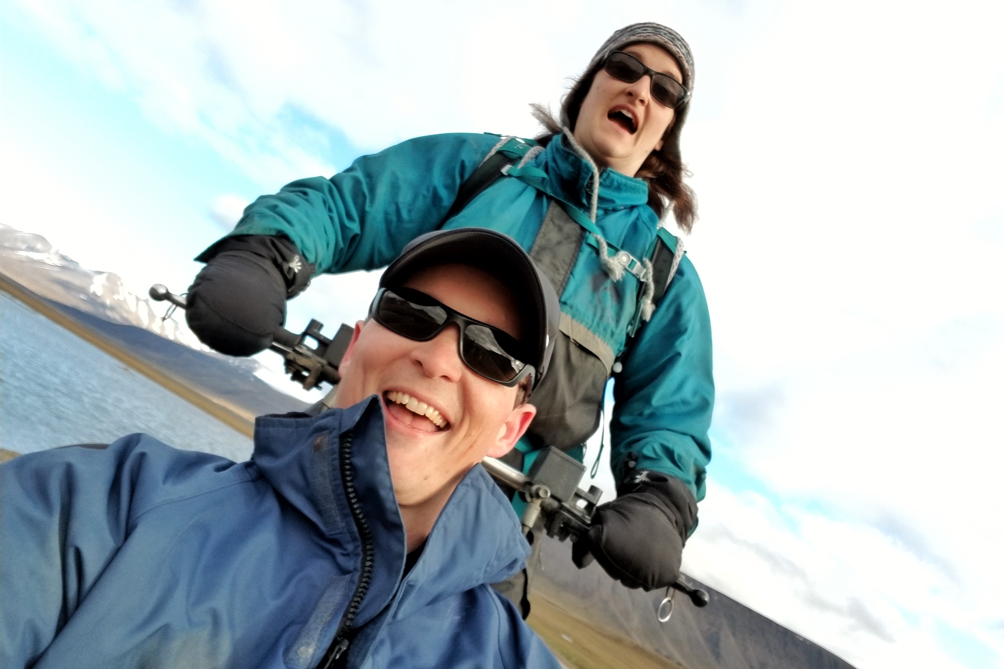
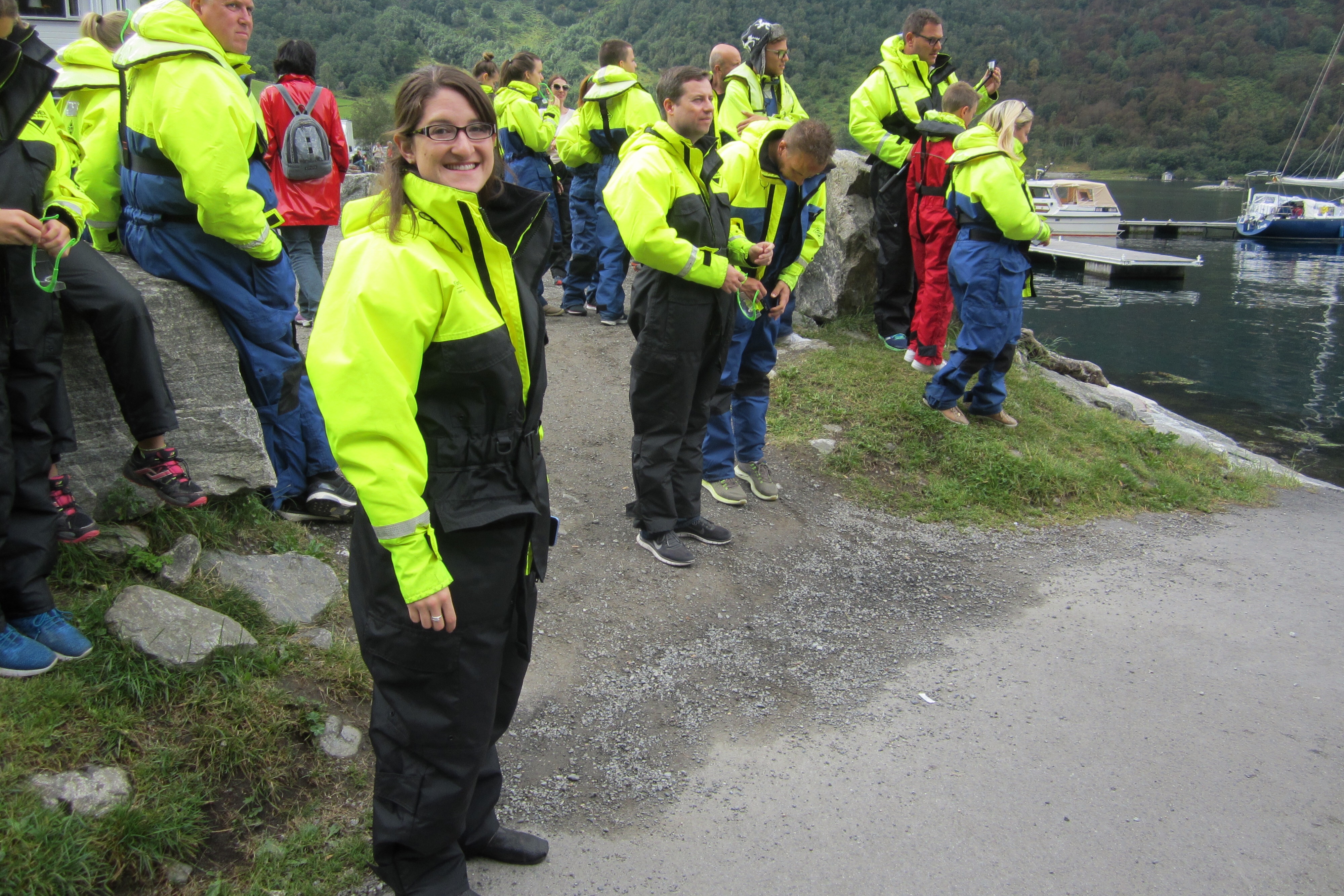
Carefully reviewing the confirmation sheet for today’s activity

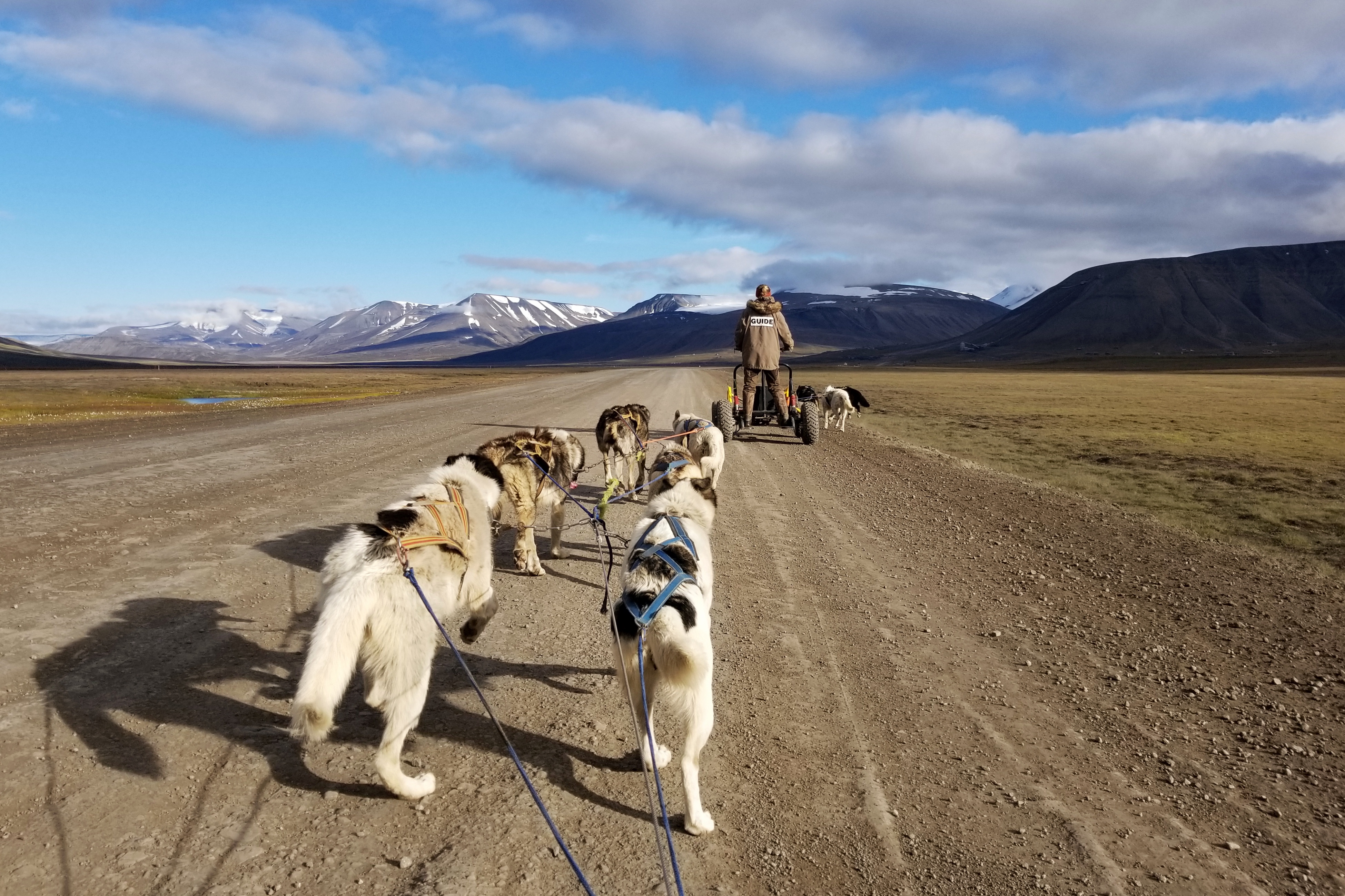
Our flight from Svalbard back to Norway was in the mid-afternoon, so we booked one last adventure for the morning — a fossil hunt! We met our guide at 9:30am and soon discovered the hike/hunt was going to take place just up the valley where our hotel was situated.

Fossil hike guide gives us some directional pointers


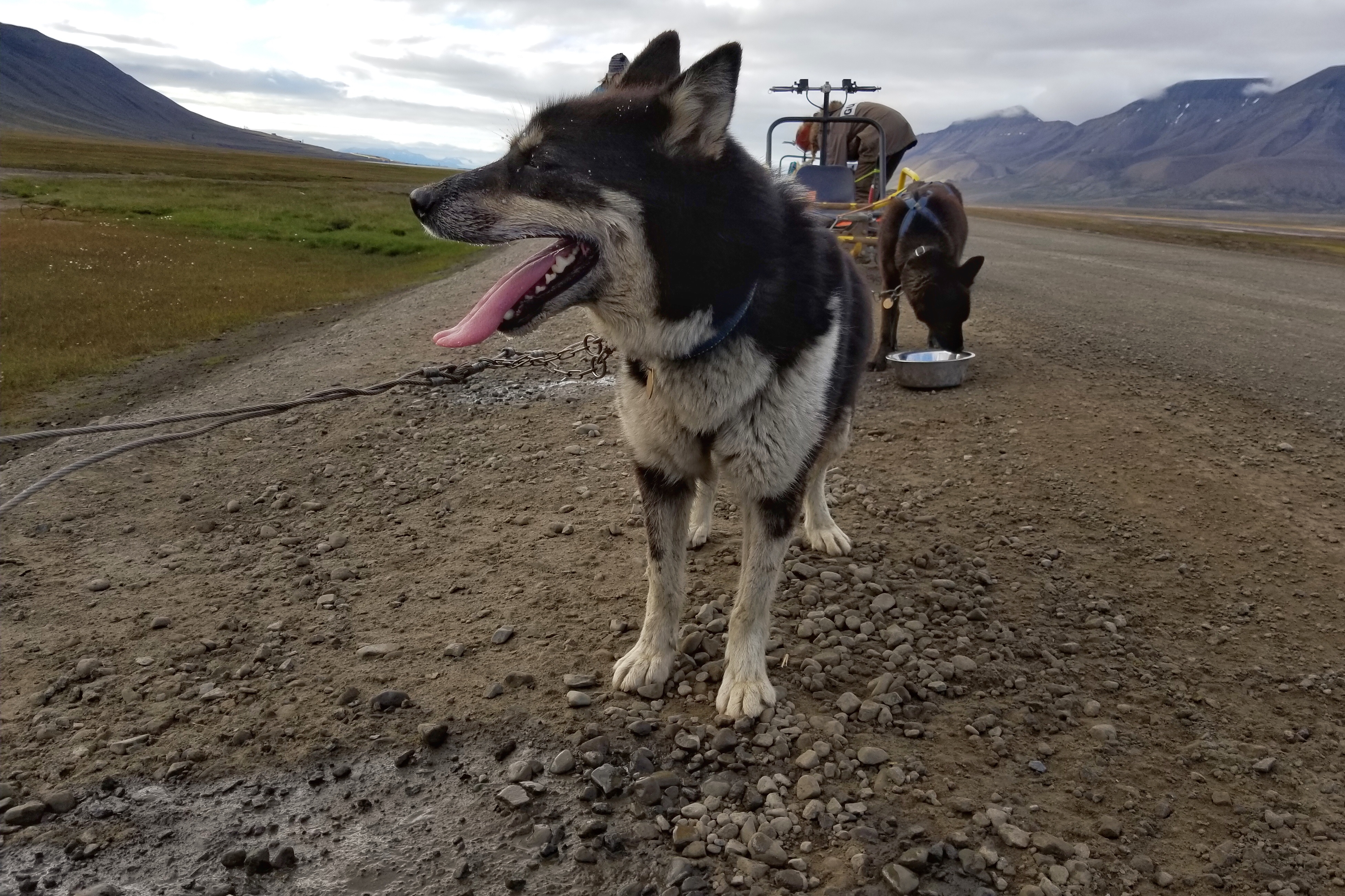
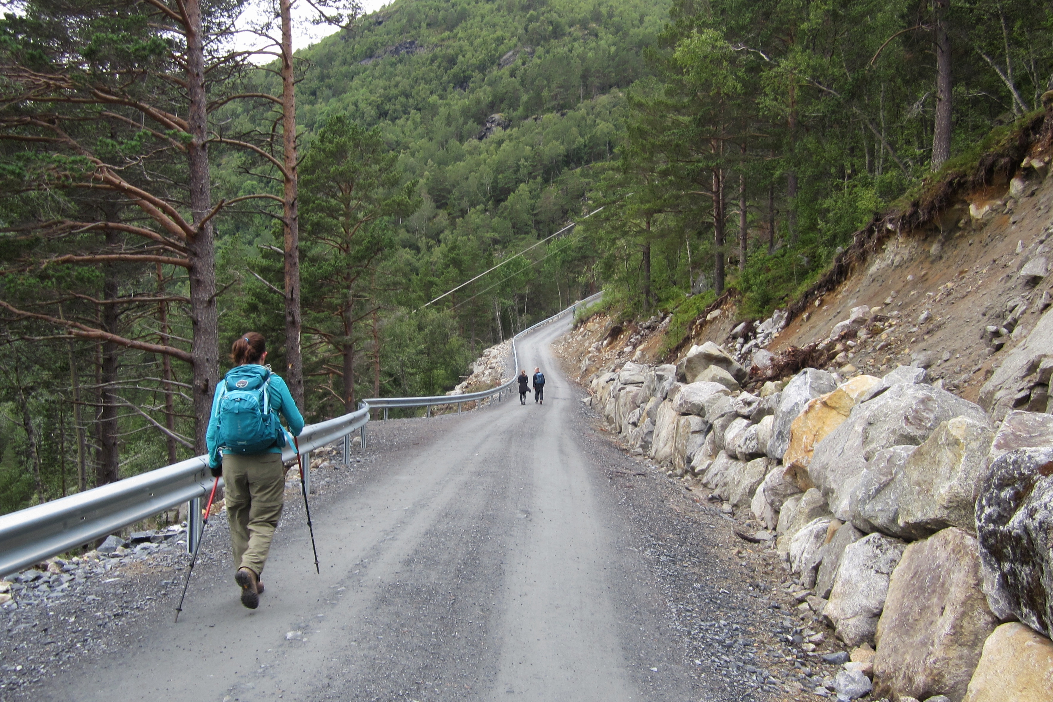
Rocky road up the moraine

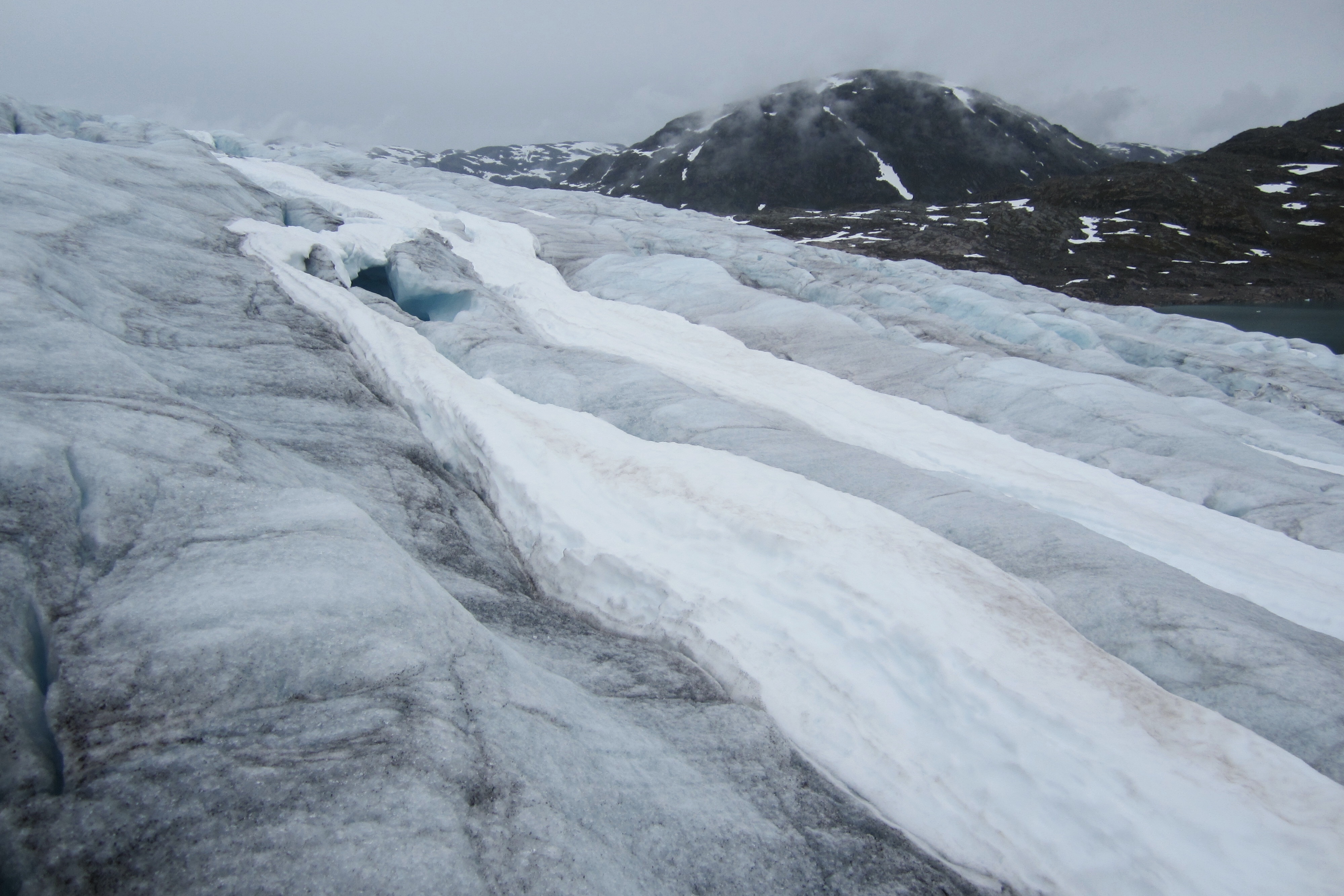
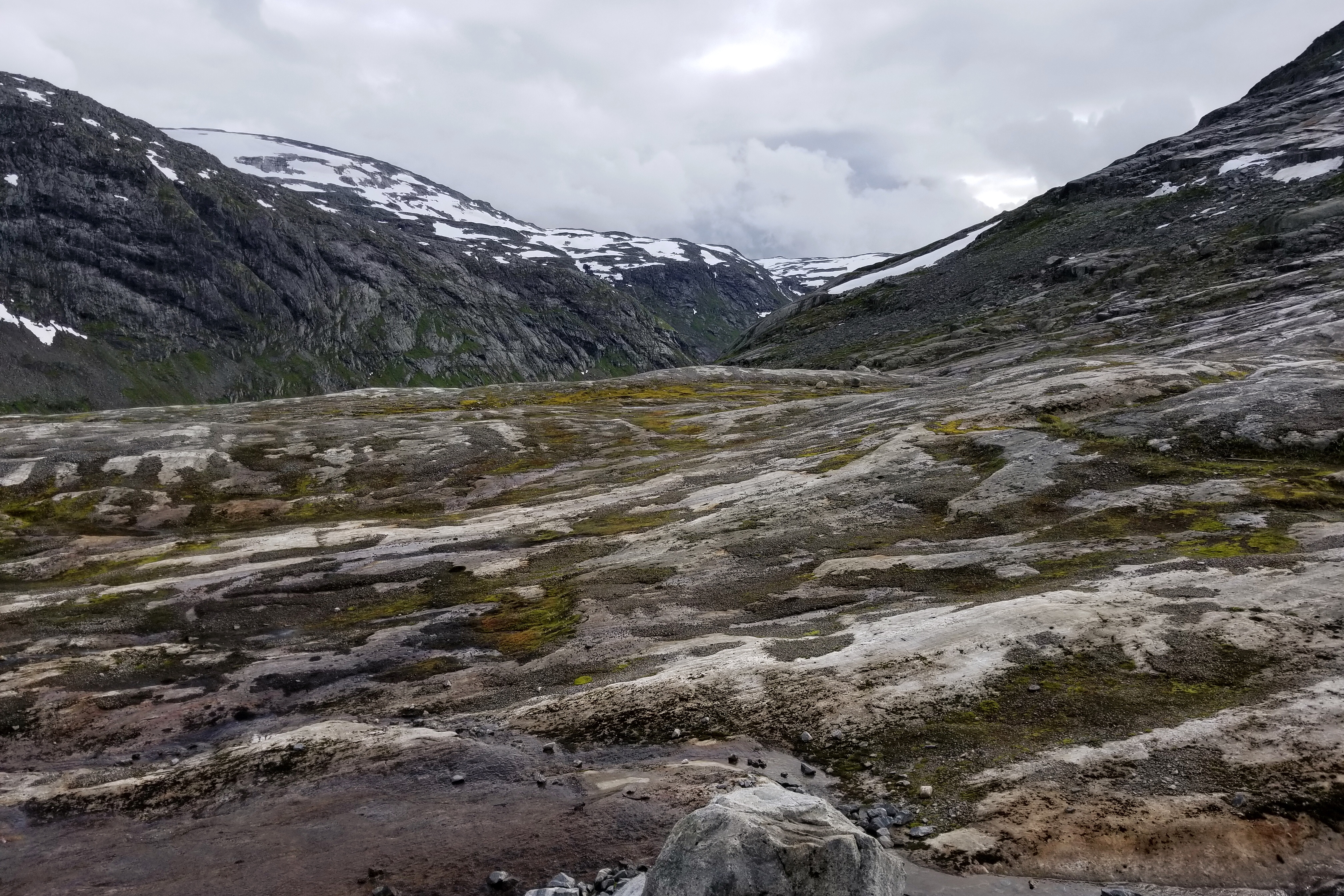
We hiked up the moraine towards Longyearbyen glacier (but not actually to it). Way back in the days of Pangea, Svalbard was below the equator and therefore tropical. As it drifted North, the vegetation couldn’t survive the cold and dark winters, and eventually died. Many fossils of those plants can be found in the surrounding rocks as the rest were decomposed and compressed into the abundance of coal that is still being mined.

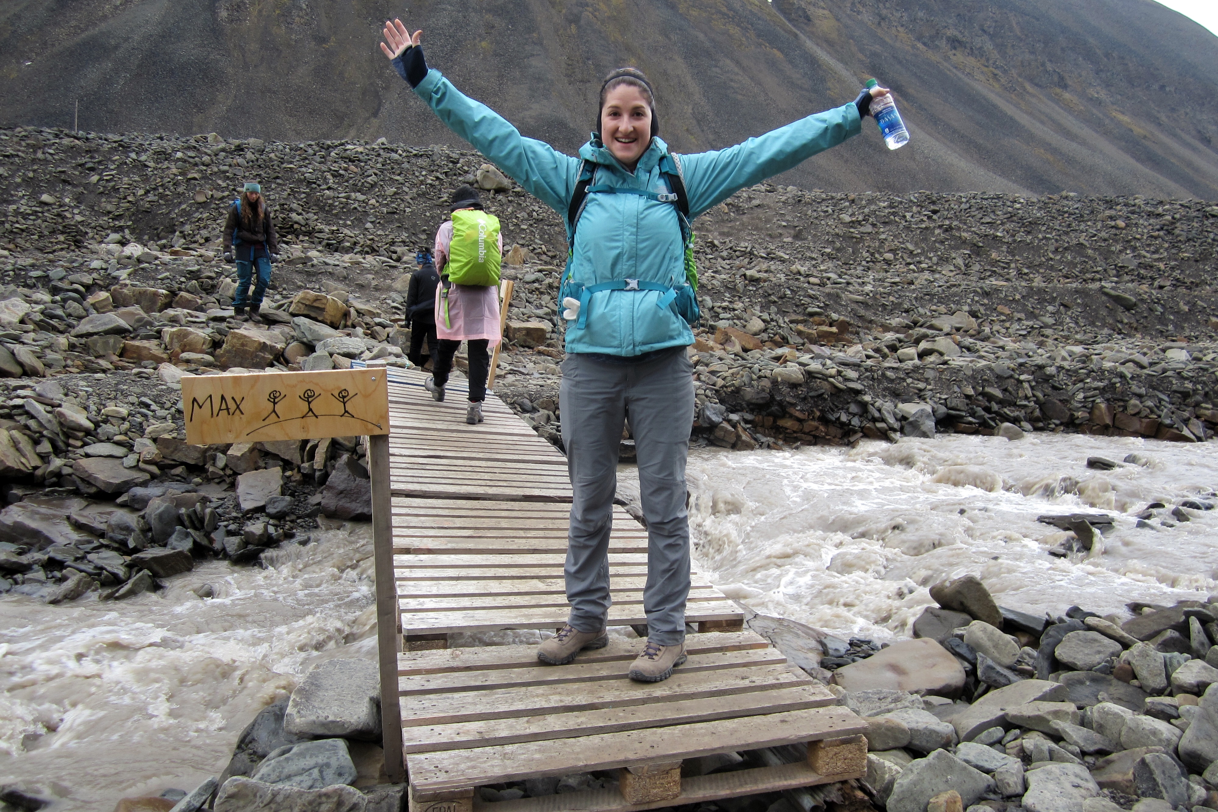
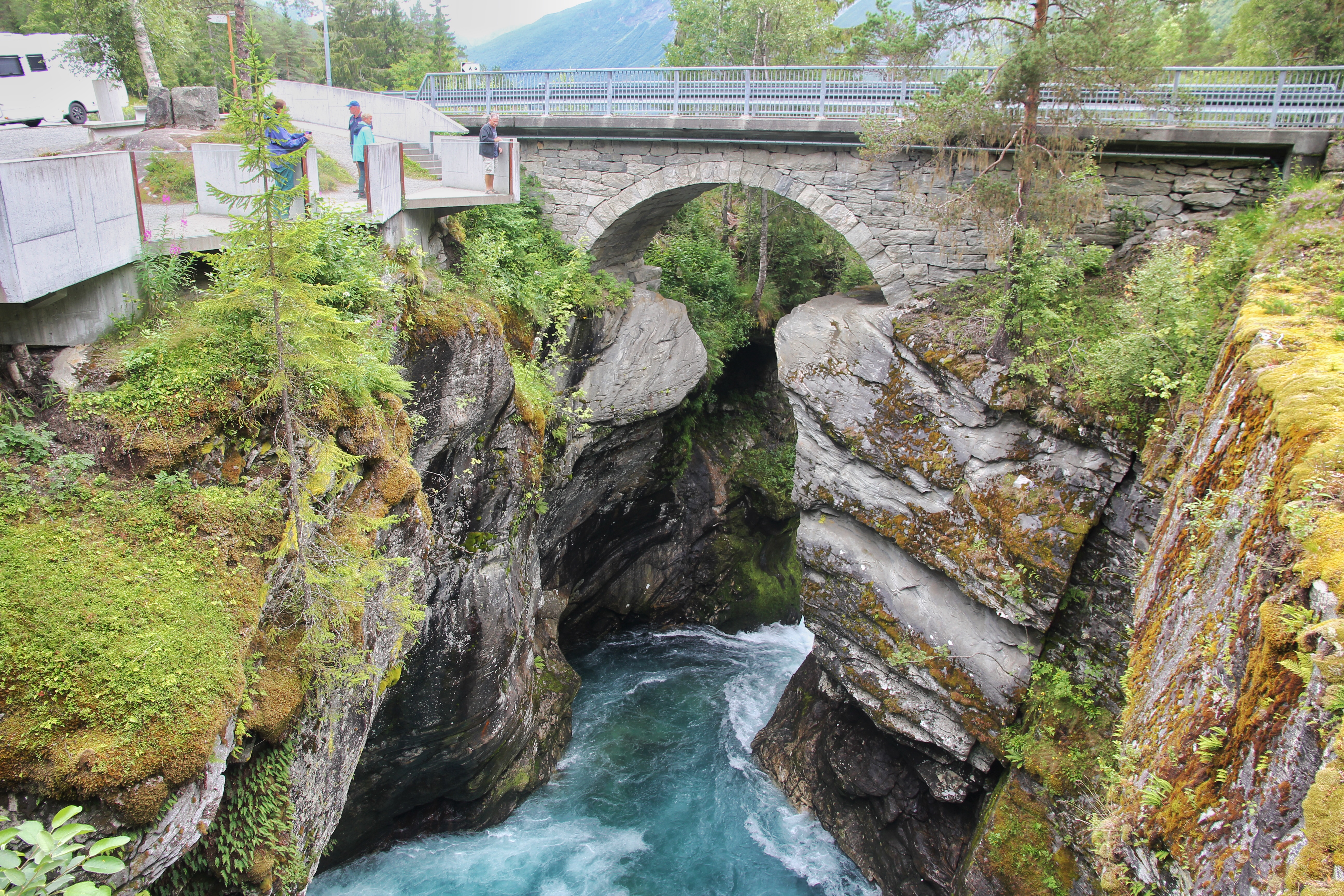
No! This bridge is for Max!


Not much grows here, but enough for reindeer snacks

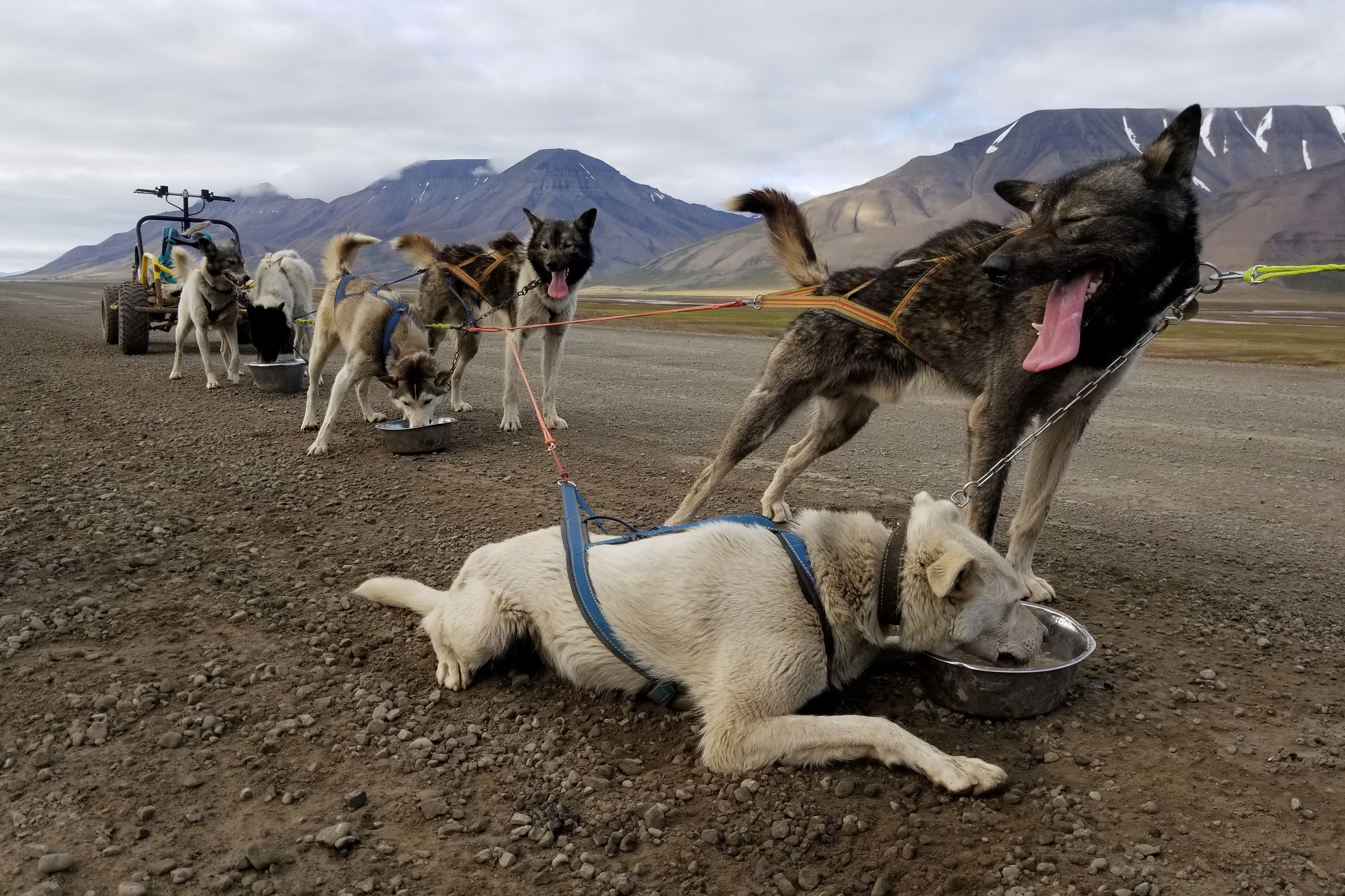
There was a bit of a learning curve to spotting the rocks with fossils in them. It felt like staring at a pile of puzzle pieces to find the one that’s going to fit. Our guide handed out rock hammers and we doubled our efforts. Eventually, we found some rocks with fossils worth taking back with us.

Checking closely for fossils


When you are told that rock “is not the fossil”


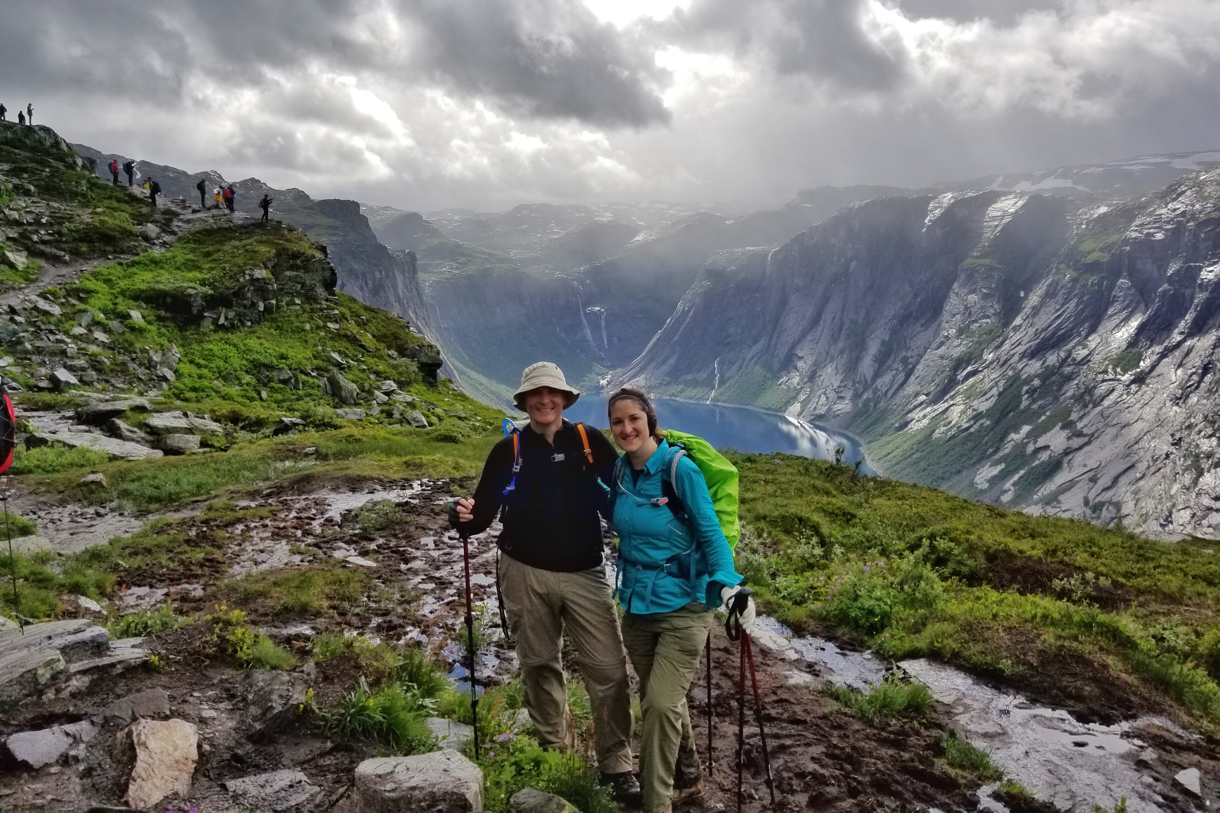
Couple fossil keepers


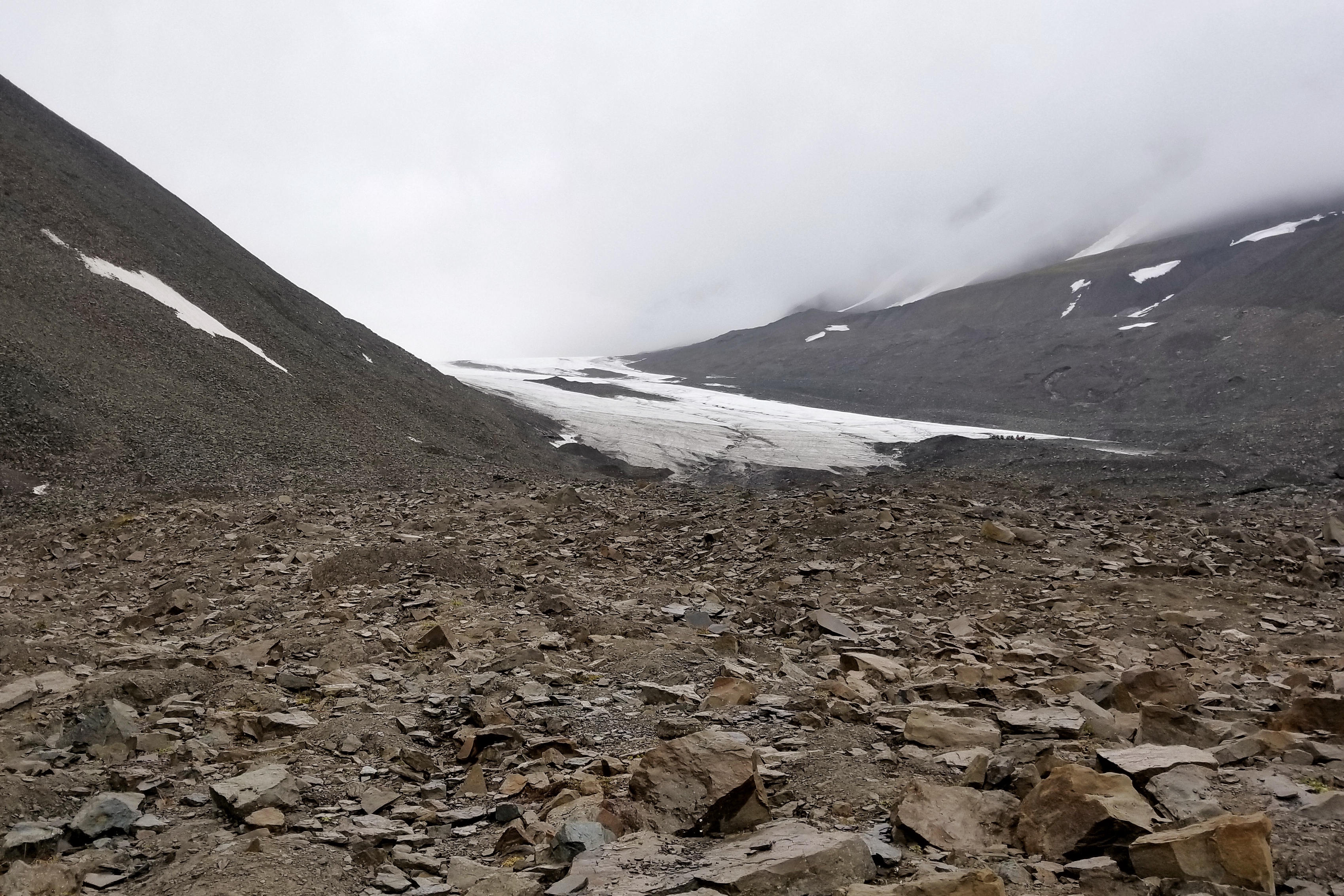
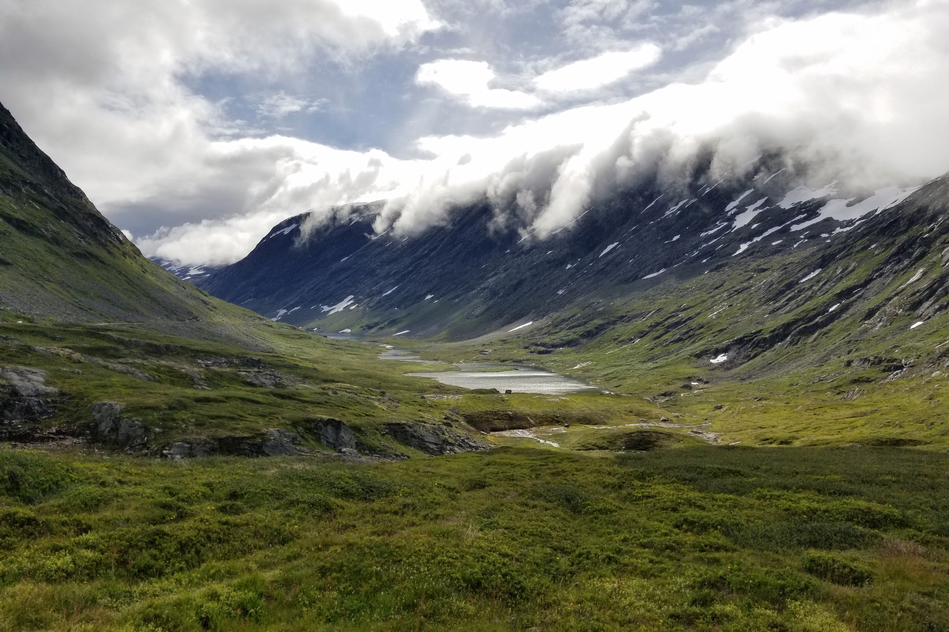
The terminus of the Longyearbyen Glacier further up the valley


Crazy rocks splitting open like books up here!


Last pass of Coal Miner’s Cabins as we headed back down the valley

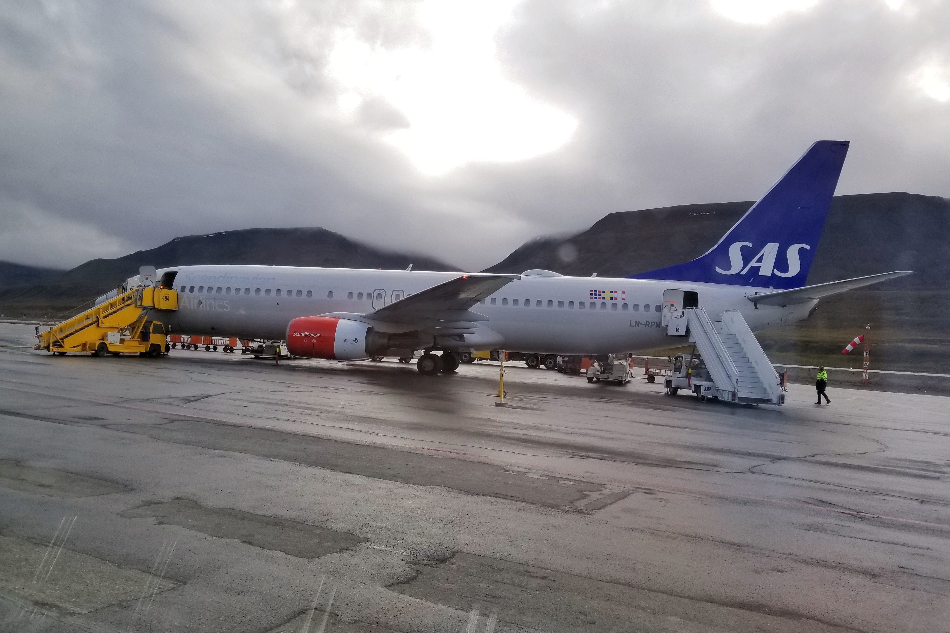
A successful fossil hunt completed, our guide drove us to the airport. The Longyearbyen airport pretty much only has one flight at a time, so we checked in our bags with everyone else on the flight, walked through security, and had a seat in the waiting room by the gate. Small airports are fun! Plus, SAS airlines has an efficient way to board a flight… from both the front and aft!

Regular boarding in the front, party boarding in the back

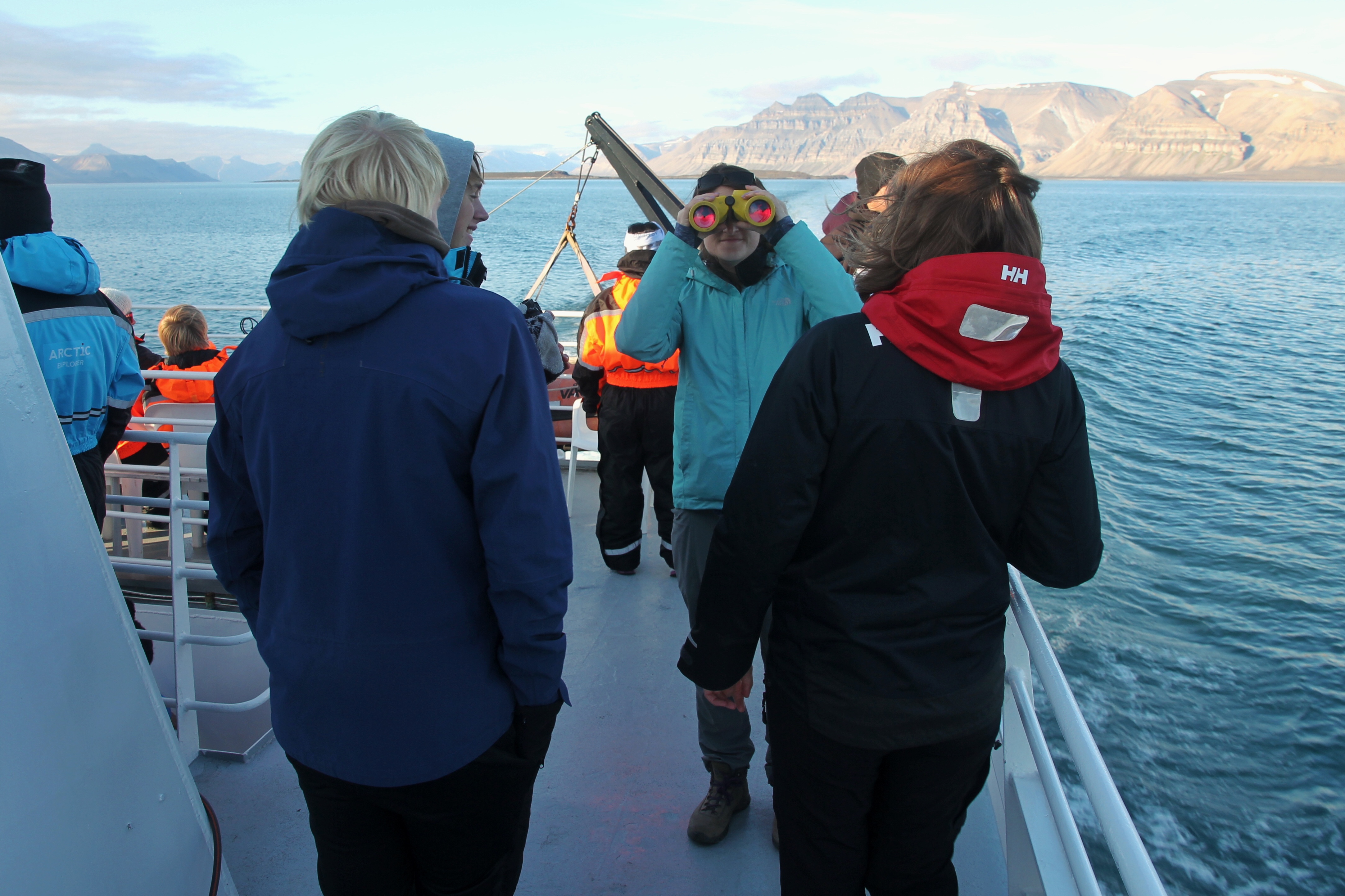
After landing in Tromsø, we passed through customs and re-checked our bags. Svalbard is controlled by Norway, but doesn’t really officially belong to anyone, so another stamp goes in the passport as we officially returned to Norway. We got through security with no issues and found our favorite spot in the Tromso airport to wait for our next flight to Leknes (which is a table by the Pizza Hut). The next flight to Leknes feature the smallest plane on the trip so far. It featured roughly the same seating capacity as a Chicago city bus, with free-for-all seating a la Southwest.

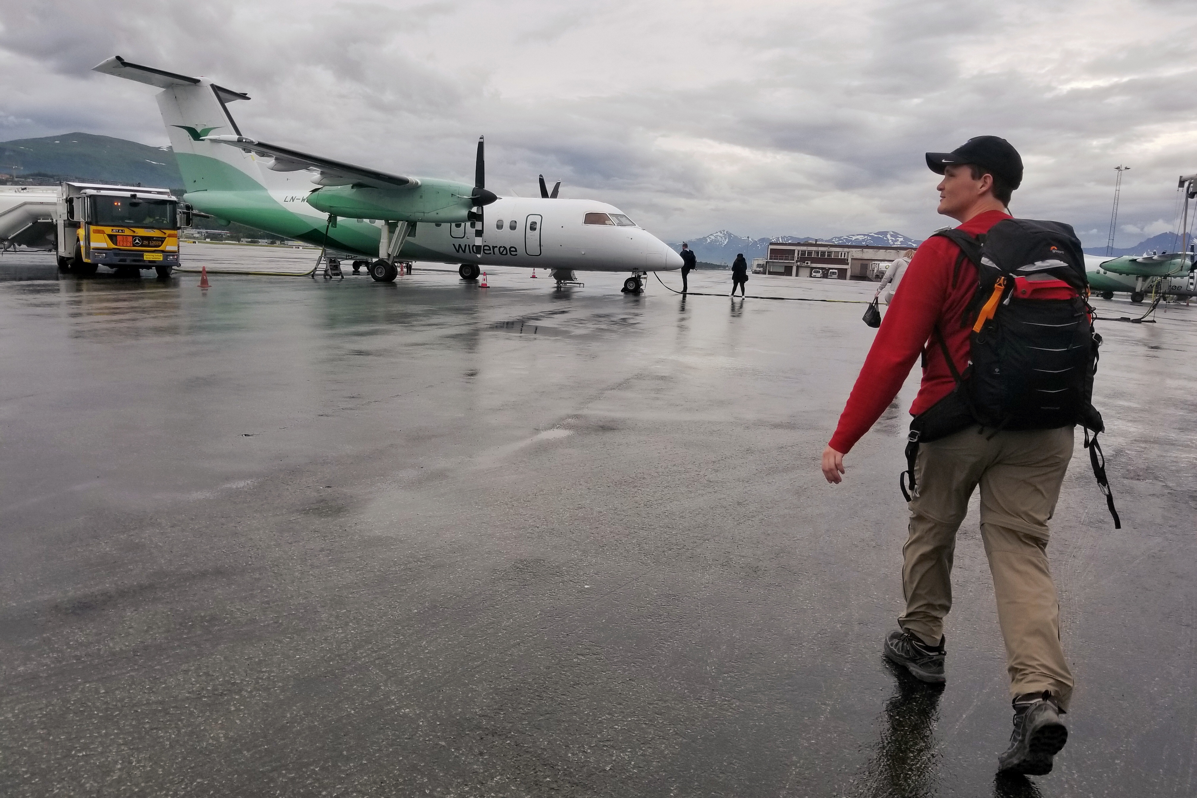
Boarding our puddle jumper to Leknes


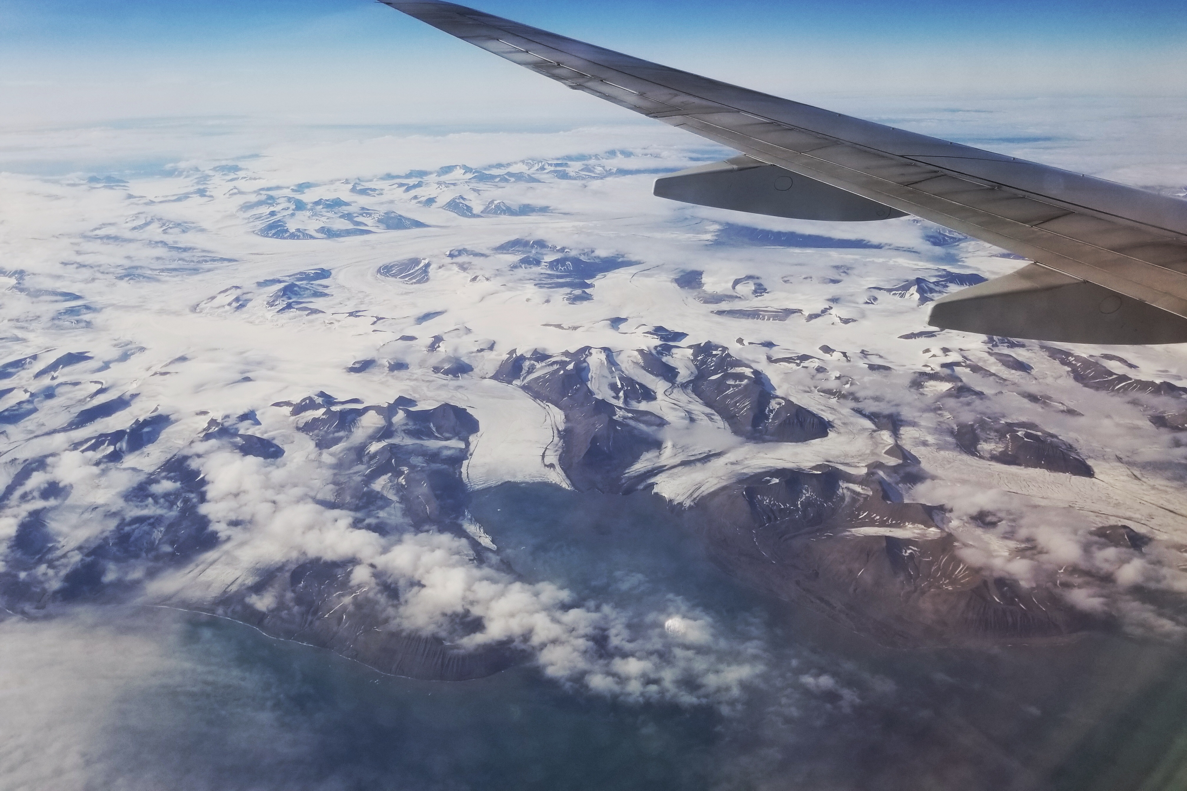
Lofoten Islands aerial, Part 1


Lofoten Islands aerial, Part 2

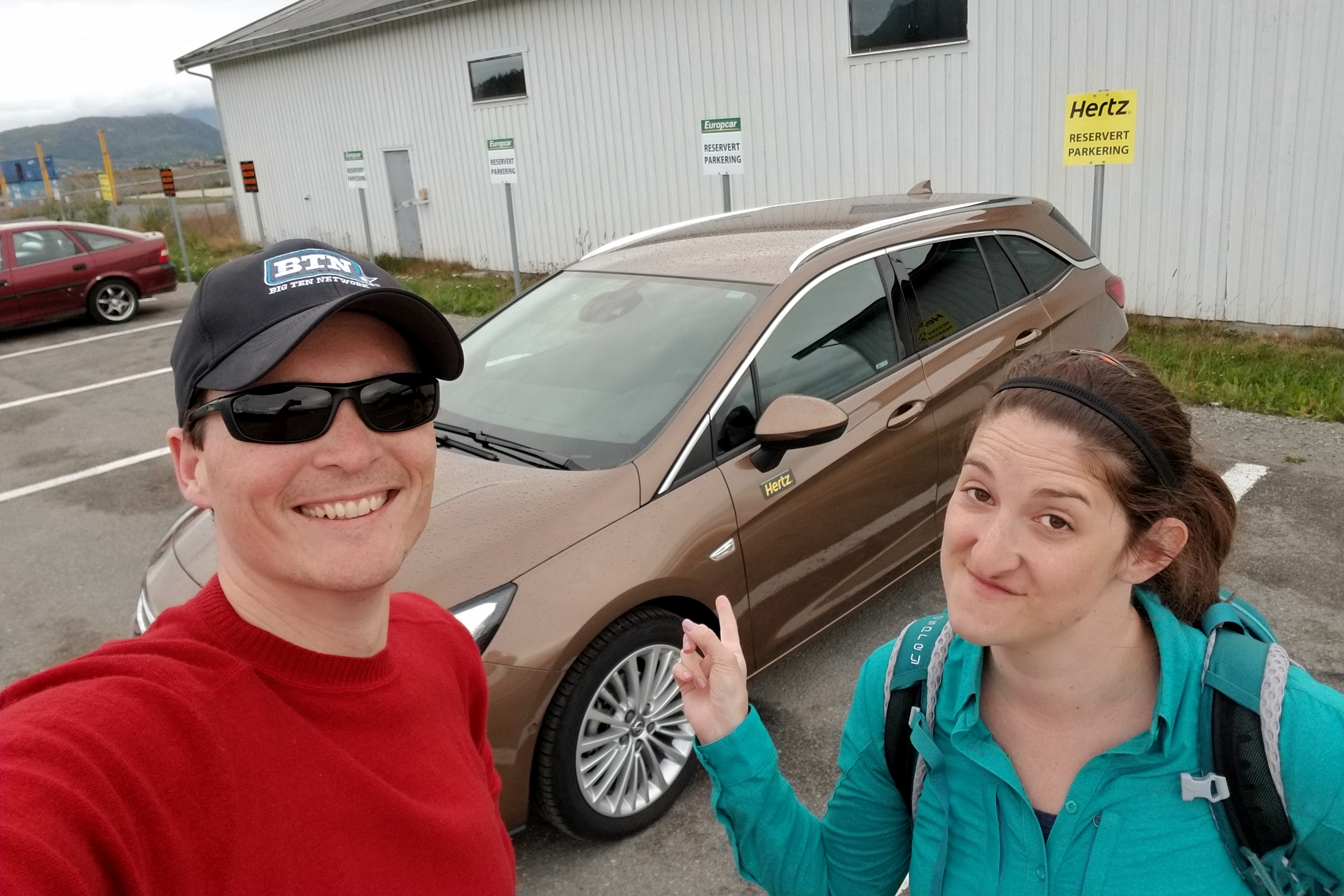
Rather than being confined to the limits of the Leknes bus service for the next two days, we decided to audible and get another rental car — primarily to explore the Lofoten scenic route tomorrow. Finding our AirBnB with the rental car was a snap, and we even grabbed some groceries on the way for dinner and breakfast.

Hatchback station wagons are all the rage here


Found our AirBnB!

Tomorrow, we will explore the Lofoten islands in the morning, and then chill with some Vikings in the afternoon.

Day 12: Barentsburg/Pyramiden

Good news! The midnight sun did not keep us from falling asleep. After our alarms rang at 7am, we had a quick Coal Miner’s breakfast and were soon thereafter picked up for a day of exploring Svalbard on an Arctic Explorer cruise.

This shot was taken around 1am

We opted for the full-day Explorer tour which took us all over the Isfjorden region, punctuated by amazing scenery, a glacier, various wildlife sightings, and a double-header of Russian mining towns in various degrees of operation — Barentsburg to the south, and Pyramiden to the north.

Our path today follows the red lines

The catamaran left Longyearbyen at 9am, heading south to Barentsburg. Seeing as it is the Arctic, and the boat was going upwards of 20 knots, it got pretty chilly in the wind. Good thing they offered us those snazzy warm jump suits! It was also cloudy and overcast, but not rainy, so we’ll take it!

Could you explain “leeward side of the boat” again?

Once we arrived in Barentsburg, we disembarked and explored the town, starting with a guided tour. While legally controlled by Norway, Barentsburg is basically Russia. I mean, there is a bust of Lenin in the town square.

Arriving in Barentsburg, an active coal-mining settlement


Our Goal is Communism!

As a currently active mining town of 400 people owned by Russia, it is not surprising the place has a lot of old Russian influences. There is a school (which, by the way, looks WAY bigger than necessary for the 70 kids who live there), a brewery (no longer the northernmost, thanks to Longyearbyen), and a hospital. The hospital only has four doctors — whom our guide says don’t even know how to use all the fancy equipment — but that’s OK because no one is allowed to give birth or die anywhere on Svalbard.

The Barentsburg school has some gorgeous murals


Yep, this is basically Russia

After Barentsburg, we boarded the boat and headed back to Longyearbyen, sailing along the coast to check out the mining “ghost” town of Grumant and the nearby Green Mountains.

We used the rest of the time time to eat some lunch, drink some hot beverages, and start on the blog. Some people were left back in Barentsburg (on purpose, presumably, because they were trekking back), and nearly everybody else from the small group of passengers ended their trip back in Longyearbyen.

Old mining town Grumant near the Green Mountains

But, a handful of people stayed on the boat with us for the day’s second tour — a trip north to see the Nordenskiöld Glacier up close and the now-defunct (and mostly abandoned) Russian mining town Pyramiden.

Plenty of new people showed up as well (about 70) because a mathematics conference of some sort is in town (really?) and apparently, they all had this afternoon free to go on an excursion.

Nordenskiöld Glacier close up


Vast landscape dwarfs small object, Part 1


Vast landscape dwarfs small object, Part 2

Unlike Barentsburg, which is still functioning, Pyramiden was closed and abandoned in 1996. Last-owned by Russia (yep, they also have a Lenin bust and all the Communist fixins’), the city features buildings that are still standing and open for tours, but otherwise forgotten by time and left to the elements.

Pyramiden wanted to have the nicest sign


Found a rusted wheel bearing amid the abandoned debris

Pyramiden is probably one of the strangest places you can visit, considering it was a self-sufficient, company-run town (in the ARCTIC!) that was trying to “prove” the value of Socialst government. Coal miners would willingly work here for a hearty salary on a two-year contract, bringing their wives and families to live and work in the town. Housing, food, sports, and everything else was included (although sometime doled out based on class and/or mining effort).

Since its closing, the same coal mining company that owned the town has kept it open for tours. There is even a hotel that somehow attracts enough visitors to stay open. A grand total of ten people live here during the summer season, and only two residents stay all year to maintain the hotel — a very “The Shinning-esque” job.

The old commissary building was one of the buildings we were allowed to explore


Investigating the lower level


Eerie abandoned kitchen

The last fun fact about Pyramiden is that it is — by a matter of degrees — the farthest north we’ll be on this trip. The exact latitude is 78-something (40, maybe?), but it looks like they just rounded that up to 79 degrees for the official landmark in the town square.

79° N in Pyramiden


Firearm escort thru town and back to our boat, Aurora the Explora’

As we finished up the tour in Pyramiden and sailed away, the sun started to come out, allowing us to see the tops of the mountains that were partially hidden earlier.

New light for the landscape

The wildlife seemed the appreciate the sunshine as well, as we spotted a variety of critters on the way back to Longyearbyen. First, some polar bears on a rocky outcrop, then a breaching whale amid some birds feedeing. Just as we were about to pull into the dock in Longyearbyen, we saw pods of beluga whales as well!

Time to spy some wildlife!


Polar bears, can you spot them?


Whale, via the super zoom on the guy’s camera next to me


Beluga whales, in multiple pods near the end


Return to Longyearbyen

By the time the trip ended at 8:45pm (but daylight that felt more like 5pm), we were driven via bus back to our lodging at the Coal Miner’s Cabins — which now feels much more appropriate! We headed straight to the lounge and ordered up the delicious looking ribs and chicken.

Mmmmmmmmmmm

Afterwards, we kicked back with another round of Spitsbergen brews (trying the IPA tonight), relaxed in the comfy chairs, and enjoyed the excellent musical taste they have at this establishment. Tomorrow, we’ll spend a little more time in Svalbard in the morning, but in the afternoon, we’ll be exiting the land of the midnight sun.

Day 11: Longyearbyen

Even when the hotel is at the airport, you still need to wake up early. We gathered our things, grabbed some breakfast and headed over to the terminal for our 8:15am flight. The check-in was smooth and the first flight to Tromsø went off without a hitch. We arrived with plenty of time to make our connecting flight on SAS to the VERY northern island of Svalbard.

Not raining at Trondheim airport this morning?!?


Glimpse of the Lofoten Islands area from Trondheim to Tromsø


Multiple glaciers visible on approach over Svalbard Island

After landing in Svalbard, we collected our bags and found the bus that runs new visitors from the airport to all the hotels in the city after each flight arrives. The weather was gorgeous; sunny, a crisp 45-50 degrees, and a refreshing breeze.

Welcome to Svalbard, 78.2232° N, 15.6267° E

The bus dropped us off at the Coal Miner’s Cabins, our home for the next two nights. The cabins used to be real barracks for the miners working in the area. Most of the mines have been abandoned because they mined out all of the coal, so the cabins were converted into lodging for visitors.

Coal Miner’s Cabins


What is this, a pick-axe for ants?! 🙂


The view from our window in the cabin (looking north)

We quickly dropped off our stuff, and got ready for our dog-sled carting adventure. Svalbard Husky guide Jacobine picked us up at the cabin, at which point we realized we were the only ones booked this afternoon… awesome! After a quick fitting for warm jumpsuits, we drove south up the valley to meet the dogs. Svalbard Husky owns 86 dogs. We happily greeted them all before getting our team geared up.

Hello huskies!!!!!


So glad you are here!!!


Want to go for a cart run?

We learned how to put the harness on the dogs and attach them to the cart. Once our team was assembled, we learned how to drive the cart –basically, steer, break and don’t drive into the ditch.

Dog team assemble!!!


Today’s starting lineup


Fixing a collar malfunction


Israel to Chaplin: You ready to go?

Driving the car pulled by six huskies was really fun. They can go pretty fast, and some of the dogs would rather run on their own than with the team. The view of the snow-capped and barren mountains surrounding us wasn’t so bad either.

Rolling down Svalbard in our Husky-six


Really letting the throttle go


One of several water breaks (warm out for the dogs)


Cortney is hydrated and ready to go again

When we returned, we unclipped our dogs, removed the harnesses, and an brought them back to their kennels where they got dinner. Before leaving, we also got to see the husky puppies that were only six weeks old, as well as a few who were only two weeks old.

Husky puppy, awwwwwwww

We said goodbye to the pups, and were driven back to the cabins. On the way, we saw some reindeer, though none with red noses. In the lounge of the hotel, we enjoyed delicious beer brewed locally in Svalbard. The locals are proud of how far north they are, so many things are “the most northern _____.” Therefore, we are drinking the most northern brewed beer, staying in the most Northern hotel, etc. Dinner at the Coal Miners was also very tasty.

Excellent local brews

The weather has finally been great for us today, which is quite the advantage in Svalbard. The sun will never fully set when we are here. It is now 11:35pm and it looks like 7:35am out the window. We’ll see you “tomorrow” from the land of the midnight sun!

Day 10: Atlantic Road

Today was our last day with the rental car and we aimed to make the most of it! Our plan called for us to wake up in Andalsnes and drive over 400km to Trondheim. As usual, we stocked up on breakfast food and hit the road at 8:30am. Thankfully we were on our way before most of the cruise ship people ventured into town (pretty sure it was the same boat we saw in Geiranger yesterday).

If it’s always raining like this, then the trolls are right


Andalsnes from across the bay

From Andalsnes, we considered two possible routes to head north, both of them involving a ferry. The route we picked had another Stave Church nearby, so we took a detour to find it. Since it was built in the 1100s, it was close to the water and a bit off the main road. In the time it took us to walk around the church, light drizzle turned into a heavy rain, so we got back in the car and continued the drive.

Did I not already mention YOU MUST STAVE AN UMBRELLA!

Instead of taking the shorter drive to Trondheim through inland highways, we took the Alanterhavsvegen scenic route following the Norwegian Sea. Officially, the route starts in the small fishing town of Bud, but the views leading up to it were pretty great as well. The rain had stopped and was holding off, which was very helpful and appreciated. The first stop, Kjeksa, provided a viewpoint of Hustadvika Bay, shipping lanes, and the ocean.

We’ve reached the Hustadvika!


Driving along the coast from Bud to Kristiansund


Weather-beaten coastline

Although not a listed stop on the scenic route, we came across an farm from the 1800s. While no longer functioning, it has been preserved for visitors to stop by and see a typical Norwegian farm.

This barn looks startled

Across the road from the farm was another point of interest called Askevagen Bay. After a little backtracking, we found the viewing platform and gazed out over the sea. In the past, kelp from this area would be burned to use for medicinal purposes, such as making potent iodine. Burning of the kelp has since been banned, but it is still used for commercial pharmaceutical purposes.

If it’s the Norwegian Sea, why do they call it the Atlantic Road?


I’m not Smoky the Bear, but sure looks like some kelp “caught fire” here

As we continued along the ocean, we arrived at Eldhusøya Island. There is a walking trail on the island, but the real attraction is a series of nearby bridges — including Storseisund Bridge, which is the largest bridge along the Atlantic Road. Perhaps you’ve seen it in a car commercial?

Storseisund Bridge


Getting a good view of the bridge

Myrbærholm Bridge isn’t as stunning as Storseisund, but it’s prime fishing location (and great view) makes it a popular spot. We didn’t try to catch anything except pictures.

Lots of locals fishing


More locals fishing

Shortly after the bridge, the scenic route concluded, and we continued to Kristiansund via Atlantic tunnel before heading inland. We took our last ferry across the bay from Halsa to Kanestraum, picking up a snack on board.

One more spin on a ferry!

Once we exited the ferry, we still had blue skies (WHAT!?!) and were treated to great views for the final 130km of driving to Trondheim.

Follow the red car to Trondheim, Part 1


Follow the red car to Trondheim, Part 2

Rather than going straight to the hotel (30 minutes outside Trondheim), we decided to spend a couple hours in the city itself.

Mostly a college town, Trondheim has many shops, pubs, street art, and a big church. We found a lovely park and took a break to eat some dinner before driving truly aimlessly through the streets for a while. Trondheim is a very active city, and very hilly. To help the bikers, on the very steep hills, there are bike lifts where you place your foot on a mechanical ramp to push you and your bike up the hill.

Colorful Trondheim


Streets of Trondheim

Eventually, we parked the car and wandered around on foot. The Nidaros Domkirke Cathedral was built in the 11th Century over the burial spot of St. Olaf, the King of Norway. It’s big, old, and houses a giant organ. We arrived just in time to hear the end of an orgelmeditasjon, or organ meditation. Impressive.

Nidaros Domkirke Cathedral


Somebody won the Cathedral ring toss!!

Meandering down towards the pier, we passed by some street art, a stage in a square, various closed museums, and some interesting shops. Trondheim seems like it would be a fun place to explore, but alas, we must be on our way to the hotel and prepare for our next adventure.

Trondheim street art

We arrived at the Raddison Blue Trondheim Airport hotel just after 8pm. Of course, the rain started up again, lol. A long, but exciting day of driving completed, we said goodbye to our trusty car, which carried us about 1800 kilometers (1,118 mi). It was helpful that the rental car company and airport are literally a two minute walk from the hotel… Again, not an accident.

Tomorrow we fly out of Trondheim at 8:15am and connect in Tromsø before flying to the island of Svalbard. Fingers crossed the flights go smoothly!

Day 9: Geiranger

Hey, it’s still raining! After another tasty Norwegian breakfast, we checked out of the Fossheim Turisthotell and crossed the street to the Lom Stave Church for some quick pics. The church was open, and surrounded by tour buses. Even in the rain, getting a look at the old architecture was worth it.

Shocking weather development… rain


Off to brave the elements again


Today you must Stave an umbrella

We continued to drive out of Lom and head north towards Geiranger. Route 15 is not technically one of Norway’s Scenic Routes, but the view still seemed pretty scenic to these Midwesterners. The rain even cleared up for a bit.

Looks like the mountains are holding back a frothy beverage


This road is not open for more than half the year


Bank barns are popular in Norway

Once we arrived in the town of Geiranger, things got more scenic, but also more crowded. A small town of 240 residents, with a fjord and amazing views, Geiranger is a main stop for cruise ships. Today there were (only!) two ships in port, raising the amount of people in town to about 6,000. We made our way through the throngs to find the meeting spot for our RIB Boat tour. Zipped up in warm waterproof suits, we were ready to speed through the fjords.

Ready for some speed-boating in the fjord

Unlike your typical fjord tour boats (like the one we took in Flam), an RIB boat holds 10-15 people, goes very fast, and gets you so close to the cliffs you can touch them. It was super fun.

Want to check out that waterfall?


Have a look!


Natural hair dryer


Most famous waterfall in the fjord is the “Seven Sisters”


Seven sisters close up

Finishing the boat ride and our pit stop in Geiranger, we continued north into the mountains the only other way you can drive in or out of Geiranger — via the Ørnesvingen-Eagle road. We stopped at the viewing platform at the top for a last look.

So long, Geiranger!


So long, Geirangerfjord!

After another ferry ride from Eidsdal to Linge, we emerged in strawberry country. This, of course, required a stop at one of the roadside stands for a delicious carton.

Jordbær fields!


Berry good road snack

The stops along the scenic route got less crowded as we travelled away from Geiranger, including Gudbrandsjuvet Gorge. It’s a pretty standard gorge by traditional gorge standards (rushing water carving out rock and such), but the Norwegians do love installing avant-garde architecture to spice things up.

Gudbrandsjuvet Gorge


Was the architect previously a basket-weaver?

By the time we got to Trollstigen, it was raining pretty hard again. Any views were totally blocked. Only 30 minutes from the hotel, and still only 5pm, we decided to hang in the visitor center/cafe to see if the rain would let up. Trollstigen (Trolls Footpath) is a stretch of road with 11 hairpin bends and a 10-percent grade. It is a popular and scenic road when it is not covered in clouds.

By 7pm, the rain had stopped, but the clouds still lingered. The visitor center was closing, so we packed up and made do with what we could see — which wasn’t too much.

Trollstigen viewing platform, visibility low

We took the switchbacks down (which, by the way, are not scary anymore… we have been driving in Norway long enough) and got a couple decent views once we were below cloud level. There was a road-widening project here a few years ago, so this road was probably in better shape than 90 percent of the rest of the roads we’ve driven in Norway.

Best view of a Trollstigen in dreary weather

Finding the hotel in Andalesnes, we were ready to take it easy for the night. Tomorrow we hope to drive all the way up to Trondheim and say goodbye to our trusty car.

Day 8: Austdal Glacier

What do you do when your muscles are no longer sore? Go kayaking and hike on a glacier, of course! The day began as usual… pack up, eat breakfast, squirrel away some food for lunch, you know the drill. Driving north from Gaupne into Jostedal Glacier National Park — in the usual rainy weather — we made a pit stop at the the Breheim Center entrance to meet up with our Ice Troll company guides for the day.

The road to Jostedal Glacier National Park

After the necessary paperwork signing our rights away, we got back in the car and drove in a caravan further north (and ever-rising elevation) to the lake where we would start our kayaking adventure. Tour guides provided us with the gear we needed, and we hiked about ten minutes over the dam to our launch point. Though still raining, everybody persevered (even the family that decided it was a good day for jeans). Two paddles and one quick kayaking lesson later, we were ready to go.

Launching the fleet

The dam was built in 1990, causing what was previously two lakes to merge into one. The lake is the highest glacial lake used commercially for kayak tours in the world. The kayaking portion of the trip was six kilometers, and it rained the entire time, but it didn’t stop our fun!

Glacial ice is served!

After arriving at the terminus of the Austdal Glacier, we added more layers (it’s cold on a giant sheet of ice), stopped for lunch, and geared up for the hiking portion. Turns out, walking on top of a glacier can be kind of dangerous – slipping on the ice and falling into crevasses and all. The use of crampons, ice picks, and ropes helped keep us safe.

Geared up for a glacier walk


And that’s why they gear you up


Heavy snowfall last season means several snow bridge sections are still in tact


Apparently the snow bridges were still safe enough to venture across


But again… giant crevasses!


Thank goodness for crampons!

Near the end of the hike, we were surprised with hot chocolate! An excellent addition to an already awesome day.

Bringing hot chocolate makes Michael a legendary guide

As the hike came to the end and we geared up to kayak back, the sun started to peek out of the clouds, providing some clearer views.

Austdal Glacier


Next group of hikers take to the glacier


Ready for another 6km row!


Largest ice berg chunk we saw floating across the lake


In summary, the verdict on our glacier kayak and hike trip

Pulling our kayak onto the shore at 6pm, we walked back down to the parking lot, returned all our kayaking gear, and changed into dry clothes. Now we were ready for the day’s final mission, driving to our next pit stop in Lom.

Here’s the alpine National Park scenery we missed in the morning rain


View of the Nigard Glacier from the Breheim Center

To get to Lom, we first needed to drive south back to the town of Gaupne where we could turn to the east and begin making our way north (stupid mountains in the way). Along the road back to Gaupne, we encountered a 30-minute delay where a car had driven into the ditch on a one-lane portion of the road. It was kind of surprising we made it this far into the trip without seeing any automobile accidents, given the Norway roads.

Well, at least the guy next door has a tractor to help out.

After passing back thru Gaupne, the rest of the three-hour drive to Lom was on the Sognefjellet scenic route. Again, slightly foiled by the weather, we couldn’t see many of the mountain peaks and glaciers in the distance (we assume they were still there), but it still was very scenic and worth the drive.

Waterfalls, evening mists, reflecting lakes, etc


Mostly cloudy and rainy on the route, but still gorgeous


This glass telescope is a great way to realize how many mountain peaks we are not seeing in the clouds

We finally arrived to our hotel in Lom at 10pm. There appears to be another Stave Church across the street that we might check out tomorrow morning. Otherwise, it’s off to Andalsnes with a stop in the Geiranger Fjord.

Day 7: Flam/Aurland

With a full day planned, we started early… out of bed at 5:30-6am, packed up, and checked out by 7am. While not as epic of a buffet as the Thon, the Fretheim selection was more than sufficient. We ate quickly and walked across the street to the Flam Railway station. The Flam Railway was built in 1924 and opened in 1940. It is 12.6 miles long and goes up 2,831 feet.

This guy is in the Flambana promotional video, so he probably didn’t just start this gig yesterday

Because the railway is the third most visited tourist attraction in Norway (per Wikipedia) and the late morning and afternoon rides were booked, we were surprised to find a relatively empty train at 7:30am. We were able to roam to seats on both sides of the car, allowing for clear shots. The only thing blocking our view were those pesky clouds. Still, the ride was pretty cool.

Climbing up the mountain toward Myrdal


Picturesque towns along the railway

Arriving back in Flam at 9:30am, we had enough time for second breakfast before our 10am Nærøyfjord cruise on the new “Vision of the Fjords” boat. The weather decided it didn’t want to play nice this time, and it rained for much of the tour. The inside was nice, and again, fairly empty, so admiring the view from the window wasn’t the worst. We also took turns braving the elements to get some pictures.

Our sweet ride through the fjords


I only have to share the top deck with the plastic owl!


Entering the narrowest portion of the Nærøyfjord

Unlike the train, which took us back to our starting point, the boat dropped us of in Gudvangen. We took a shuttle bus back to Flam and went through the same long tunnels we took yesterday (in the same direction).

The MAN bus

Flam is a town with 400 permanent residents and a handful of hotels, so it was pretty quiet – until a cruise ship rolls up! By the time we got back from our fjord tour, the place was packed. Fortunately, we completed our Flam activities and were ready to forge ahead.

Next to Flam is Aurland, a small shoe-making town dating back to the 1880s when salmon fisherman needed their shoes repaired. In the 1930s, a cobbler named Nils Tveranger returned to Norway after studying in the United States and developed the first penny loafer inspired by the moccasins worn by the Iroquois. The shoes were a huge success. They developed and changed over time, but the basic pattern is still used today. While many stores in Norway and Europe sell the Aurland Loafer, the store in Aurland also houses the small factory where a team of seven people make every pair by hand. They allow visitors to tour the factory and watch the artists at work.

The production floor of the Aurland Shoe Factory


Original hand-made Penny Loafers

We couldn’t leave Aurland without getting a pair for ourselves. My choice was easy, as they had my go-to color, which is currently very popular in Norway. At least I will be in style for the next week. Due to the unique nature of handmade products, each shoe, even of the same size, fits slightly differently. After finding the perfect pair, we were ready to hit the road in style.

The route toward Guapne has two options. One is a 24.5km long tunnel at 80 km/hr. The other is the Aurlandsfjellet scenic route, which winds up and over the alpine mountains. Being in no hurry, our choice was clear! Our directions were not. We drove through the long tunnel before realizing we passed the entrance to the scenic route. The only “scenic” thing in the super-long tunnel was a handful of rest sections that were lit up with blue and green lights – perhaps to simulate the Northern Lights?

We are mole people for the next 25km


Will fake Northern lights make you feel better about being in the middle of a mountain, perhaps?

To remedy the situation, we just turned around and took the scenic route back to where we started. Turns out that was the suggested direction anyway. Clouds still obstructed some views on the route, but they cleared up for the best spot, the viewing platform at Stegastein.

Traversing alpine terrain of the Aurlandsfjellet scenic route


Rest stop benches, Norway-style


Studying the shrouded mountain scenery…


…in some stylish new kicks


Glad he showed up for our pre-arranged photo shoot


It’s the Stegastein viewing platform, but it’s friends call it Stegasaurus


Looking down upon the fjords from the Stegastein platform

Back where were started earlier in the afternoon, we took another spin through the Lærdalstunnelen – and kept going north this time – toward the Mannheller-Fodnes Ferry on the way toward Sogndal and Gaupne.

Our last mission before getting to the hotel was to find the Kaupanger Stave Church. Scattered throughout the country are churches built in the 1100s constructed out of wood rather than stone. While each church is different, they all have corner-posts and timber framing. We plan to see a few more throughout the rest of the trip, but we can also go to Little Norway, Wisconsin and see the Stave Church replica that was used as a stall to debut Aurland shoes in the 1893 World’s Fair in Chicago.

Kaupanger stave church still in use today…


…but not after 5pm

As the sun started to peek through, we finally arrived at our hotel in Guapne to end the day. That’s enough relaxing. Back to active adventures tomorrow!

Day 6: Bergen/Flam

As expected, Bergen was a bit rainy this morning. With only casual exploring to do, we took our time to get ready. It is worth noting the Thon breakfast buffet lives up to the online hype – if for no other reason than the orange juice machine. The food choices spanned from eggs to bacon, to various deli meats, cheeses, salad, breads, and desserts. After sampling all that, and a few cups of cappuccinos, we were ready to explore the city.

Orange you glad it’s breakfast?! Yes indeed


Preparing to venture out and about Bergen

Within Bergen is the area of Bryggen. Dating back to 1070, Bryggen is made up of wood buildings and was used as the town center. Today, it is a UNESCO World Heritage Center and houses shops, museums, and restaurants.

Bryggen craft shops feel like the Renaissance Fair, and smell like fancy wood


A study of Bryggen porches, part 1


A study of Bryggen porches, part 2

When walking through one of the shops, we discovered necklaces hand-made by an artist in Northern Norway who uses the Sami culture as inspiration. After some contemplation, I decided to get a silver necklace with reindeer antlers. Given the price, we realized it is probably the best value we will find in Norway. So, we returned to the same shop later to buy a gold one as well.

Further west past Bryggen is the Rosenkrantz Castle from the 1240s. In WWII, the Norwegians accidentally blew up one of their ships, and it damaged the castle. Good work, guys.

The Rosenkrantz castle in Bergen…


…which was blown up ‘accidentally’ in WW2 (but probably the Germans, no?)

Continuing on, we passed all the shops selling tour boat people their junk souvenirs. Then we ventured into the more modern part of the city with a large plaza and a variety of department stores, including a “Super Duper” Moods of Norway Store.

New game show pitch: Moose, Elk, Caribou or Reindeer???


Everybody is playing!


Sailors Monument in Torgallmenningen Square


Rainy scene in the city


Current mood of Norway is soggy

As promised, we stopped back at the fish market for lunch. After our large breakfast, and knowing that we would also be receiving dinner at our next hotel in Flam, we decided to forgo the giant mixed seafood plates and split a salmon plate instead.

Fish market operates rain or shine


Mmmmm… lunch

The drive to Flam included many tunnels, and although the route was not an official scenic drive, it was still pretty good.

Bergen Railway sighting


Back to the mountains


Lots of tunnels, including two totalling 15km near Flam

We arrived at the historic Fretheim Hotel, which used to be a barn, but too many rich English Lords wanted a place to stay while they hunted and fished, so it turned into a hotel. We took it easy, ate our dinner, and continued taking it easy after that.

Arrival at Fretheim Hotel, just like English lords of yore


Contemplating the gray skies over dinner

We have tickets to ride the Flam Railway tomorrow morning at 7:30. Good thing our hotel is about three minutes from the station. It’s like that was on purpose!

Day 5: Hardanger/Bergen

It was nice to wake up this morning without an alarm. We had time to leisurely pack up our things and have breakfast before saying goodbye to Odda and its teeny tiny streets.

This comically narrow road earns you a PhD in parallel parking

There was a quick discussion of which route to take to Bergen. We decided on the scenic route over the one with two super long tunnels. That turned out to be a good choice as we passed some pretty cool spots along the way including a hydroelectric power plant (good use of all those waterfalls), orchards, and more fjords/cliffs.

Glad we took the scenic route to Jondal instead of the tunnels


Marriage of hydroelectric power and Scandinavian design


Hardanger region orchards


Not quite apple season yet…


…but it is moreller (cherry) season!

After our cherry break, the orchards were done, but the views were not. Here’s some proof that not all roads in Norway are at the base of a steep slope next to a body of water:

Next to the fjords and through the woods


Patches of sun heading south on Hardanger scenic drive toward Jondal


Little girl is so over the artsy architecture design at this Hereiane travel stop

We took another Ferry to get across the Fjord from Jondal to Torvikbygd (which was pretty hard to say to the ticket dude). On the way to Bergen we passed Steinsdalsfossen, a waterfall which was probably more powerful than usual due to the summer snow melts and the recent rains. There is a trail that takes you up and behind the falls where you are able to stand under it and not get wet.

Steinsdalsfossen is a waterfall in the village of Steine in the municipality of Kvam in Hordaland county. In other words, it was on our way.


It’s not the biggest waterfall but it packs a punch, and you can walk behind it


Well, there are some bridges in Chicago if you’re looking…

We made it to Bergen around 6pm and found much of the crowd returning to their cruise ship after a day at port. Checking into the hotel, we were pleasantly surprised to find out (or remember) that the hotel offers free dinner!

Arrival in Bergen!

After we ate a few bowls of delicious lamb stew, we walked a couple of blocks to Floibanan, the Mt. Fløyen Funnicular. We bought tickets and rode up to the top — no hiking up crazy trails today. In addition to taking in the great view of the city, we meandered around the forested park area at the top and hung out with a friendly duck for a while.

Overlooking Bergen from Mt Fløyen


Near-sunset view of Bergen from Mt Fløyen


Team of free-range goats that mow the lawn on Mt. Fløyen… wonder what they’d name an orange goat?


Yeah man! Way to not let those billy goats push you around!


Sorry, looking for bread from carb-free lady isn’t going to fly

Still light out when we came back down at 9pm, we wandered the streets of Bergen for a while longer. ALERT! First sighting of McDonalds and Starbucks in Norway. We also went to the famous Bergen Fish Market where we were offered samples of smoked salmon and whale meat. While not too excited to eat any more whale, we will definitely be returning for lunch tomorrow for some fresh seafood.

Friendly fish guy gives us samples


The Bryggen row houses catch the day’s remaining rays of sun

We plan to continue to explore Bergen tomorrow before heading over to Flam.

Day 4: Trolltunga

When we woke up this morning, there were periods of rain predicted throughout the day. Instead of letting that stop us, we followed the old Norwegian saying, “Det finnes ikke dÃ¥rlig vær, bare dÃ¥rlig klær!” which translates to, “There’s no such thing as bad weather, just bad clothes!”

Packing layers and rain coats, we made sure we had clothes for all the weather could throw at us. We fueled up with eggs and bacon, as well as coffee of unknown strength (because I can’t read the Norwegian serving sizes on the jar).

Breakfast of champions

When we arrived to the Trolltunga parking lot at 8am, it was nearly full. Trolltunga (or Troll’s Tongue) is a rock formation that juts out from the cliff and is a popular destination for hikers. It takes about 10 hours round trip, so people tend to start early. The first 4km is an 8% grade gravel/dirt road with switchbacks. After that, the trail mixes it up with steep stone steps, bald-faced rock sections, giant boulders, mud, water, snow, you name it!

Starting the hike with 3-4km of switchbacks


Navigating past lakes and other standing waters

The weather was nice to us, with only a few passing showers as we went up. As expected, the views were spectacular.

Lake Ringedalsvatnet comes into view


Final 2km terrain before Trolltunga

We made good time and arrived at Trolltunga after four and a half hours. Because it is so popular, and because the ledge is fairly small, only one group of people are allowed on at a time, resulting in a line. After waiting for our turn, we asked our line mate to take our picture for us, but she couldn’t get the camera to work. Instead, she took some on her own phone and I gave her my email, but she spoke very little English, sooooo…. check back to find out if those ever arrive! 🙂 In the meantime, here’s what the place looked like:

We have arrived!


The line to step onto Trolltunga


Where’s Waldo! Can you find Jo, two people who are 30 minutes from getting engaged, and the lady who may or may not remember to send us pics of when we walked onto Trolltunga?


Every rule on this sign was being ignored

Even without going out on Trolltunga, the area provides incredible views overlooking the Fjord and cliffs. Plus, you are still up really freaking high, so if you want the same adrenaline rush that going on Trolltunga might provide, uh, just look over the edge.

Here is our backup photo from the higher peak next to Trolltunga


The view looking west-ish from Trolltunga

It was pretty windy and chilly at the top, so we hiked back down a few kilometers before stopping for lunch. It was lovely for a few minutes, then some real rain came in. We finished up, put on our rain coats, and got back on the trail for our long journey down.

Trying to re-trace our path on the way back


Cool rocks, man


Some really nice cleavage


This view is pretty good…


…we should stop and eat lunch in front of it…


…and finish just in time to put on rain jackets


And since we got rain, how about some snow too

Again, the rain passed fairly quickly, and the sun came out for the majority of the remaining hike. The strenuous uphill hike was still hard on the way down for our weak American legs. Judging by the looks and speed of fellow hikers, every day is leg day in Norway. When we finally made it back to the switchback road, a few cars drove by, seemingly taunting us. We successfully finished the 28km (17 miles!) hike in 10 hours and 10 minutes. Hopefully I will be able to walk tomorrow.

Back to the parking lot… We did it!

Back at the house, we made a quick dinner and moved as little as possible.

Canned foods never tasted so good!

Tomorrow is mostly a rest day. Our only plan is to drive to Bergen and explore the town.