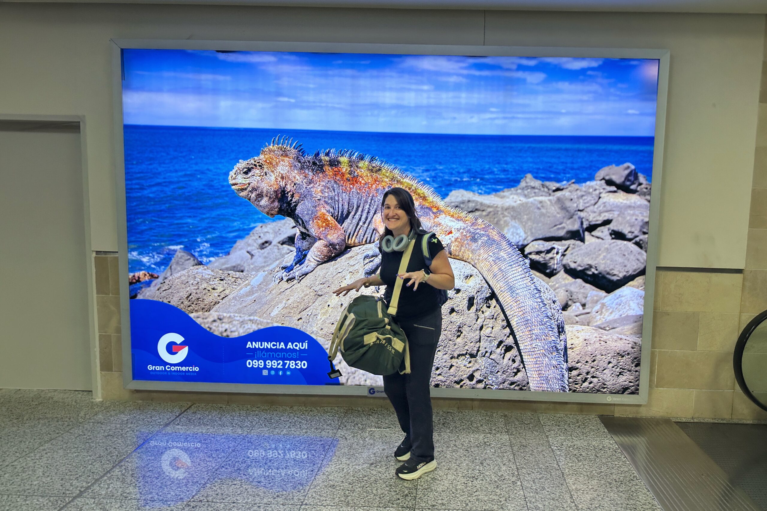
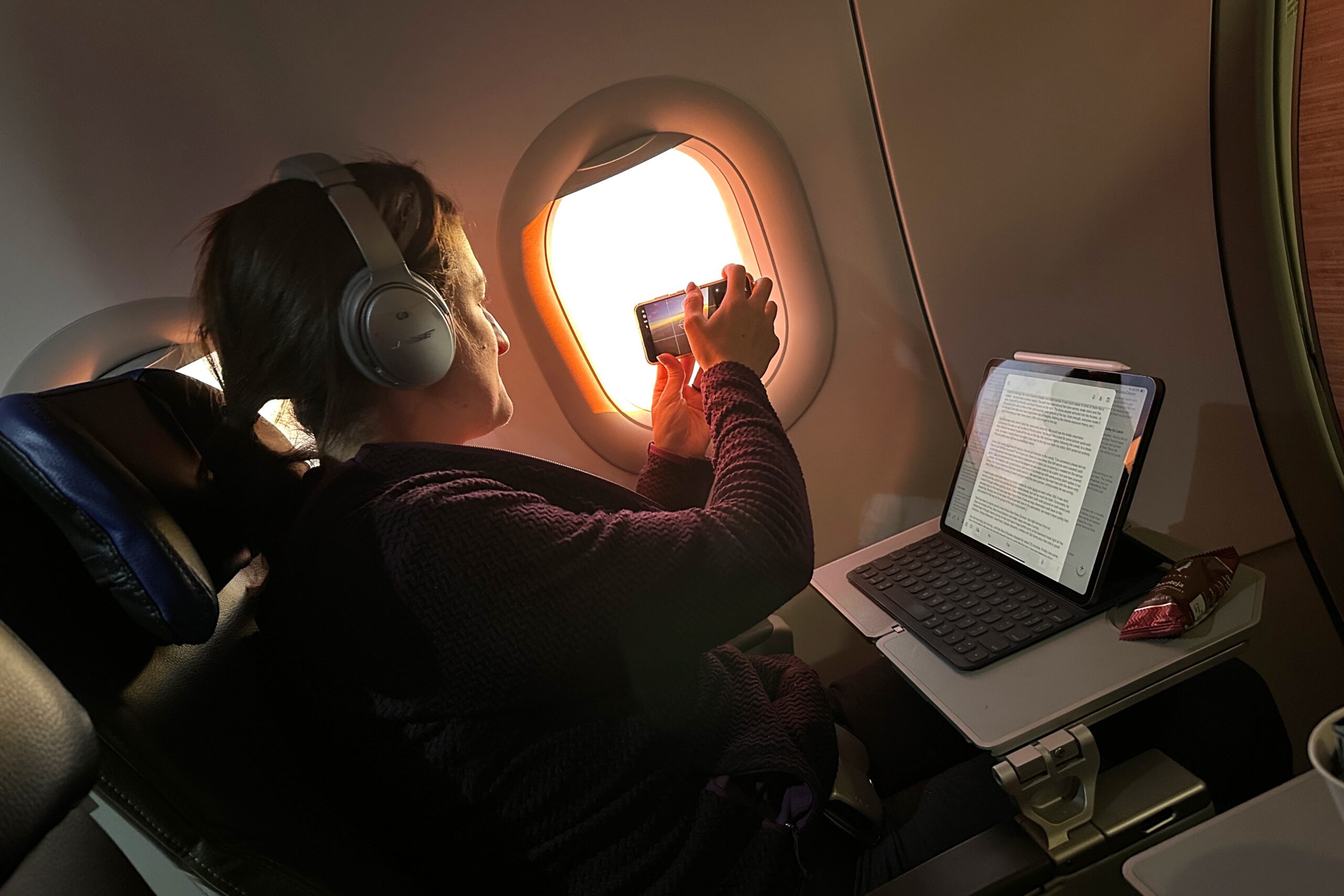
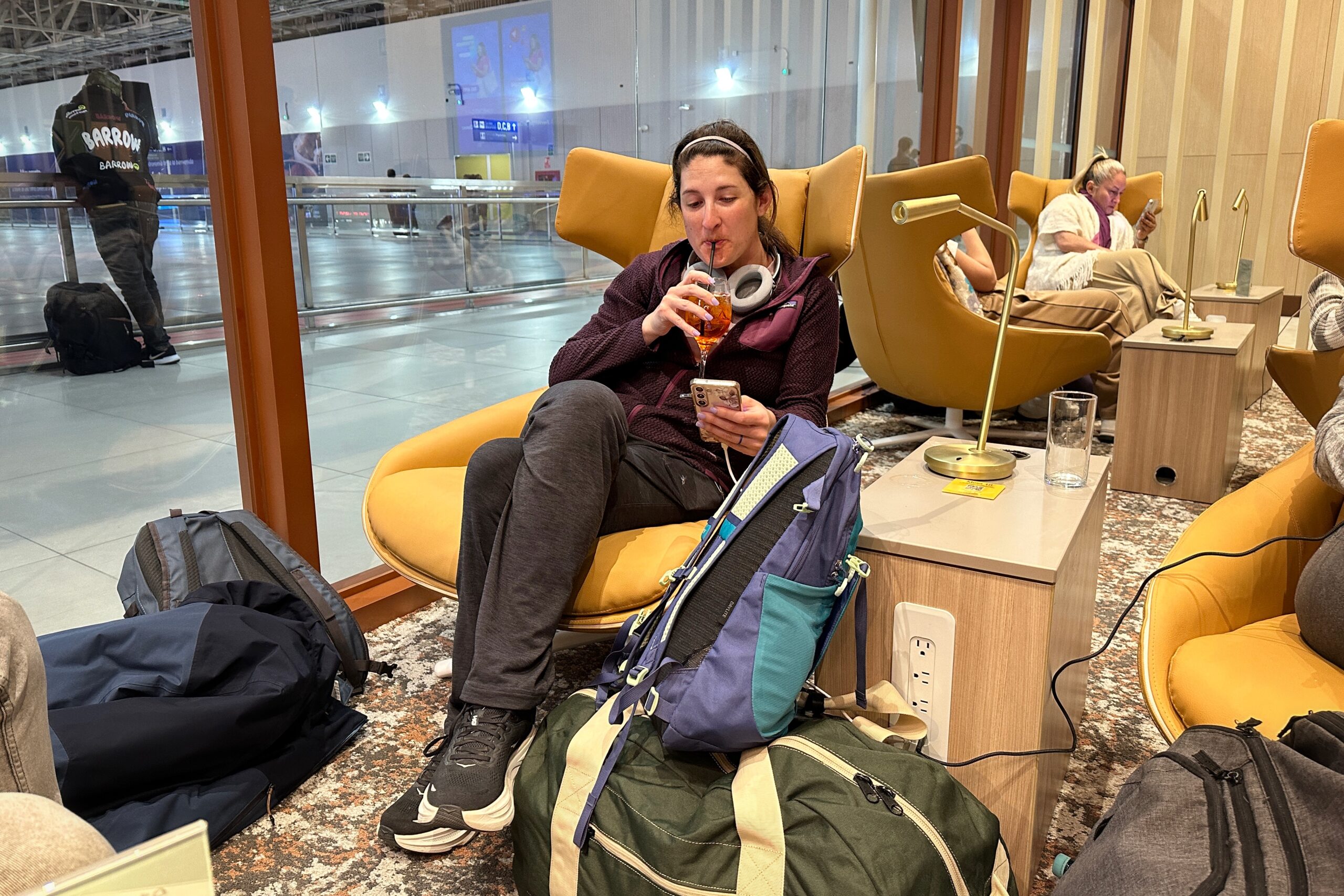
We woke up this morning and didn’t hear any rain! Santiago met us at breakfast and told us to come outside. There were some clouds, but lo and behold, we finally caught a glimpse of Cotopaxi. It does exist! We returned to breakfast to fuel up for the day – including fruit and granola with homemade yogurt (perks of farm life).
It’s not raining today!
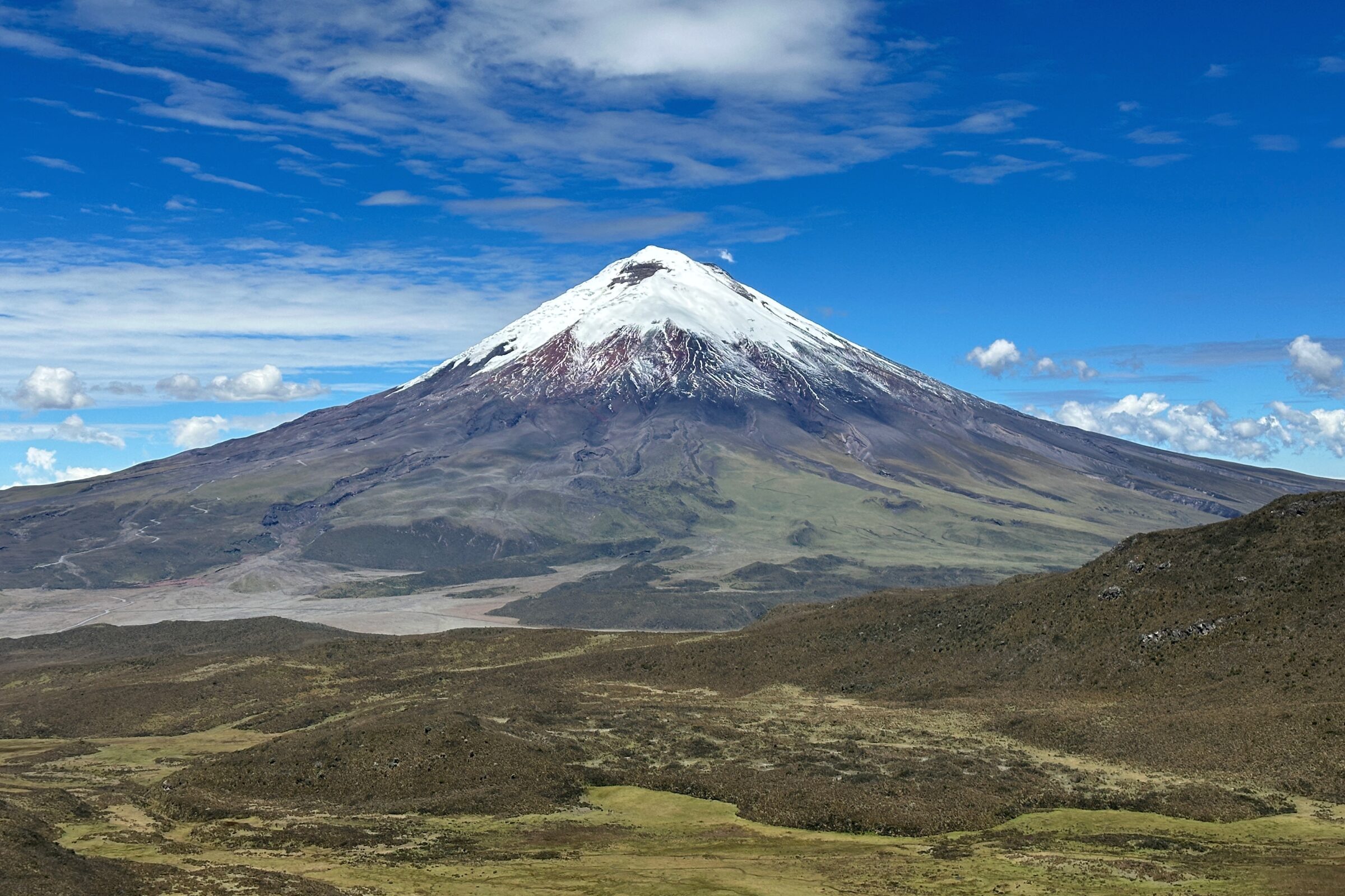
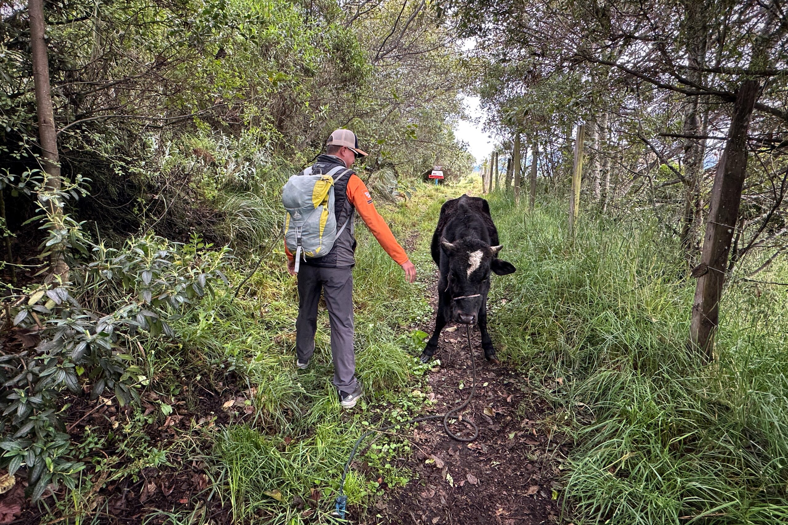
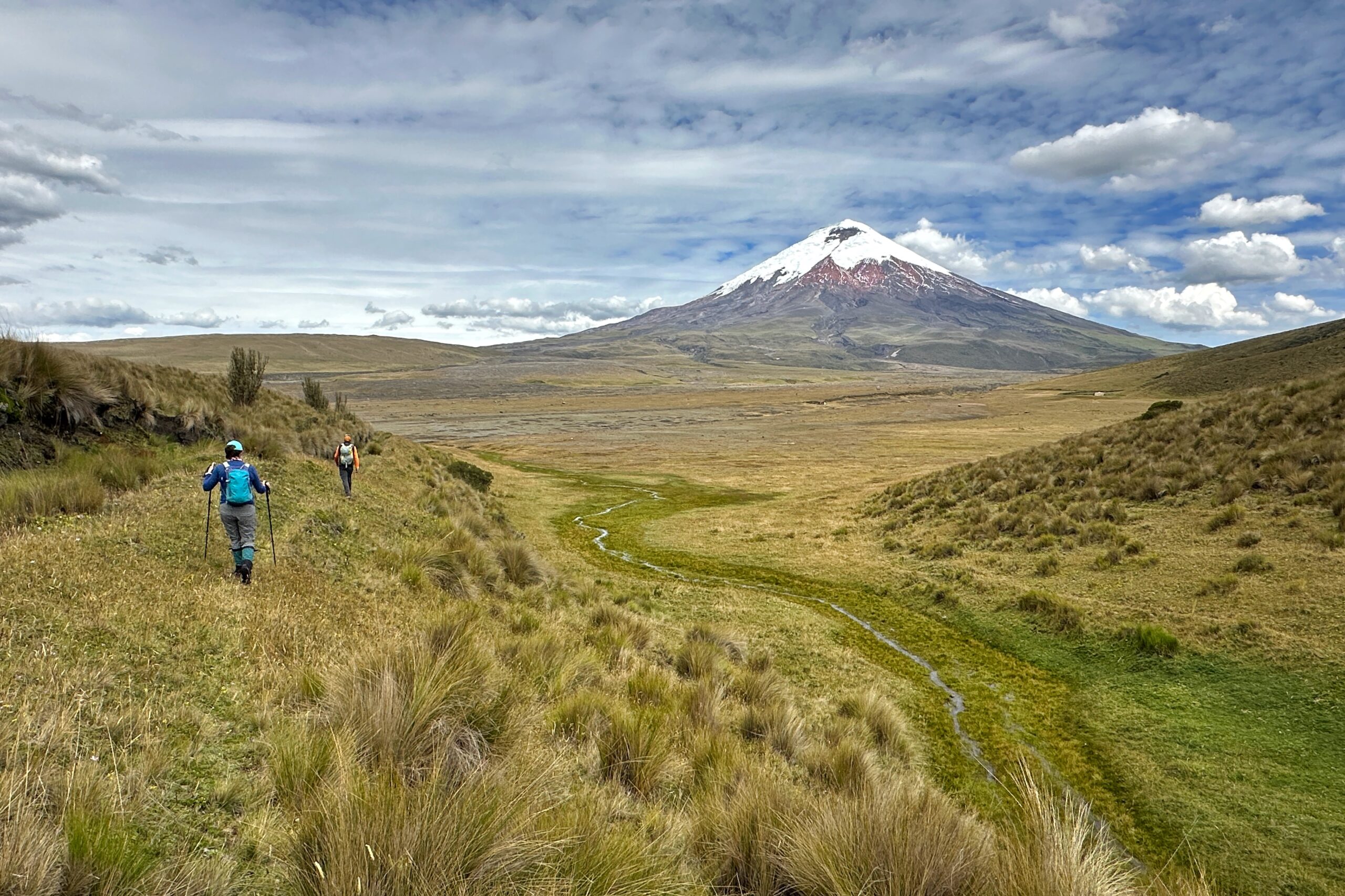
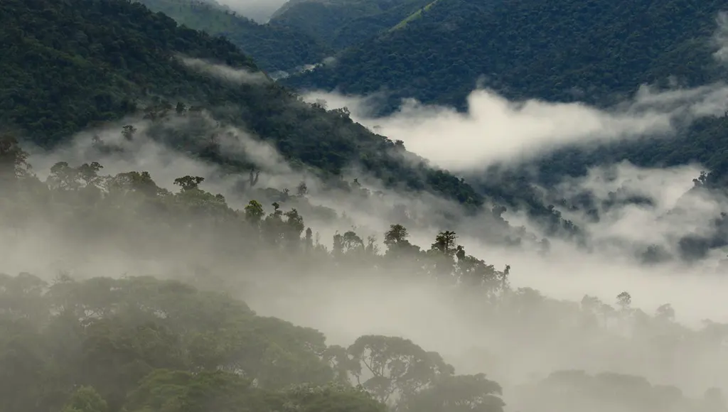
Today’s hike went straight from Hacienda El Porvenir to Tambopaxi lodge. No van needed for us, but our driver did transport our bags. We entered a hiking trail right outside the building and were on our way. Almost the entire hike is on the property owned by Hacienda El Porvenir, so there was no one else on the trail all day — except for a cow and potato farmers in a field nearby. The weather was still clear and we were taking all the pictures of Cotopaxi as we could. Never know when the clouds will roll in.
Santiago assured us he just wants to play
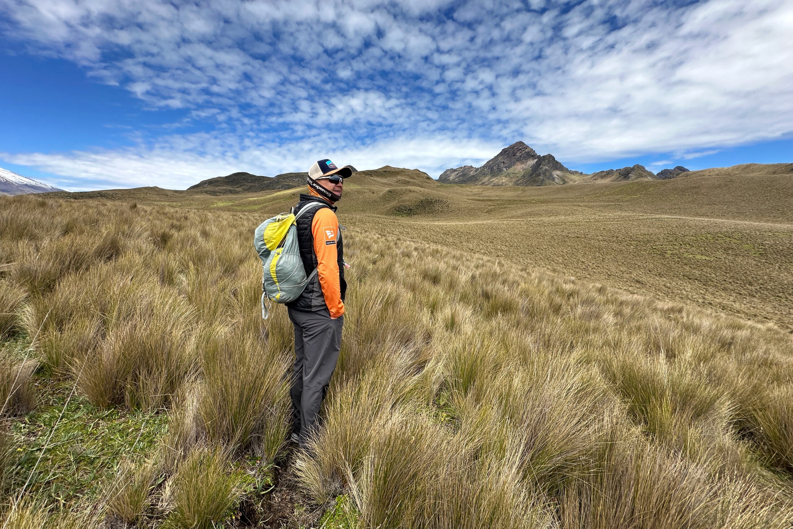
Hacienda El Porvenir and Sincholahua in the distance
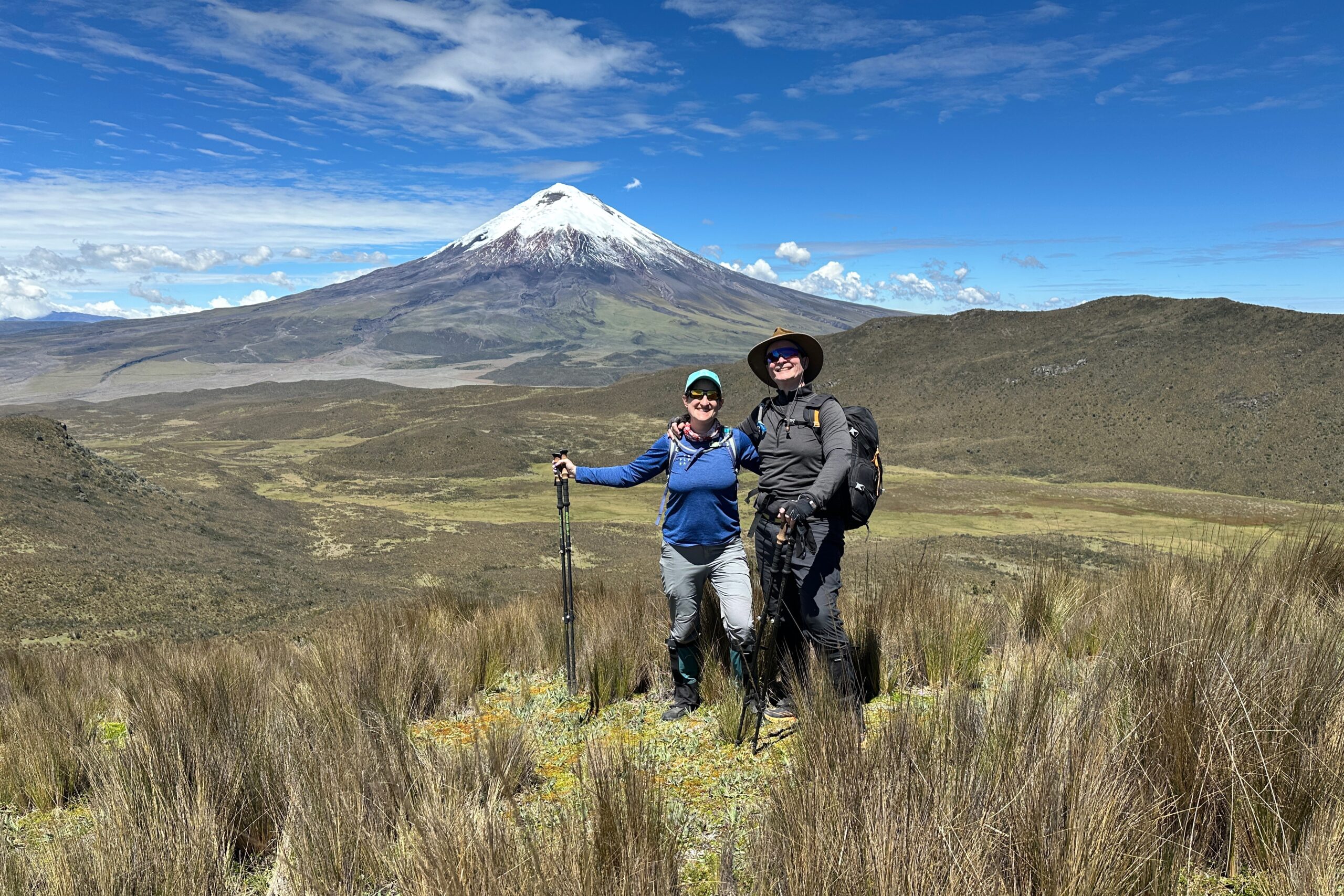
Clear view of Cotopaxi
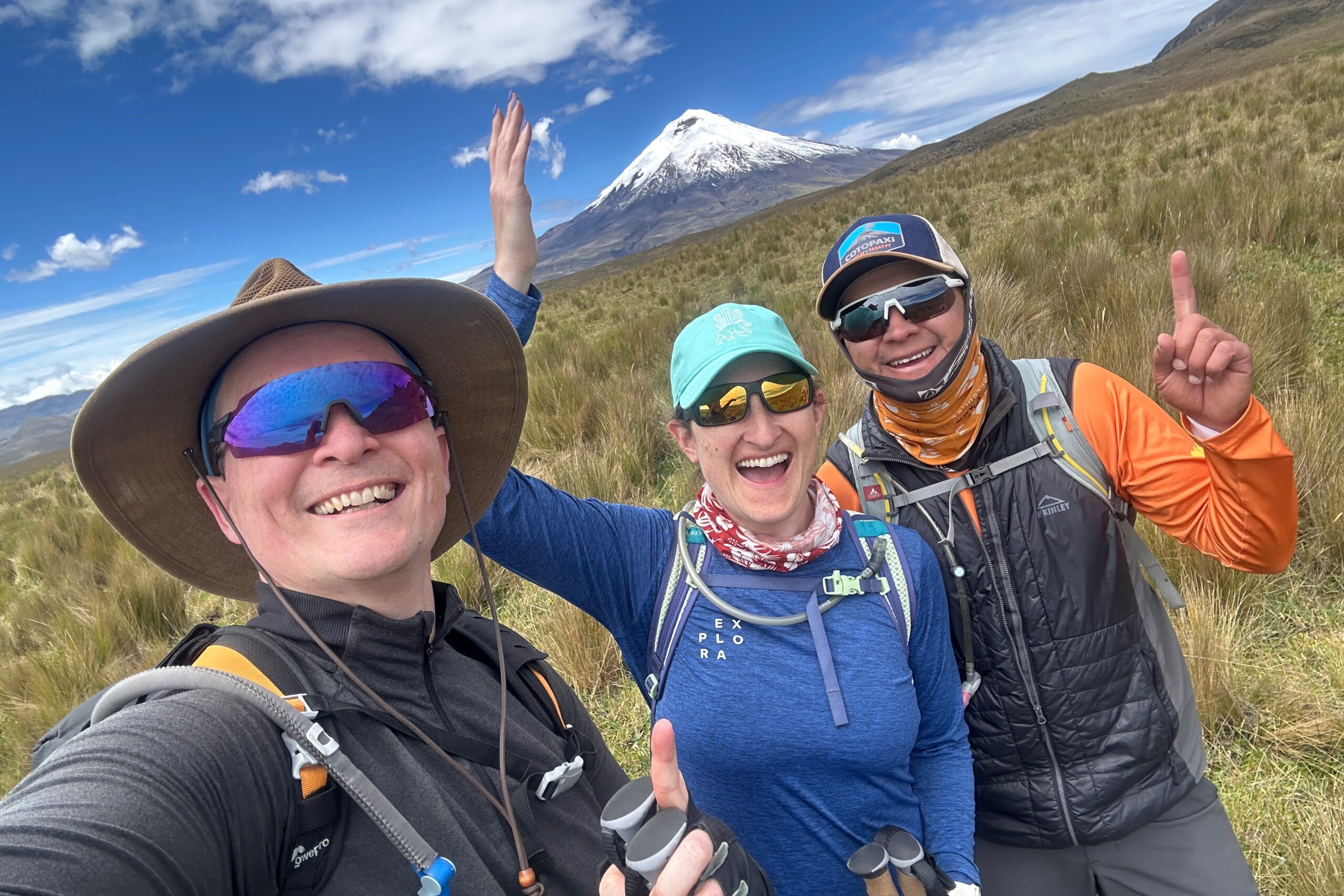
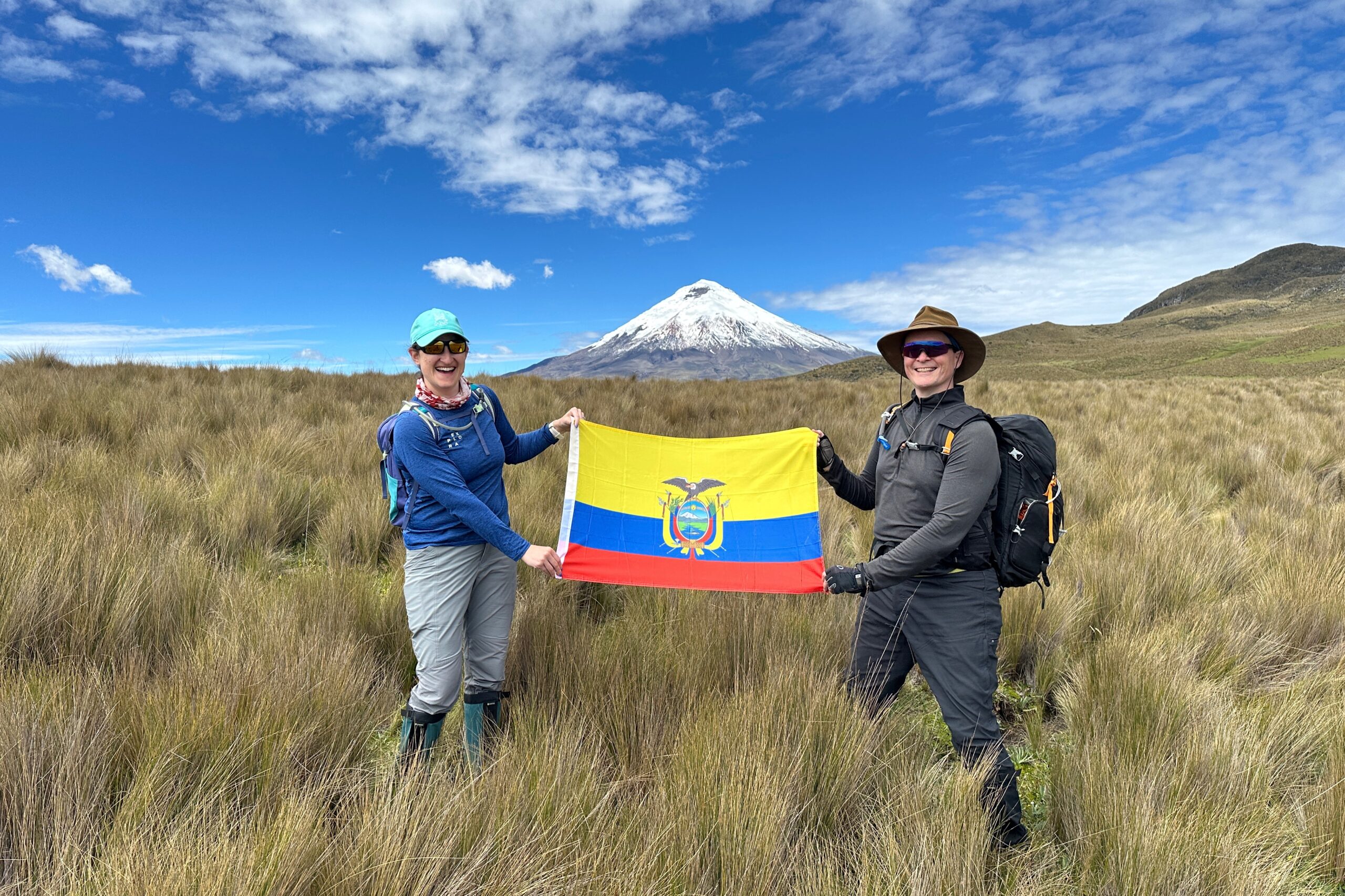
Ecuador flag series #2
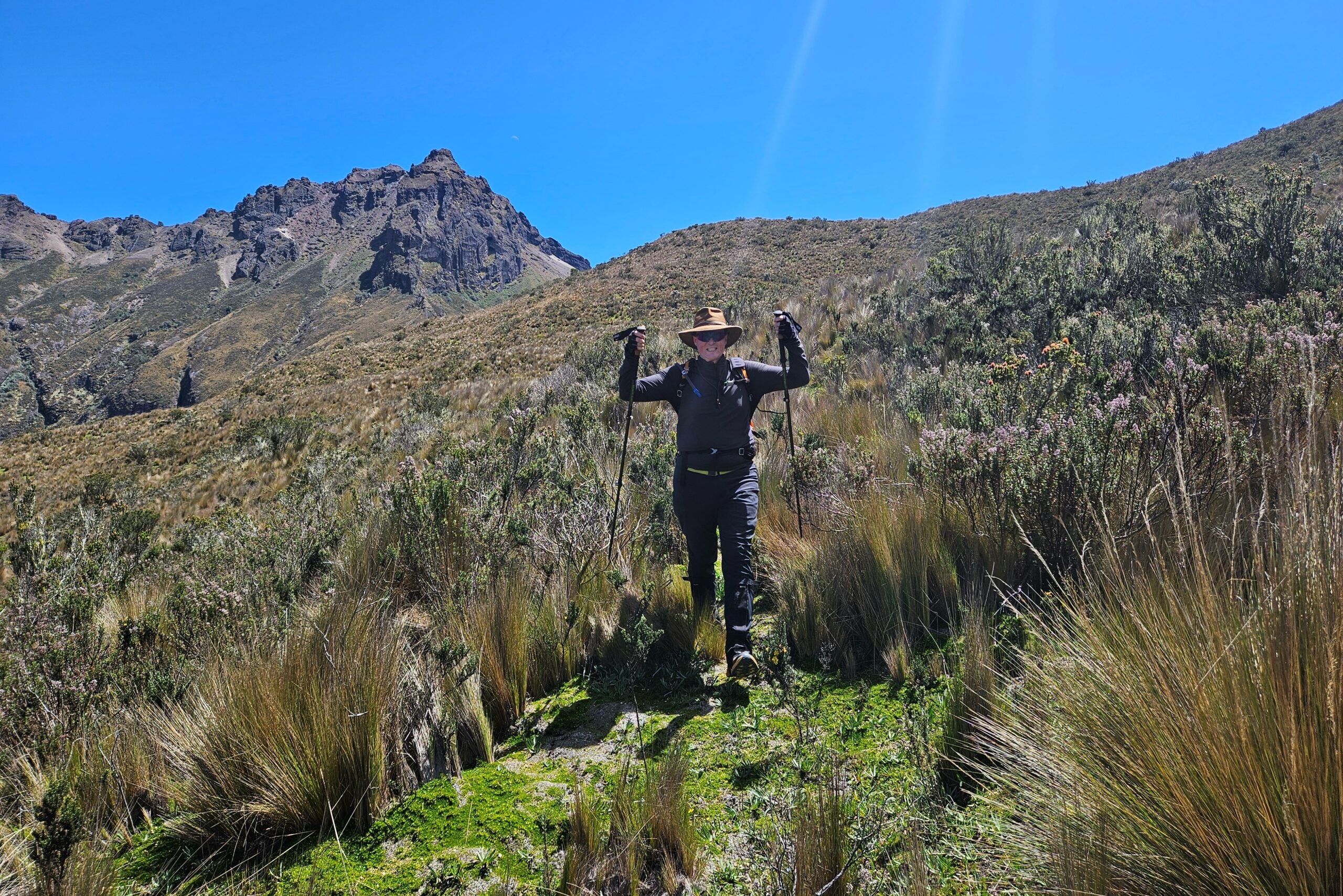
Santiago leads the way to our pass near Rumiñahui
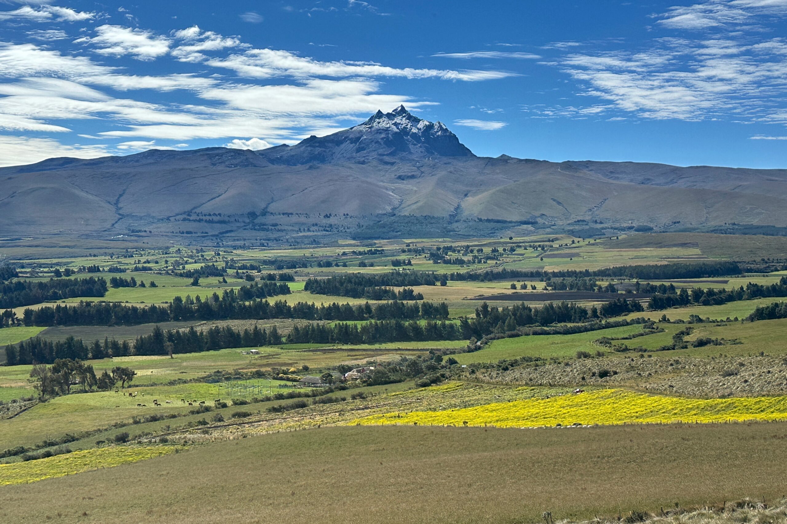
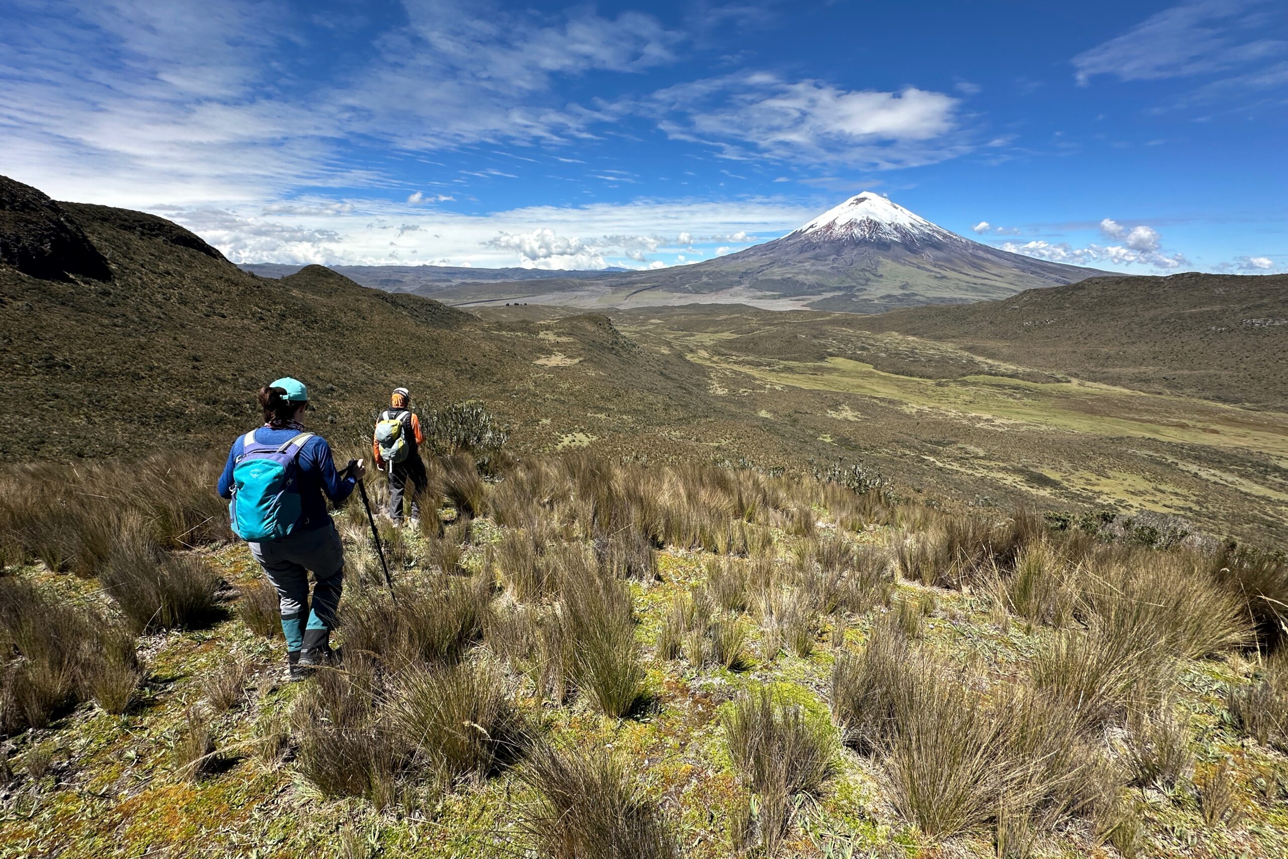
The hike was a gradual uphill climb followed by a couple miles of steep uphill climbing to traverse the pass near Rumiñahui. With today’s clear weather, we could really see for ourselves why this area is called the Avenue of Volcanoes. There are multiple volcanoes on each side of the valley. At the top, we had a great view of Cotopaxi. Plus, we could see the peaks of the tallest volcanoes in Ecuador, including Chimborazo in the distance.
Cotopaxi glamour shot
View of Cotopaxi from 13,800ft elevation
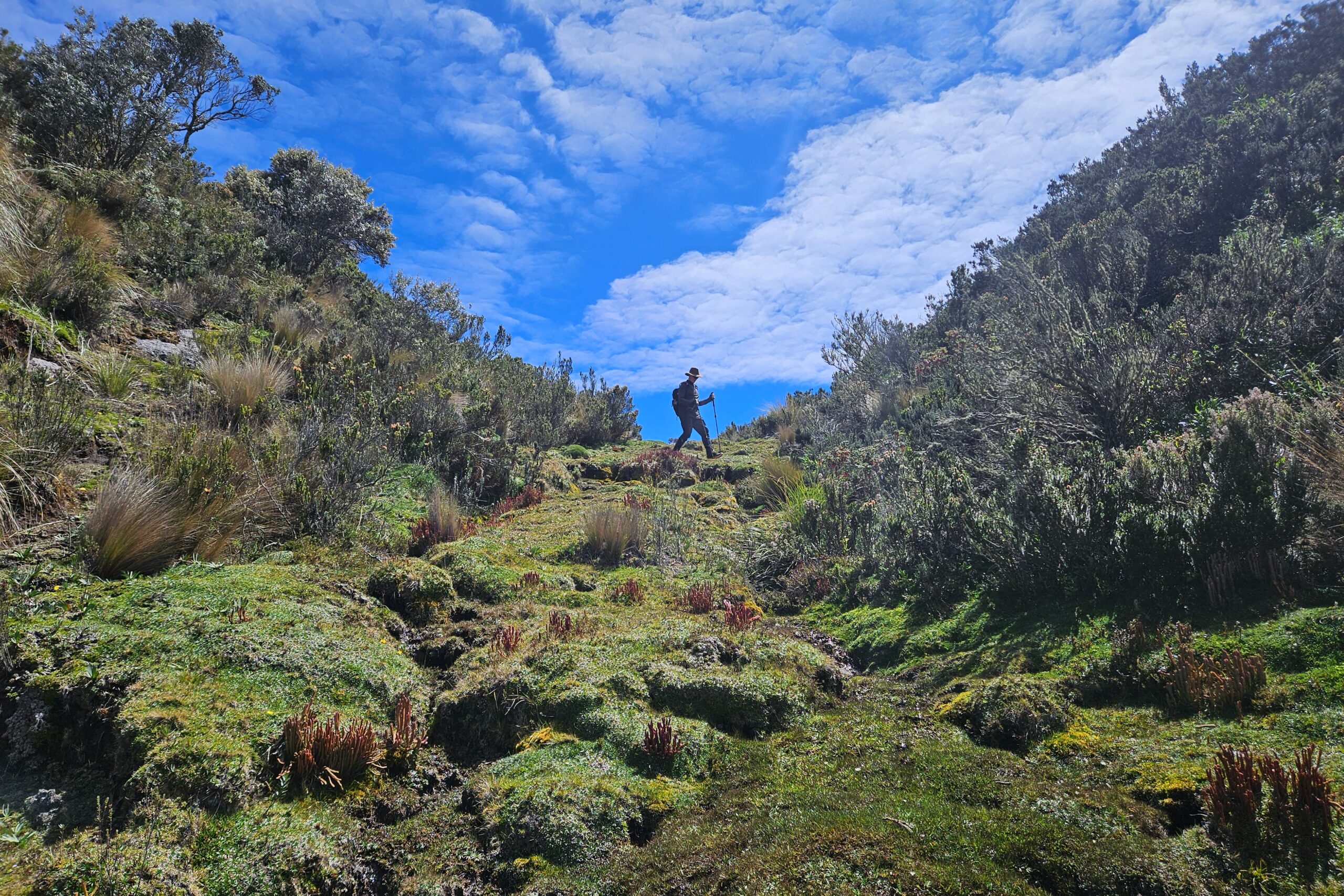
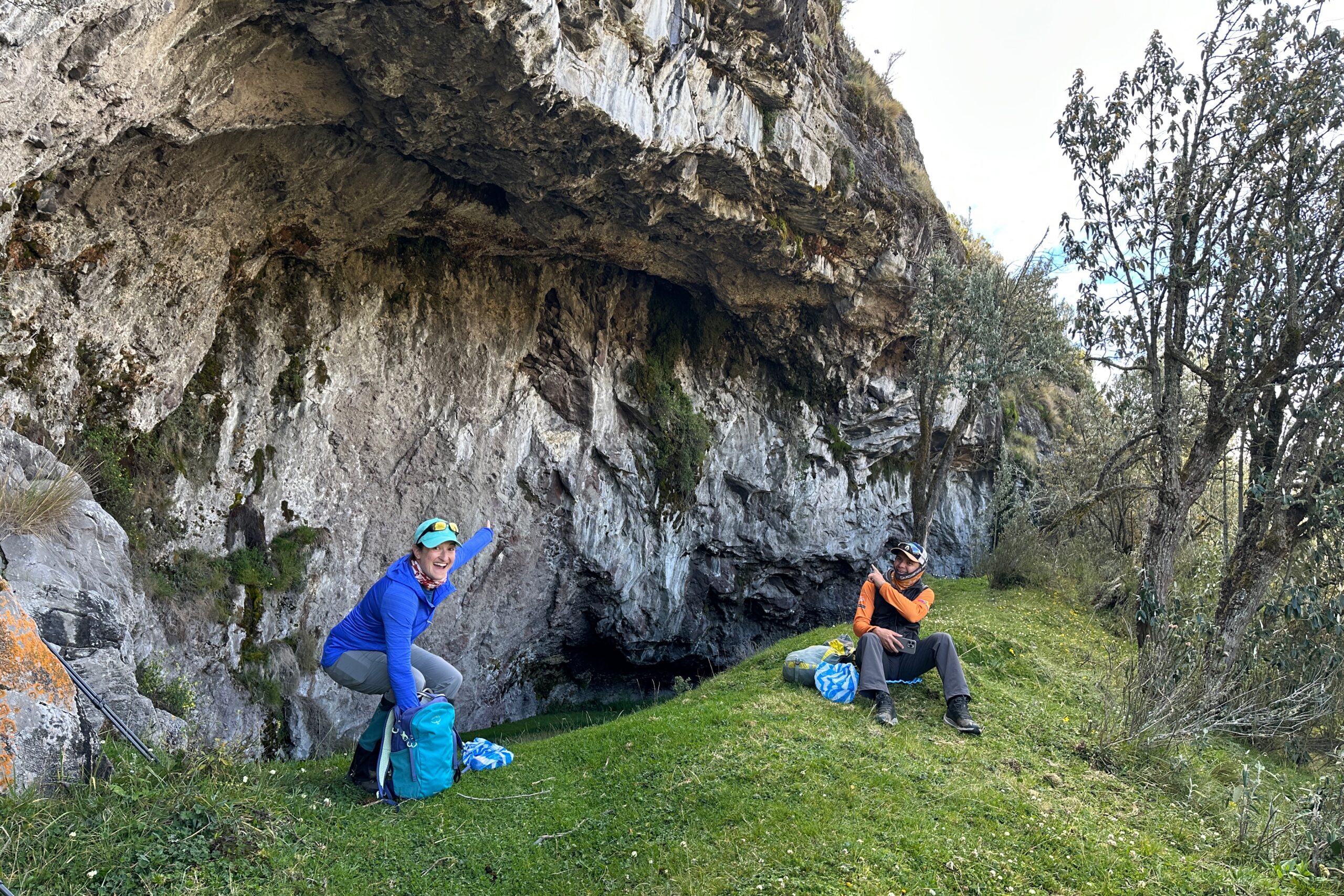
The hike was all downhill from there. We walked down a bit to get out of the wind and find flat ground. Santiago knew of a cave nearby where a great horned owl lives. That would be our lunch spot. As we approached, we made sure to be really quiet so we don’t scare off the owl. We looked around for a minute but didn’t spot him. Then Jo caught a glimpse of it flying and tracked it until it landed on its perch in the cave. It stayed there while we ate lunch.
Heading down from the pass
All downhill from here
Following natural drainage paths
Lunch by the owl cave
After lunch, we had about 3 more miles to go. We made it to Tambopaxi Lodge in good time and had the afternoon to relax. Overall, the hike was eight miles, took six hours, over 2,000 feet in elevation gain, and had a maximum elevation of 13,843 feet. Oh, and zero rain!
Hiking…
Still Hiking…
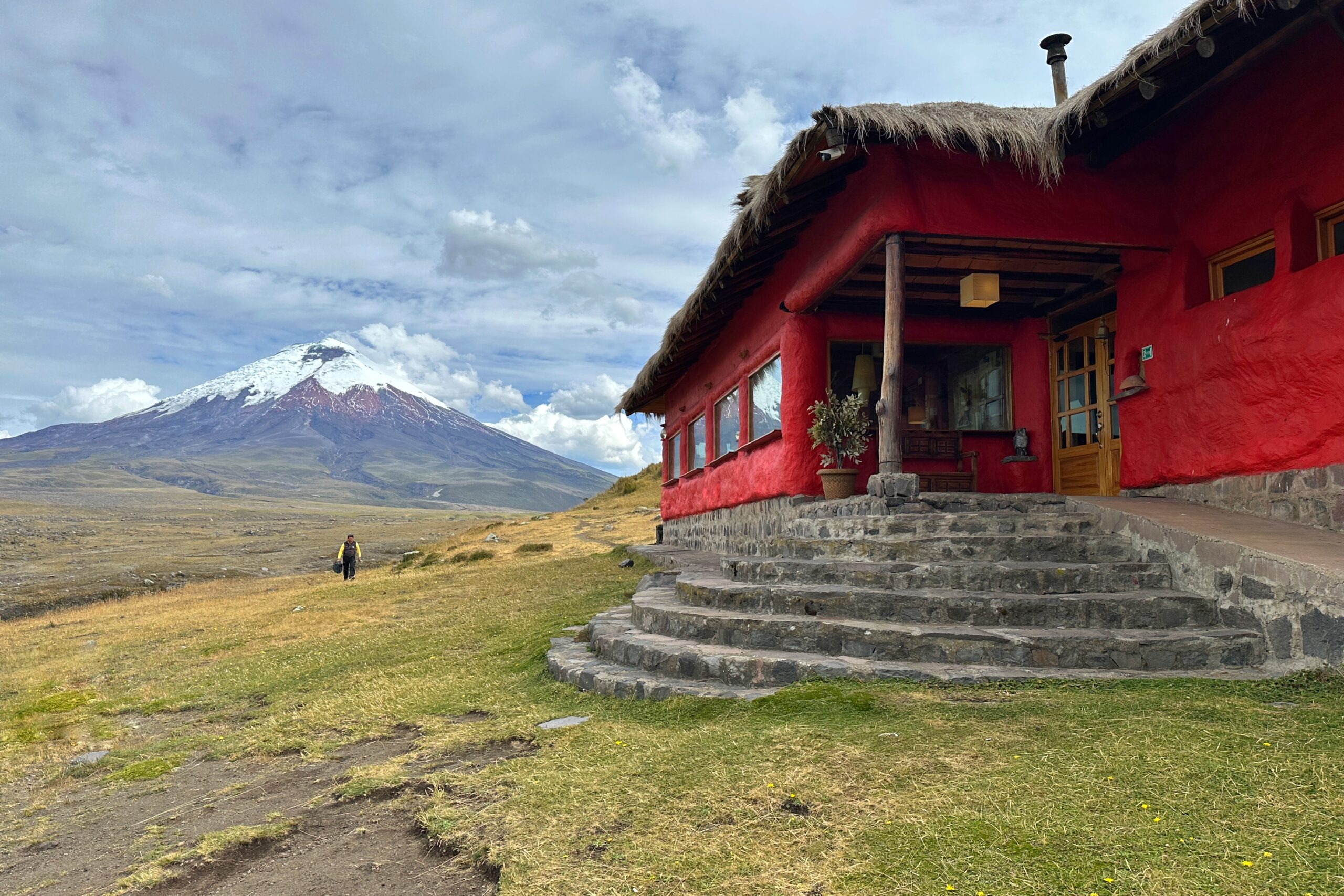
Arrival at Tambopaxi Lodge
Our cabaña for the night
This is basically Link’s house
Hey guys, how the nap?
After a couple hours of relaxing — and watching the sunset — we walked back up to the main lodge building for a bite to eat and a couple refreshing Apple Ice flavored Gatorades. Hopefully the electrolytes will help Jo recover from a bit too much sun on today’s hike and we’ll be ready to roll tomorrow for Cotopaxi.
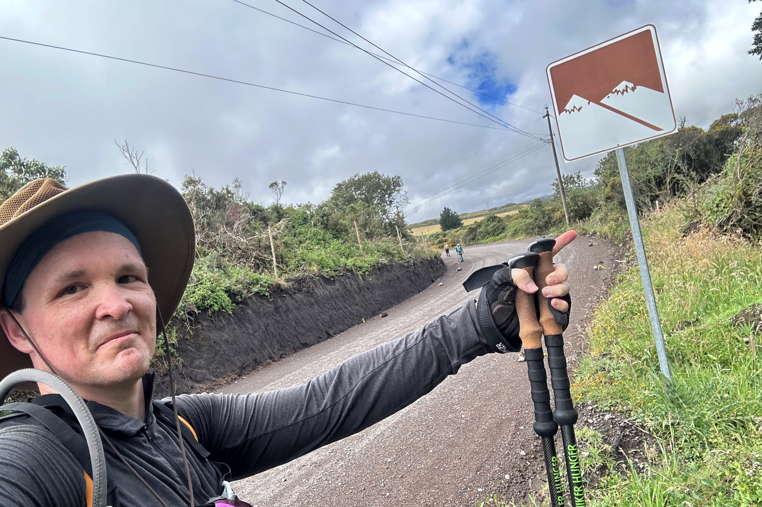
In an effort to avoid the traditional Ecuadorian afternoon rains, we started about an hour early today. Unfortunately, it was also raining in the morning (which is apparently uncommon, yet has happened every day so far). We ate breakfast, donned our rain gear and set out on foot.
Thanks, Juan Carlos!
Follow the aqueduct road
As expected, a few minutes after we left, the rain stopped and we changed layers. The first part of today’s hike was on gravel and cobblestone roads snaking past farms and fields heading south from Cotopaxi Punga. Soon into the start of the hike we had to climb a gate to get into private land (don’t worry, we had permission). The road was pretty flat, so we were making good time.
Mountain views spoiler alert: Not today!
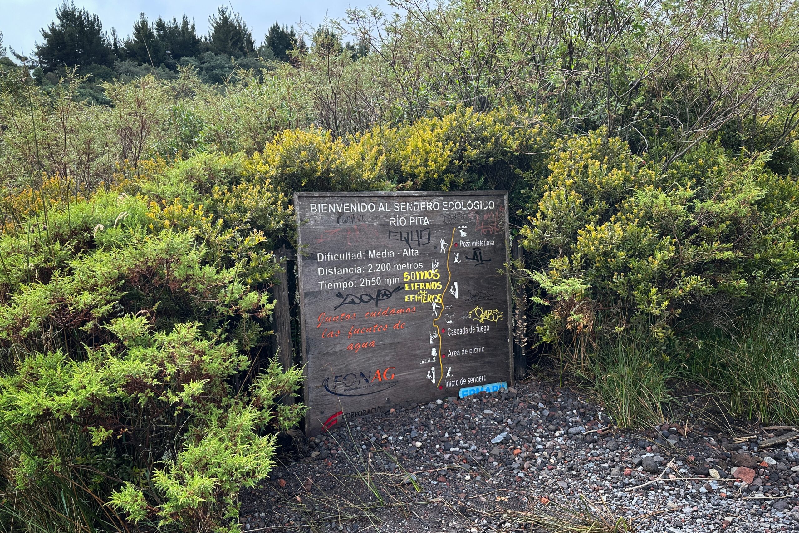
After following the road for a couple of miles, we made it to the trailhead of Cascada de Fuego. We also met Victor (our new driver for the next few days) stationed here with the van and our lunches. We packed what we wanted to carry and left the rest with the van. The next part of the hike was a more challenging route.
That’s not a US “medium”
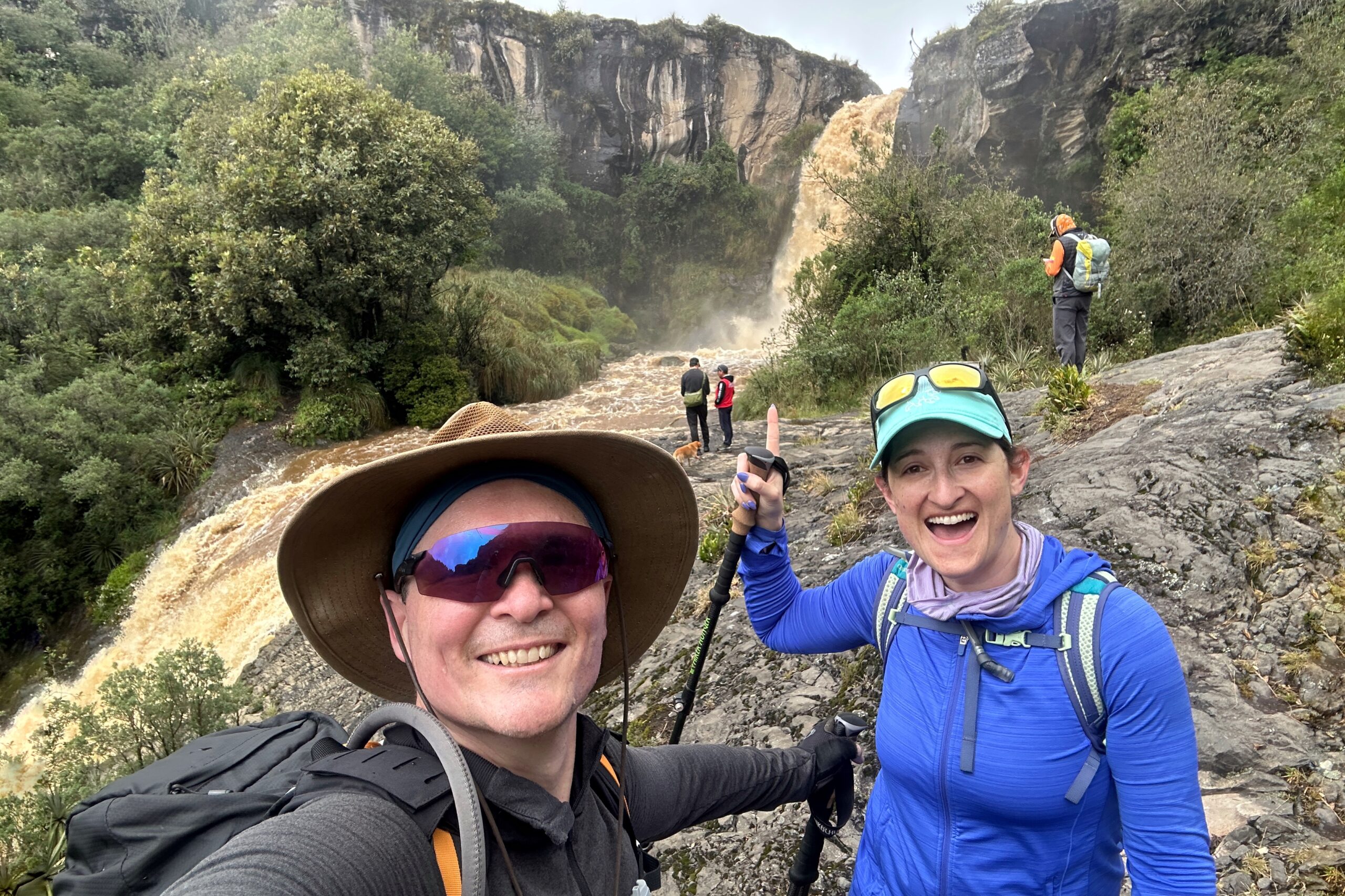
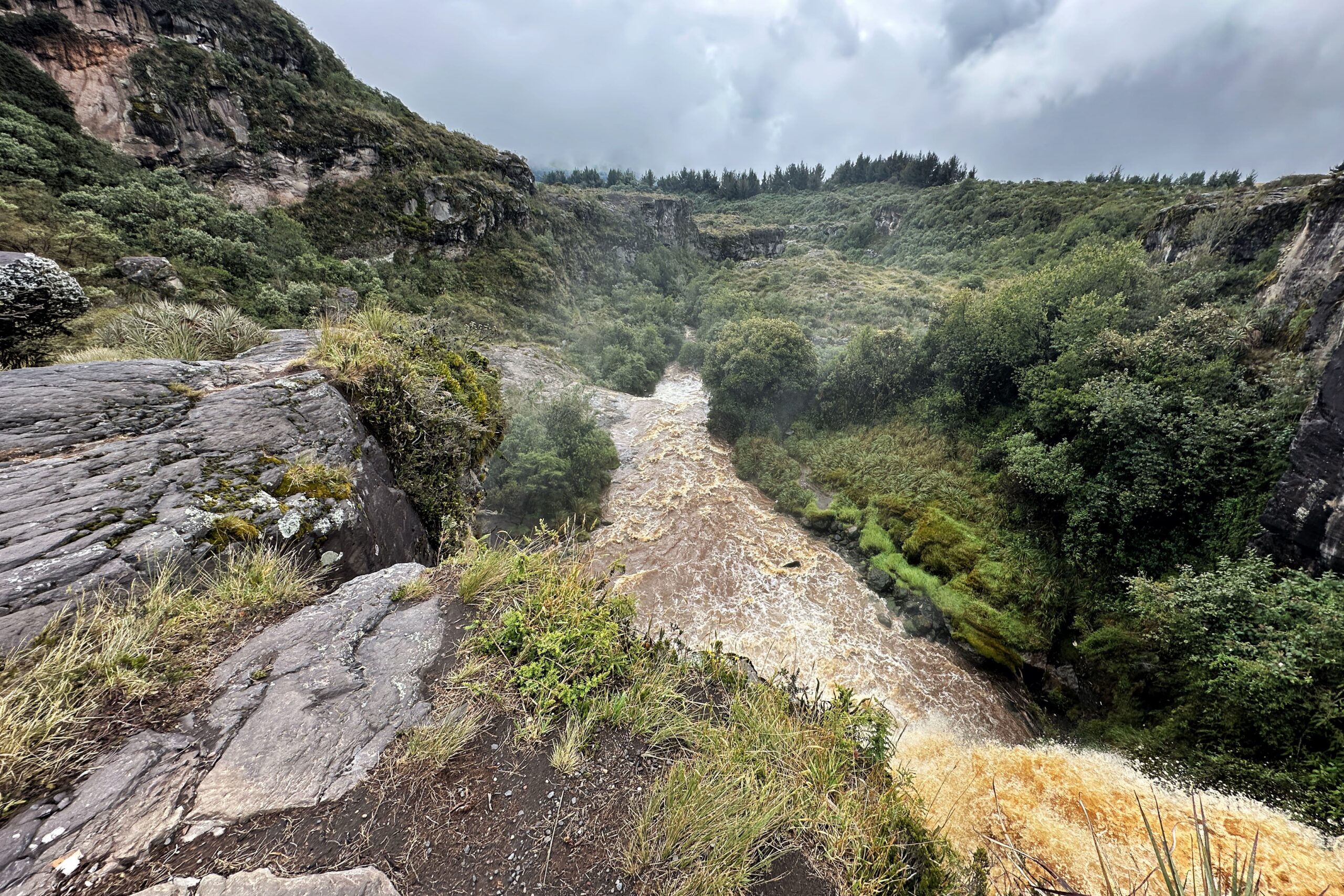
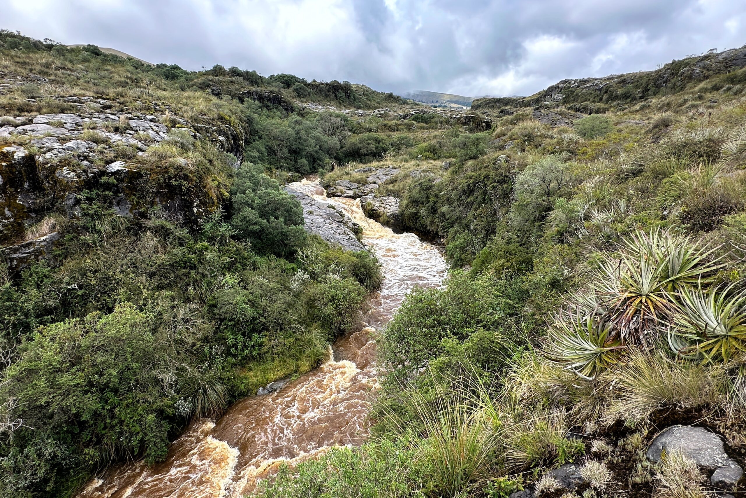
We followed the Pita River (same one as yesterday) on lava flows from the last eruption of Cotopaxi. There was a clear path and it was easy to follow. All is well so far. We eventually made it to Cascada de Fuego. At the top, we saw a group getting ready to repel down the falls.
Made it to Cascada Fuego!
View from the top of the waterfall
Here’s one thing we won’t be doing at the top of the waterfall
We continued on past the waterfall. This part of the hike is where things get dicey. The trail was more of a chose your own adventure. There was a path (of sorts), but it was often covered with spiky plants, up or down some rocks, or on the very edge of the cliff with the raging Pita River below (leading to that big waterfall). On the plus side, this entire area is covered in lava, so there are tons of fun lava trails and lava rocks along the way.
The aforementioned “medium” difficulty river cliff navigation
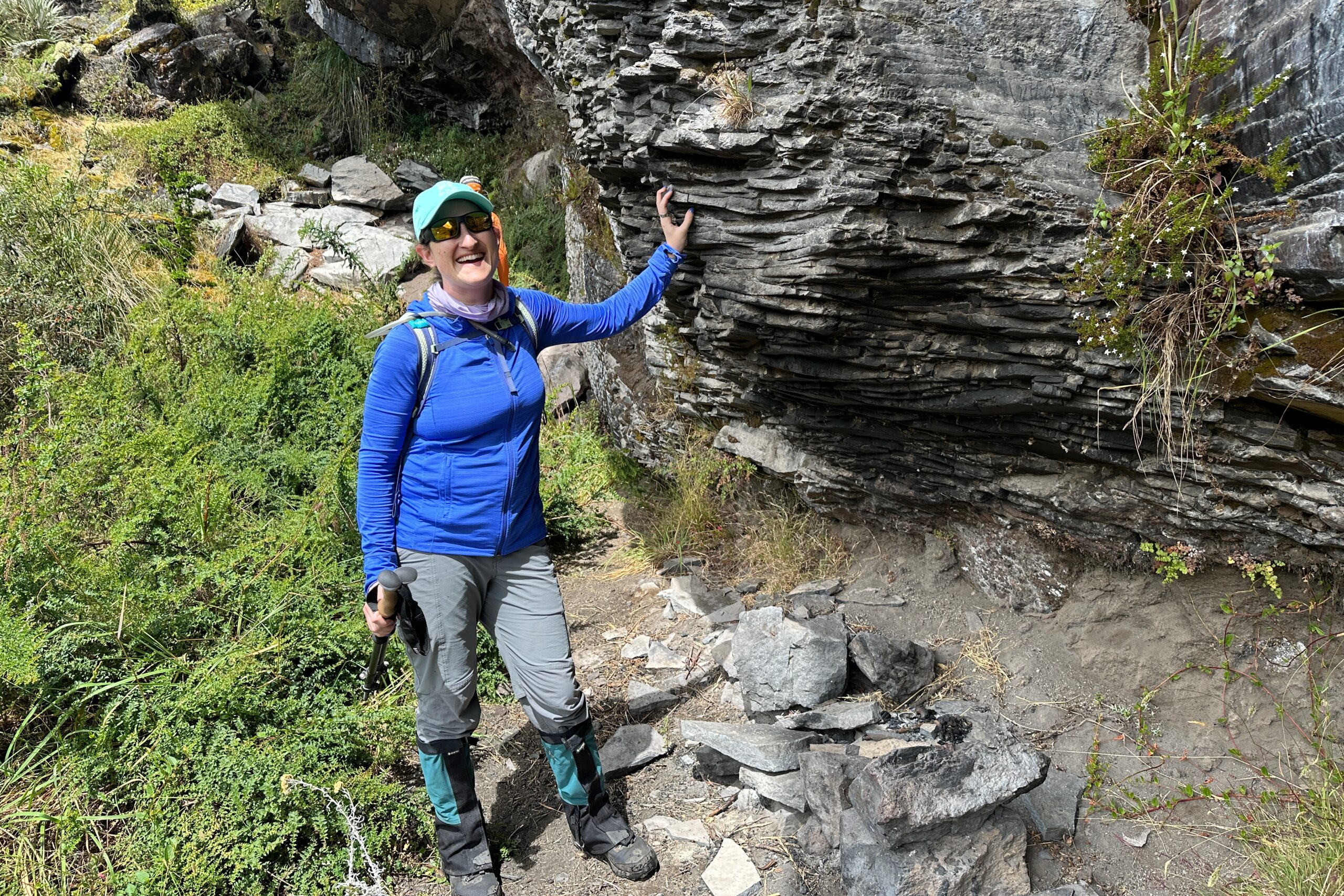
Big blocks of andesite (not Andes-ite)
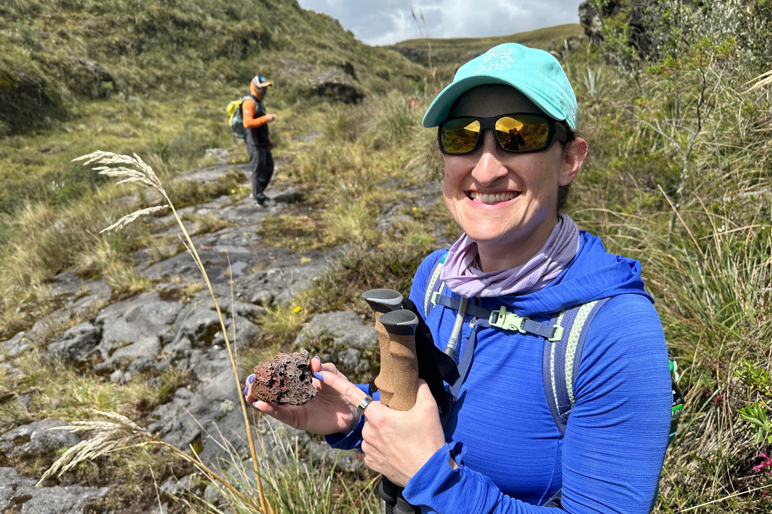
Little tuff guy
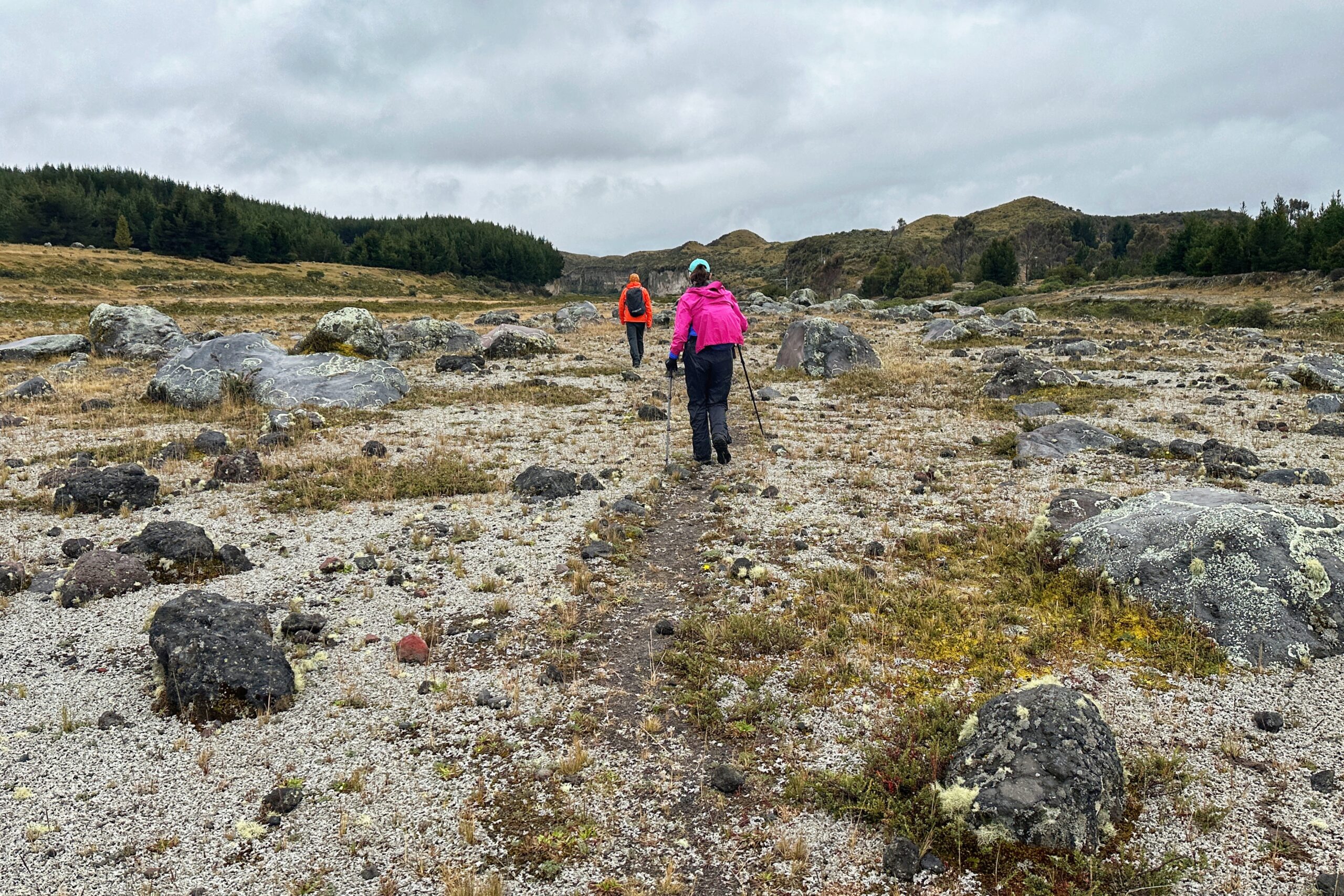
We found a flat, open area for lunch. It looked like the rain was coming earlier than expected, and we put our rain gear on as we finished eating. Sure enough, it did start to rain, and never really stopped. Fortunately, we had entered the next part of the hike: moraine fields.
Heading south along the Rio Pita
Yet another satisfied camping chair customer
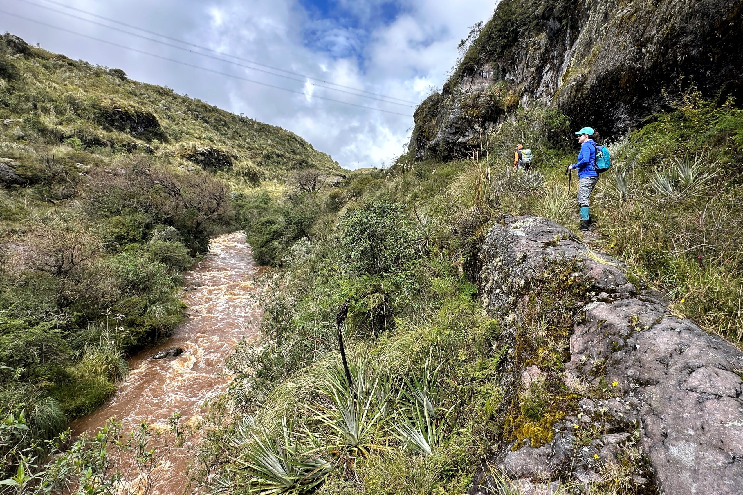
There were a couple more rock climbs/cliff edges, but we quickly came to wide open spaces and could relax our minds a bit. We did have to go through a barbed wire fence and cross a couple of bridges. Overall, this section was pretty easy, but the distance still needed to be covered.
Hiking along rocks carried down by the volcanic lahar
Finally, we made it to the final section of the hike: hiking up to the road. We took it slow and steady and made it to the top just fine. Just as we reached the road, Victor pulled up in the van. We made it! Technically, we were given the option to continue walking another 4km uphill on the road to get to the hotel. We almost said yes, but sanity prevailed and we opted for the drive. The entire hike took six hours, covered 10 miles, and about 1600 feet in elevation gain. We were ready to sit and eat the rest of our lunch.
But if you’re going to enter, at least don’t hunt, fish, fire, car, or ATV
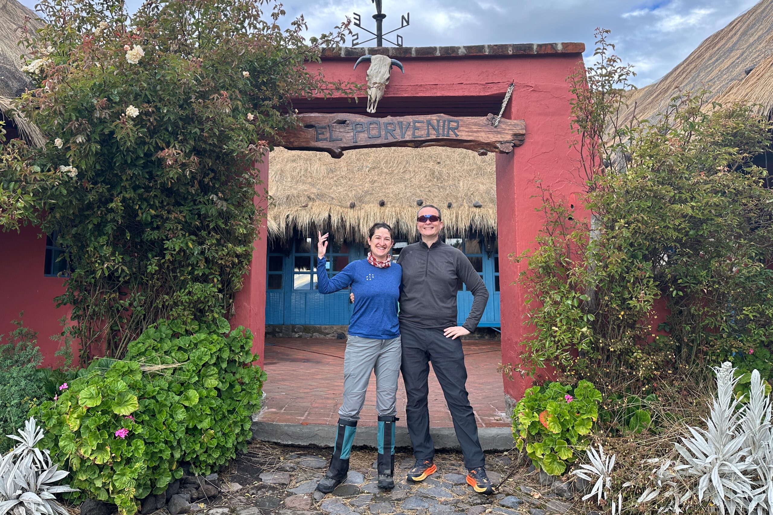
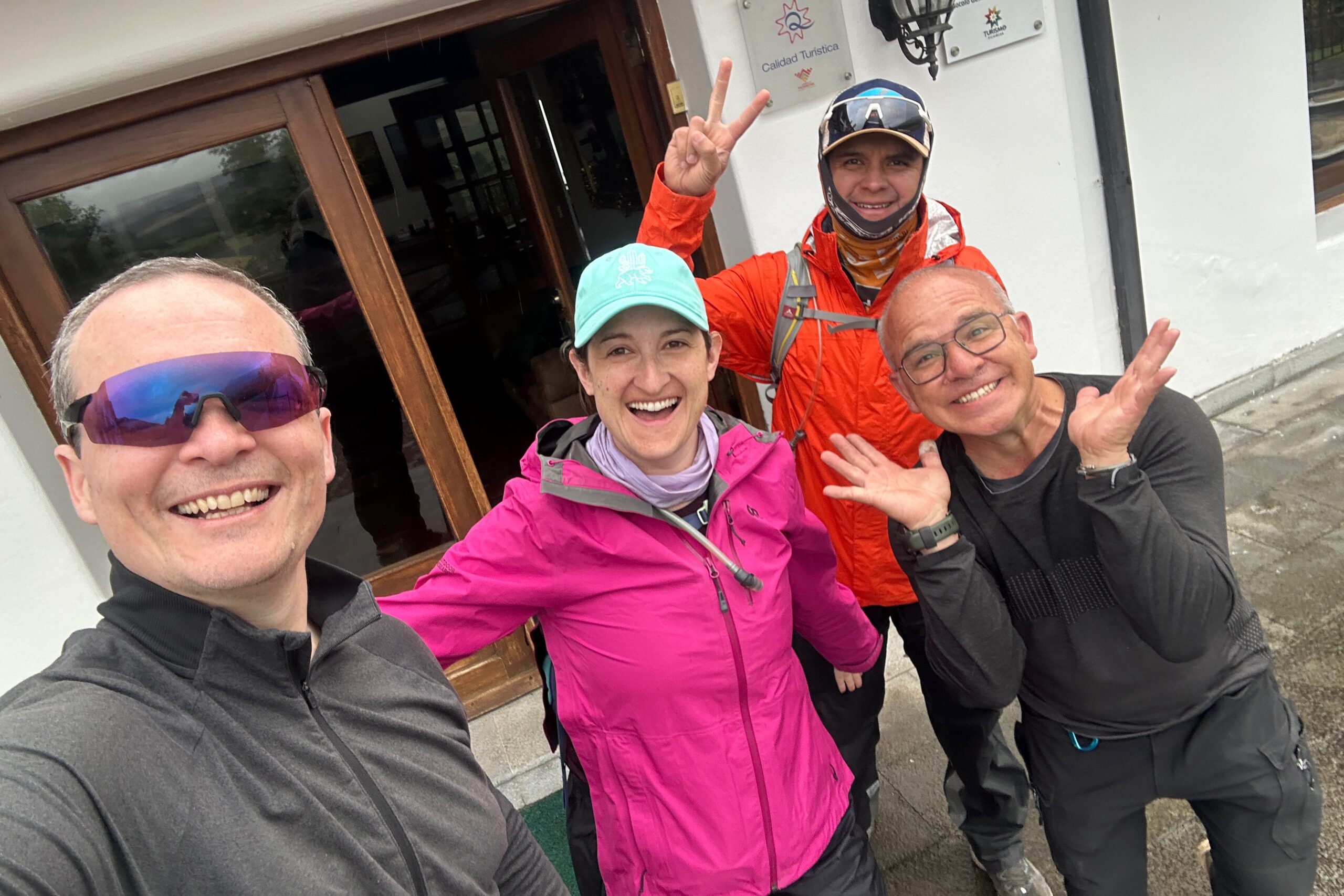
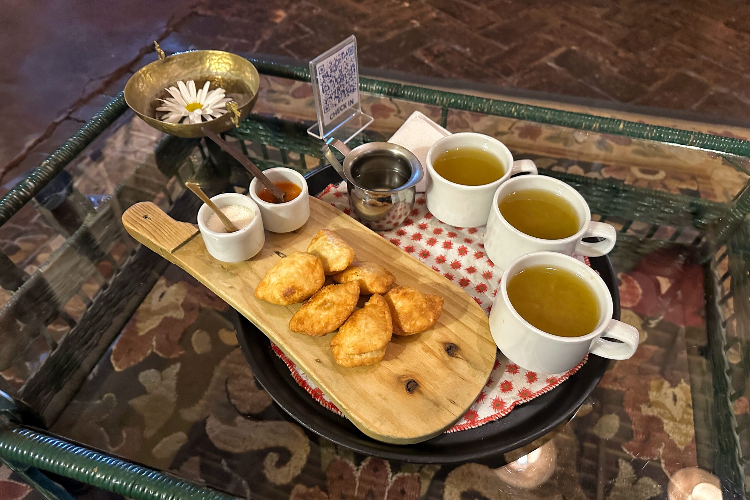
When we arrived at Hacienda El Porvenir, we were welcomed with… you guessed it, canelazos! We also had bonus cheese empanadas. Santiago showed us that you first dip them in the salsa, then sugar. Why has no one told us this before!?!
Hacienda El Porvenir? More like Hacienda El Pourveniring Rain
The perfect welcoming tray
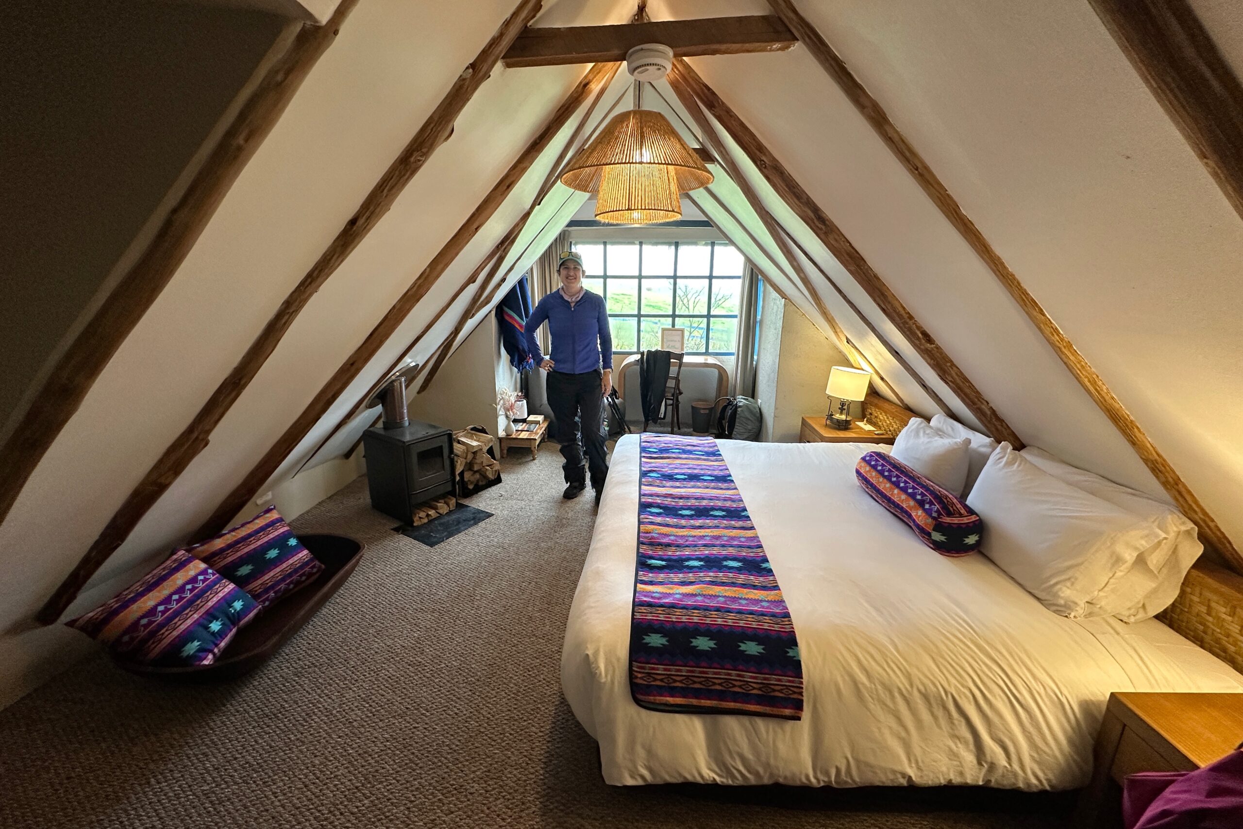
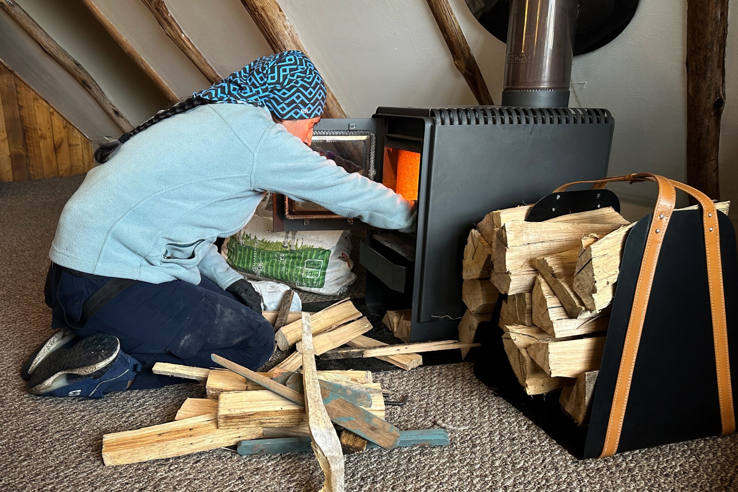
We took some time to relax and hang our wet gear. Our room has a wood burning stove for heat, which the wonderful staff started for us. In case you are wondering, the entire stove gets very hot. Best not put anything directly on it. After settling in, Jo went for a quick soak in the jacuzzi and Matt got a massage. Worked wonders on his shoulder, so he rebooked immediately for when we are back in two days.
Suite room!
Junior suite perks
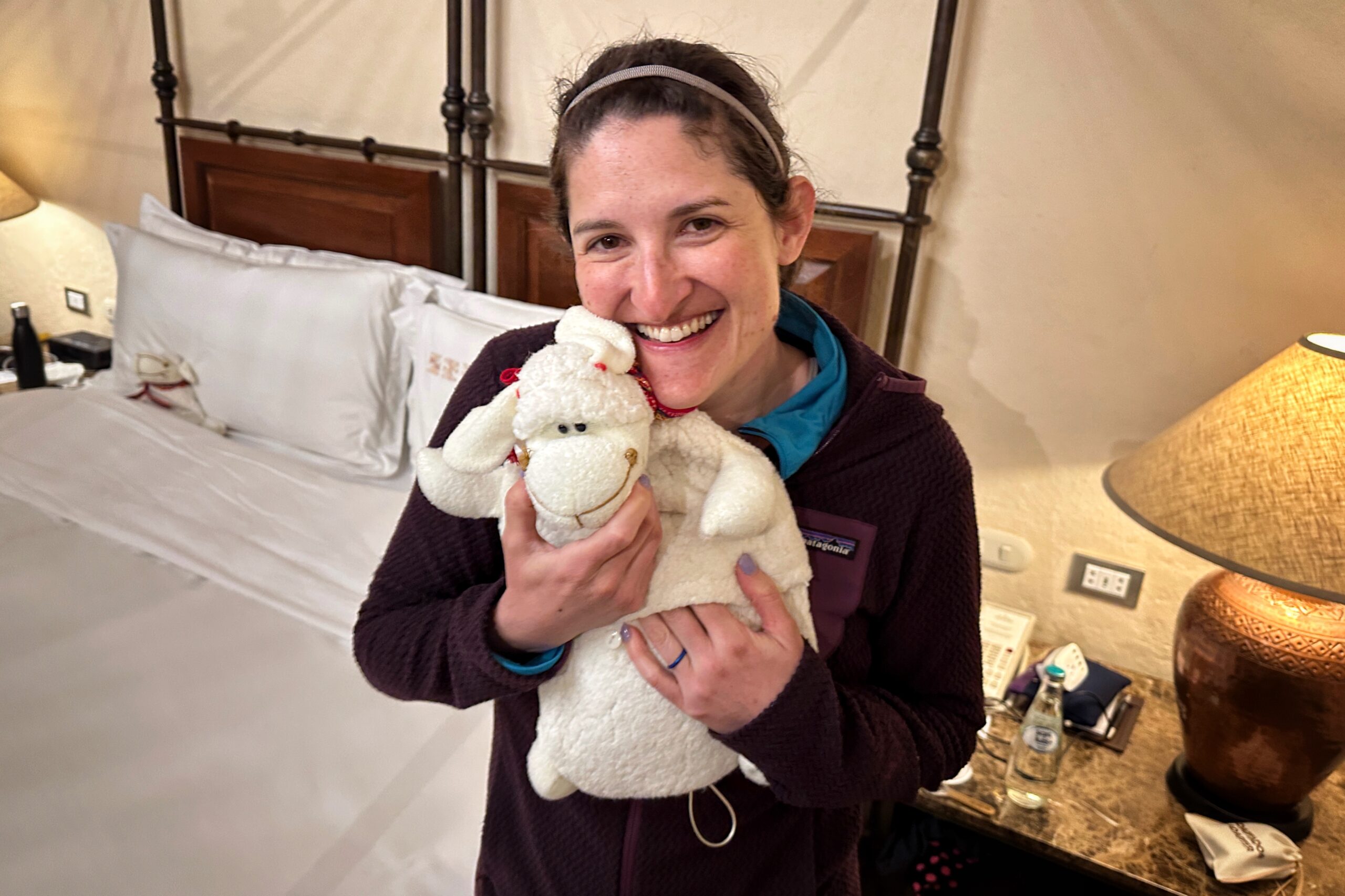
Housekeeping MVP
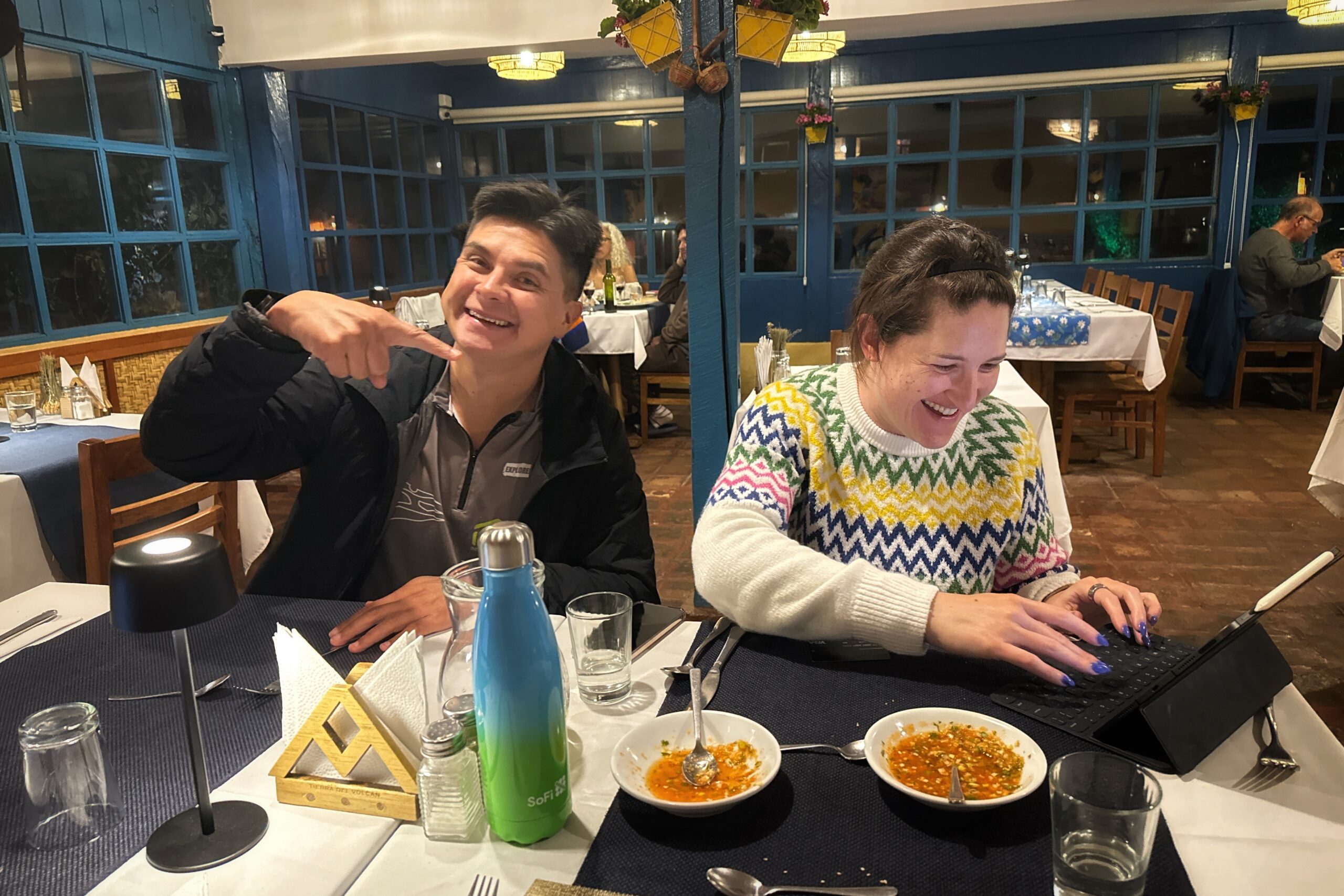
On our way to dinner, we made two very important purchases – a magnet, and a Tierra del Volcan buff (the only shirts featured mountain bikers). Tonight’s dinner featured a side quest: helping procure Studio Ghibli Museum tickets for our trip with the Cordinas to Japan next month (stay tuned to the blog!). We bought our iPads to dinner and entered the virtual waiting room for a lottery number. Somehow Jo always has ridiculously good luck with these things and the side quest was a success.
Ghibli ticket mission accomplished!
With that out of the way, dinner was served! All of Matt’s foods involved volcanic rocks to match the theme of the day. Santiago was not kidding when he said the food at this hacienda was the best — everything was delicious. We reviewed the plan for tomorrow (hike up a lot, then hike down to the next hotel) and went off to bed.
PS. We are literally on the foothills of Cotopaxi and still haven’t seen it. At least the rain sounds nice on the roof.
After a full night of sleep, waking up early this morning was a bit easier. We got ready for today’s hike and packed up all our excess luggage. Before checking out, we had another delicious breakfast on the roof with as much bread and jam as possible. Also, it was a bit more clear out this morning so we enjoyed the view.
View from our window… they’ll definitely know when we leave
Goodbye Hotel Alquimia
For the next few days when we are hiking in the highlands, so we will have a driver in addition to our guide. Today’s driver was Ariel, who picked us up at 8:30 am. After about 30 minutes, we pulled over and picked up Santiago who lives nearby and was waiting for us. We continued on to the Avenue of the Volcanoes. Santiago requested a quick stop at one of the last convenience stores to buy a Sporade (aka. Powerade). Good idea, we said, and picked up a couple of Sporades ourselves along with some cold coffee drinks.
Hello Ariel!
After leaving Quito, the road to Cotopaxi is unpaved. There are some dirt sections, and some cobblestones, but there is a construction plan to pave the entire route. Because of this, there was some roadwork we had to drive around. I don’t think it made an impact on our time at all. We arrived at the start of the Sendero Vilatuña, a trail that follows the Pita River and its many waterfalls. We got ourselves ready (real hiking gear this time) and headed out. A stray dog we named Paloma started to follow us. It quickly became clear that Paloma was the expert on this route and was there to guide us.
Paloma will be joining us today
The trail was mostly soft dirt, but had a lot of fun rocky sections, bridges to cross the river, and ladders to get up or down really steep/cliff sections. There were also signs boasting about how many different bird species live on this trail, and we saw a few.
Starting our waterfall obstacle course with bridges…
Stairs…
Wobbly bridges…
Ladders…
Bigger ladders…
Ladders off the sides of cliffs
After the last and largest waterfall, we took one last ladder down to a bridge where We could see trout swimming in the clear waters. This was the end of our route, so we turned around to head back. Plus, Paloma couldn’t find a way down this last cliff and was whining until we returned. On the way back, we were wondering how Paloma would make his way up the other steep slopes we had traversed. But don’t you worry. He can CLIMB LADDERS.
On the way back, we stopped to climb the rocks down to the river banks for closer views on a few of the waterfalls. There was one with via ferrata-style footholds and a cable installed in the rock… but after some test runs, we decided it probably wasn’t worth the risk to fall in the river.
Pointing at waterfalls
Testing my climbing skills
Paloma really likes waterfalls
We made good time getting back to the van and took a quick break before the next part of our hiking day.
Paloma’s guiding service payment
Unless your dog can fucking climb ladders
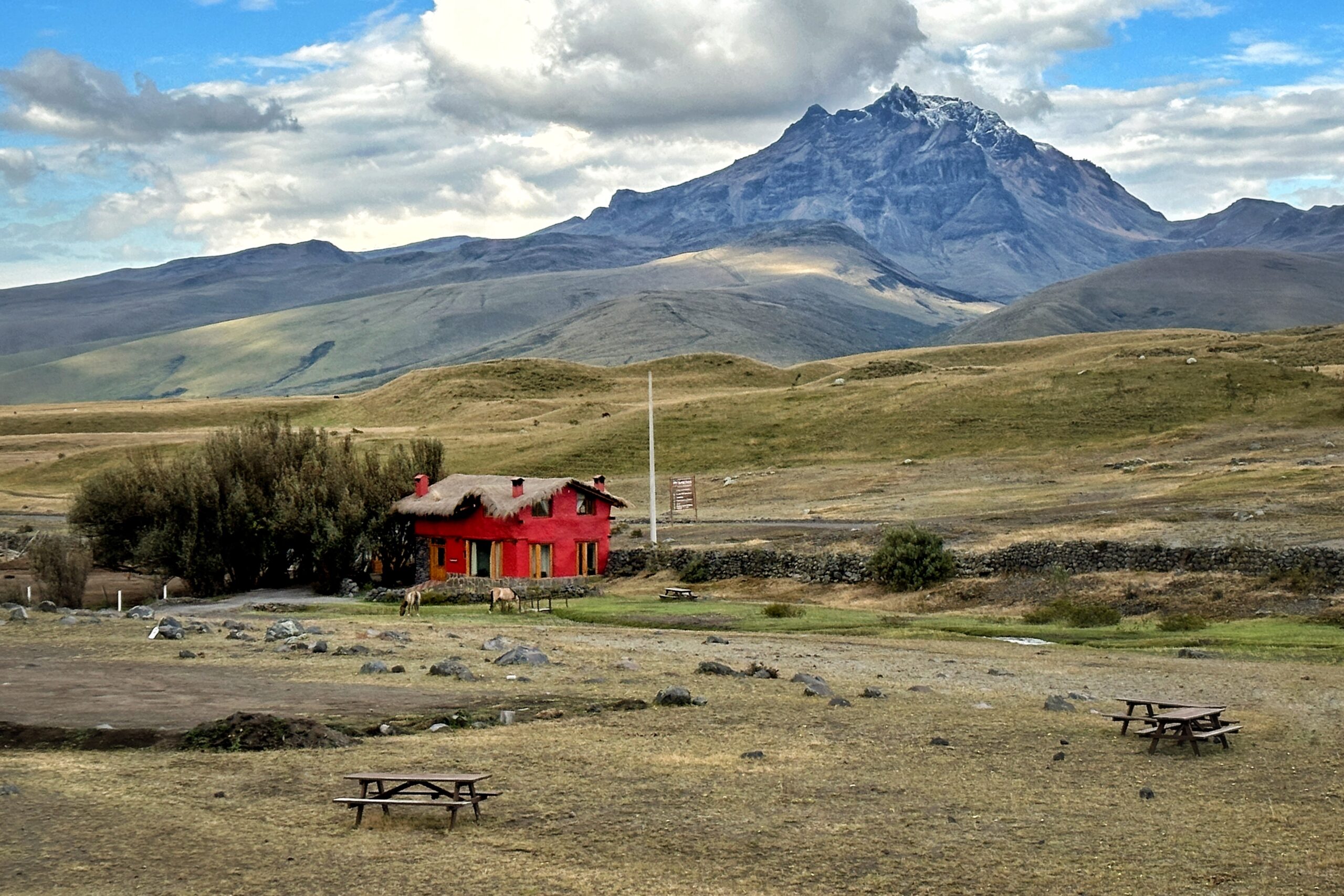
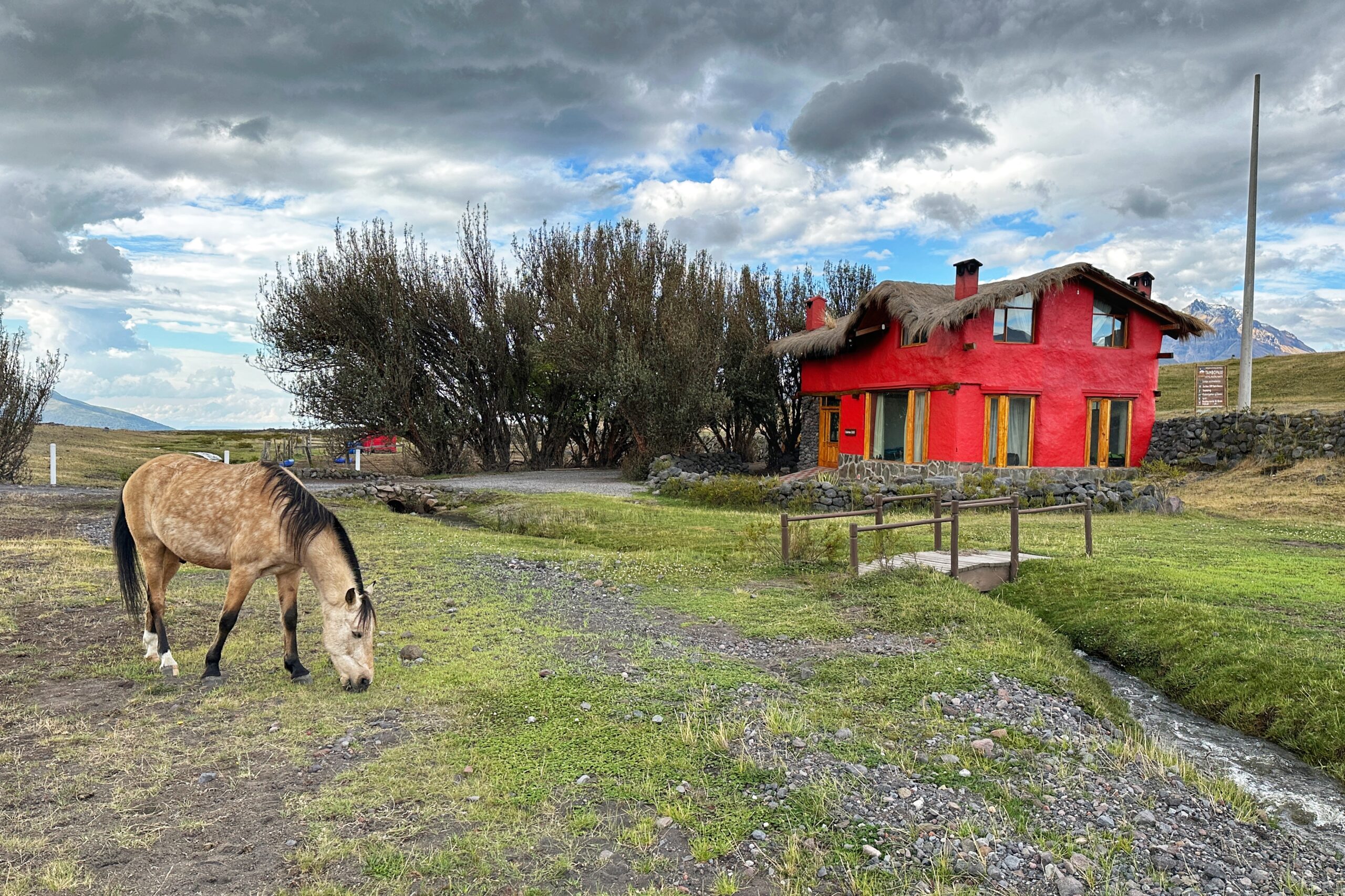
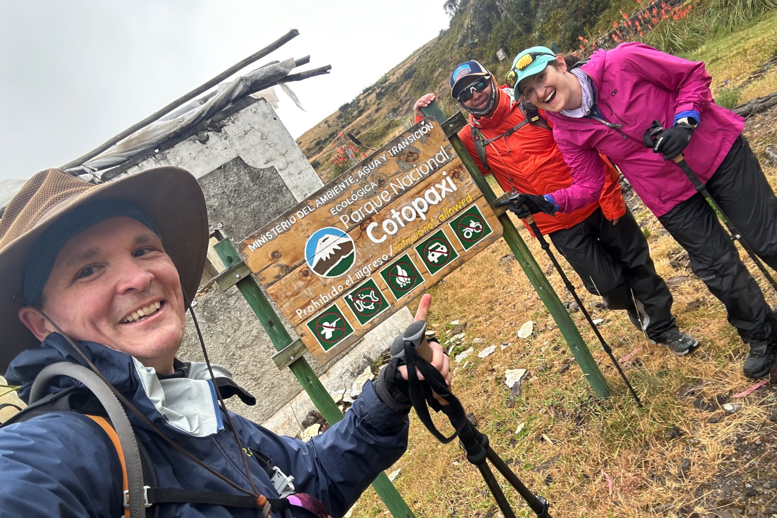
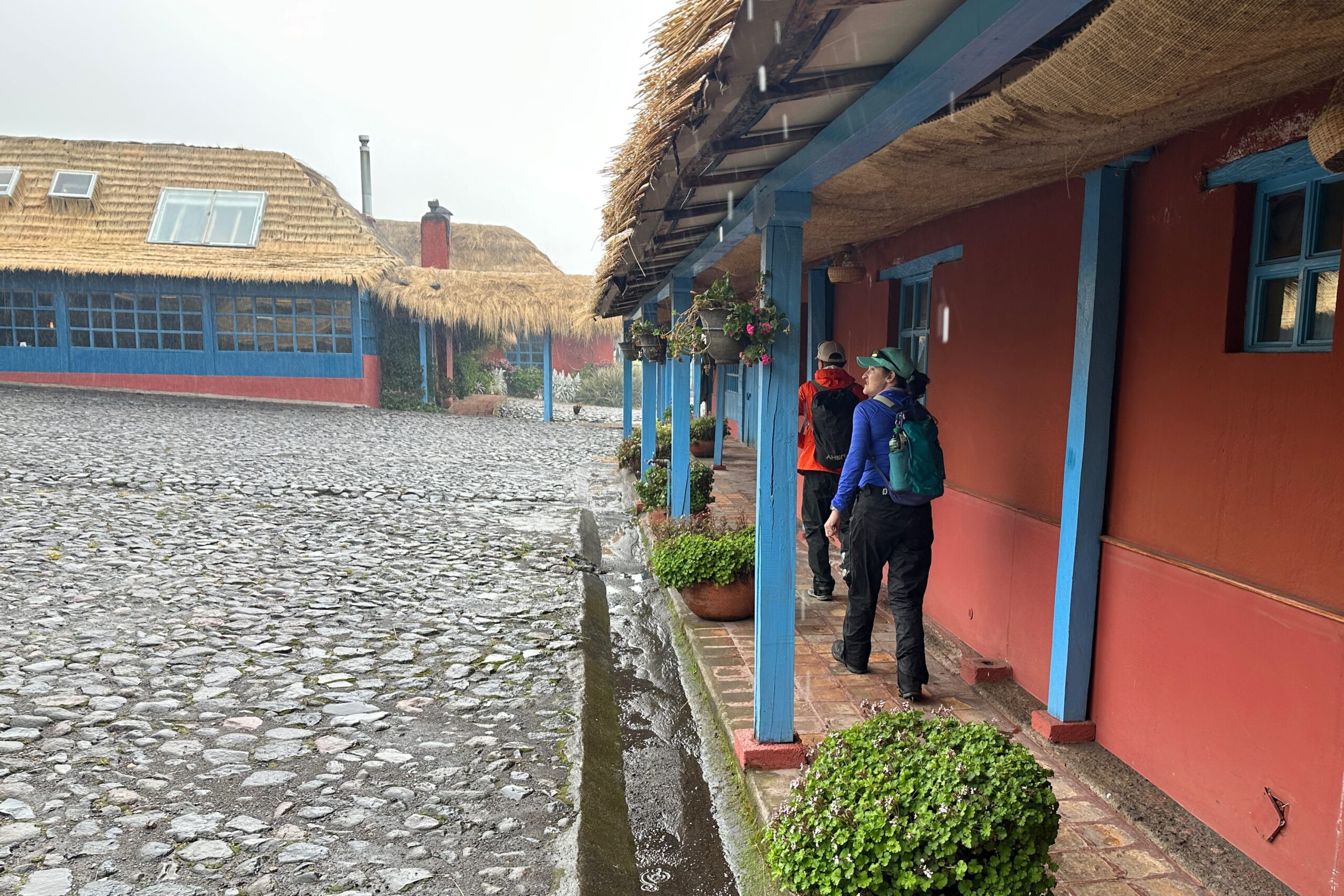
The plan was to continue hiking all the way to our next hotel. We started the uphill trek along a cobblestone road. We passed dairy farms along the way. After a couple of kilometers, we made it to the Cotopaxi Pungo Hotel. Pungo means gate/door/window. This area is within the Cotopaxi National Park and really marks the start of Cotopaxi adventures. Plus, on clear days, there is a great view of Cotopaxi and the nearby volcanoes. Alas, it has not been clear at all today. Upon our arrival, we were greeted by the owner, Sebastian, and given welcome drinks of… Canelazos!
On the road again
Made it to the hotel!
We learned a bit about the hotel and how it was originally made in the adobe style. Sebastian also explained there are 84 volcanoes in the area aptly called the “Avenue of Volcanoes.” Of course, most are dormant or extinct, but two, including Cotopaxi, are still active. Apparently, if it erupts the pyroclastic flow will stop about 9 km from here, so we are totally safe. The geology major has doubts.
Dining room with a view! We might be the only visitors at the moment.
The magical realism of Ecuadorian painter Gonzalo Endara Crow
The hotel staff showed us to our room and we changed to meet Santiago and Ariel in the dining room for lunch. Two delicious potato soups and grilled trouts later, we went to the main attraction – the pool! When we entered the pool house, we saw two hot tubs ,and realized the “pool” was actually one large hot tub. It was just as hot and had jets. They were all warm, but not too hot, which allowed us to stay in for longer. After about an hour, our muscles felt better and we went back to the room to shower and relax.
Moody weather from our front porch
We eventually went to the lounge area. We were the only guests in the hotel at the time. A group was supposed to show up in the afternoon, but there was an accident on a main road, and they were delayed by hours. So, we basically had the place to ourselves. As evening approached, the rain continued outside and it became cooler, so we sat by the fireplace with Santiago. The hotel manager, Juan Carlo joined as well and we all chatted before dinner. Pro tip: when you are surrounded by dairy farms, order the cheese.
After dinner, we went back to the fireplace to digest and work on the blog. There is another fireplace in our room as well to keep us cozy and warm throughout the night. We have an early departure tomorrow for our hike right from this hotel to the next. It should take about 5-6 hours and we are hoping to beat the ever-present afternoon rain.
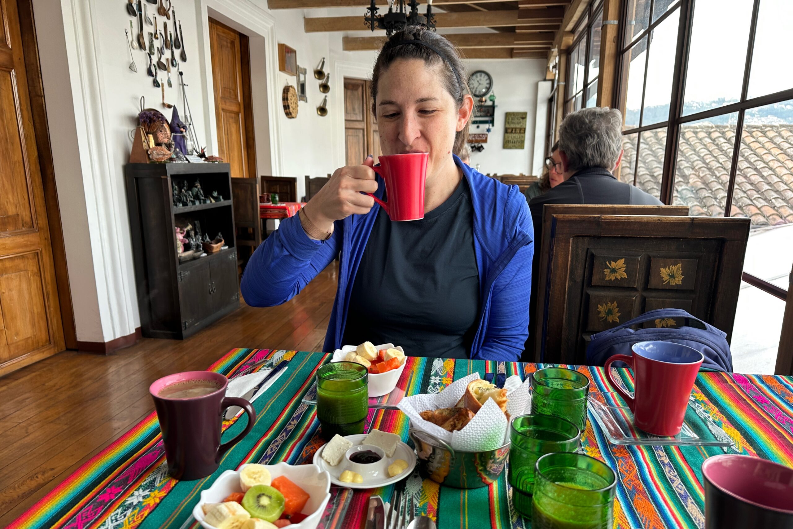
Despite getting in late last night, today’s early wake up time didn’t seem so bad. We were excited to start the day and the trip. After getting ready, we went to the roof of the hotel for breakfast. We were served coffee, juice, fruit, delicious rolls, and scrambled eggs. Although the roof is only on the third floor, we are able to take in the view of the city for the first time (since it was dark when we arrived last night). After breakfast, we met Santiago right on time at 8:30 am.
Ecuadorian coffee confirmed good
Dogs and cable cars in our future
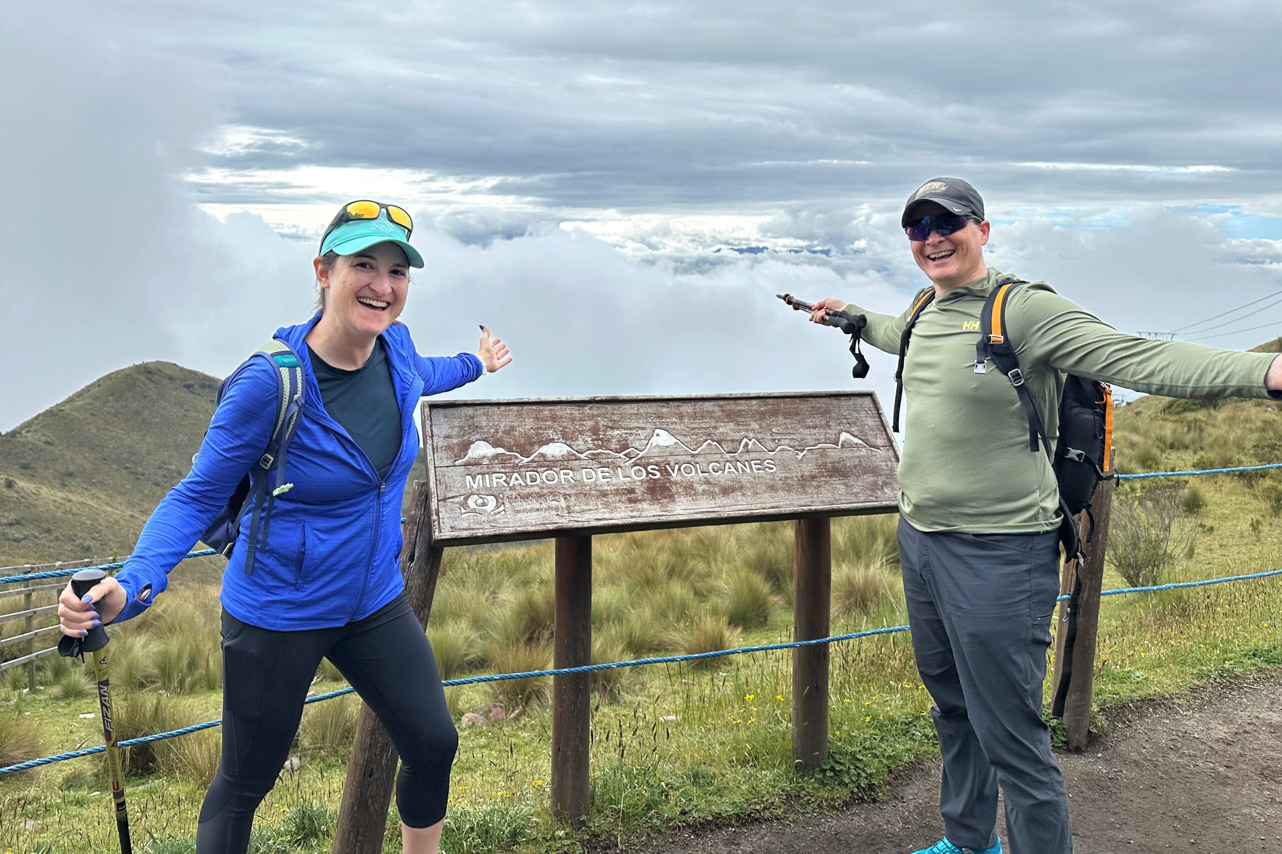
The first stop of the day was the TelefériQo, a cable car from Quito up to the Pichincha Volcano. The ride took about 10 minutes and provided some nice views of Quito from above. Once we got to the top, we started our hike. On clear days, you can see the mountains in the highlands region, including Cotopaxi. It was pretty cloudy all day, so we never got a clear view of the volcanoes. But hey, that’s OK, we are headed that way tomorrow and will see them up close… take that, clouds!
Not much mirador-ing from up here today
We were expecting this to be an easy loop trail with some gentle ups and downs, but ha ha, no. It’s a totally legit hike. Not to mention the top of the cable car sits at about 13,000 feet in elevation, and the hike goes up from there. The entire trail is very long, goes to the summit of Ruta a Rucu, and back down the other side.
Suggestions for a legit hike
Along the way, we saw a hawk and a few Cara Cara’s. Santiago pointed out the Chuquiraga plant, which is referred to as the Flower of the Andes because it is the only flowering plant seen at this elevation in this area. It also provides nectar for hummingbirds.
Santiago explains the Chuquiraga plant
Flower of the Andes close up
Since our plan was never to go full volcano — and being our first hike in elevation in a while — we took it slow and steady. Plenty of friendly dogs (with their owners) shared the trail and stopped by to say hello. After making it past the radio tower, but not quite the cave, we turned back in order to leave plenty of time to explore the city for the rest of the afternoon.
Kicking it
Descending safely
After the hike, there was no line for the cable car, so we hopped right on. Back at the car, we drove to a parking lot near the hotel to start the afternoon exploration of Quito. The entire city of Quito is a UNESCO World Heritage Site due to having the largest and best-preserved historical center in Latin America. We started our tour on Calle de Ronda, a short pedestrian-only street with restaurants and a lively nightlife. This is also were Casa de Las Artes is located. Casa de Las Artes is a small museum showing what life was like in colonial Quito.
Historical Quito
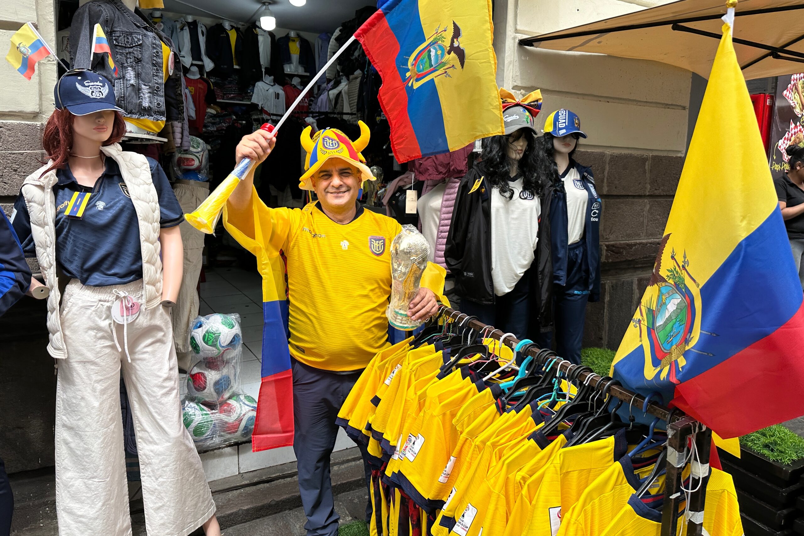
This guy is ready for the World Cup
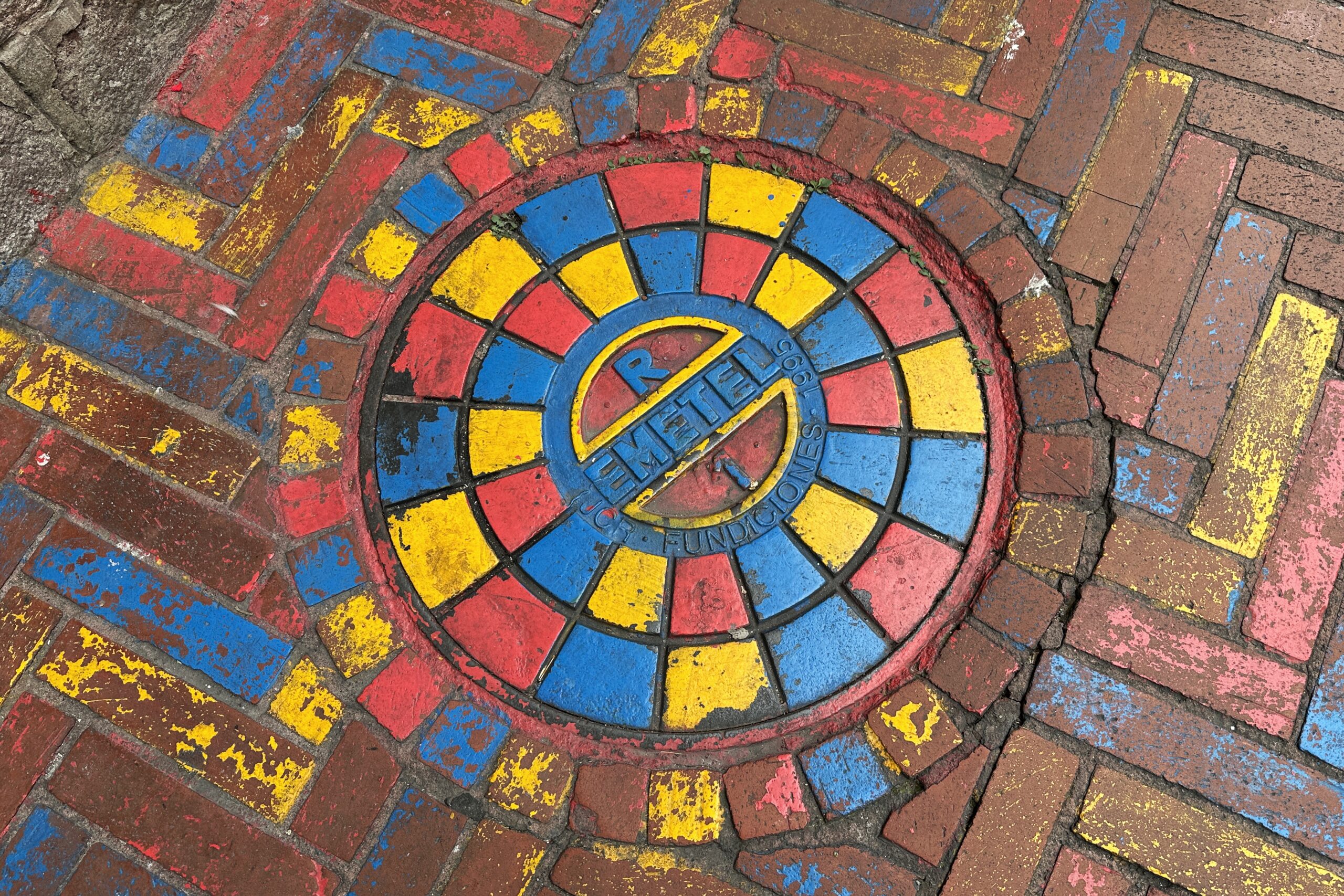
This sewer lid is also ready for the World Cup
We (but mostly a hungry Jo) decided that the next stop will be lunch. Along the way, we walked on a street officially called Calle Gabriel Garcia Moreno, but commonly known as Calle de las Siete Cruces due to the seven churches on this street. We made sure to count as we passed by.
Our lunch at Lavid Restaurante included an appetizer, entire, and dessert each. We were also eyeing juices form other tables, and Matt ordered a guabábana juice, a sweet and tart, tropical fruit. The restaurant had a great view of the Plaza Grande, one of the town squares were there were lots of vendors and visitors to watch as we ate.
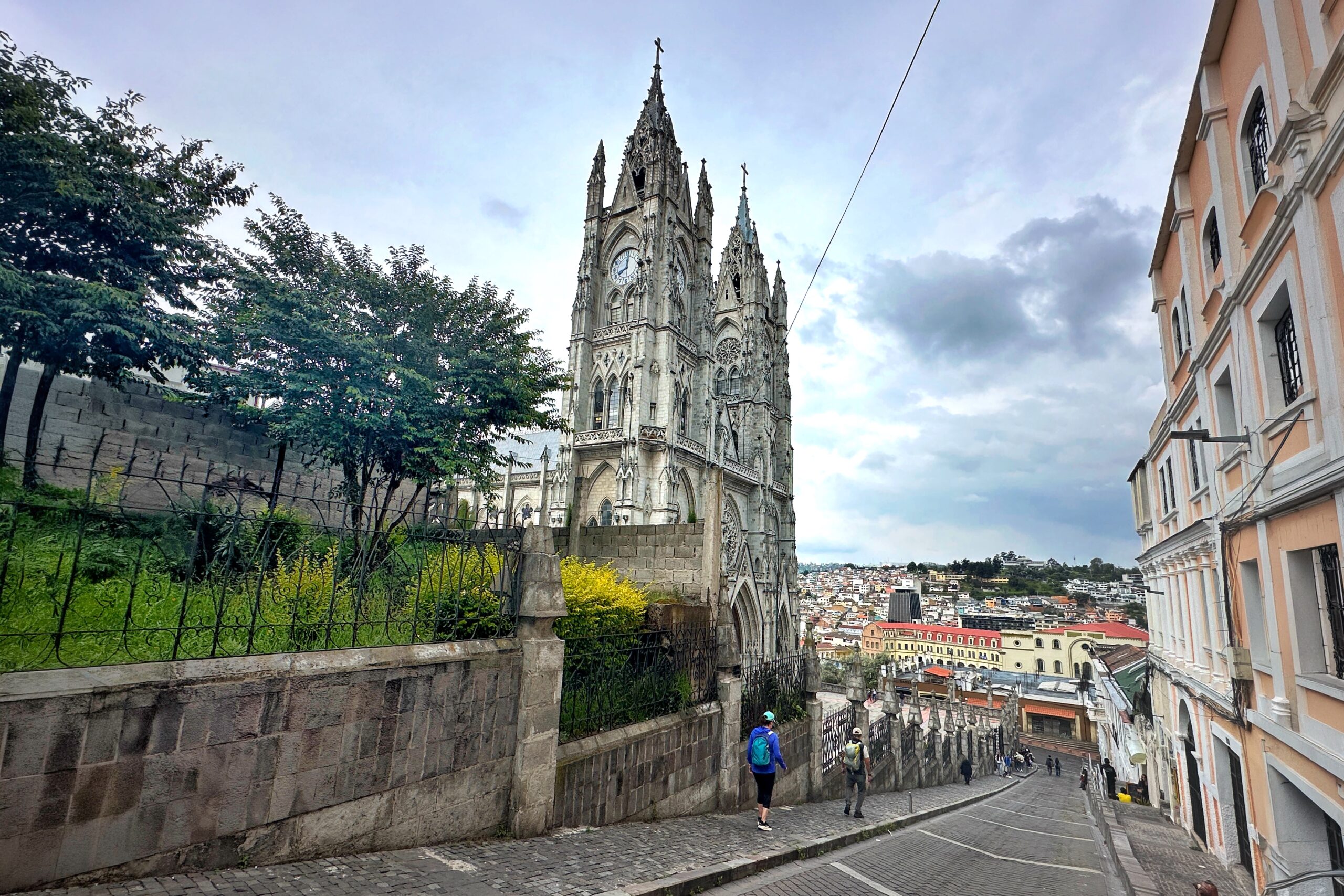
After lunch, walked through street markets to the Basilica del Voto Nacional. The construction of the Basilica started in the late 1800s. It’s built in the gothic style, but instead of gargoyles, they used condors and other local fauna. A Basilica can only be named as such if the Pope gives it that name. We were able to climb to the top of the bell tower and view the church with the surrounding stain glass windows.
The Basilica is church #7 on Calle de las Siete Cruces
View from Basilica tower
Did you know, TWO broken clocks are right FOUR times a day???
Orchids in the stained glass to rep local fauna
When we left, it started to rain. The weather reports were threatening rain all day, so we were prepared. We put on our rain jackets, covered our bags, and continued on. The streets were much less crowded, but the vendors selling ponchos and umbrellas were crushing it.
Next stop was San Francisco church. On the Panecillo, the hill in the very middle of Quito, there is a giant statue of the Virgin Mary with wings. Inside the San Francisco church is the original artwork, only about a foot tall, that was used as a sample of what the statue would be. There is also a larger, human-sized version as well near the alter. We learned about the original construction and size of the towers on the church and how an earthquake hit and destroyed them. They were rebuilt, but made to be smaller.
It never rains in San Francisco, but it definitely rains on San Francisco
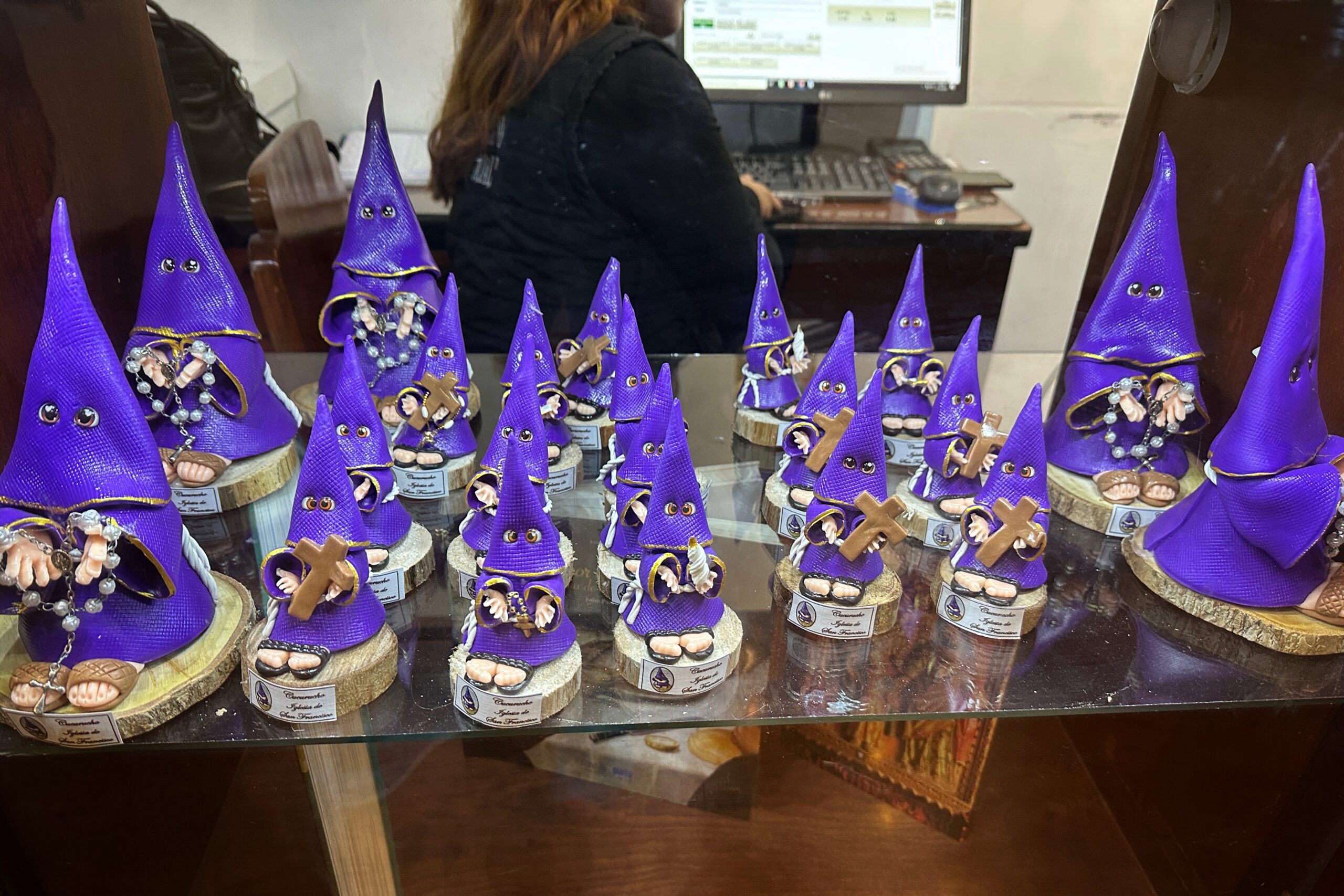
That concluded the Quito tour and we were back at the hotel. Santiago went home for the night while Matt and Jo walked back to Calle Ronda (literally a block from our hotel) to find some magnets. Let’s get the shopping out of the way. We found two that we liked and secured our purchase. By the way, if you see people wearing robes and cone shaped hoods (in purple, not white!), it’s not what you think. It’s a religious symbol representing penance and devotion.
Church gift shop item. They know. The googly eyes help, maybe?
As we meandered on the street, the various restaurants were calling out their specials, trying to get you to come inside. Still full from lunch, only one one caught our attention – a place selling cups of something called canelazo for one dollar. Using our limited Spanish, we figured out that a canelazo is a hot, sweet and spiced drink, kind of like an apple cider. Oh, and it has cane sugar alcohol. The women at the restaurant gave us a small sample and we quickly ordered two. This version also added naranjilla juice to give it a bit of a sweeter taste.
Best $1 we’ll spend the whole trip!
Back home to the Alquimia
We walked back to the hotel to enjoy our warm, spiced, alcoholic cider, and relax. Little sleep, busy days, and probably a bit of the altitude has made us pretty tired. Tomorrow we leave Quito and head towards the highlands.
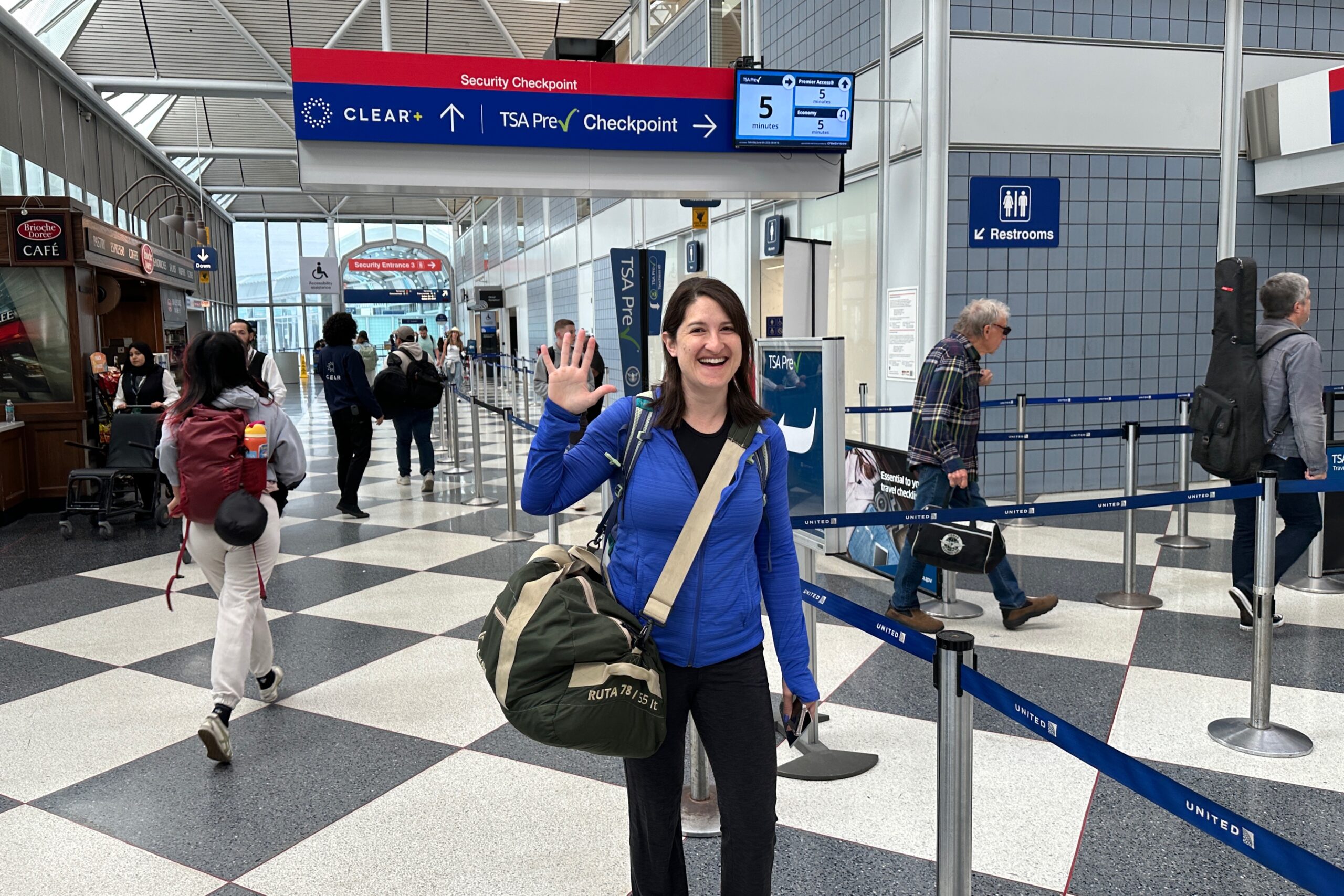
It’s day one and we’re off! It was a hot and humid day in Chicago when we left at 7:30 am, so we were happy to travel to cooler climates. We hopped in a Lyft and made it to the airport in good time. O’Hare was not very crowded and we were able to check our bags and breeze through security — until they flagged Jo’s bag.
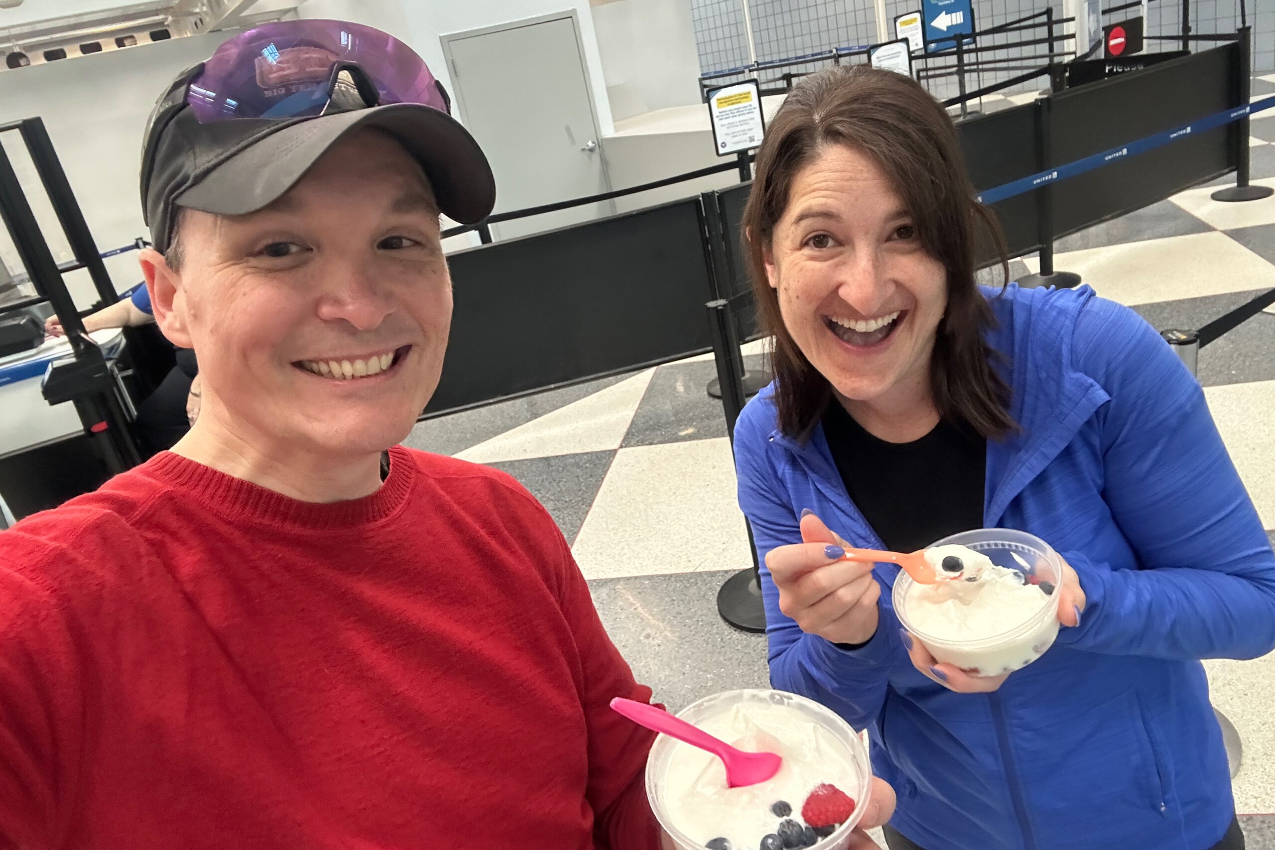
Turns out little containers of fruit and yogurt you might make yourself for breakfast are considered a liquid. Or as our conversation with the friendly TSA lady went… TSA Lady: “They didn’t let you take your food thru???” Us: “No, they said no yogurt.” TSA Lady: “Ohhhh yeah. No Yogurt. Can’t do Yogurt!!!” We could have tossed them, but it was not busy, and we were gonna consume them in about five minutes anyway, so we opted to exit security for our snack. TSA Lady also suggested the “freeze your liquids” trick might work on yogurt. Hmmm… would it work on sunscreen?
Pointing at security lines since we didn’t take a train
Eating yogurt in a very empty security line
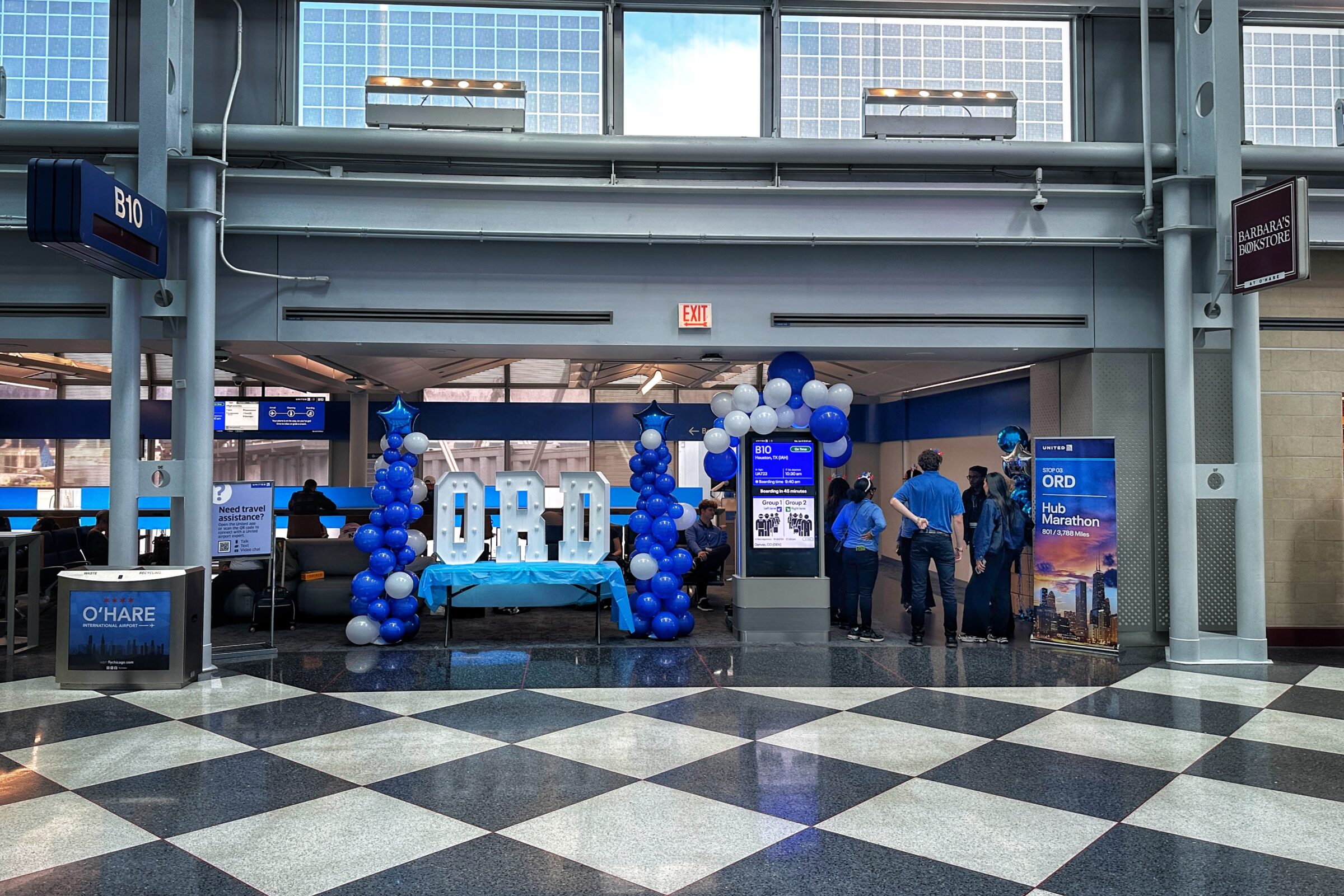
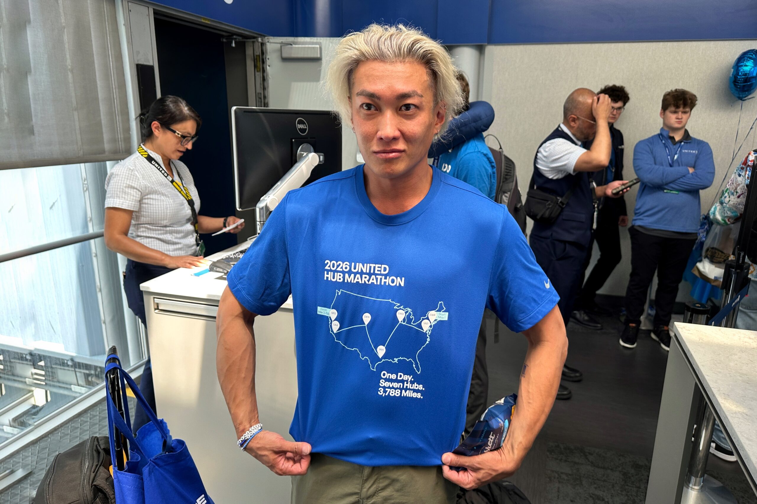
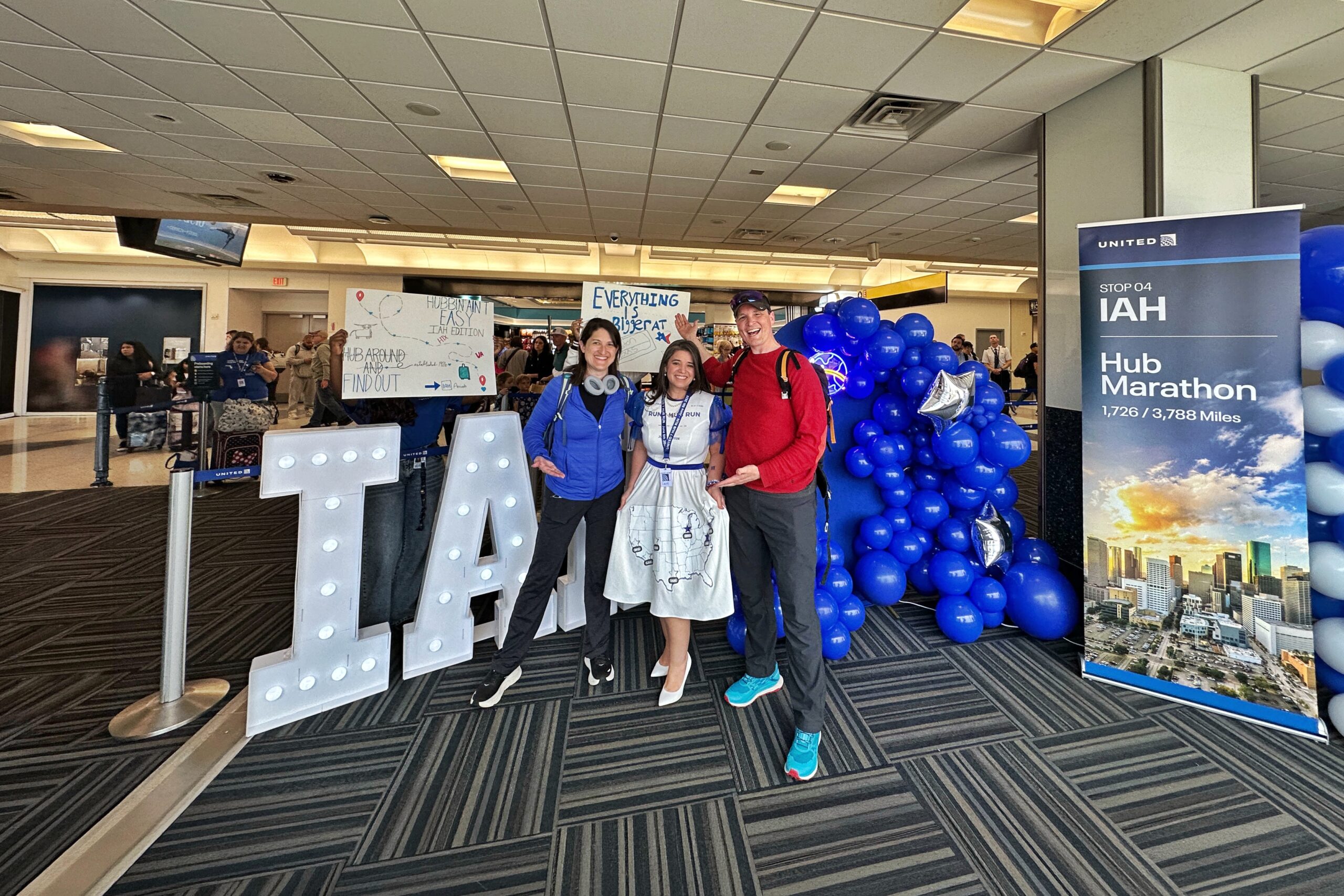
Having finished our snack and banished any trace of liquid from our bags, we went back through securtiy, said hi again to our new TSA friends, and went to our gate (B10) just a few steps away. We sat down behind some balloons and a table with big light-up ORD letters and a bunch of United employees hanging around. Turns out our flight is part of an unofficial (but supported) United Hub Marathon where about 60 people are attempting to fly thru seven United hubs by the end of the day.
O’Hare dino celebrating United’s 100th birthday
Hub Marathon set up
Soon after arriving at the gate, we were notified that our flight was delayed by about two hours (mechanical issue on the inbound flight?). Since we are paranoid fliers, we still had plenty of time to make our connection in Houston and weren’t concerned once we saw the connecting flight take off. Plus, we figured United had some incentive to keep their 60 Hub Runners on track!
Meahwhile, we relaxed at the gate until the flight arrived and observed/joined in the Hub Marathon party. The United staff made signs and cheered the passengers as they deplaned. O’Hare was hub stop number three, and Houston was stop number four. The plane boarded quickly — regular folk as well as the Hub Runners who only moments ago de-planed. On the way down the jetway, everyone was given a bag of Garret’s popcorn, and each passenger had a first-class style bag on their seats. Bonus.
Hub runner t-shirt showing the route
As it turned out, our row-mate was one of the hub runners. We got to talk to her and learn more about what was going on. Apparently, there were a few people in the group who were not planning on completing all seven hubs, so… I mean… that basically makes us honorary marathoners with a total of two hubs. When we landed in Houston, we were about three hours late, but we still had plenty of time before our next flight.
Our rowmate and her homemade hub runner dress
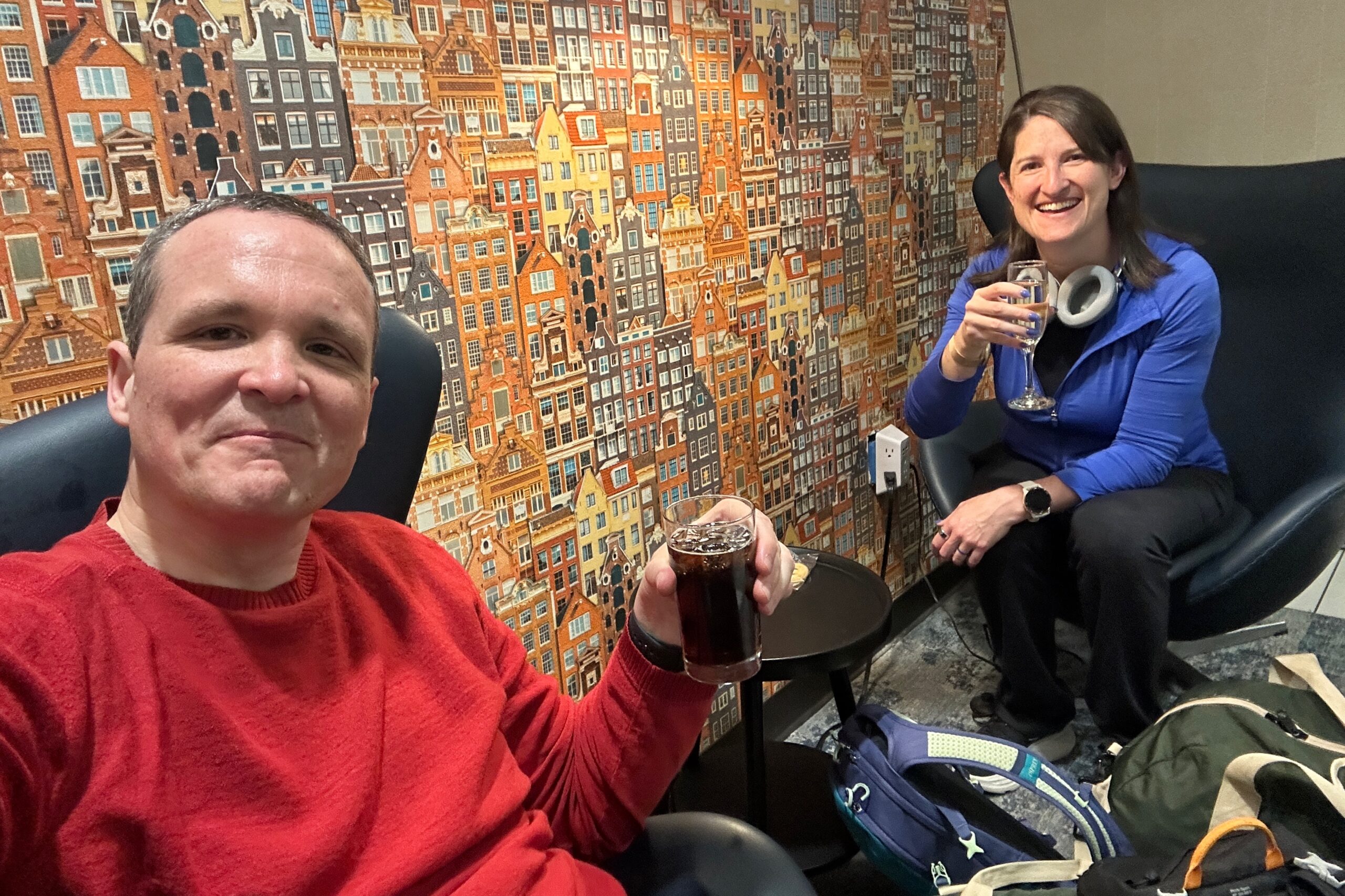
We strolled up to a Priority Pass lounge which was (surprise, surprise) not letting in anyone other than Emirates first class passengers (Don’t they get enough?!?). BUT! We successfully negotiated entry by promising the desk agent that we would only be there for 30 minutes in order to get to our gate for our flight, and we were obviously Emirates first class passengers if anybody was asking. We took the time to rearrange our carry-ons, and enjoyed some food and drinks.
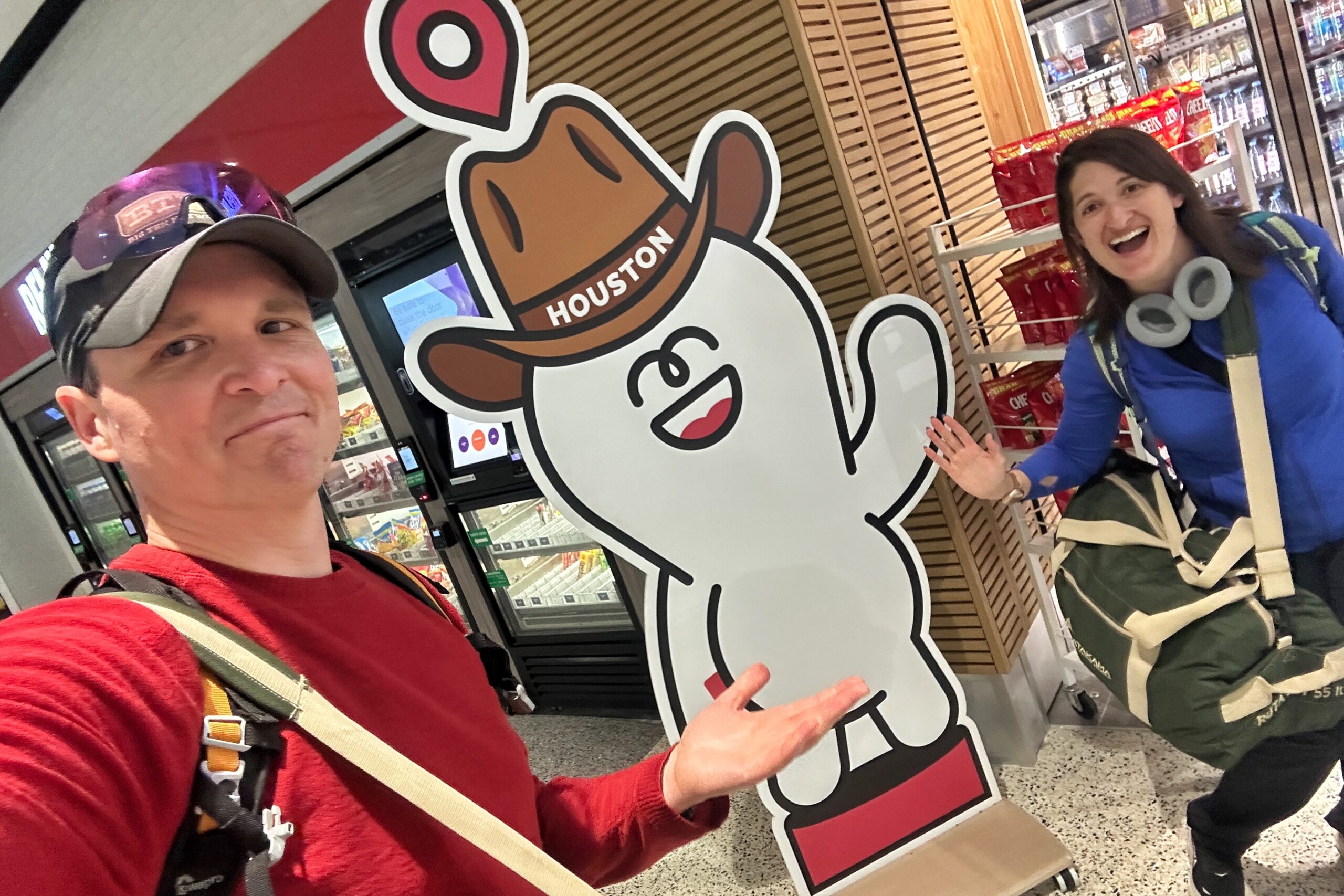
Who is this guy, Houston?
Lounge speed run
Keeping our promise, we departed the lounge after 30 minutes and made it to our gate a few minutes before boarding started. Everything went smoothly. Boarding was quick, we left on time, enjoyed a tasty dinner (sheppard’s pie and cheese enchilada), watched TV (Jo watched Pluribus and Matt watched Chernobyl), and when the pilot promised BIG turbulence, it ended up being one of the smoothest landings ever. Underpromise, overdeliver!
No hub runners on this leg
Why are there stilettos?
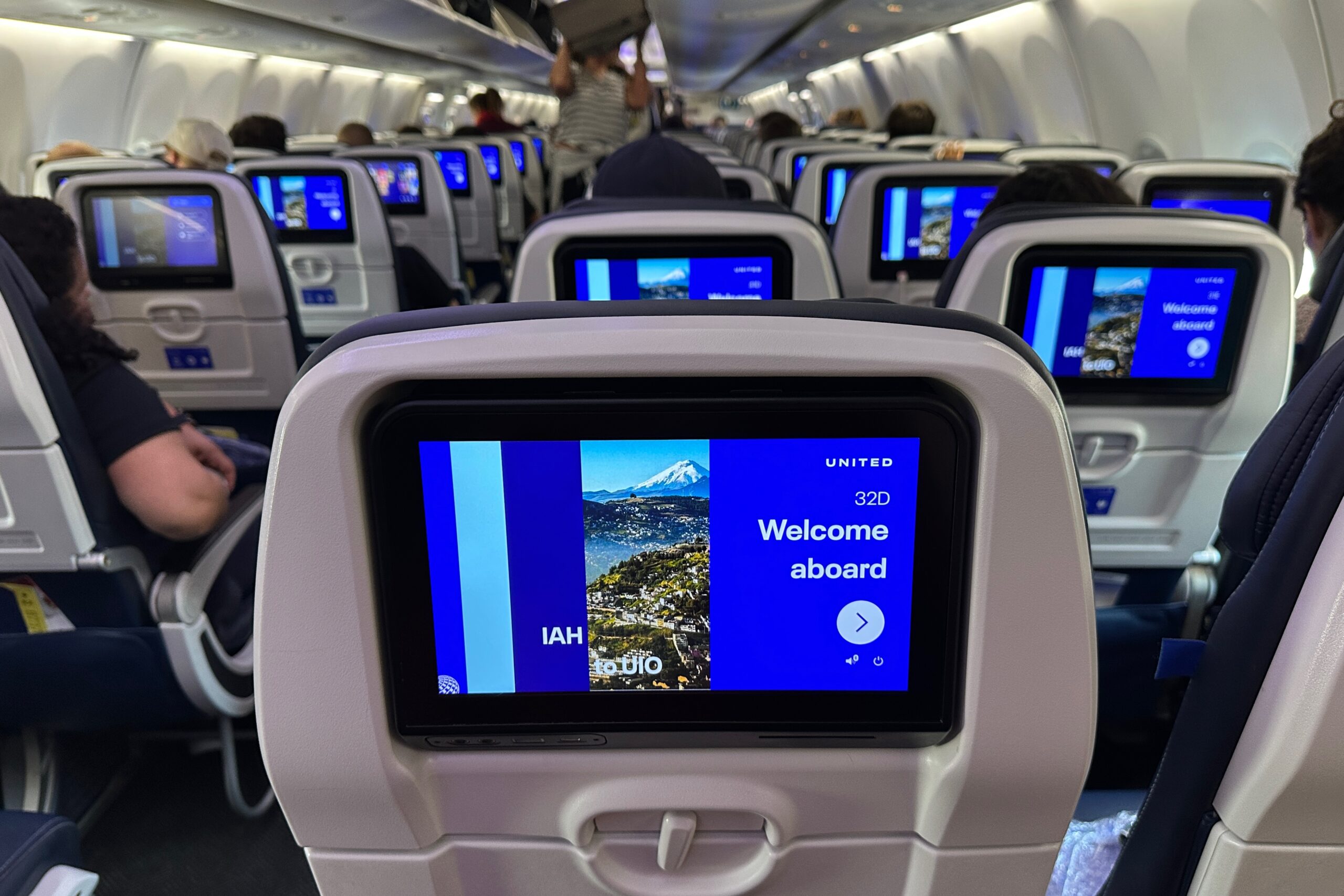
Once we landed and got off the plane, everything was quick again. The line for customs was only a few minutes and we got a REAL stamp in our passports. We got through to baggage claim, and our bags were on the carousel waiting for us. And — as an added bonus — we saw that our previously-booked American flight (that was supposed to arrive two hours earlier) actually just landed.
Future friend
We exited and found Santiago, our guide for the mainland was ready and waiting for us. He drove us to the hotel for the night and we reviewed the plan for tomorrow. Since it was already past midnight, we agreed on a late start of 8:30 am. We arrived at the hotel and immediately went to sleep. Tomorrow, the real adventure begins, starting in Quito.
School’s out for summer, so it must be time for another adventure! We are headed back to South America, to a country we’ve never been — Ecuador! Land of rainforests, mountains, and Darwinian research. Having exhausted all of the currently available (and reasonably priced) Explora locations, we went with Tierra del Volcán for all our planning and guiding needs. We also consulted with our Youth Corespondent to make sure we hit all the cool spots.
Lily didn’t know she was actually scouting for us
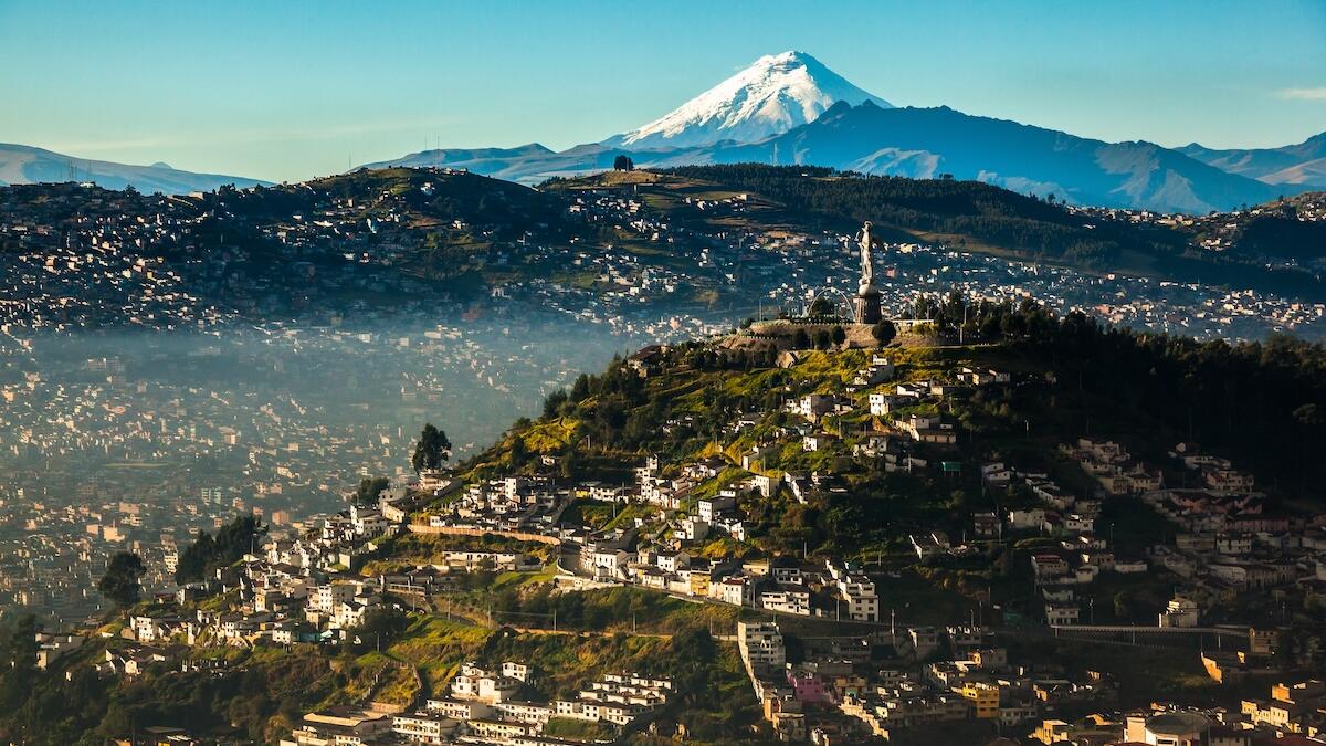
Over 14 days, we will have a highlands, islands, and rainforest adventure. First stop is Quito to explore the city and a UNESCO World Heritage Site.
First stop, Quito
From there, we’ll travel south to the Cotopaxi National Park area for some mountain hikes, including Cotopaxi (but not summiting this one).
Non-stop, to the middle
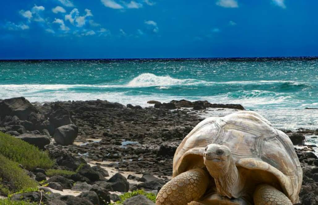
After the highish altitudes and large mountains, we’ll hop over to the Galapagos for some warmer weather, ocean swims, and giant tortoises (the real reason for going).
Giant tortoises deserve a beach vacation too
Finally, we will have some relaxation time in the cloud forest of Mindo where we can go birding and visit a chocolate factory (no golden ticket required)
Today is our last day in Colca Canyon and Peru. But on the bright side, we did not need to set any alarms in order to leisurely watch the morning sunrise from our lovely casita patio. When we made our way up to breakfast, we went with the usual… a cappuccino (or two), smoothie bowls, eggs with aji, and — a new twist — farewell french toast! Afterwards, we spent the rest of the morning relaxing and packing until our transportation arrived at 11AM.
The Belmond breakfast we’ve been raving about
Adios, casita
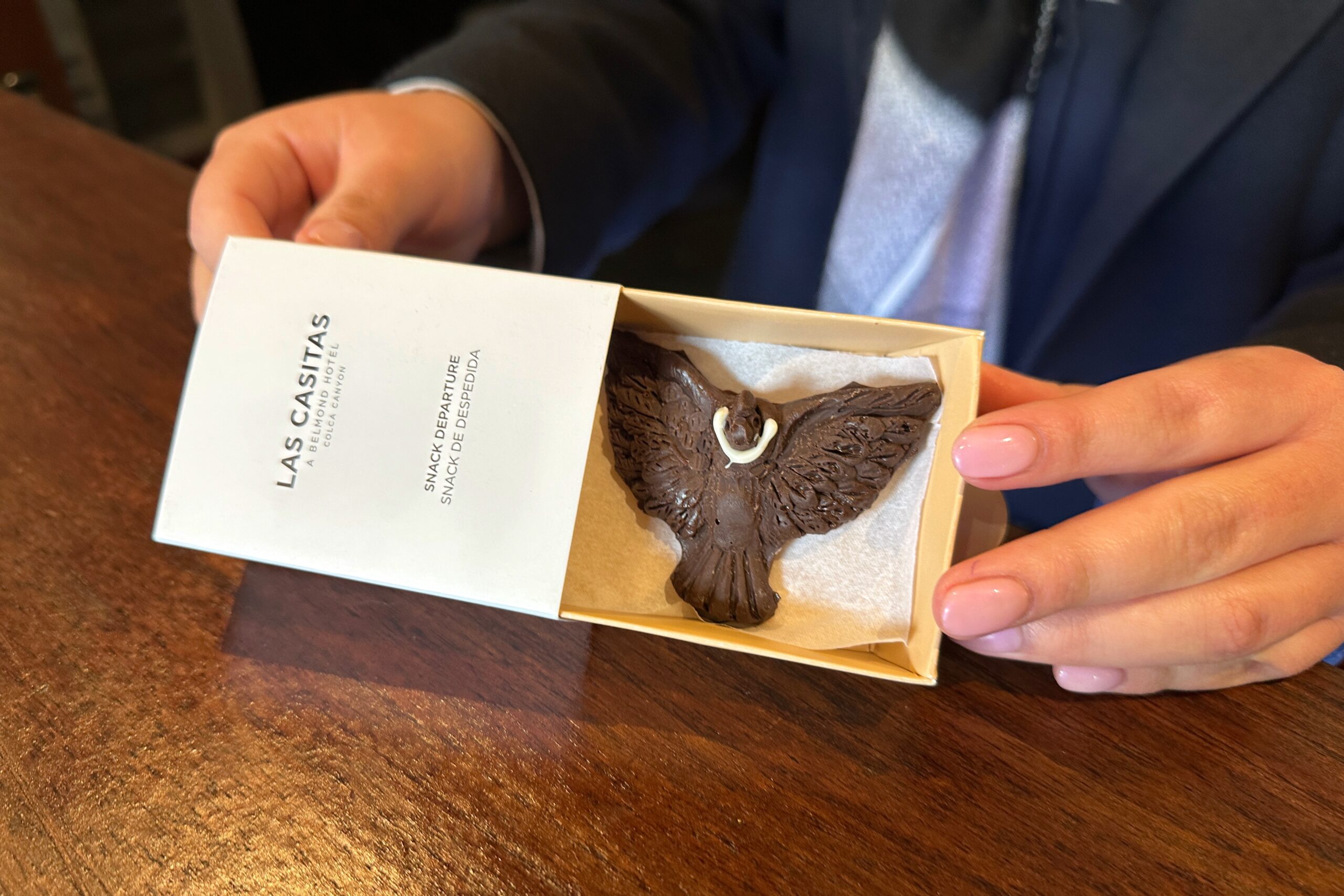
At checkout, the hotel gave us two handmade, embroidered bookmarks with patterns representing the flowers in the area. They also gave us two chocolate condors. The chocolate here is very good and we have some bars to take home (thanks, complementary minibar!).
Chocondor!
Froiland and Jorge (our same driver and guide team from Wednesday) stashed our luggage in the trunk of the car and we were off. We requested one stop in Chivay — at the same alpaca store we stopped before — in order to use our last remaining soles on some 100% alpaca yarn. Jo will be making a cardigan with the yarn haul (but don’t worry Cordwood, not for Matt).
Alpaca yarn lady comes up clutch
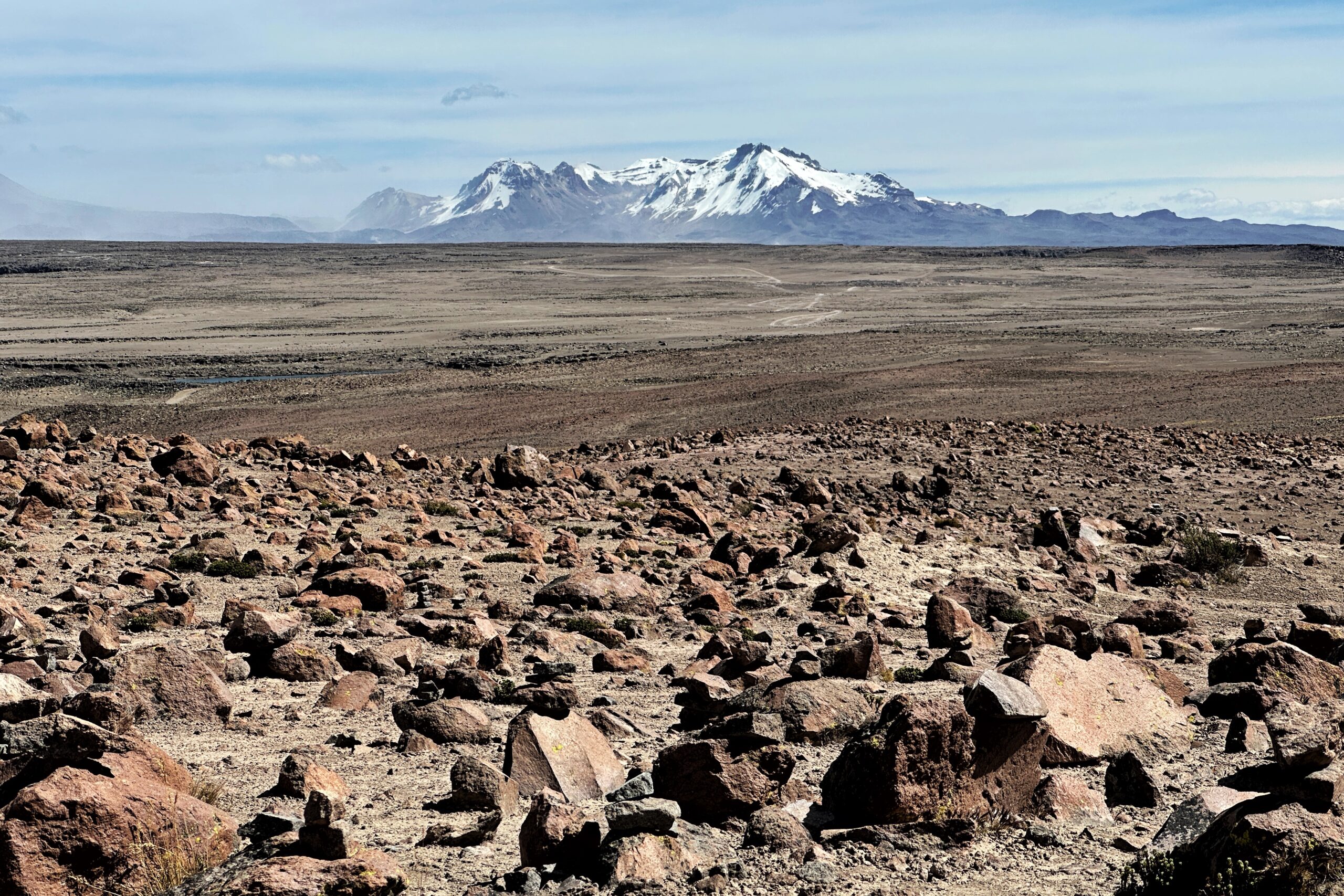
With that task accomplished, the drive proceed south from Chivay, ascending back toward the high pass thru the Andean desert landscape. A great opportunity to view the scenery — or nap. Dealer’s choice.
Up, up and away from Chivay
Back to the high life
The farewell committee
Volcan Misti is shrouded today
Pit stop at Sumaq…
… For one more Misti mate
We already got our yarn, relax bro
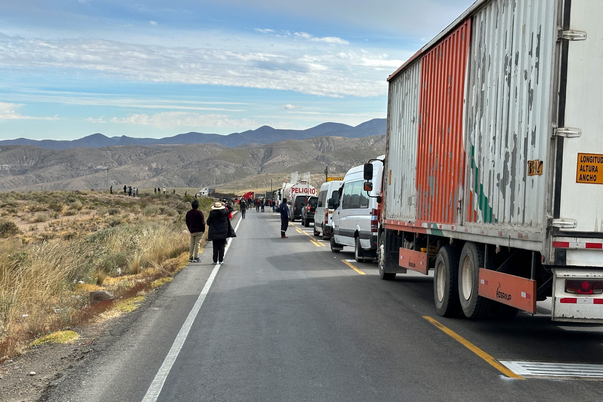
Not long after our pit stop, we re-joined the main road, and after ~15 minutes, traffic came to a halt. As we observed a few days ago, this main road features a significant amount of truck traffic (given the heavy influence of the mining industry in this part of the country). Well, sometimes high Andean desert roads and large trucks don’t mix. Turns out there was an accident on one of the hairpin turns ahead of us and a truck was blocking the road. Traffic came to a halt in both directions for ~30 minutes. People getting out of their cars and wandering down the road to see what was going on.
Well that’s not great
Jorge told us he’s seen delays like this take up to 3+ hours, which, would obviously put a small wrench in our travel plans. Fortunately, the police were already on the scene (it takes about 45 minutes to get here) and were clearing the road. With what appeared to be an assist from another truck, the jackkniffed semi was relocated to the side of the road. Soon enough we were back on our way (barring the moronic drivers who were now trying to pass on a two-lane road).
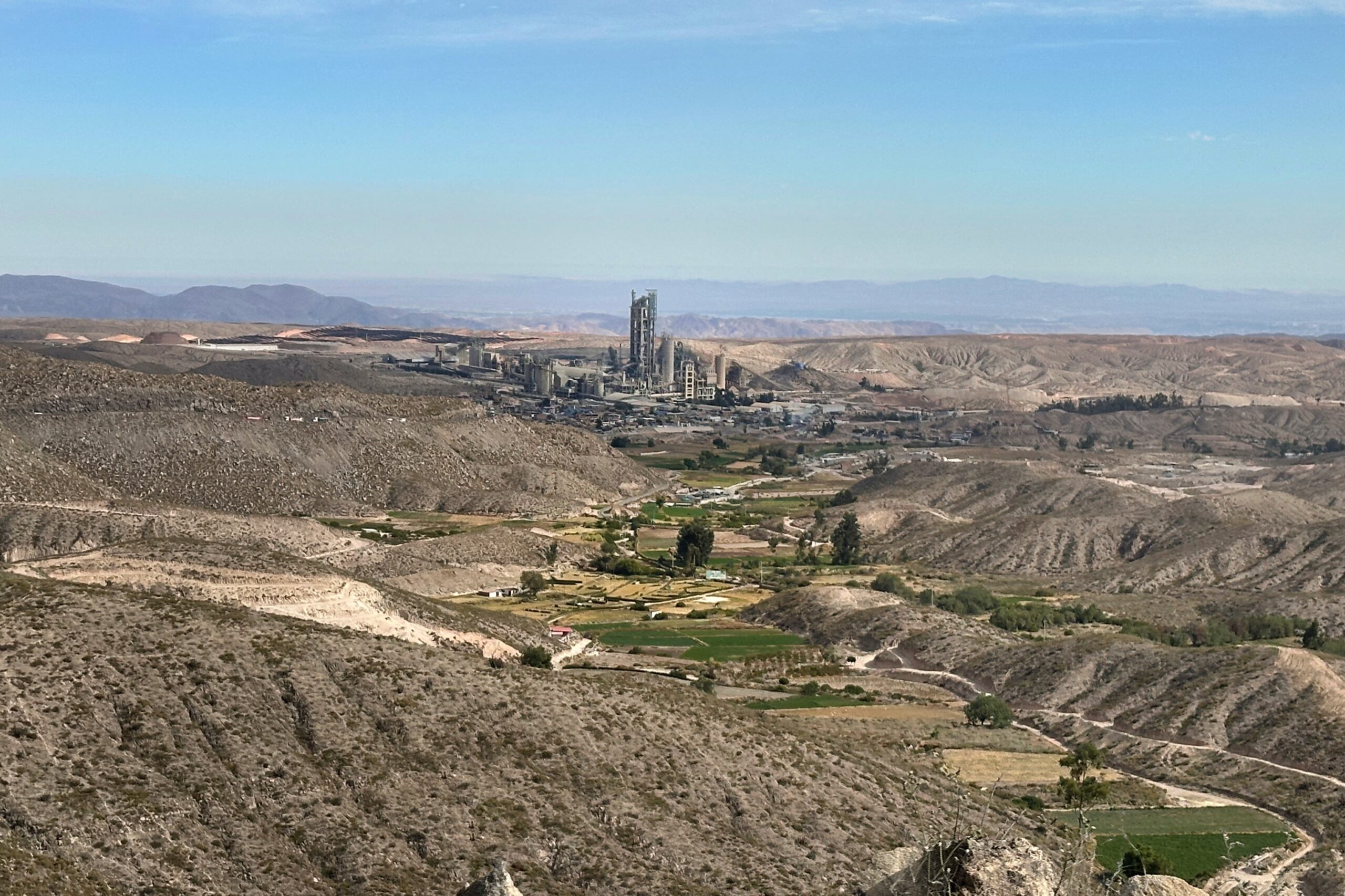
Cement factory outside Arequipa looks sci-fi
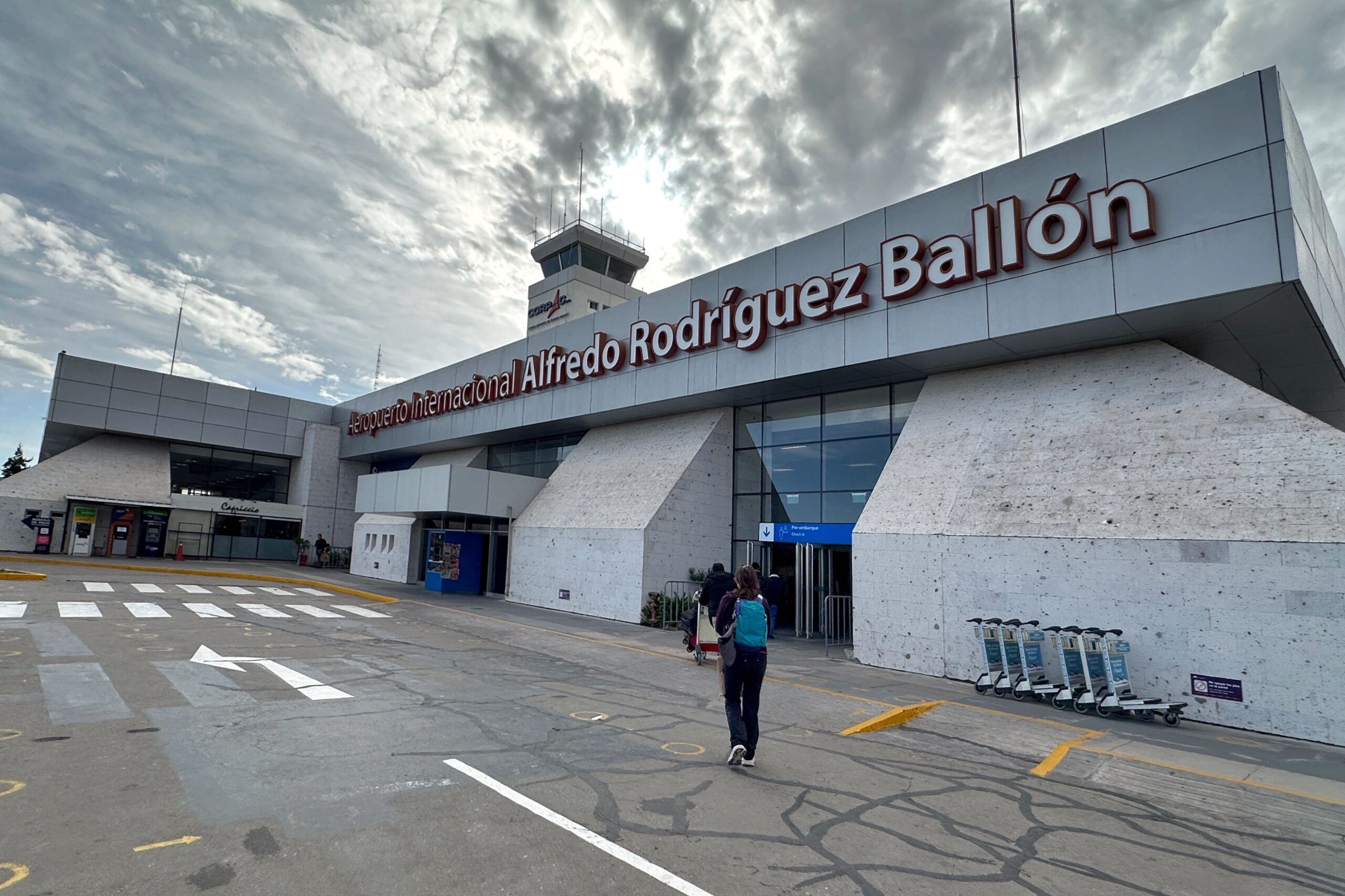
From that drama to the outskirts of Arequipa, it was mostly smooth sailing. There was some Saturday afternoon market traffic to contend with, and the occasional double-parked van straight-up blocking the road, but nothing too bad. We had allotted four hours for a three-hour ride, so we ended up getting to the airport right on time. Jorge helped us check in and directed us on which way to go. We navigated through security and found another functioning Priority Pass lounge in the lower-level to hang out in until boarding. We had some light snacks and water before heading back up to the gate.
Not jackkniffed, just jackass
We made it AQP!
The flight to Lima went well, as expected in our super-fancy premium economy seats. Well, the kicking and loud kids right behind us weren’t so great. But the sun was setting and we got some nice views out the window. Pro tip for you fancy LATAM fliers: go with the second row (not first) in premium economy so you don’t have to put your personal bag overhead for takeoff and landing. Also, moveable armrests.
Premium economy influencer
Good bye South American sunset
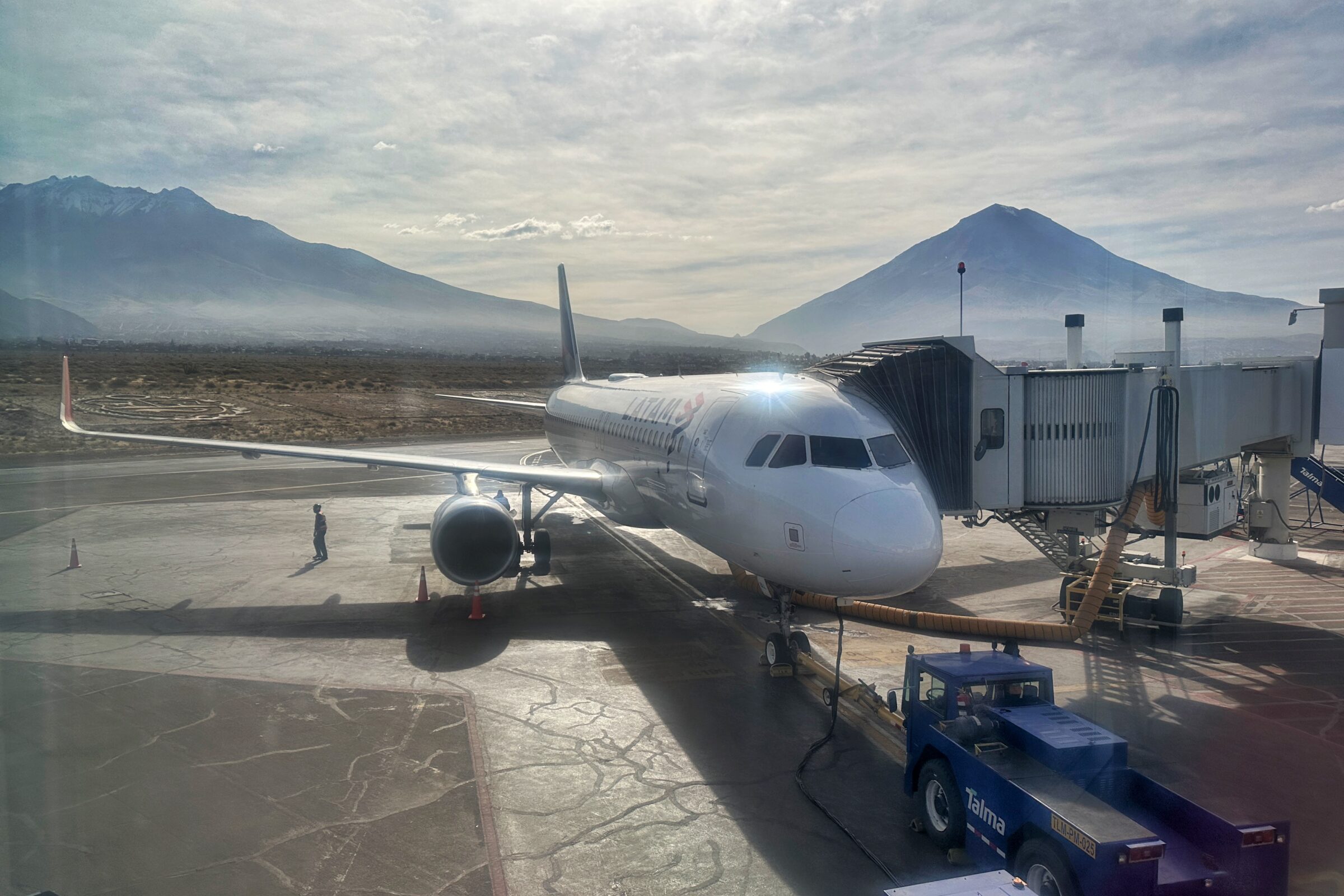
When we landed in Lima (at their brand-spanking new airport, once again), we deplaned on the tarmac and took a shuttle bus to baggage claim. Not exactly sure why the plane couldn’t pull another 20 feet forward to the jetway, but we’re guessing it has to do with the “brand-spanking new airport” part. In any case, we collected our bags and proceeded to the international terminal check-in on floor 3.
LIM so new, the jetways are still TBA
We found the American Airlines counter and the self-check in kiosks. An AA employee helped us print our boarding passes and the bag tags and directed us to the right line. Appreciate the help, but we might need to have a chat with all these airport/airline employees also touching our selection screen for us. Knock it off! Also appreciated is the fact American Airlines does not have a 3-hour restriction on accepting your checked bags. We were ~4.5 hours early for our 11:45PM flight but we were able to check-in, pass security, and clear customs right away.
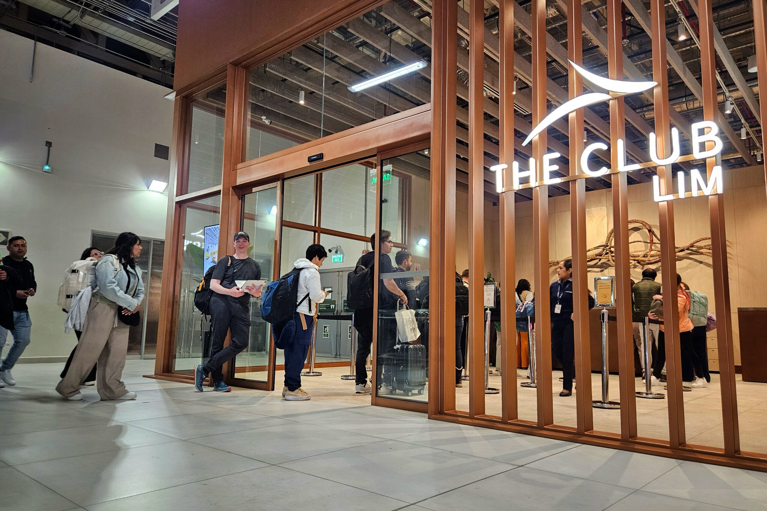
One thing you can’t do more than 3 hours ahead of your flight is get in “THE CLUB LIM” which is the Priority Pass lounge in the new airport. So, we sat on the floor outside the club to kill the time before we were allowed to enter. Our sad puppy-dog faces apparently did not faze them. Once inside, life was good. We found some comfy captain-chair seats and enjoyed a very tasty dinner spread with cocktails (last hurrah pisco sours!) while working on the blog.
Please sir, can we check in yet, sir?
Finally clubbing at the LIM
After enjoying the lounge for a couple hours, we made our way to the gate. On the way, we sorta noticed some huge crowds as we passed the security/immigration hall. Then we heard an announcement informing all passengers of regrets about some sort of electronic system delays in the airport. Ok, strange, but whatever. We made it to our gate with perfect timing, and immediately strolled onto the plane when our group was called a minute later. Everything seemed a-ok here! Of course, this is an international flight to the US, so raccoon security was in full effect to jack with all your stuff (like American Kestrel feathers in your hat). So, so stupid (Matt is right).
Anyways, we boarded and there were a ton of open seats all around us. We were plotting what to do with all the extra space, but as it turned out, boarding was not complete. Due to that security system crash, American was kindly waiting to depart, as a good chuck of passengers were slowed down by the near-riot in customs when the computers went down. The girl who eventually joined our row recounted the harrowing story. In the end, the pilot said one additional passenger “opted” not to take the flight (not sure how voluntary that was, lol), so they needed an extra 10 minutes to pull their luggage. Not long after that, the plane took off and were on our way to Miami.
After a small dose of blogging, we slept most of the overnight flight . Even with the delay, we were only about 10 minutes late. But the Miami airport is comically large, and we still needed to hoof it to make our connection. First, a walk to the tram. Then a tram to customs. Then Global Entry thru customs. Then pick up our bags. Then re-drop our bags. Then TSA pre-check, but everybody and their grandma now has TSA pre-check, so really just TSA. Finally, we cleared security and got to our gate five minutes before boarding. I guess another way of looking at it is… PERFECT TIMING!
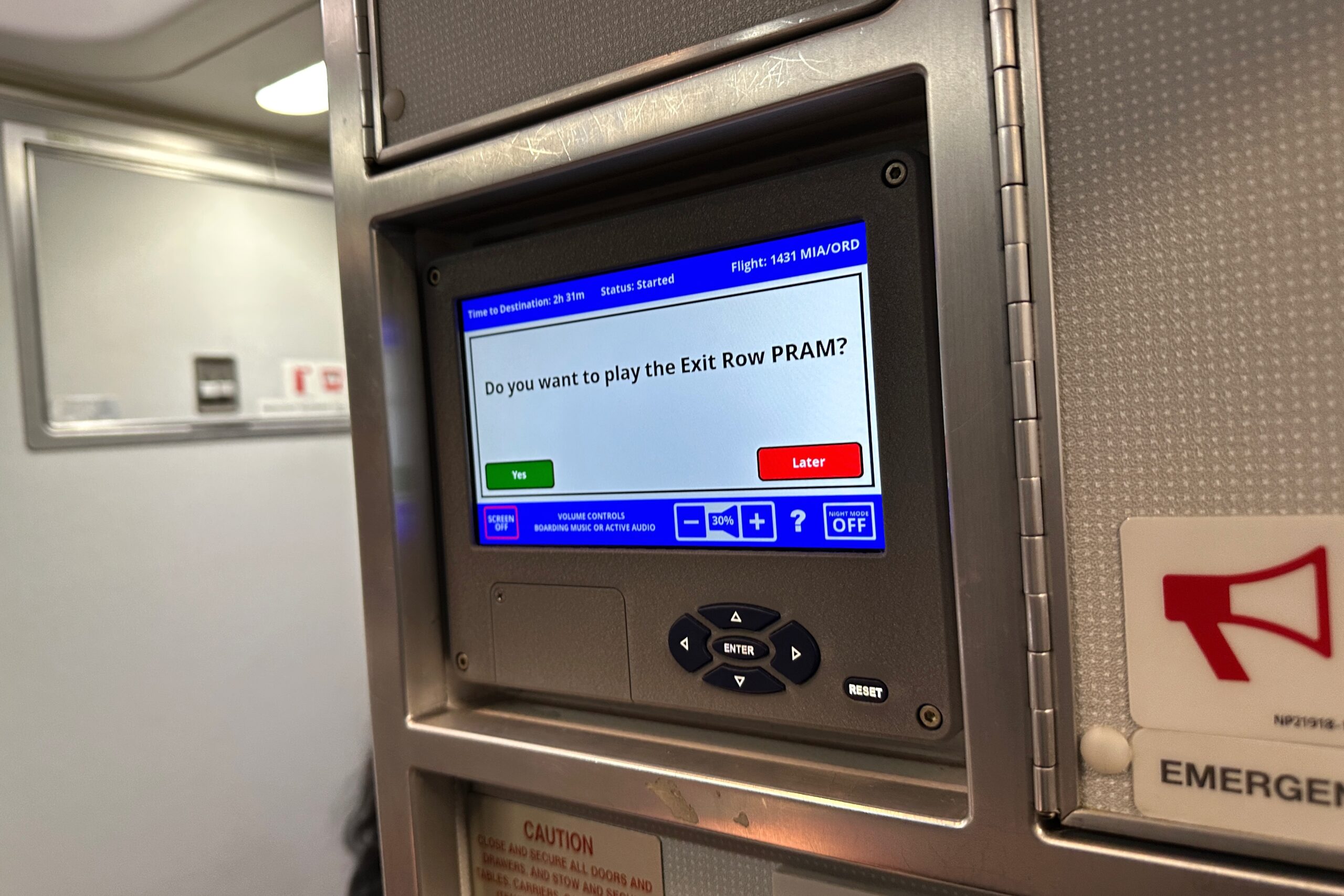
Look, I only start the boarding music (previous flight), not the Exit Row PRAM
From Miami to Chicago, it was all academic. We landed, picked up our bags and hailed the next taxi. This taxi driver did not have a death wish like the guy who picked us up from O’Hare in March. Instead, he drove like a normal person and — being Sunday — was even listening to “Wait, Wait, Don’t Tell Me!” Good stuff. Another great trip in the books!
We were tempted to do nothing today, but wisened-up and realized we didn’t travel all the way to Colca Canyon to NOT afford the final one-hour drive west to Mirador Cruz del Cóndor — a popular site for watching Andean Condors in action. We figured even if the condors didn’t cooperate, we’d still enjoy getting the spectacular views deeper into the canyon. The best time to see the condors is in the morning, and that’s when the Belmond offers the excursion, so be it… that’s when we’ll go.
Informing Wida of our Condor plans
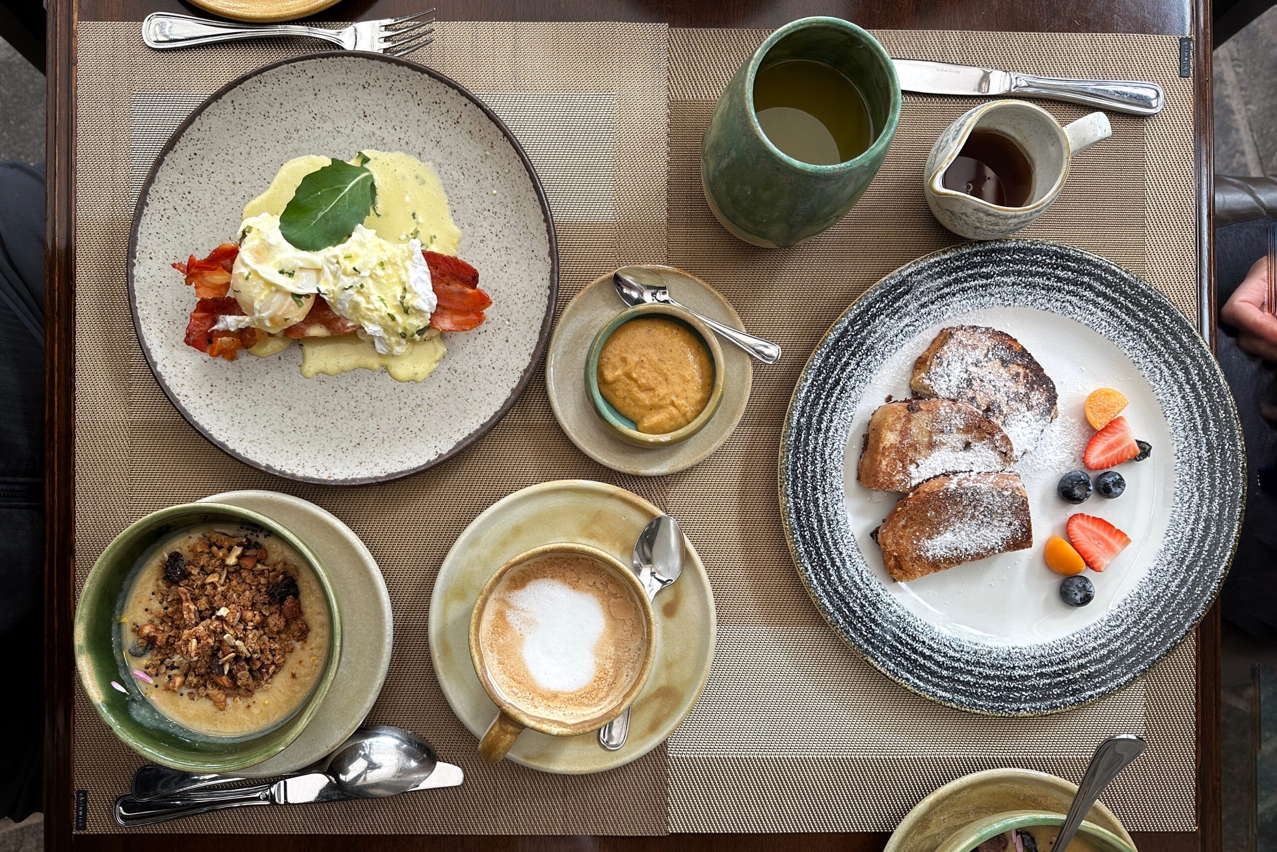
But first, breakfast! Now that we know the secrets of the kitchen menu, we didn’t bother with the buffet (except for some mango) and went straight to our favorites… ordering cappuccinos, eggs benedict with the spicy aji sauce, a fruit smoothie bowl, and the green apple quinoa porridge. We finished right on time and headed over to the reception desk for our 8AM departure.
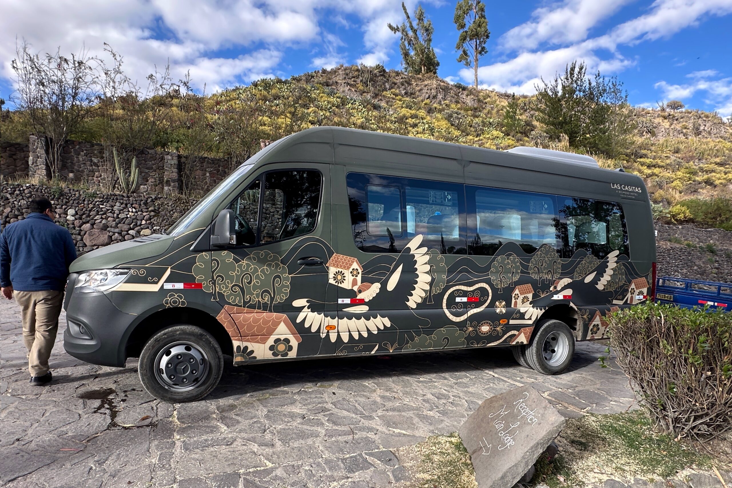
All aboard the Belmond Condor Party Bus!
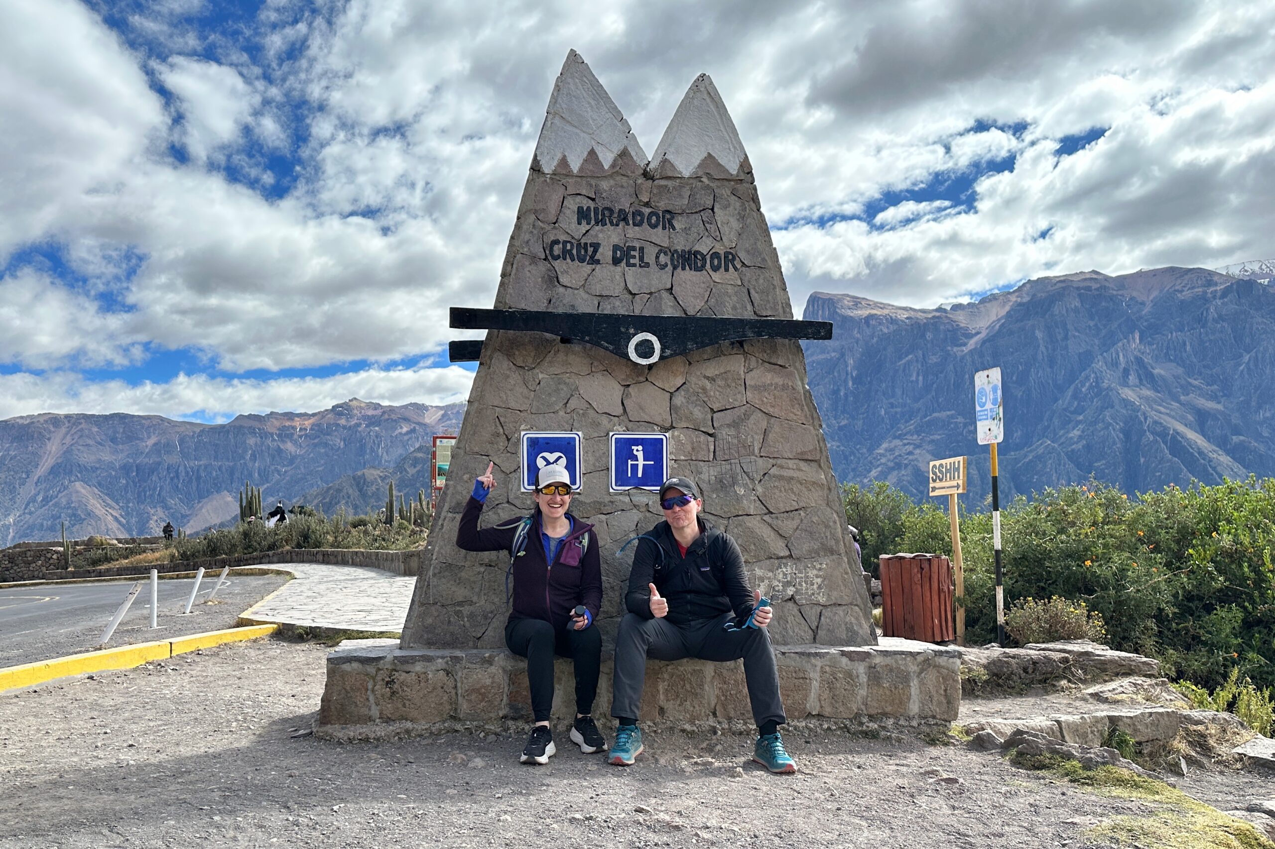
Once again, we were the only guests on our excursion today. The drive to Mirador Cruz del Condor took a little under an hour. As we approached the lookout, we stopped at the park entrance to purchase our tickets. They have a well-run system, with workers running up to your vehicle, collecting your money, running to the ticket booth, and running back with your tickets. After a few more minutes of driving along the canyon, our driver Luis parked along the side of the road near the lookout. The Belmond’s decision to decorate their condor van is very smart, because every other vehicle parked along the road was one of those omni-present white “Service Turistico” vans. We were free to roam and return when we were finished.
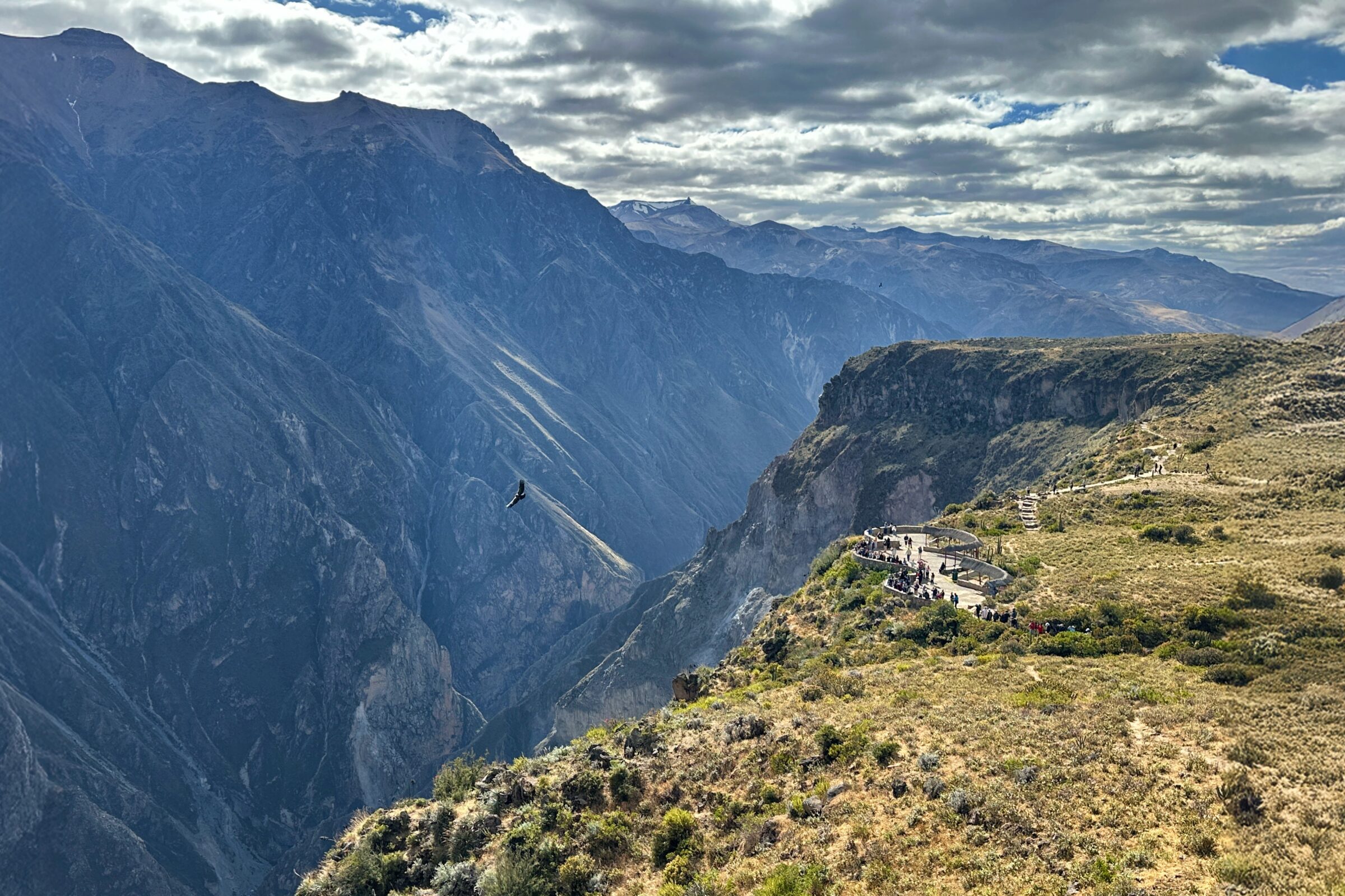
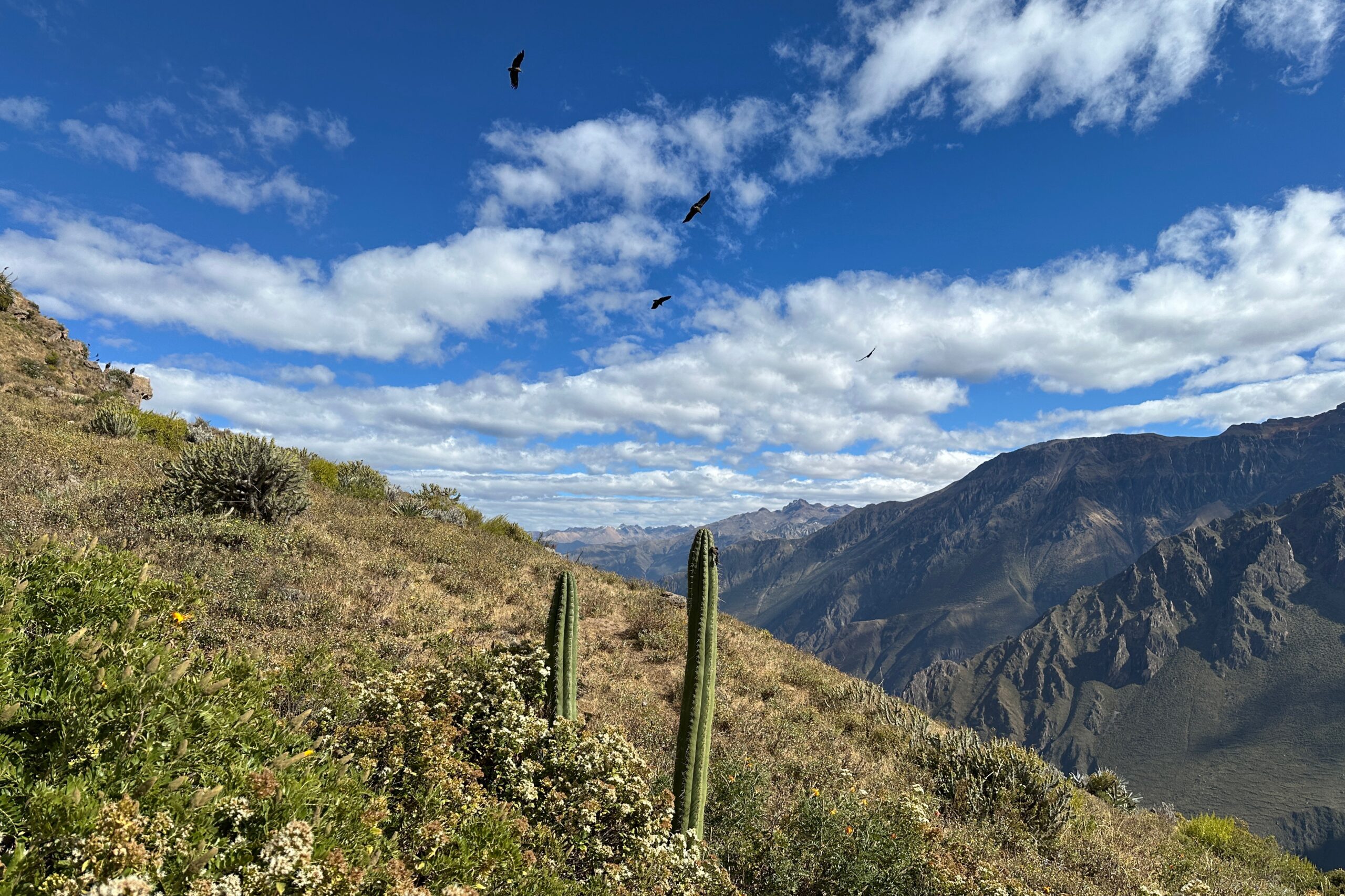
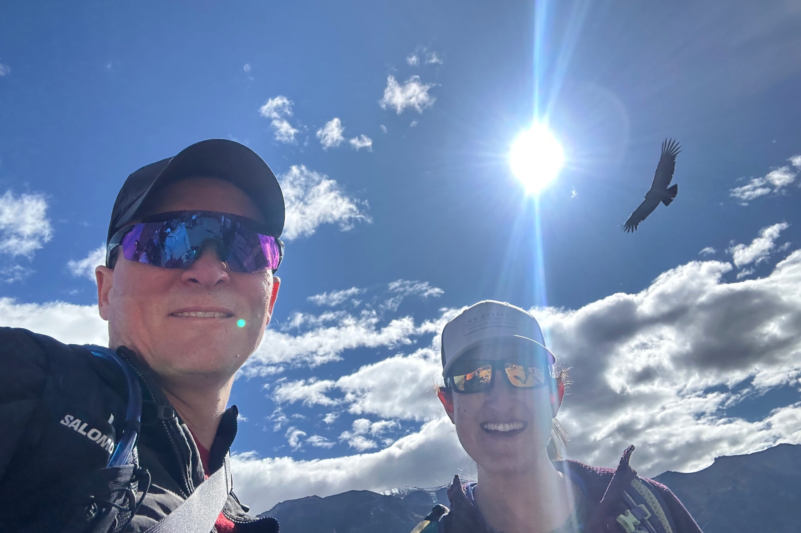
Immediately after getting out of the van, there were condors. A park ranger pointed us towards a group of people watching a couple condors sitting very close to the edge of the lookout. Despite the crowds, we still got a great view (being tall goes a long way in Peru). We stayed in that first general area for a while as a multitude of condors flew overhead.
Condors immediately spotted
Calling this Condor meeting to order!
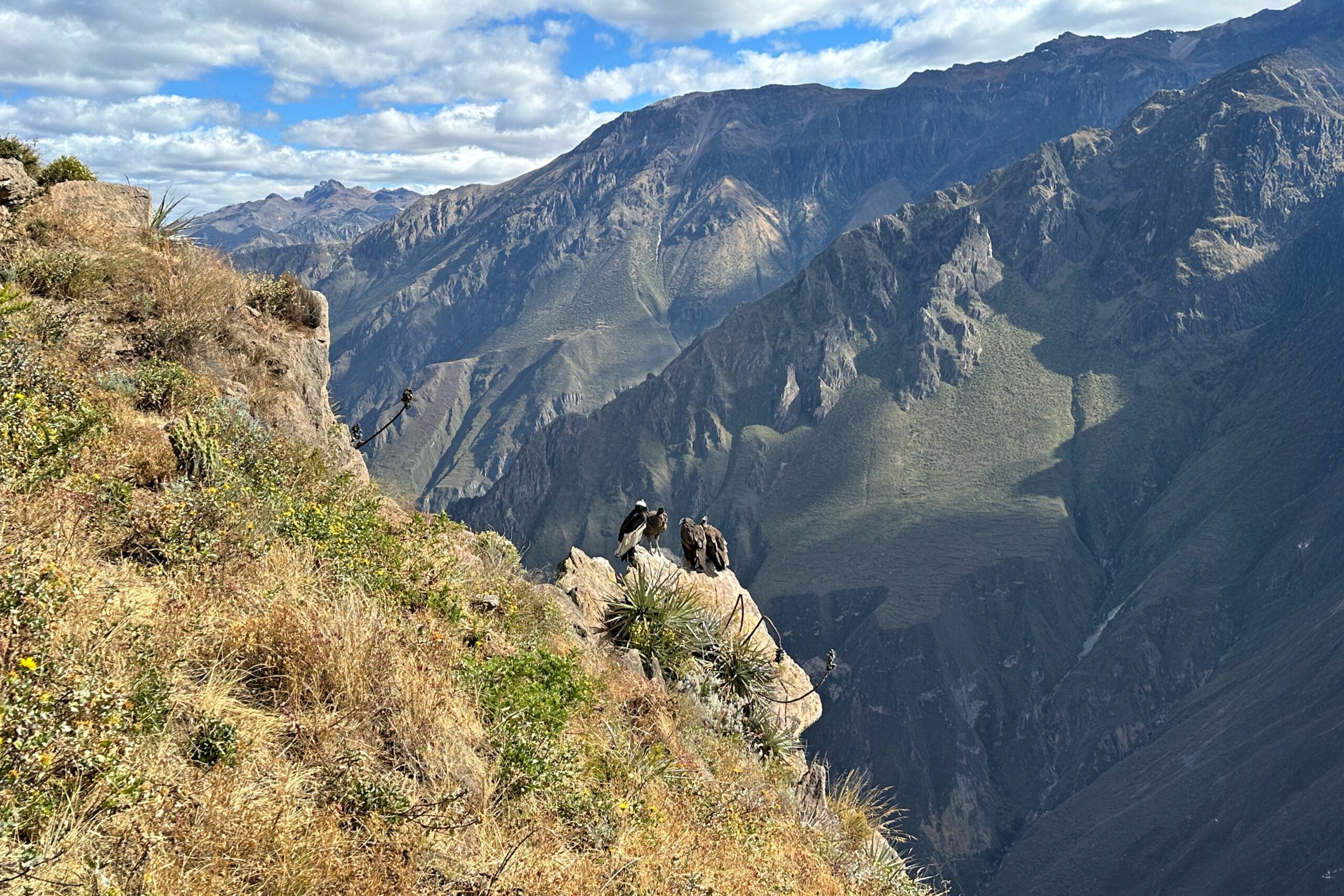
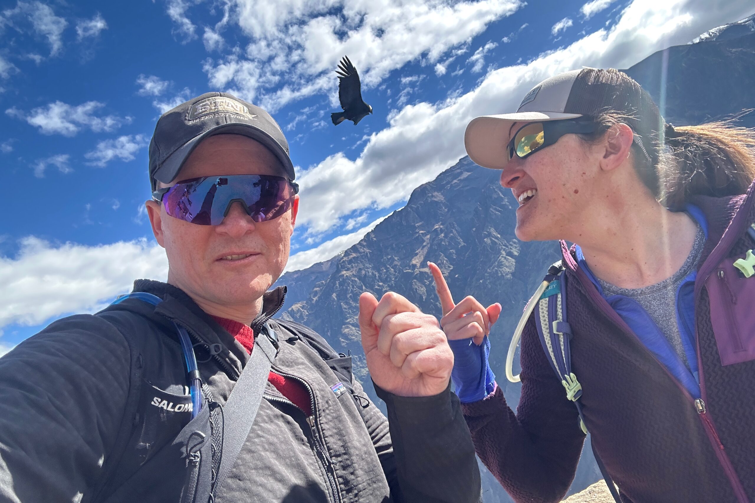
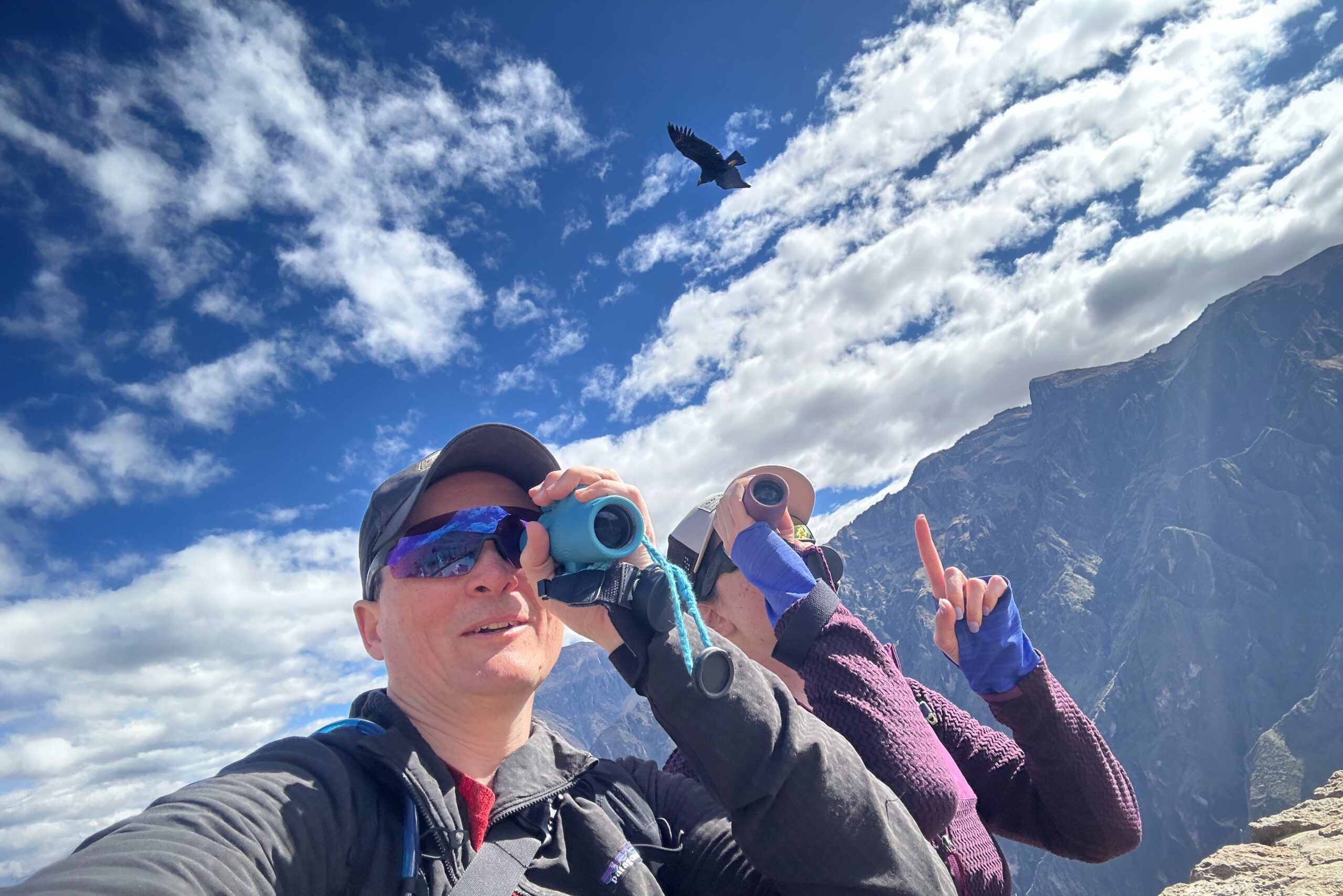
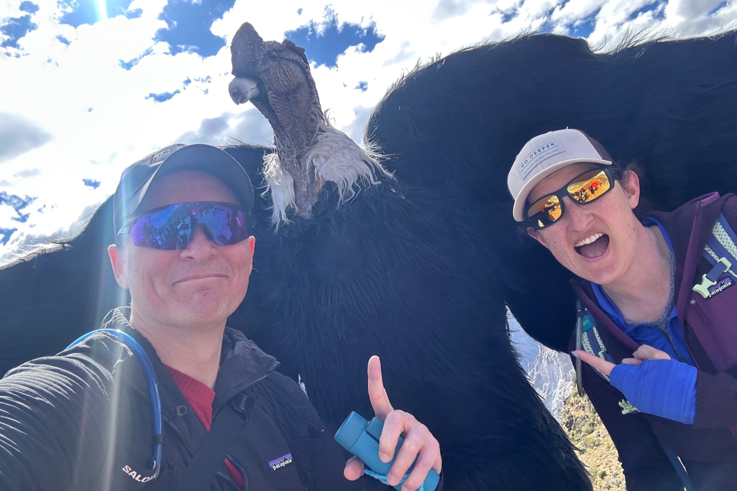
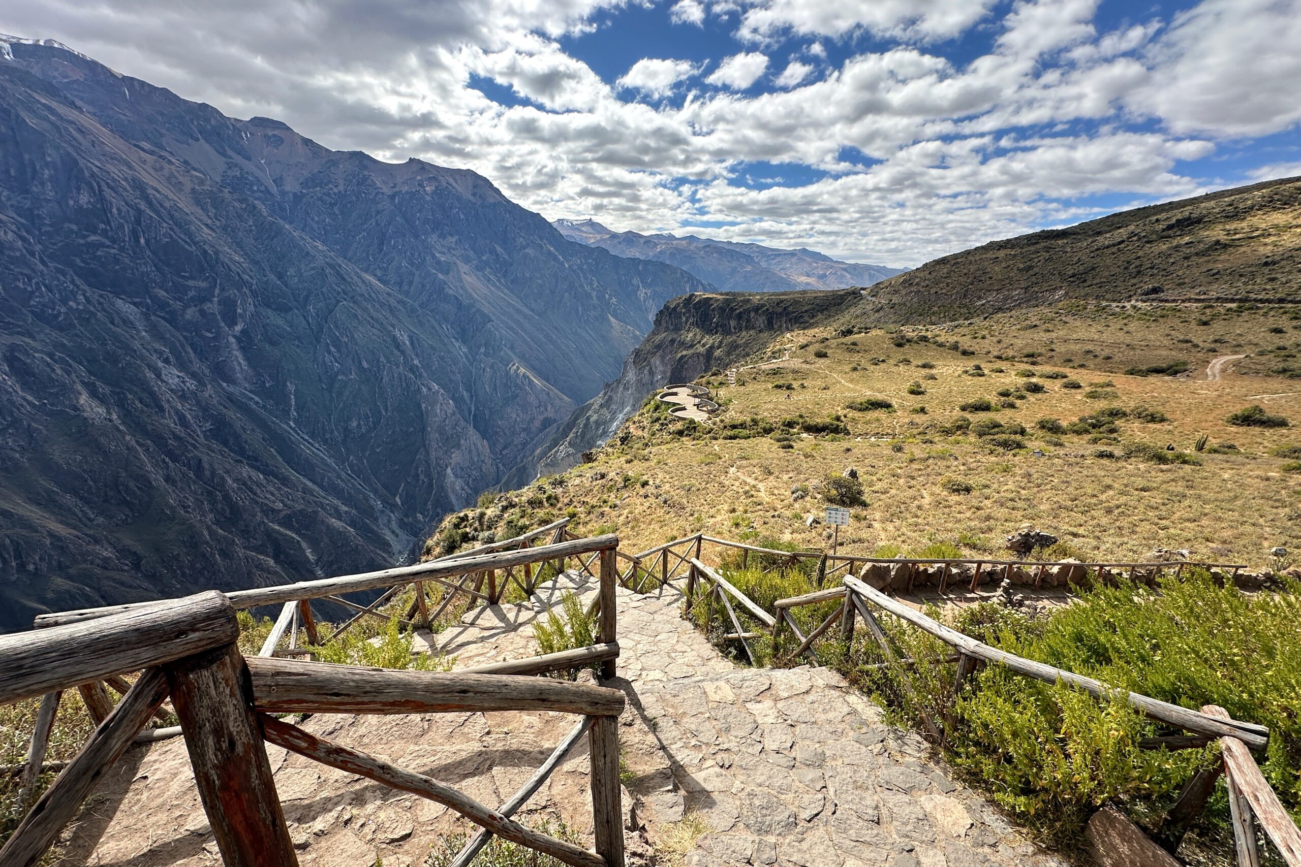
A staircase and path led down the cliffside to another lookout area. We checked it out to get some different views of the condors and the canyon. Both looked great. We put our monoculars to good use for excellent close-up views of the Andean Condors in flight. Eventually, with so many condors in the air, we began challenging ourselves to get selfies with the condors. Very Fun.
Lower observation deck
Condor selfie #1
Condor selfie #2
Condor selfie #3
Condor selfie #4
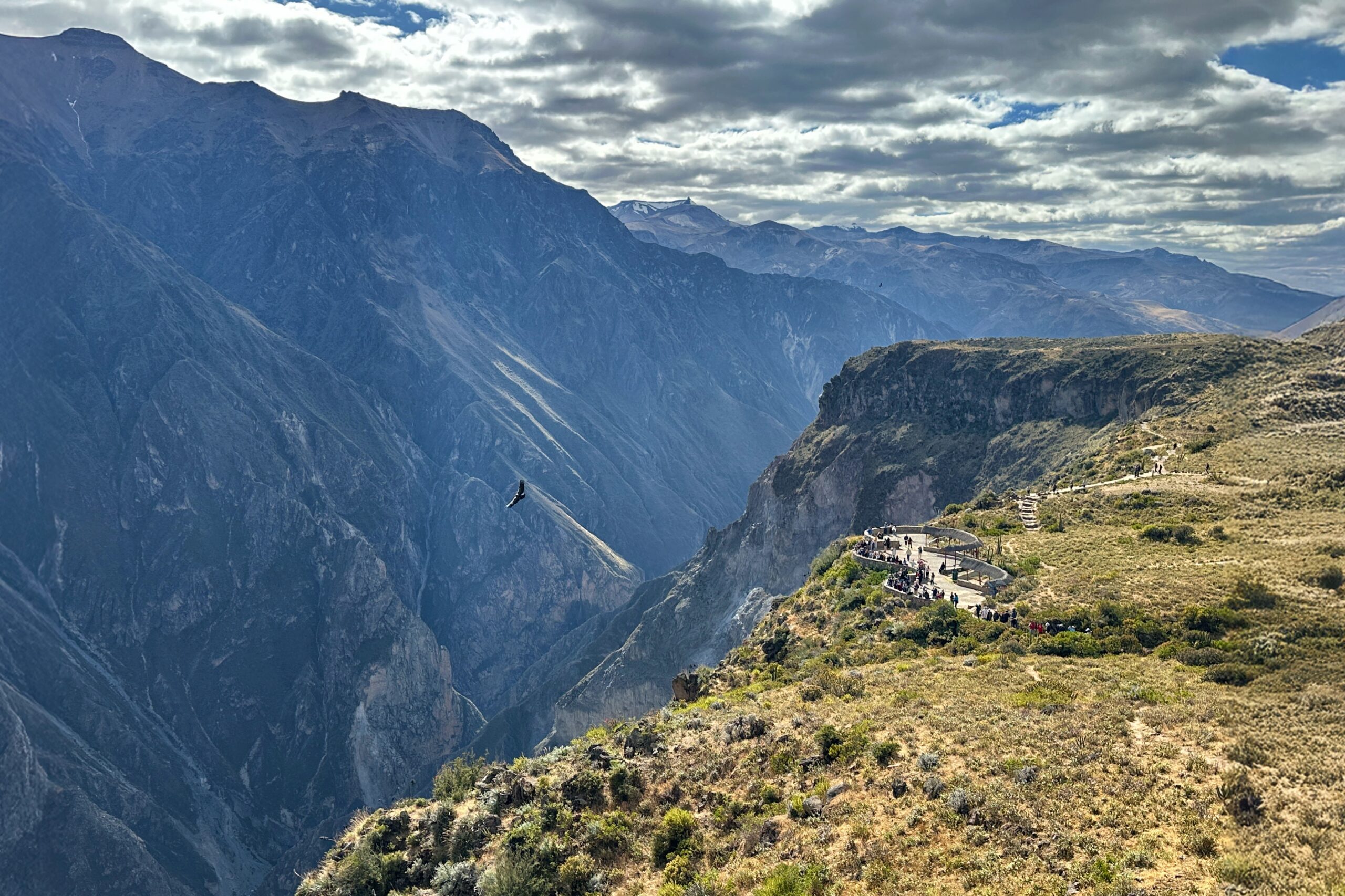
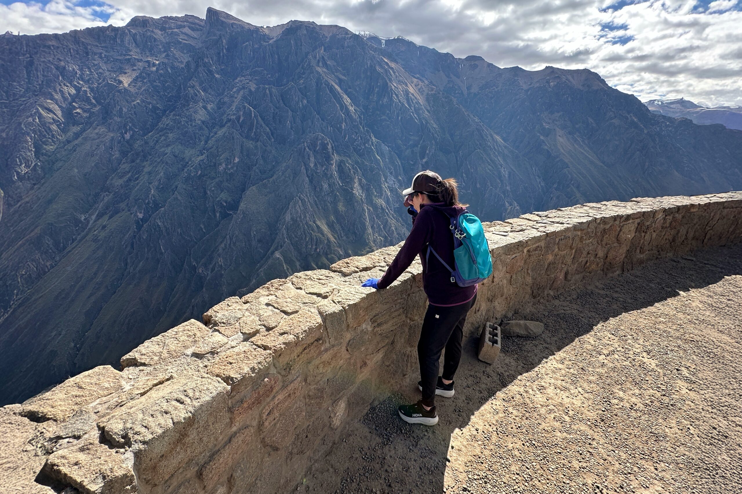
After about 45 minutes of jam-packed Andean Condor action, the birds called it a day and dispersed rather quickly — as did the crowds. Turns out the hotel is dead-on when it comes to the best time to view the condors. We saw a few strays remaining, but even those were on their way out. We used the empty viewing areas to get a few more good looks at the canyon. This isn’t the deepest part of Colca Canyon, but from the viewpoint at 3270 meters, the Rio Colca is looking pretty thin down at 2000 meters.
Where’d all the condors go?
Where’d all the people go?
Two talons way up for Mirador Cruz del Condor
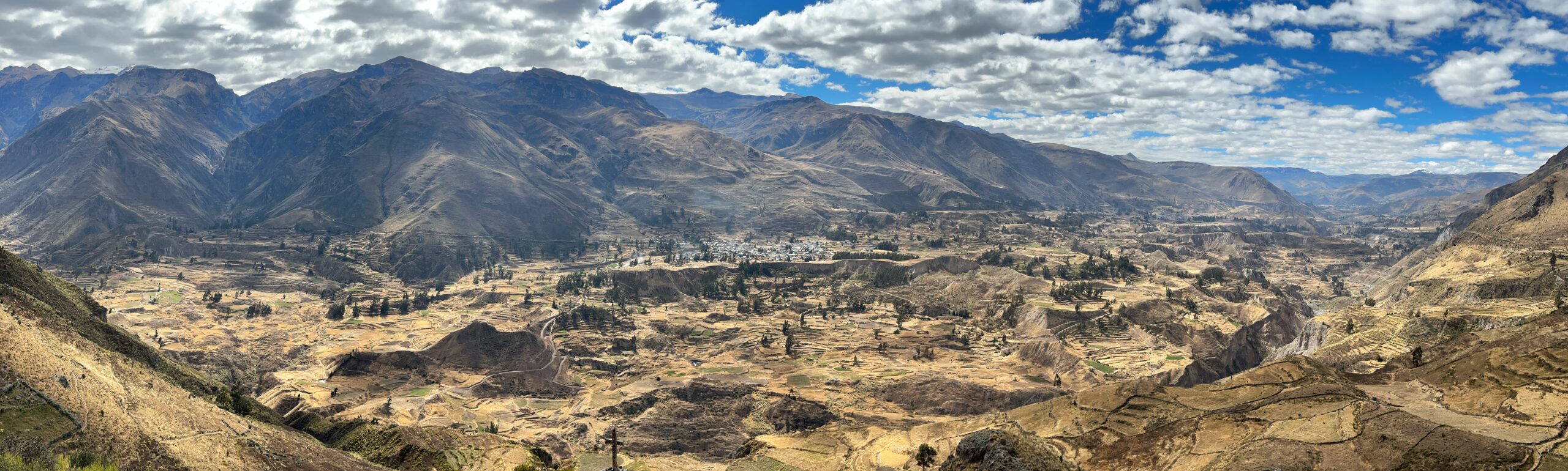
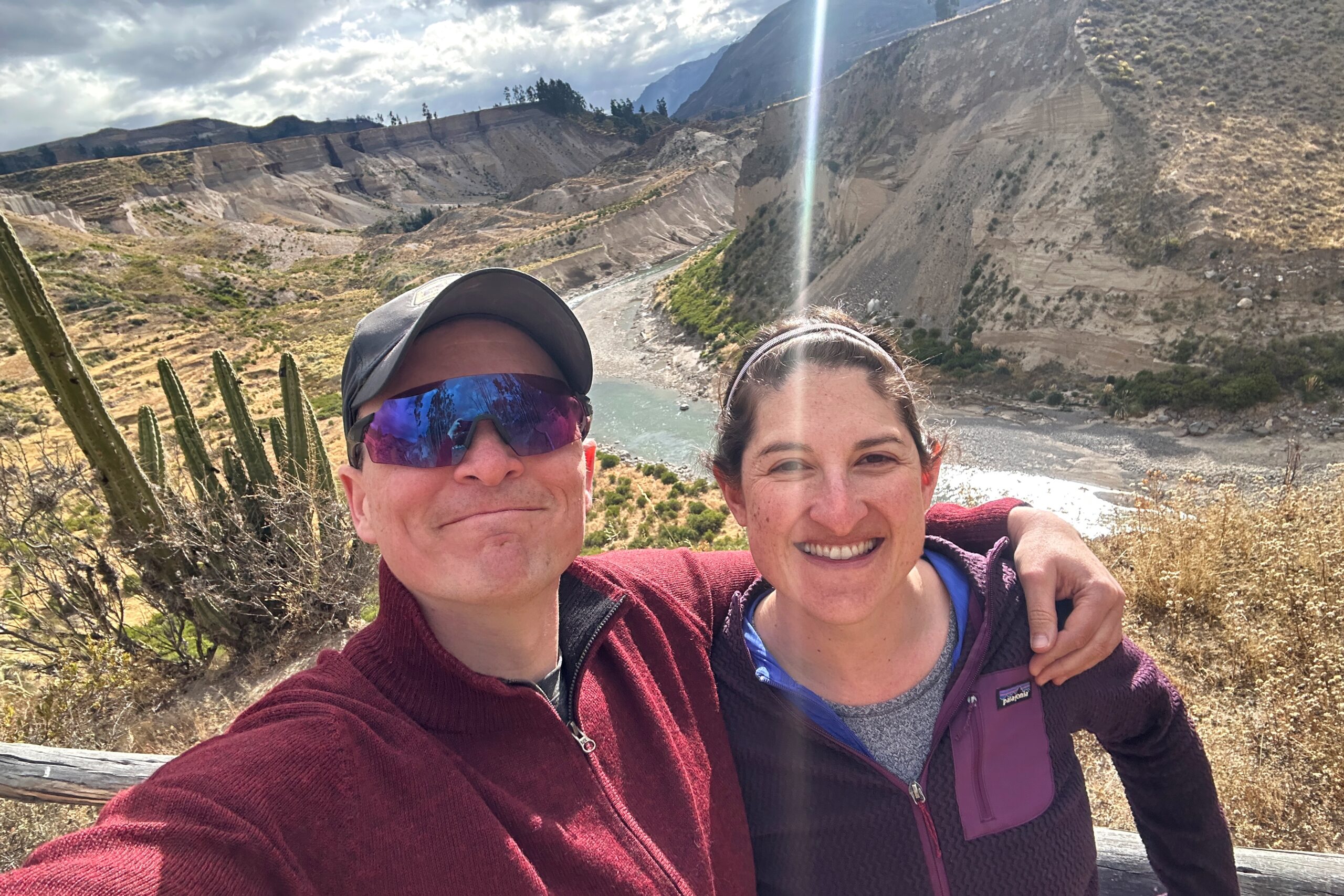
On the return journey, we stopped at a different lookout with more great canyon views. This area was back outside the official park area, so there is more residential agriculture and terracing to see next to the Rio Colca.
Heading east back toward Maca
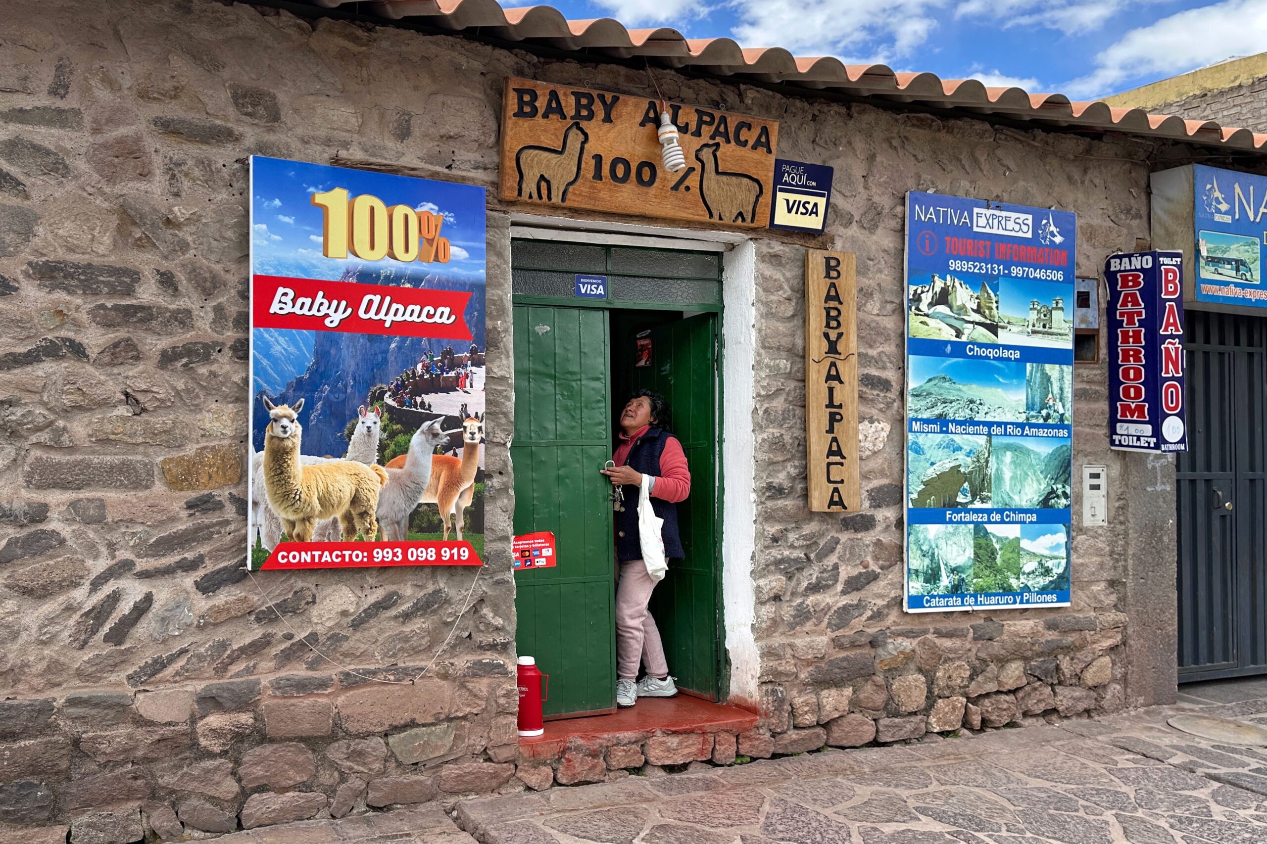
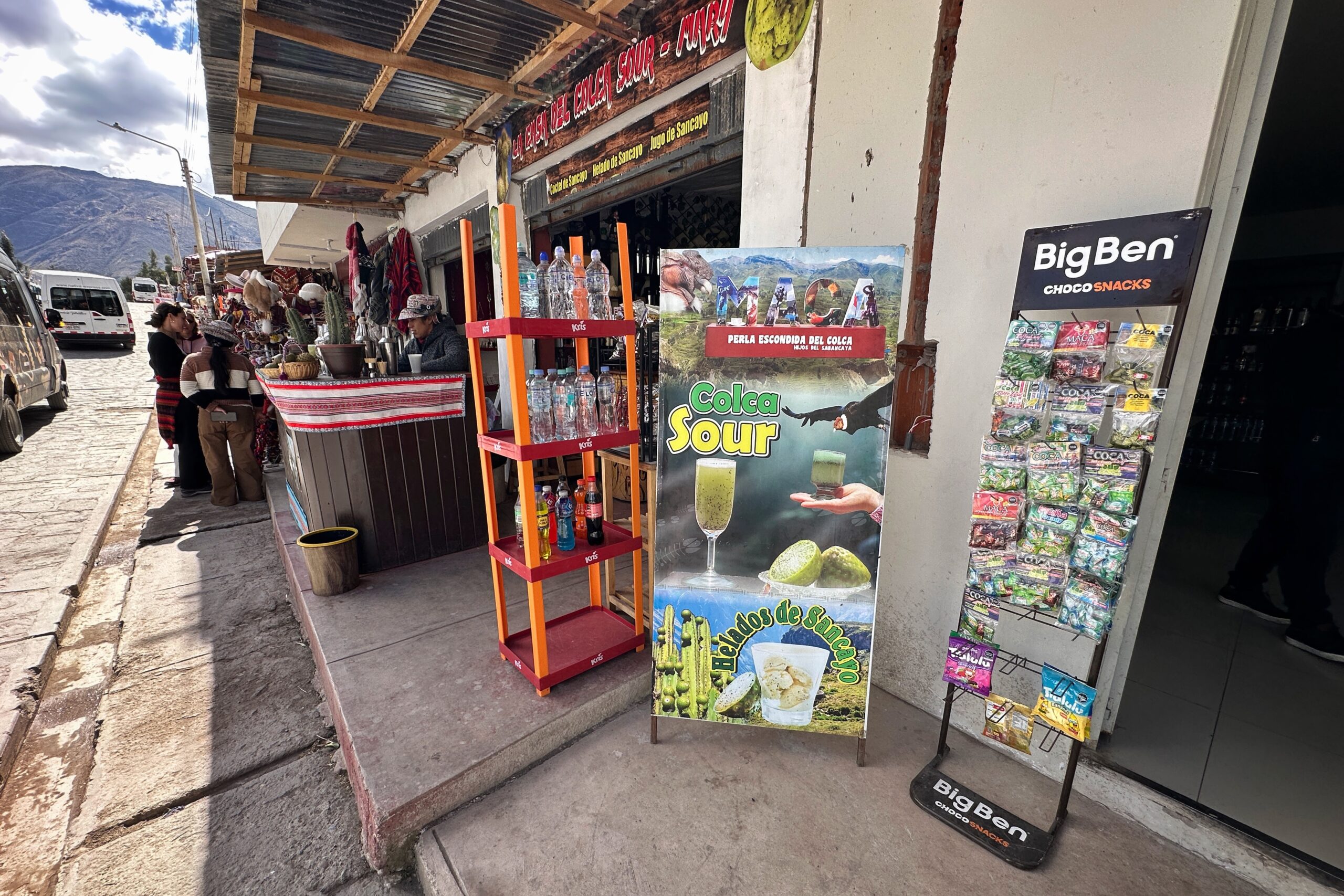
Passing thru the town of Maca, Luis made a pit stop for us to continue Matt’s search for a 100% baby alpaca sweater. This town is known locally for their markets, so fingers-crossed! The first shop had promise, but no sweaters that fit. Instead, a stone condor was added to our little stone animal collection. We also found a store with a perfect condor magnet for the fridge. Minor victories.
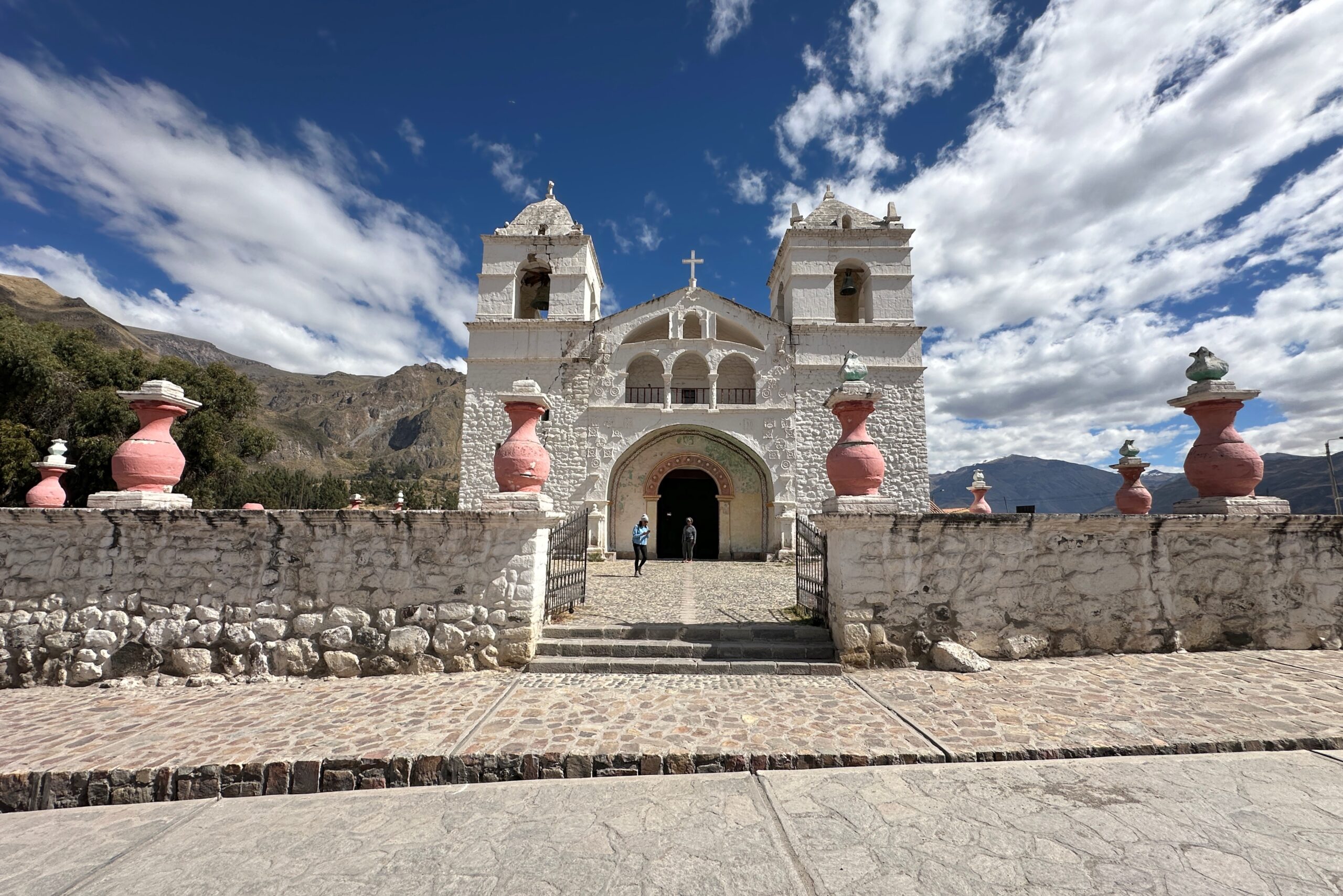
Maca town church
Market street
But we really wanted that alpaca sweater. So we walked down the market, ducking into each store that didn’t look like it was selling mass-produced stuff. We were almost out of shops when we found the sister shop to the one Jorge suggested in Chivay. They had the legit Alpaca, but nothing was fitting. Ls were too small, XLs were not the right style, etc. Before walking away, we tried on one more L, which was surely going to be too small. But somehow, it fit perfectly! Some half-hearted negotiating ensued, and with two charming alpaca magnets thrown in, Matt walked out of the place wearing it triumphantly. And that, dear blog reader, is surely more than you cared to know about our quest for the perfect dark red, 100% baby alpaca sweater. Full-zip!!
Perfect sweater weather today
Luis finished driving us back to the hotel and we had the rest of the day to enjoy the property. Our very busy afternoon itinerary included: feeding the alpacas again at 2:30PM, walking along the canyon trail, wandering through the vegetable garden, and watching the Peruvian Paso Horse “Dancing/Stepping” show in the courtyard — featuring Pascual riding Bailarine (Jo’s horse from yesterday)!
Wida! I just got this awesome baby alpaca sweater!!!!
We also walked through the spa to check out the pool, but it was a bit cloudy today, and without that completely unobstructed midday sunshine from the last couple days, it now makes sense why all the locals say it’s cold. So we decided against a swim. Back to the house it is!
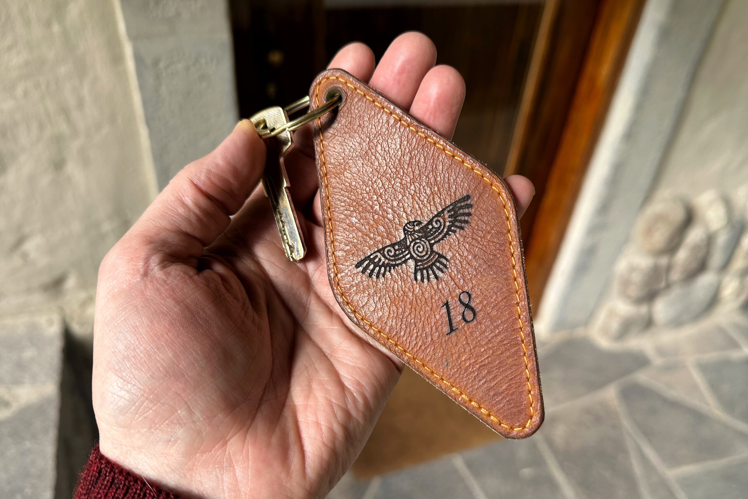
Condor keychain
Today’s complementary Belmond activity was a pisco tasting at 7PM. Today is Friday, so several more guests have arrived and there were 10 of us at the tasting. The word pisco is a Quechuan word for birds. It’s made from distilling grapes (any of eight varieties) in a process that is similar to wine or champagne, but takes extra steps to make it a Liquor. There are pure versions, which are made from a single variety of grape, and blends which tends to be better for cocktails.
The traditional recipe for a pisco sour is 3oz pisco, 1 oz lime juice, 1 oz simple syrup, and eggs whites. Shake with ice, strain into a cocktail glass and add a few drops of bitters on top. The bartender made one as an example/demonstration, and then had one of the guests make another. The brave volunteer was about 18 and managed to get the job done with some prompting from the group. Meanwhile, the kitchen staff made a pisco sour for everyone else. As expected, it was quite tasty.
We moved over to our favorite dinner table by the fireplace and made our choices for tonight. For Jo, pumpkin and orange salad, quinoa risotto, and an orange mousse dessert. For Matt, shrimp chowder, rocoto relleno, and another crack at ponderaciones for dessert.
STILL Making People Happy CONFIRMED!
We returned to our casita where we lightly packed and lightly blogged to the midnight hour. We don’t leave until 11AM tomorrow morning, so we weren’t too worried about having everything in order before we dozed off to sleep. Good night condors!
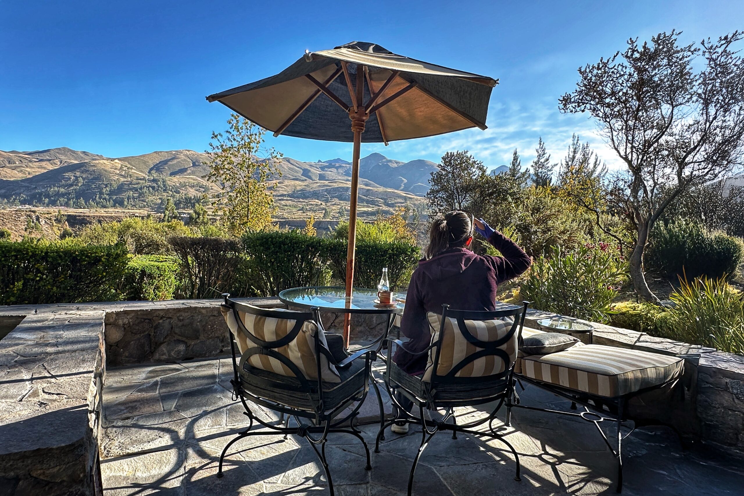
The only item on our agenda today is a horseback ride, with a departure time of 11AM, right from the hotel. So no alarms today! Plenty of time to wake up naturally and bask in the morning sun while drinking espressos and birdwatching. The “peak relaxation” portion of this trip is well underway.
Good morning Colca Canyon
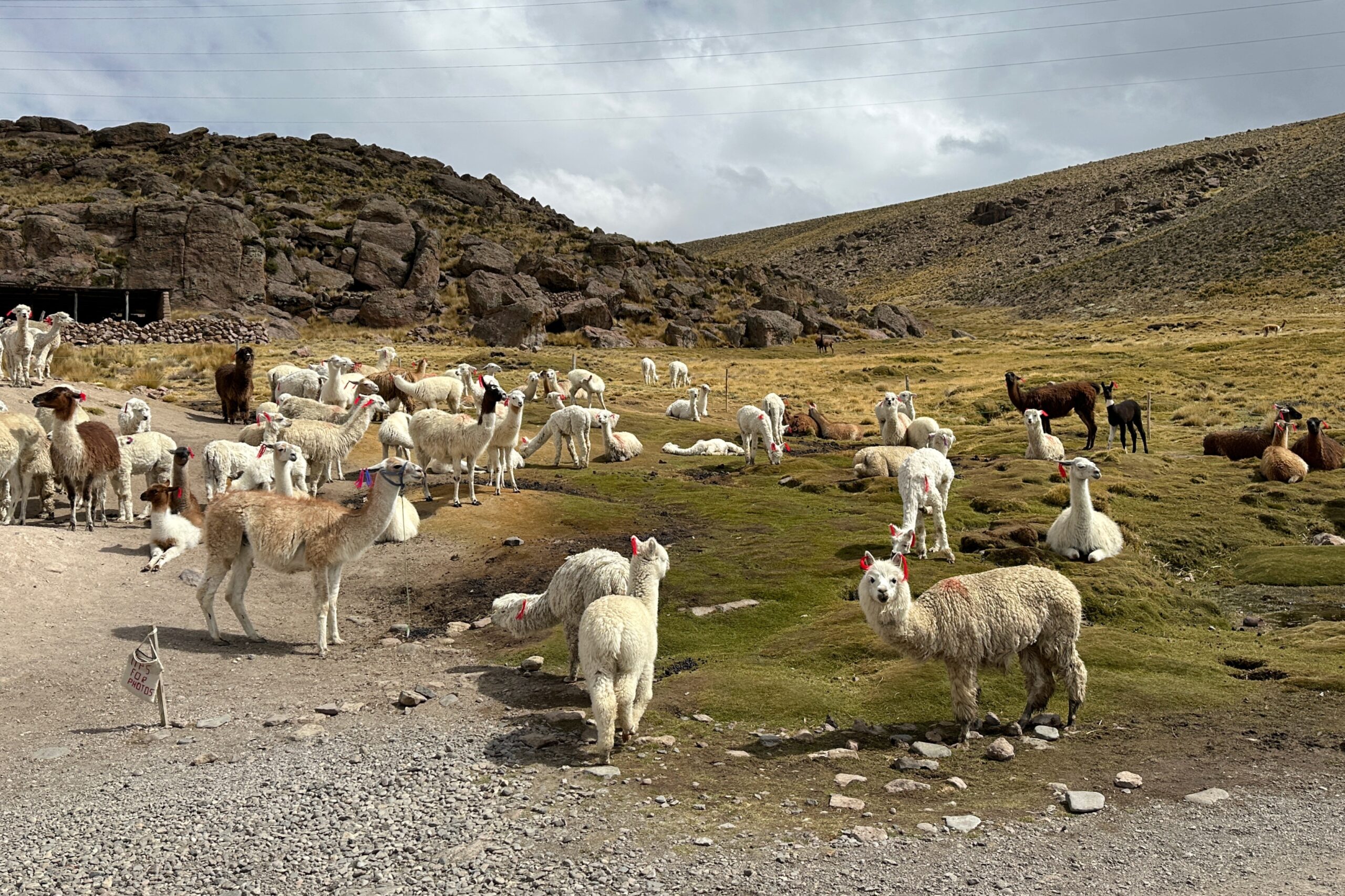
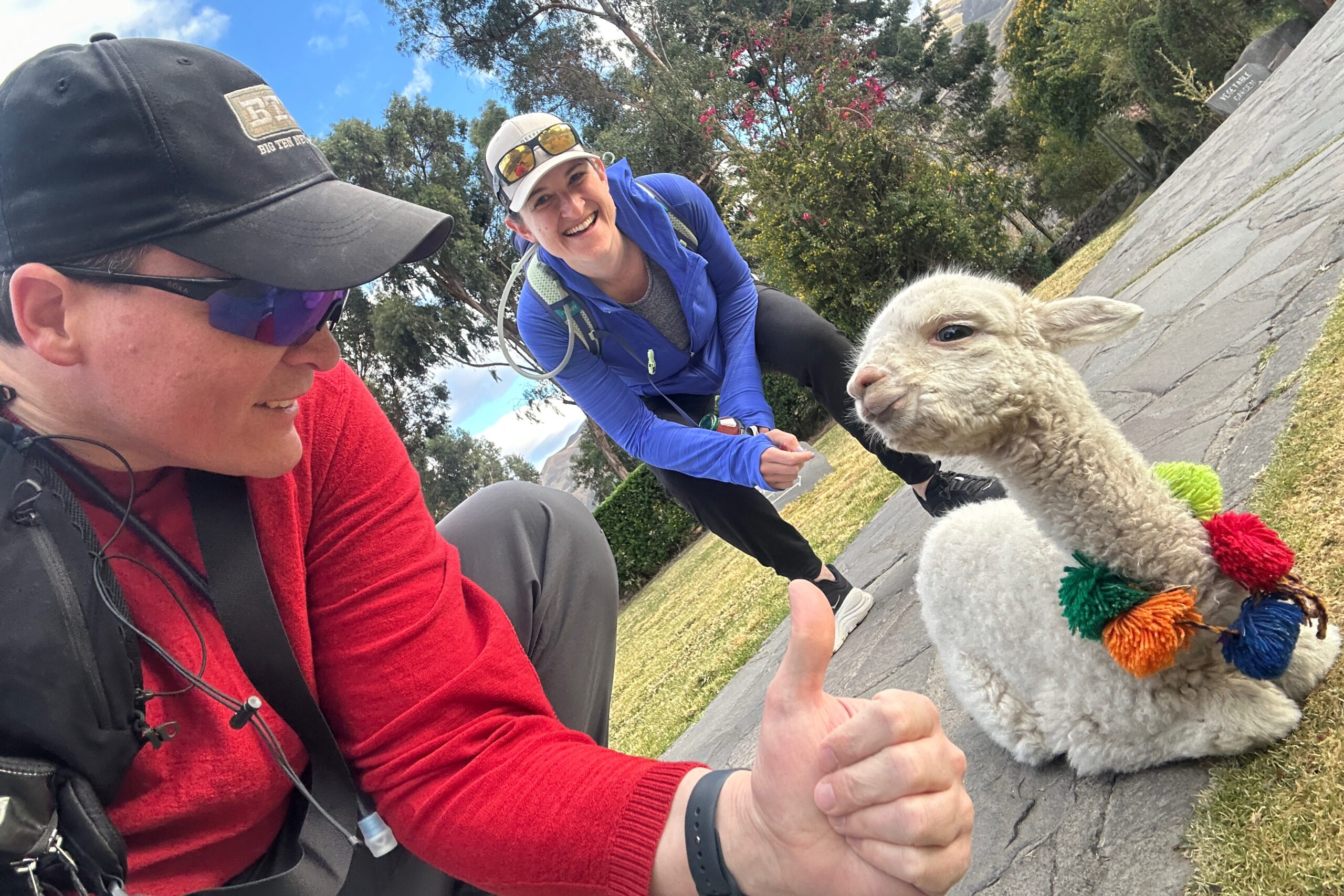
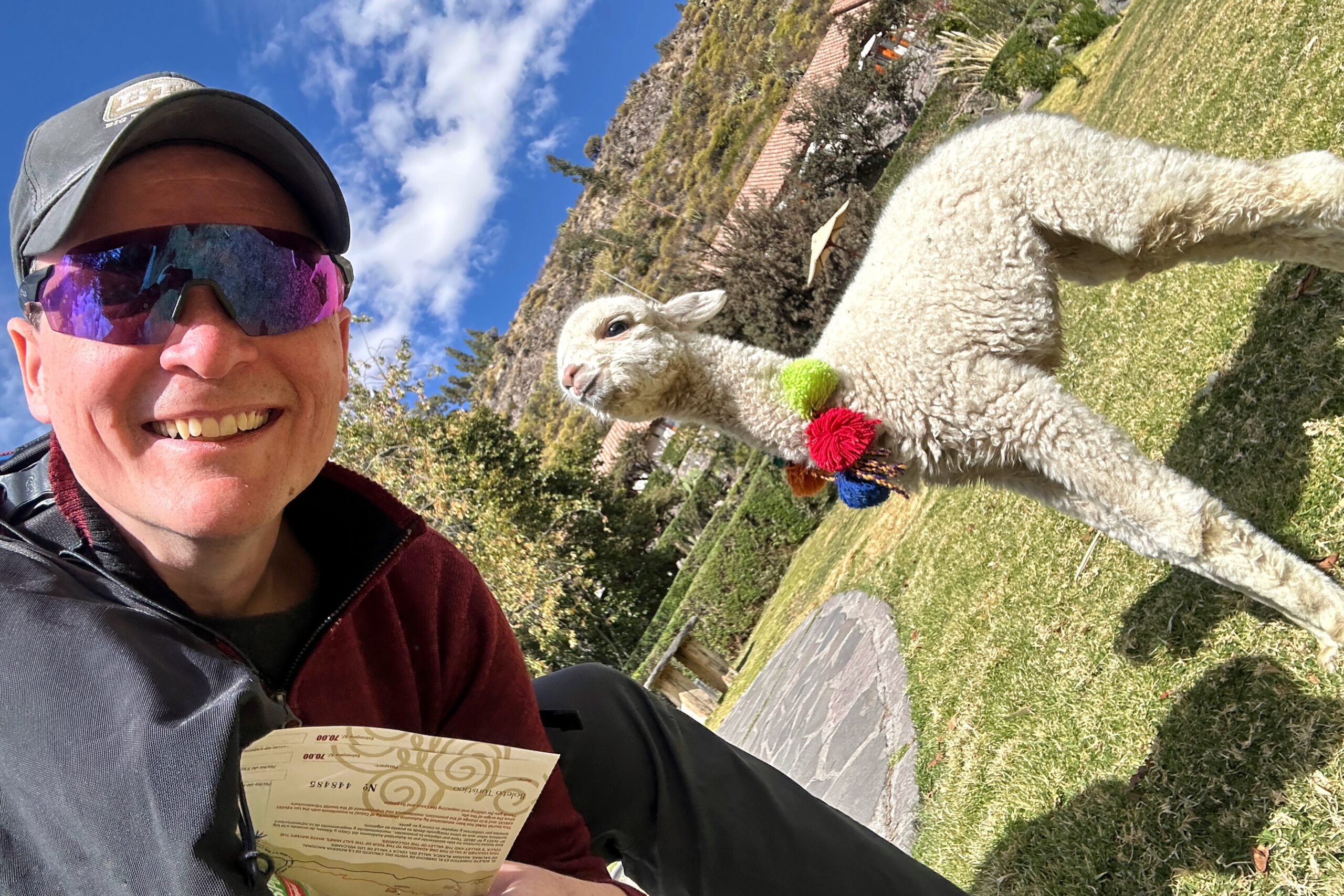
Heading up the walking path to breakfast, we were recruited by a groundskeeper to help feed a couple of the permanent residents — a 45-day old alpaca named Wida and a 4-month old llama named Misky. He handed us their bottles and we delivered. They were very cute and friendly. On the way, we also passed the fish pond, and they obviously needed some breakfast too, so we obliged.
For our breakfast, we enjoyed the typical Belmond buffet options, along with some items from the kitchen menu. We couldn’t resist the eggs benedict topped with a local “spicy sauce” called aji de la casa. It was great — just don’t use too much. We also had a couple smoothie-bowls (veggie and fruit/honey) and an apple cider quinoa porridge, all of which were quite tasty.
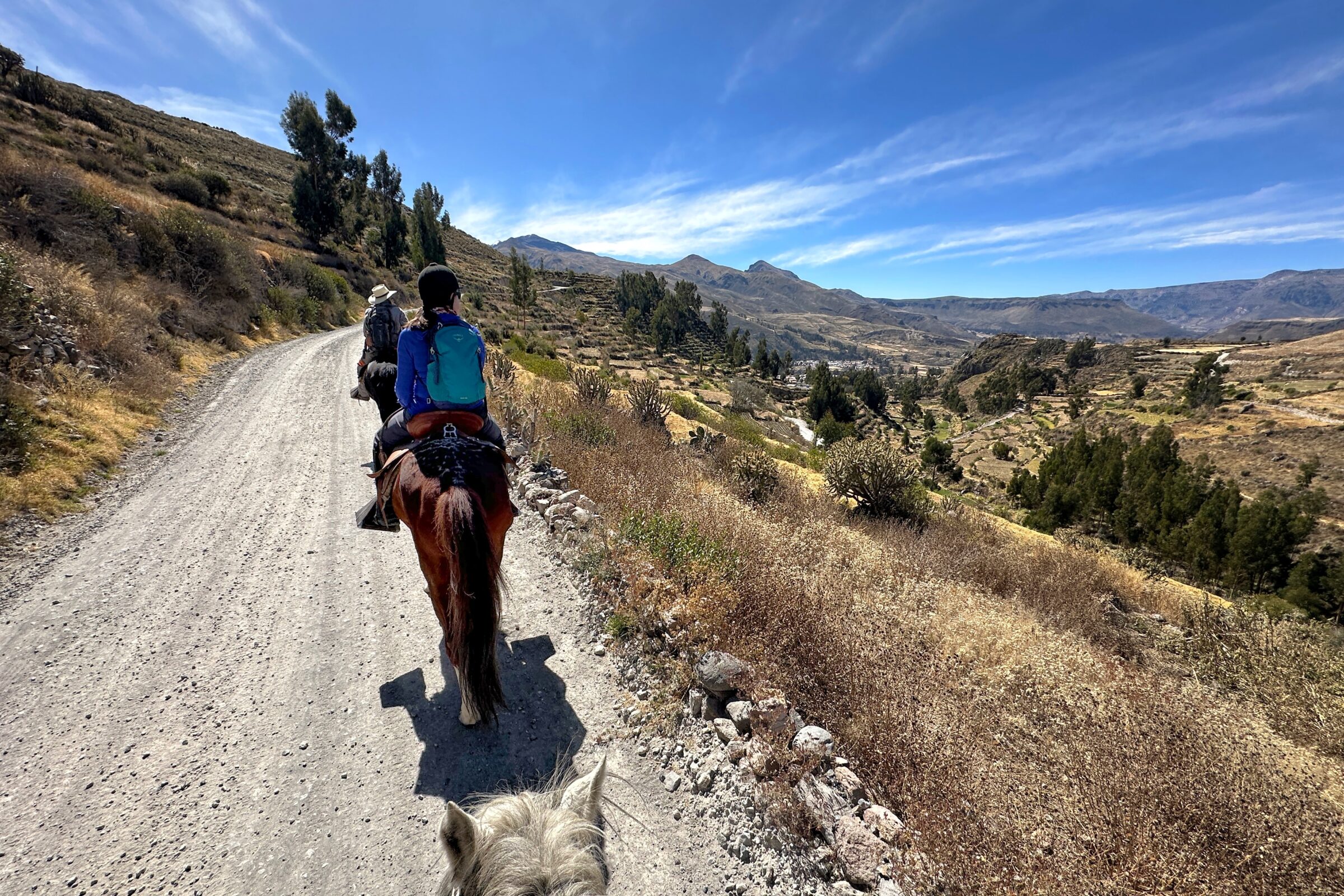
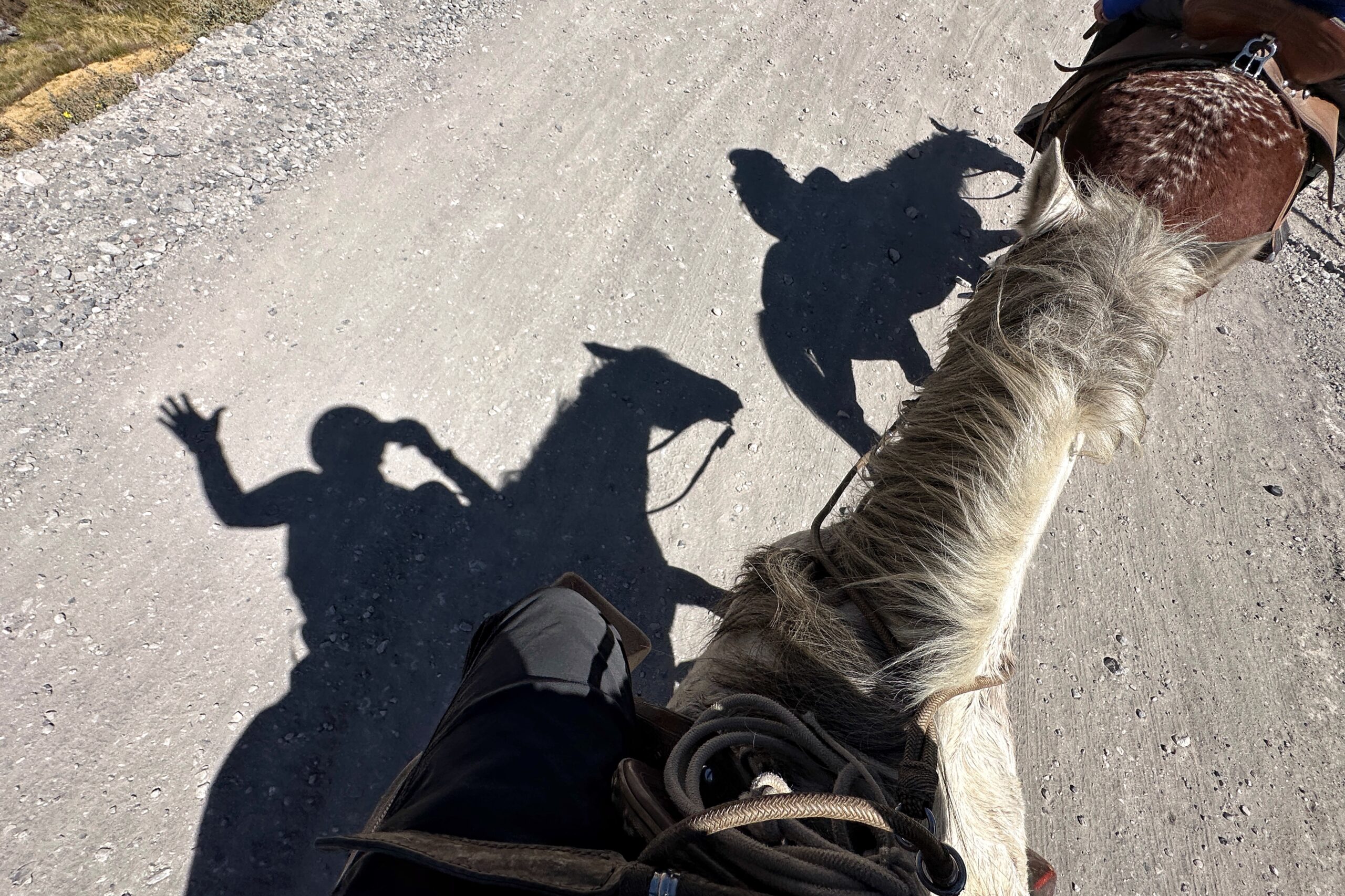
After breakfast, we geared up for our horseback ride. At the front desk, we signed our waivers, got our helmets, and met Pascual, our horse guide. Pascual does not speak much english, so the front desk agents helped with introductions until we were geared up and on our way. Matt was riding Cocoa and Jo was riding Bailarine (aka. Ballerina). Usually, when we sign up for horseback rides, they might give you a short lesson on how to hold the reins, how to control the horse, etc. Maybe even do a few laps. Nah! Not this time. Once we were on the horses, we were off! (Don’t worry, we had it under control)
Suns out, Horses out!
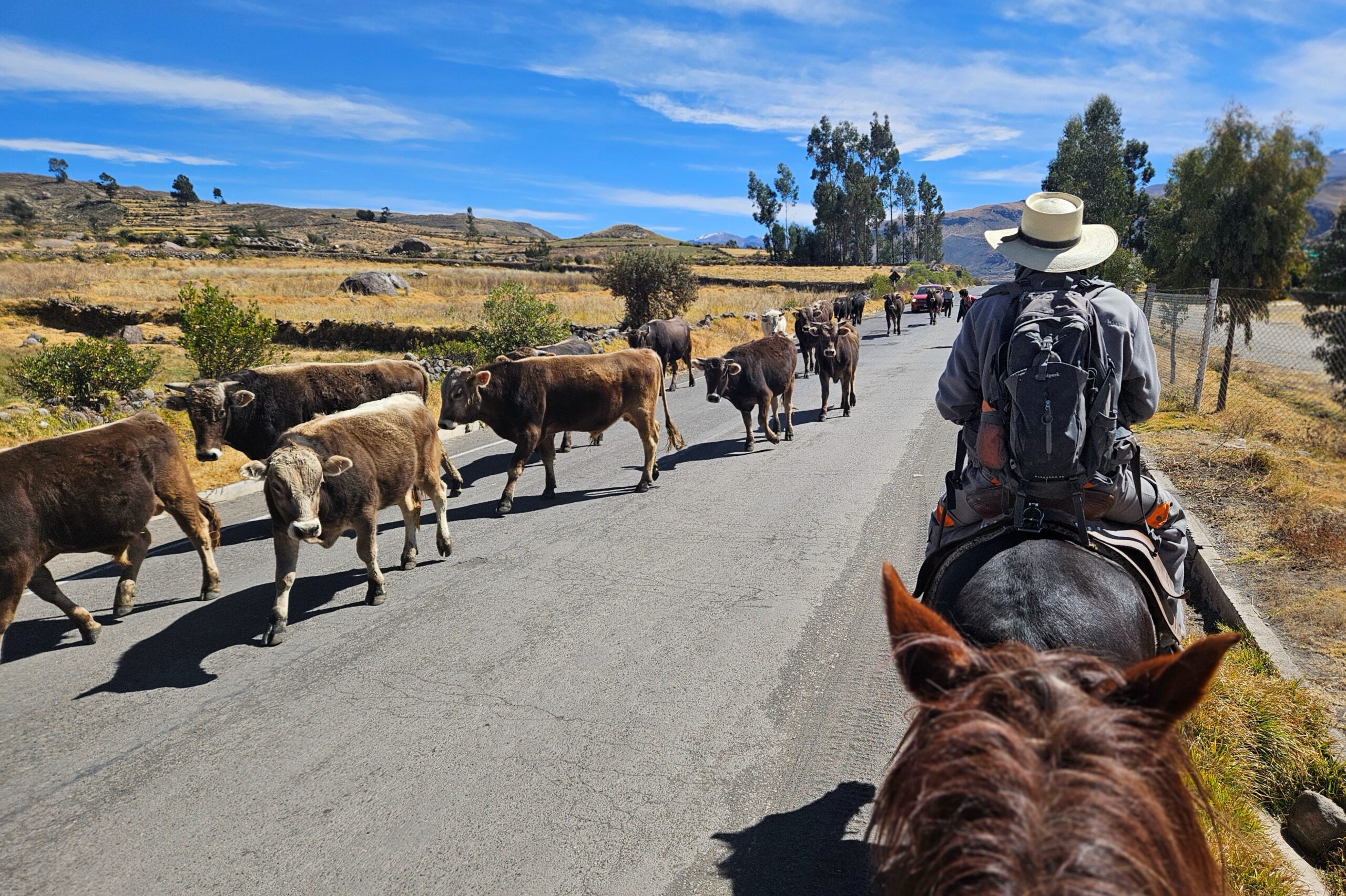
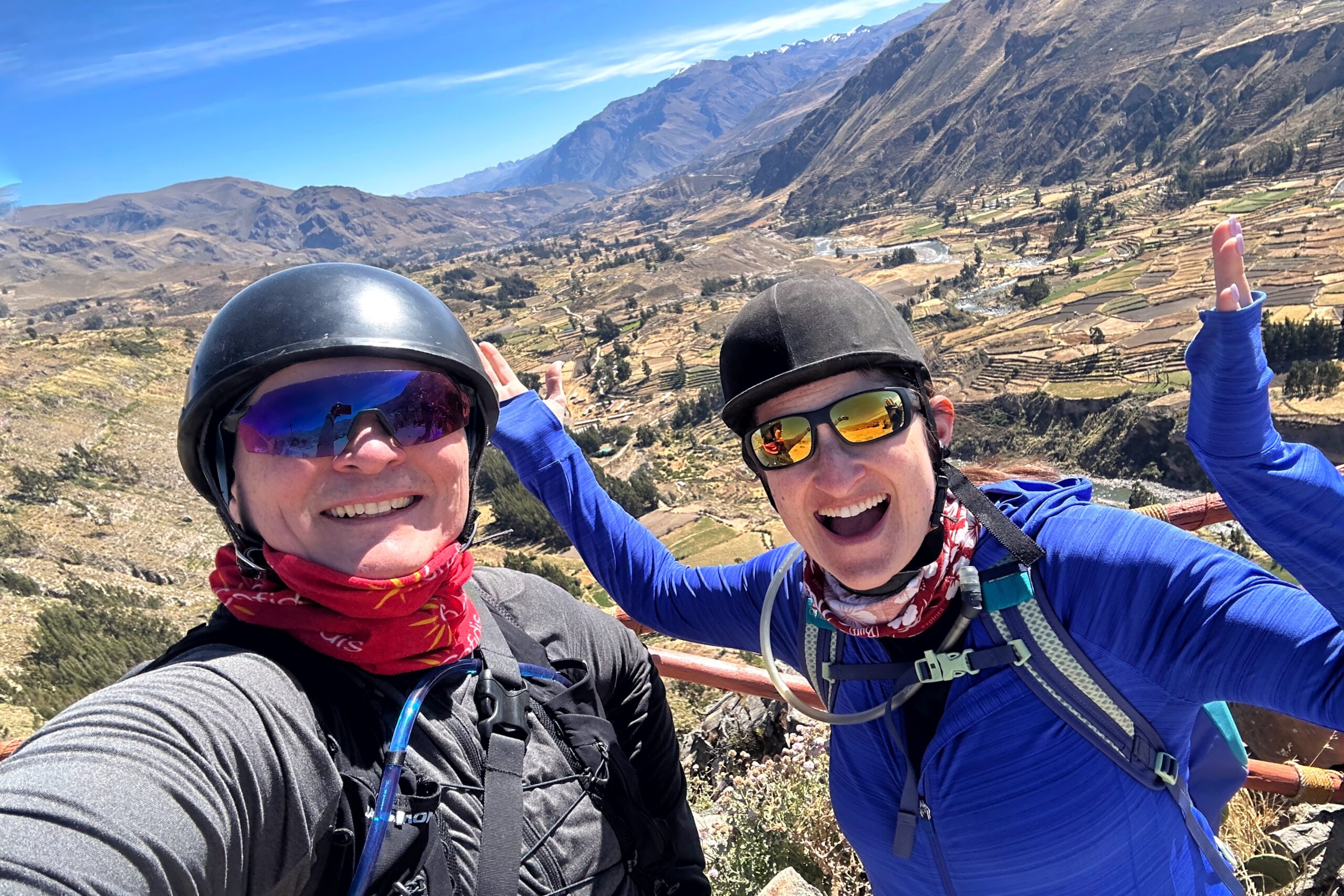
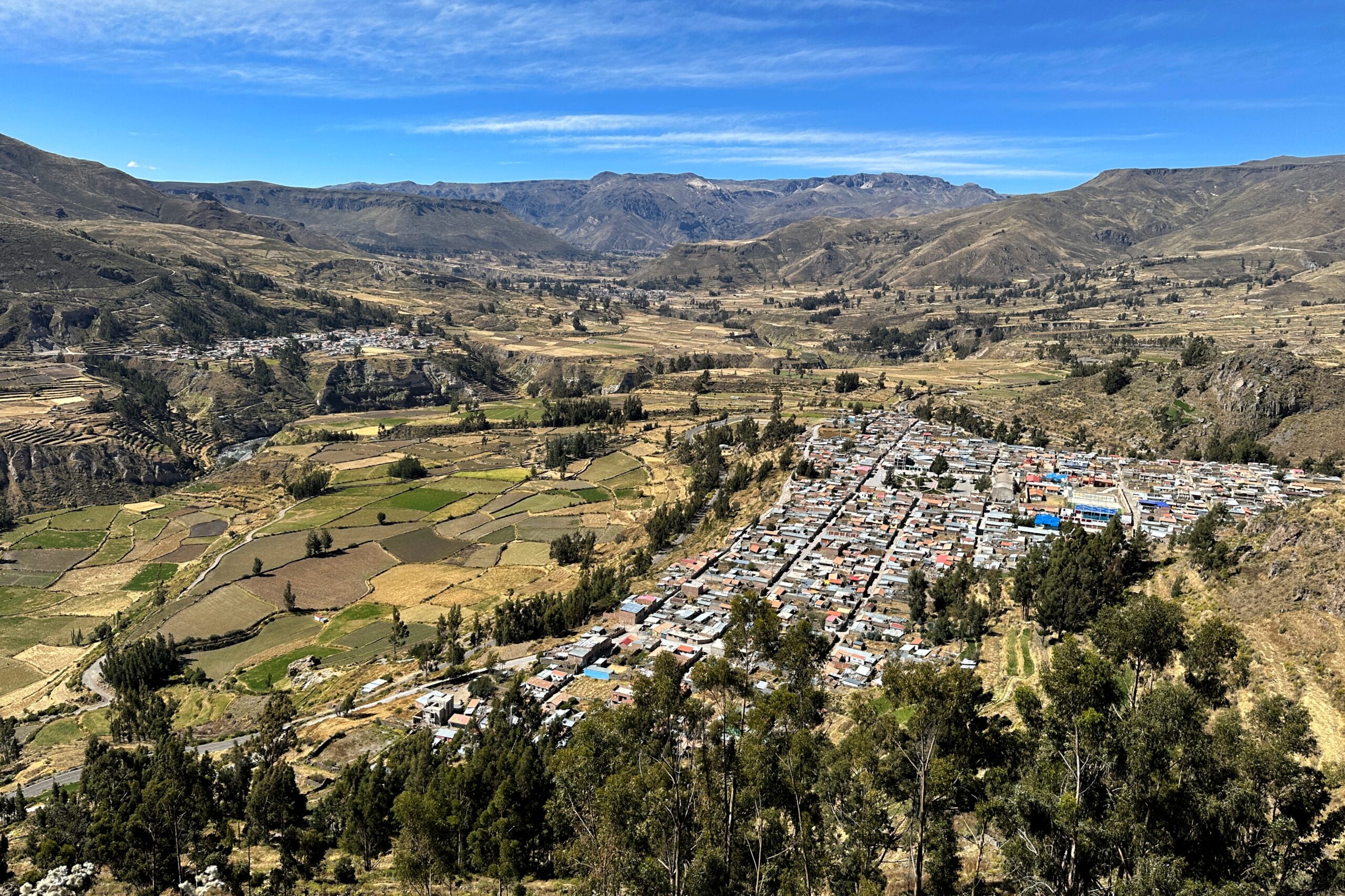
The first portion of the ride was up the Las Casitas “driveway” switchbacks to the main road. We then followed the main road west until coming to a path that meandered through farms with bulls and cows. That led us to a different road entering the small town of Achoma. We passed an elementary school, the university athletic field, and a town square with a few shops. After clearing the town, we continued up another set of switchbacks to the Achomani lookout.
Achoma traffic jam
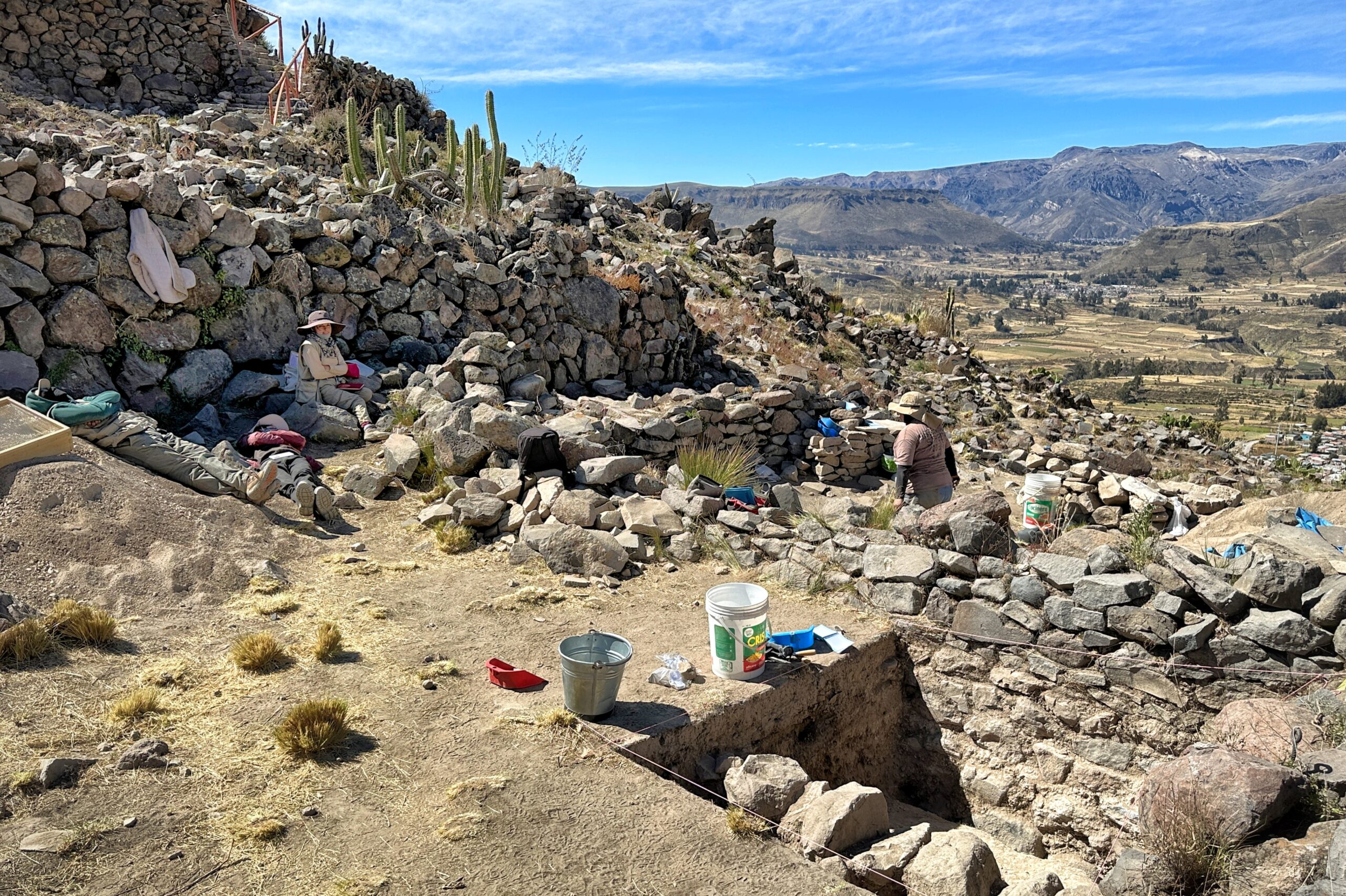
When we arrived, Pascual parked the horses and we walked up to the top of Mirador de Achomami, an Incan archaeological site that probably saw both residential and military usage back in the day. It’s currently in the process of being restored/studied, so there were several very chill archeologists milling about with digging and science equipment.
Archeology in action
Mirador de Achomani
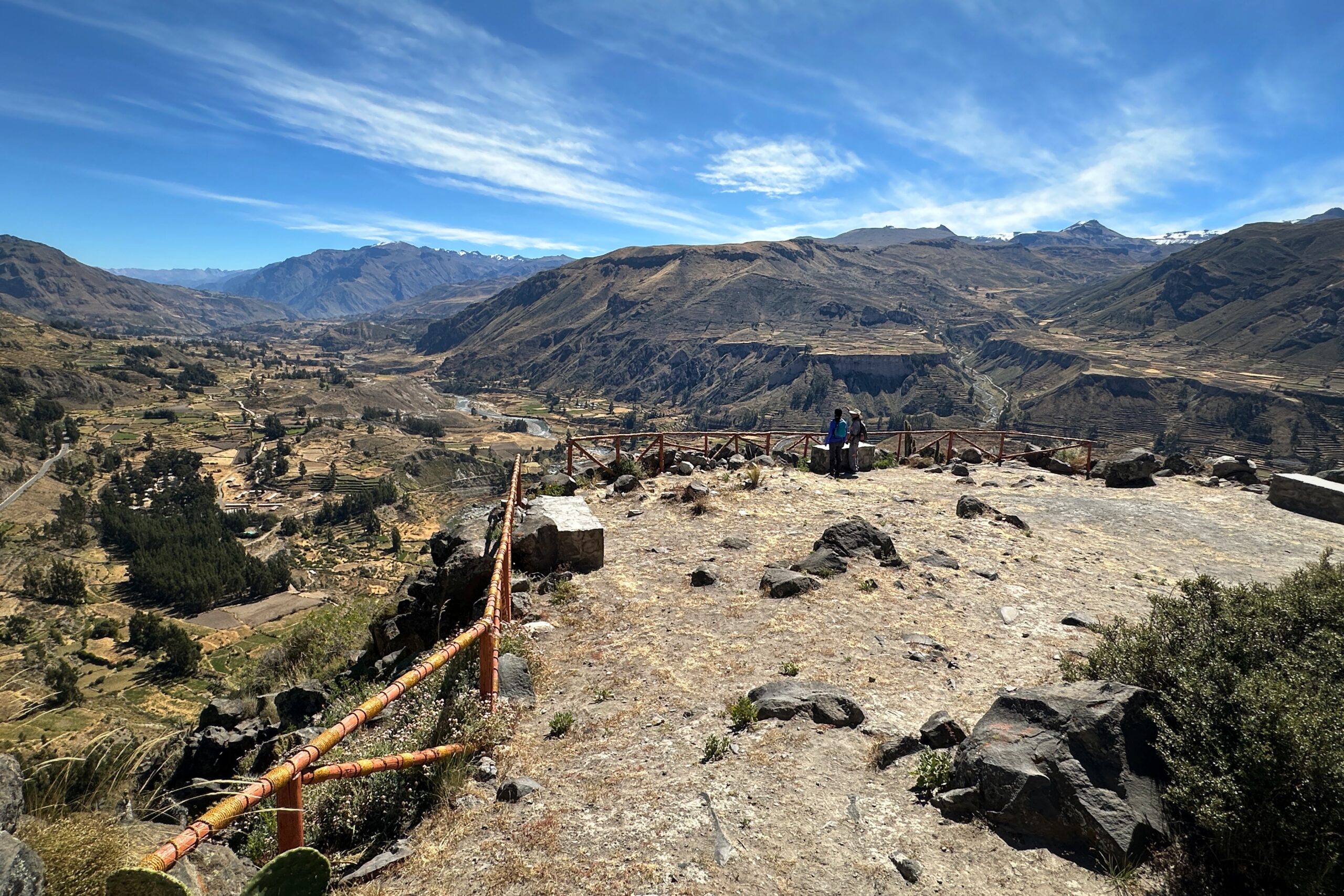
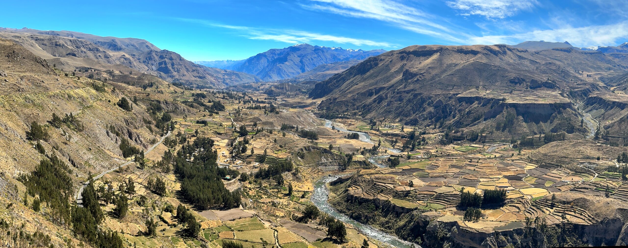
Colca Canyon to west of Achoma
From this viewpoint, you can see up (east) and down (west) the Colca Canyon. To the east (from most distant to closest), we could see Chivay (the “entrance city” to the canyon, where we stopped yesterday), then Yanque (still partying for Inti Raymi until 2:30AM), then Las Casitas (our hotel, not a village), then Ichupampa, and finally Achoma right below us.
Looking east
To the west, we could see the town of Maca, followed by more distant villages of Lari, Madrigal, and Pinchollo. (Although at some point, the “villages” get difficult to differentiate from the terraced farmland.)
Looking west
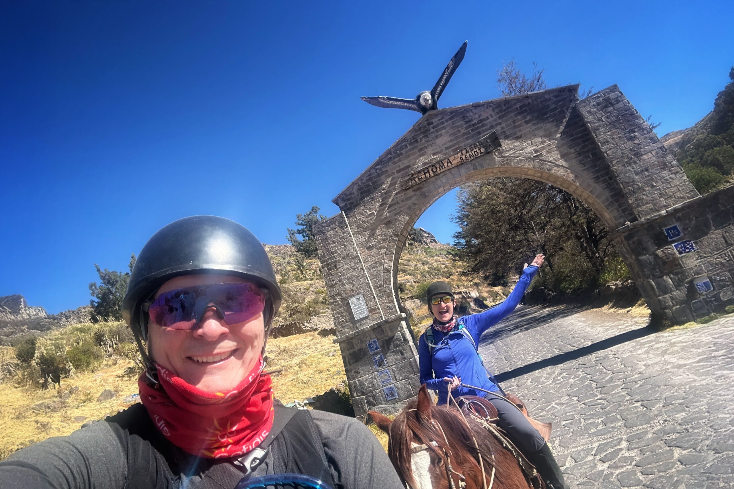
Once we finished taking in all the natural splendor visible from Mirador de Achomani, we fetched our horses and followed Pascual’s lead back down our 9km track to the hotel.
The Gates of Achoma
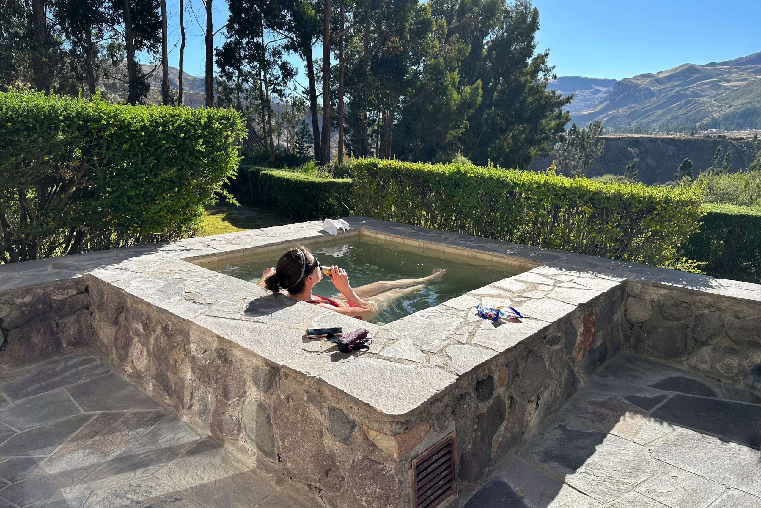
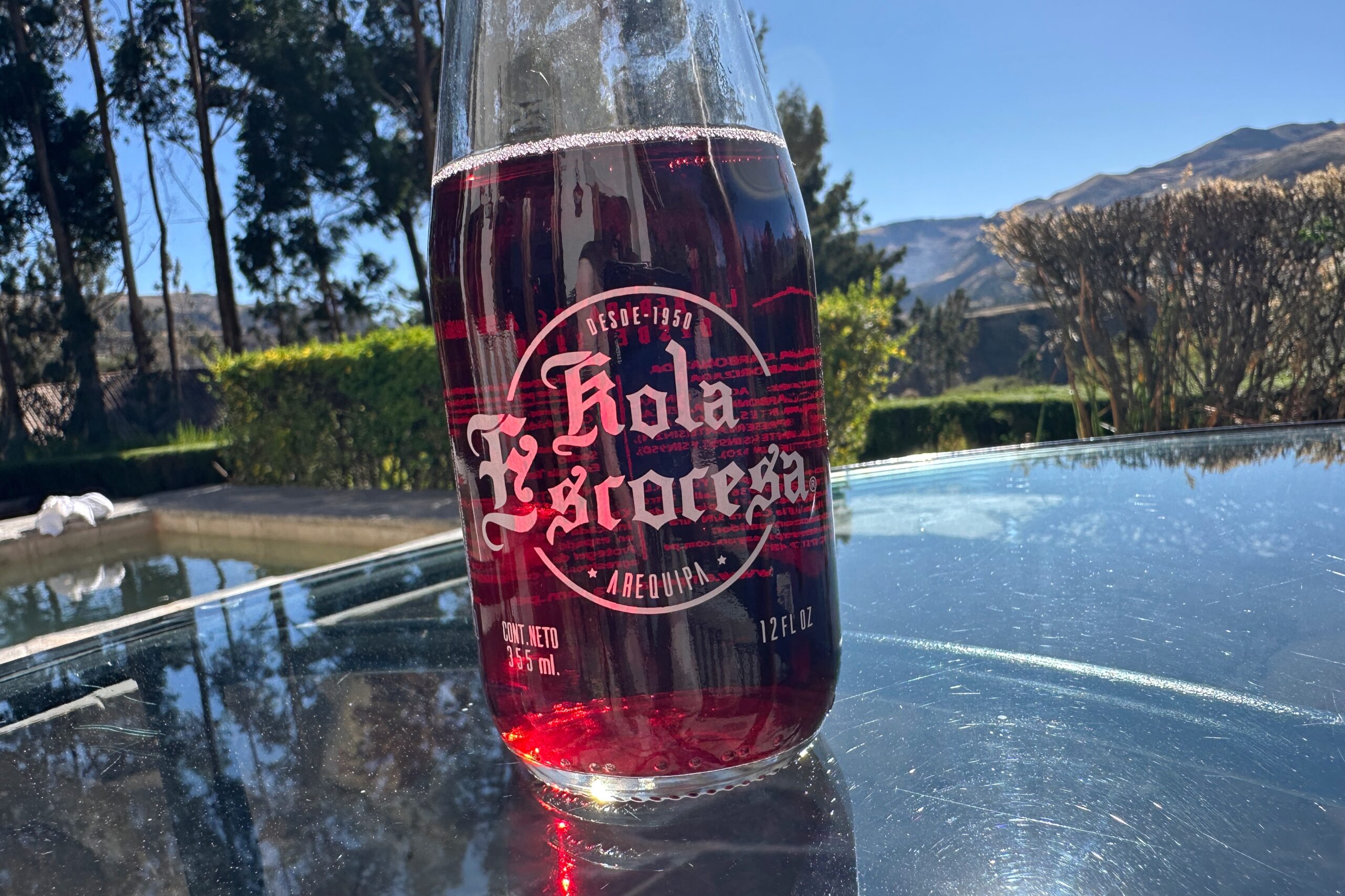
Upon our return to Las Casitas at ~2PM, we immediately returned to relaxation mode. The hot tub on our patio was calling our sore hiking muscles, and the bright afternoon sunshine was once again nap-worthy. We also discovered a fantastic cherry-flavored soft drink called Kola Escocesa (aka. “Scottish cola”) which bears that name because some Scottish guy/company started making it in Arequipa with local mineral water in the 1950s.
Goodbye sore muscles
Delicious
Decorative stonewear
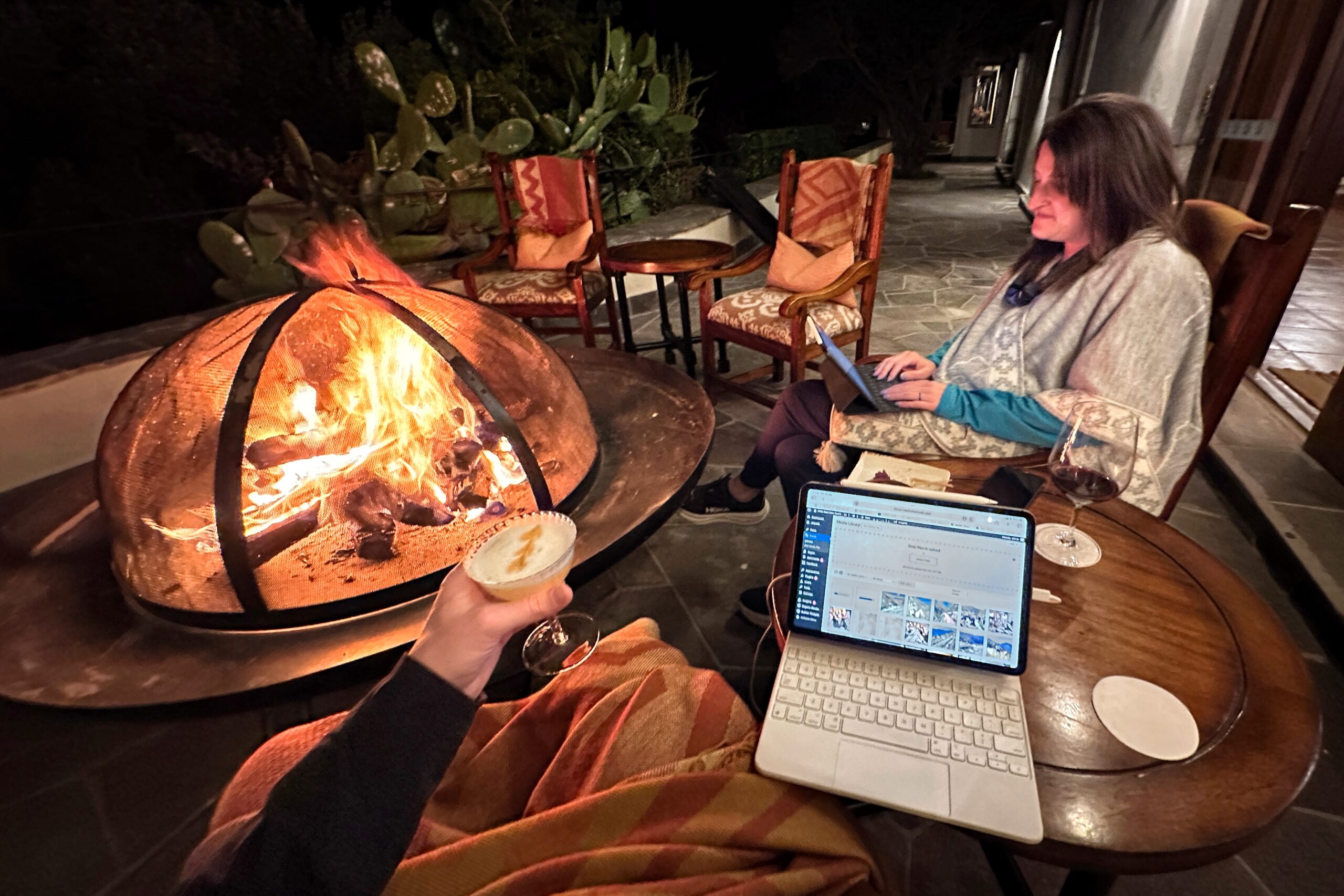
Tonight’s free Belmond activity before dinner is canapés and drinks on the restaurant terrace. Fancy! We donned our headlamps and walked over. The staff had just stoked up a cozy fire pit on the terrace. We were the only ones in attendance (we think the other guests checked out), so we grabbed two seats and settled in for some pre-dinner blogging. The very attentive server staff brought us red wine and a Colca sour — made with pisco and cacti fruit. They also brought out fried potato appetizers — similar to a small falafel ball served with guacamole.
Colca sours are also delicious
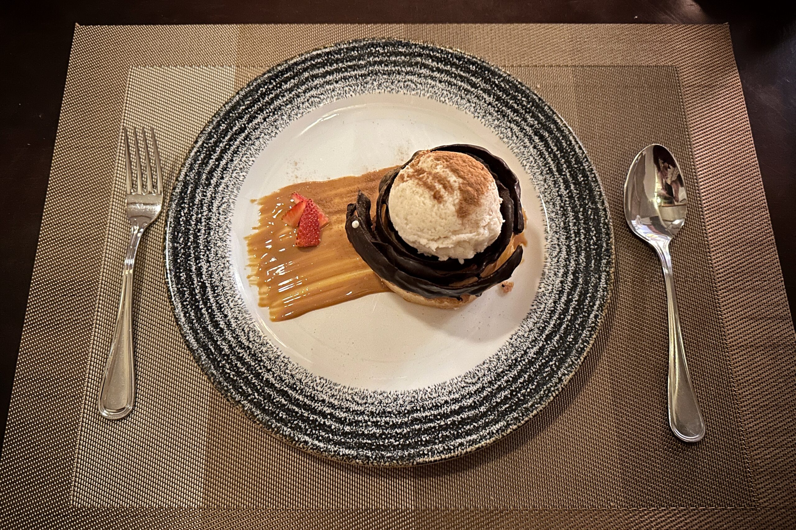
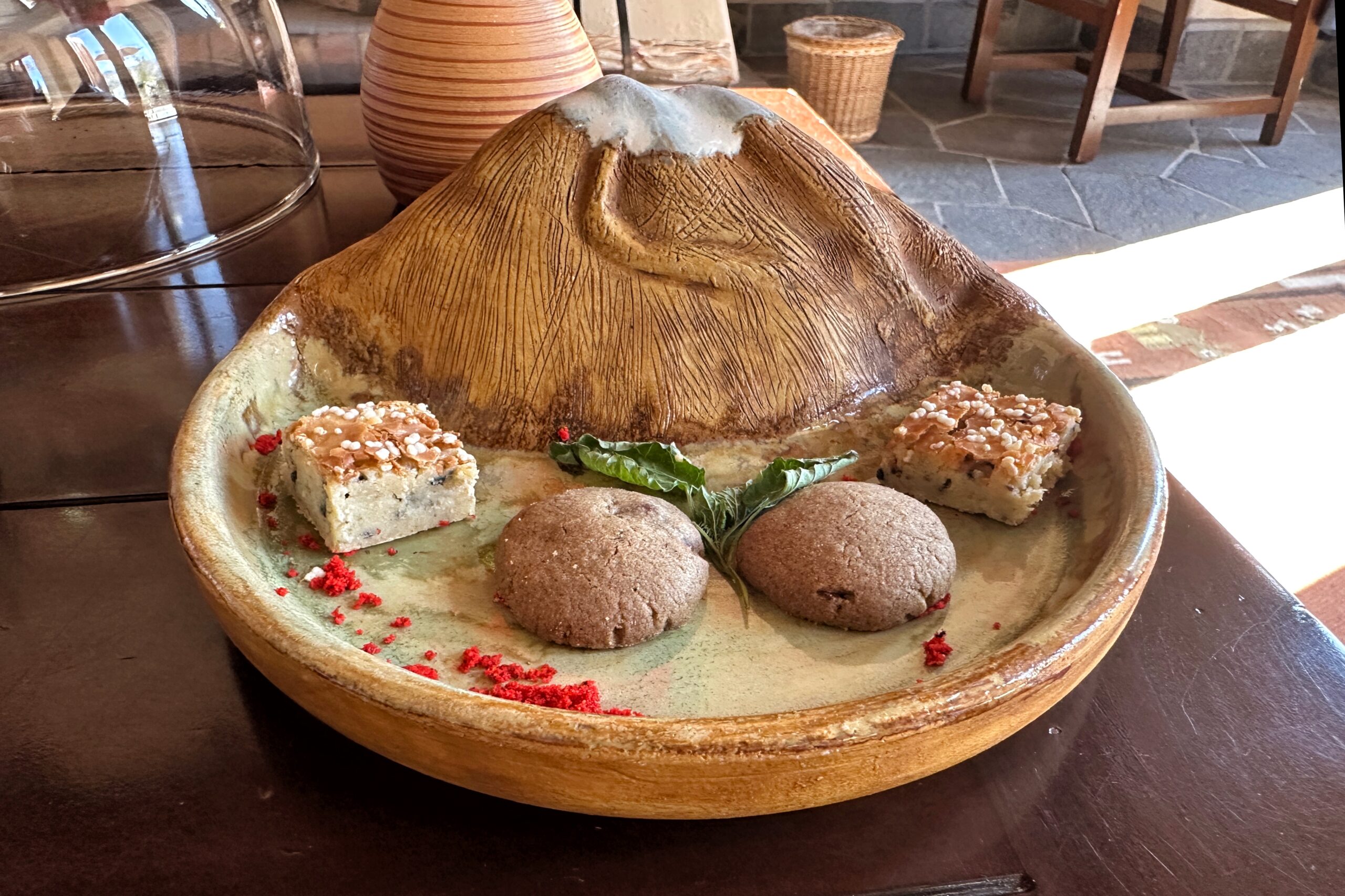
When the tasty appetizers were finished, we went inside for dinner. For starters, grilled eggplant salad and shrimp chowder. For mains, rosemary sea bass and aji de gallino (with parmesan cheese as per Luis’ recommendation). And for dessert, apple pie and ponderaciones, a traditional Peruvian dessert that “has been making people happy for the past 400 years” according to the menu. It is made with crispy dough dipped in chocolate. So yeah, we’re happy.
Making People Happy CONFIRMED!
Random observation… in the dining room they play Andean music, which has a lot of flutes. But we both stopped and did a double-take when an Andean flute music cover of Kansas’ Dust in the Wind started playing. A few other songs seemed vaguely familiar, but they might have been actual Andean songs.
After dinner we briefly pondered not signing up to do anything tomorrow, and going full lazy/cheap mode. But thankfully, we came to our senses and stopped by the front desk to confirm our excursion to Mirador Cuz del Condor at 8AM in the morning. Apparently, this is THE spot to see multiple condors in the wild as well as an excellent view of the deepest part of the canyon.
We are back on the road (and through the air) today as we depart Cusco and head to Colca Canyon via Arequipa. According to Google Maps, the trip from Cusco to Colca Canyon COULD be made in about 11 hours via bus, but we much prefer feeling like kings on LATAM, so… 4:30AM wake up call it is. In preparation, we completed our packing last night, so all we had to do was grab some breakfast of fruit and pastries from the buffet. Turns out 5AM is a bit too early for eggs benedict.
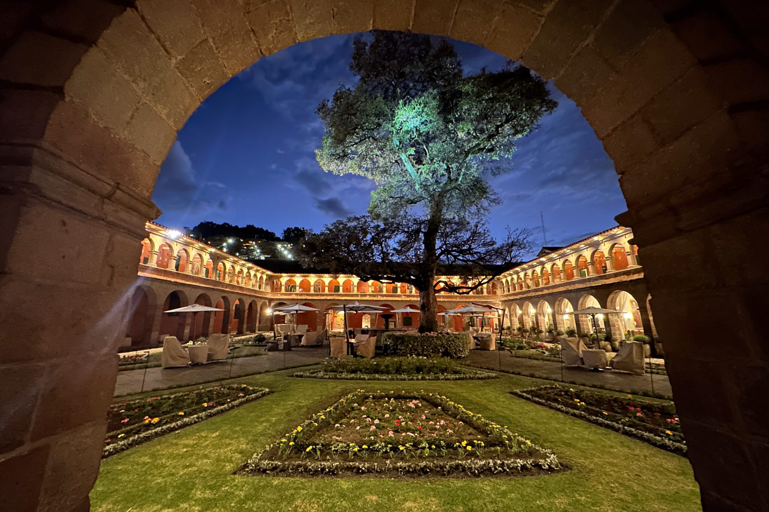
Early morning Monasterio Courtyard
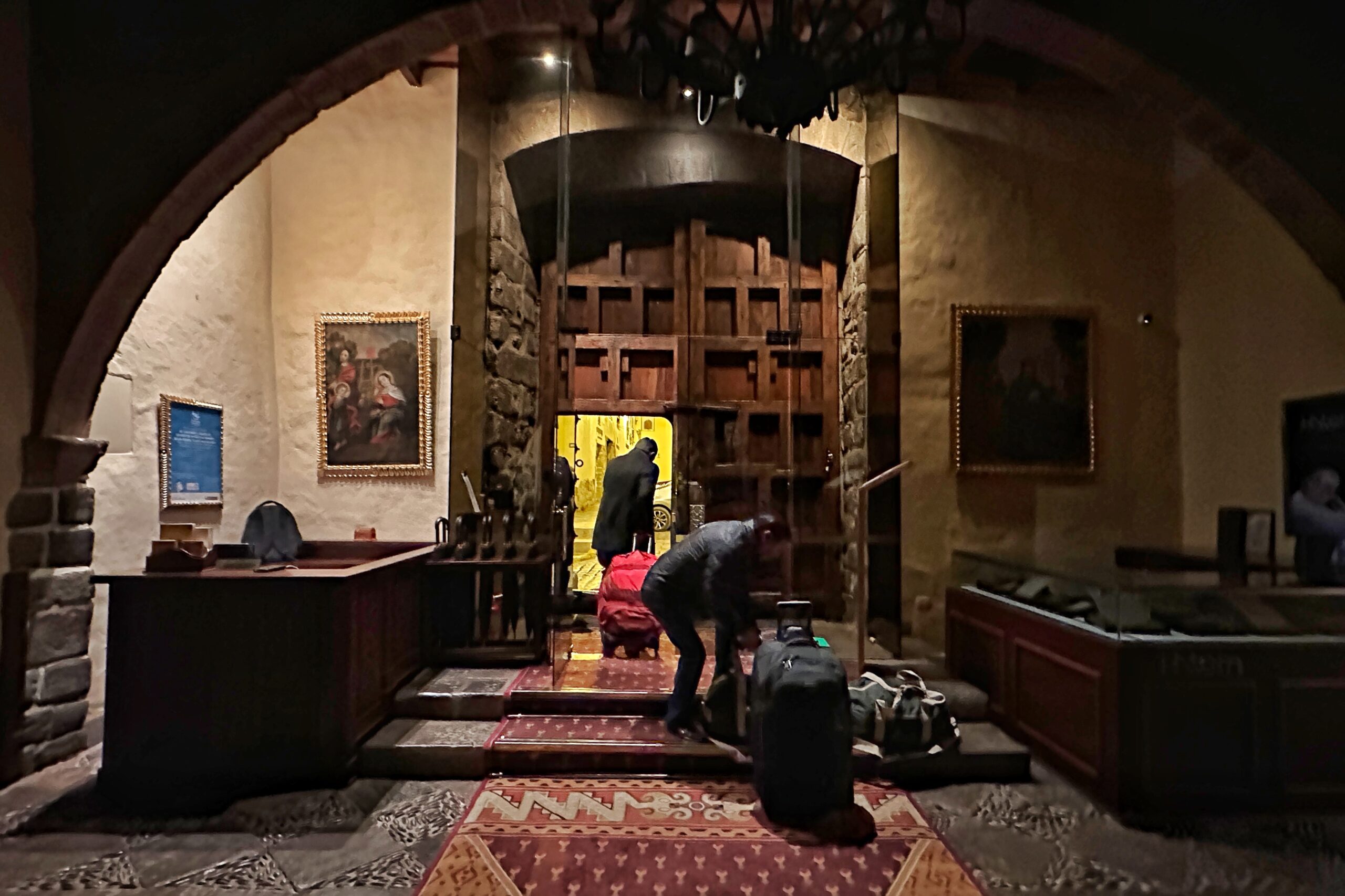
We also arranged transportation last night, and the taxi was right on time at 5:30AM. With almost no traffic on the streets (everybody must still be passed out from Inti Raymi), we made it to the airport plenty early and checked in. A bus full of EF students arrived at the same time, but no problem, hello premium economy checkout line. Woo!
Out the quarter door
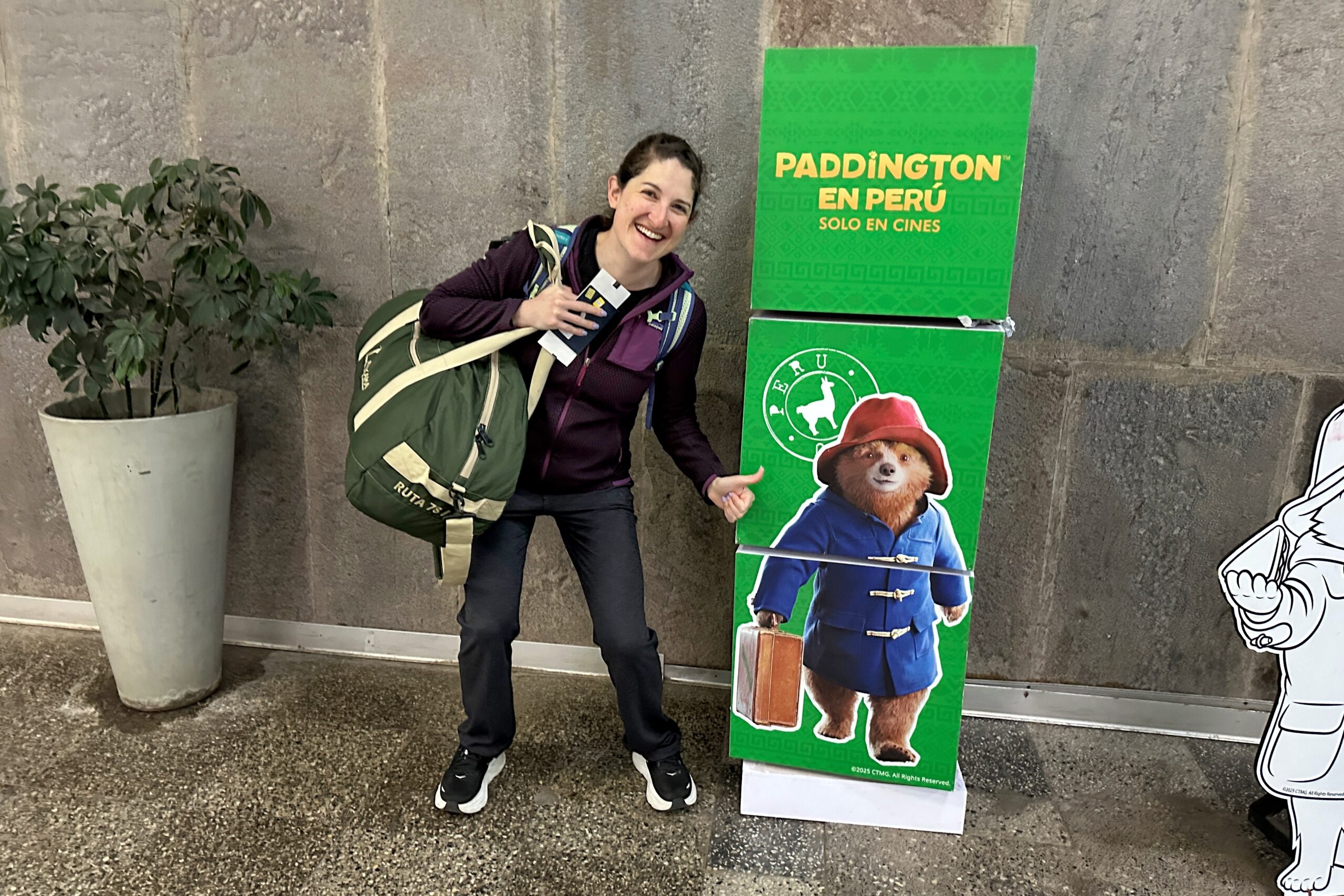
Only in theaters! And Peru!
We cleared security and found a working Priority Pass lounge in the AQP. Everyone else in the room cleared out to catch an earlier flight to Lima, so we had the place to ourselves to grab some second breakfast. Heading to our gate, we each carried a backpack and duffle bag (as per the rules). For the first time, we were “asked” if we wanted to gate-check our bags, and when we declined, they made us “try” the luggage-size-checker. Don’t they know we are PREMIUM ECONOMY!?!? Anyways, our bags fit easily, duh. Left us alone after that.
We got the whole lounge
Boarding was a breeze (after all the nuns with military babies) and the flight to Arequipa was only about an hour. We also got some great views out the window on the way.
Looking canyon-y
Volcán Chachani (left) and Volcán Misti (right)
Mining is kind of a big deal here
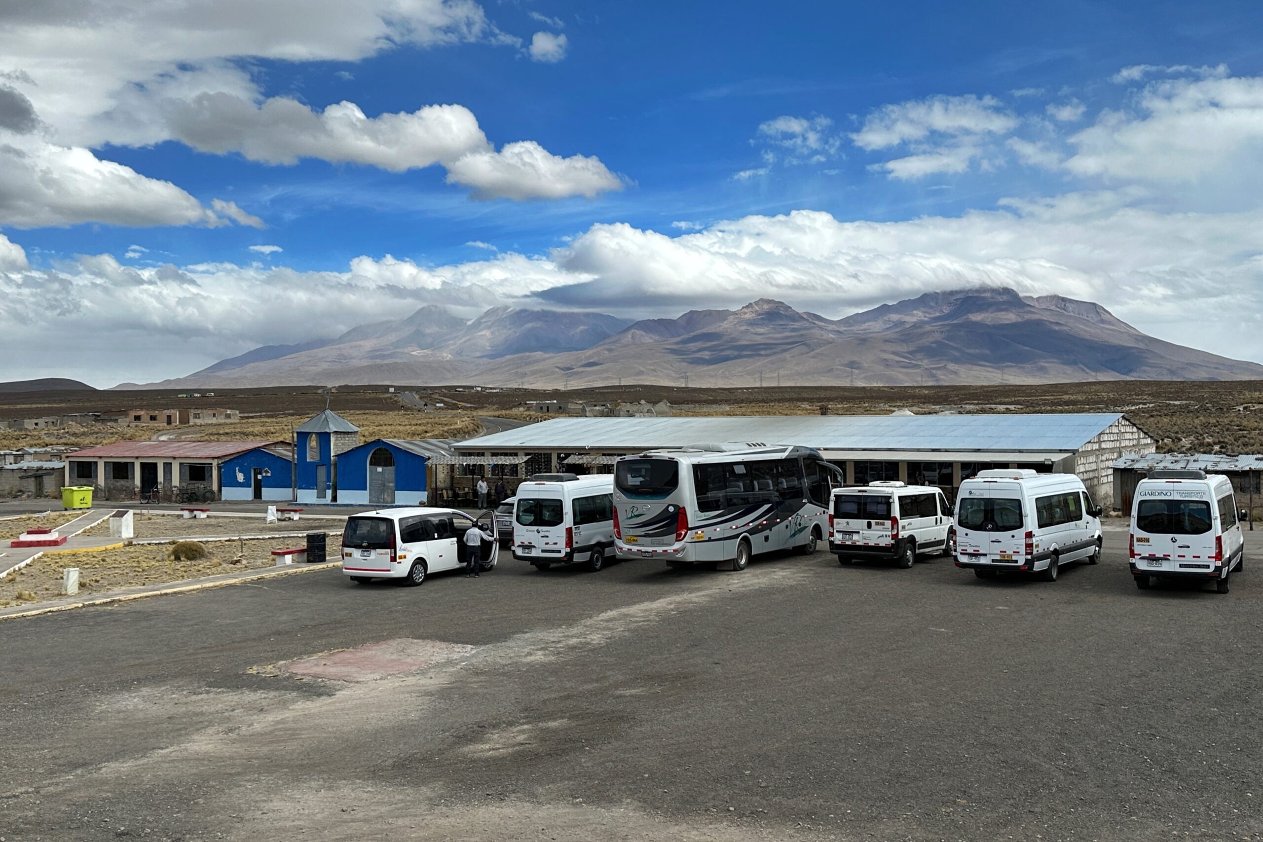
Arequipa’s airport is pretty small, with only two gates. Our bags came out immediately (Matt’s was first and Jo’s was fourth). We strolled outside to meet our pre-arranged ride to Colca Canyon, four hours away. Froiland was our Spanish-speaking driver, and his co-pilot Jorge was our English-speaking guide who provided fun facts and information about the area along the way. There are many large volcanos visible from Arequipa, with a total of 98 in the entire region. Of these 98, 16 of them are active, and eight of those are extremely lively these days. It’s no surprise the stones used in the White City area of Arequipa are made of volcanic tuff and pumice.
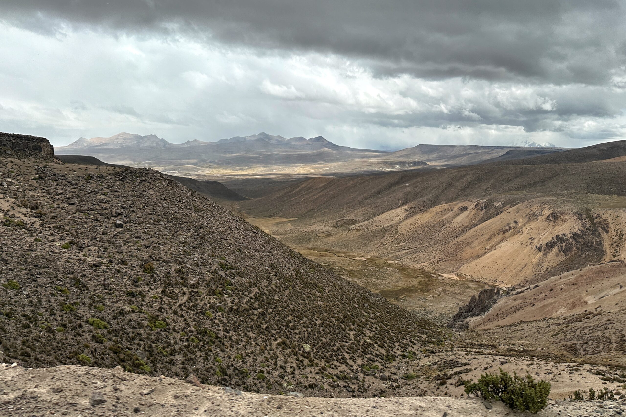
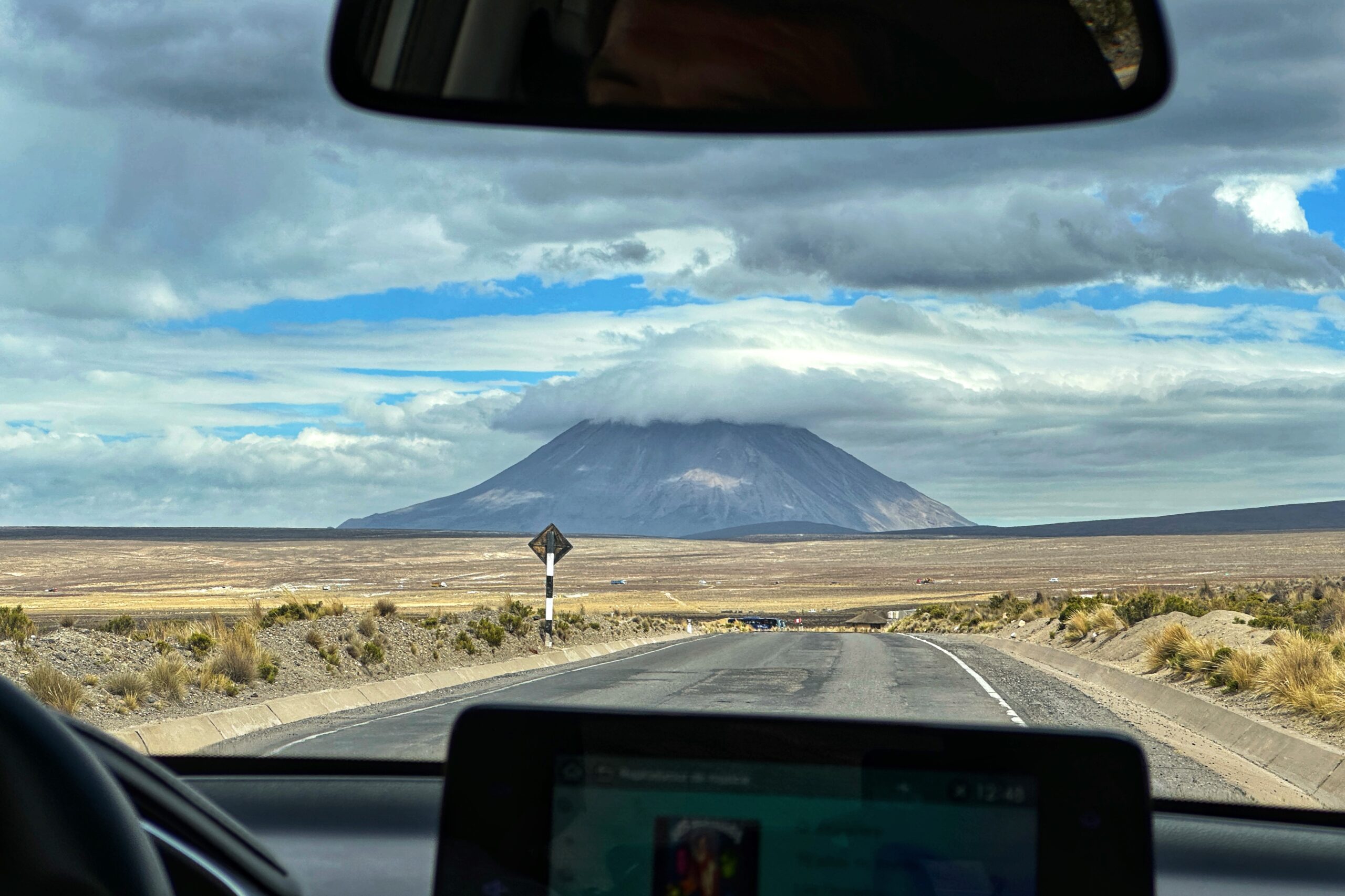
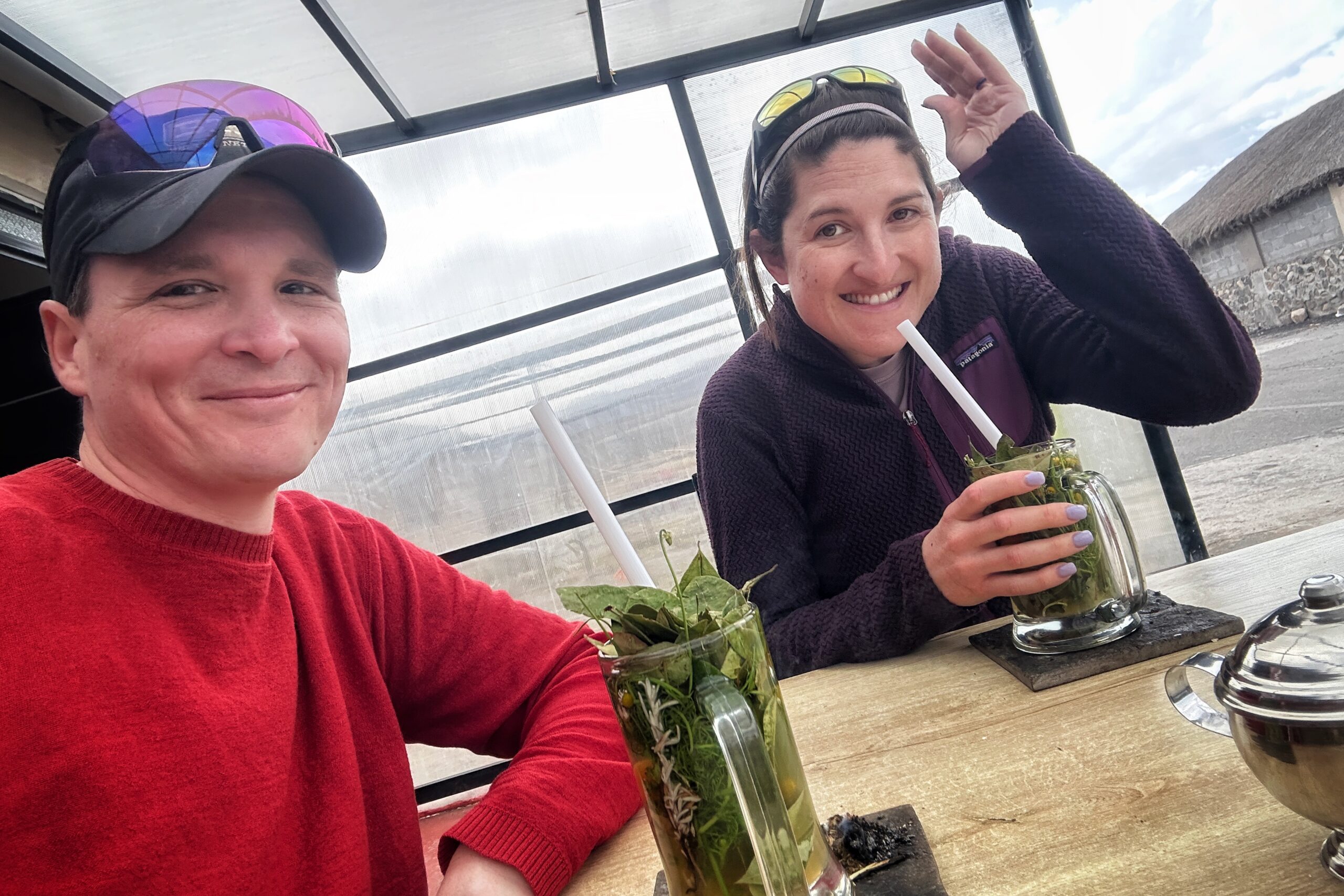
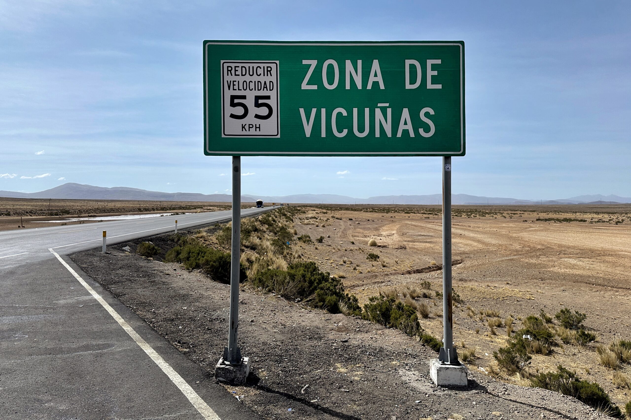
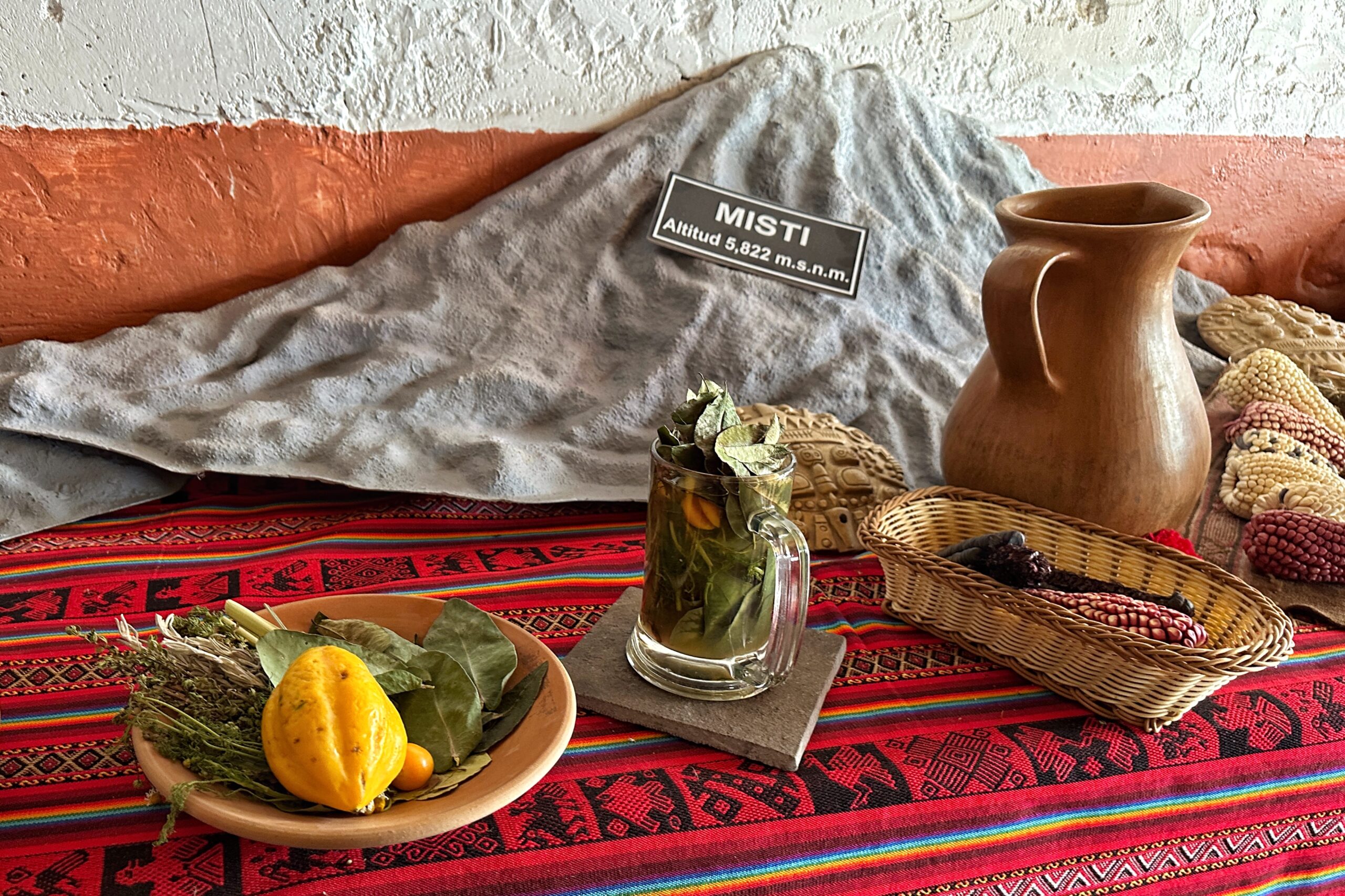
Pausing at a shop at the outskirts of Arequipa, we finally caved and bought a bag of coca leaves to try later with Jorge. We continued onward and gained elevation into the Andean dessert region with vicuñas grazing in the vast open spaces along the side of the road. After a couple hours, we stopped at a roadside cafe/tourist trap and drank some very delicious mates with seven different herbs (and spices) including coca, muña, lemongrass, and a cherry tomato.
Andean desert
Vicuñas can drive 55
How to make the Misti mate
Got the Andean desert blues
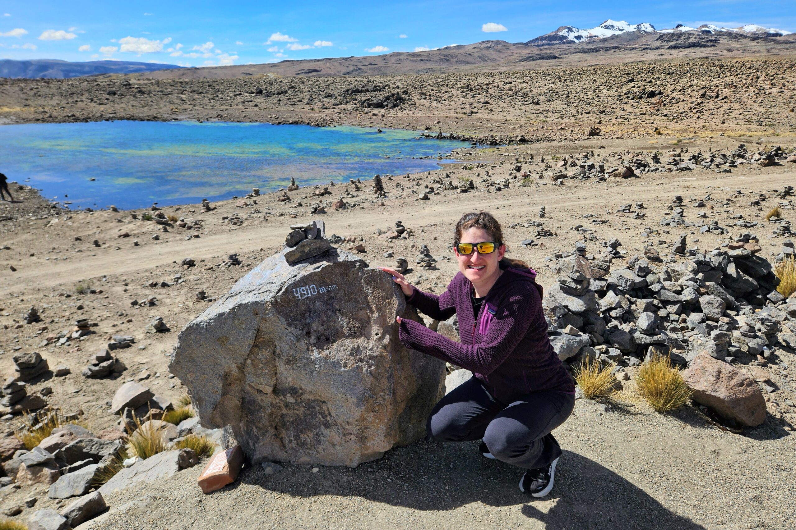
The drive continued up to the high pass at 4,910 meters (about 16,000 feet). We determined now was a good time to try chewing those coca leaves. Spoiler alert! We’re not huge fans. Unless you want a numb tongue… then they’re great! Not even that sweet coca buzz was gonna keep Jo from falling back asleep for a good portion of the remaining drive. To be fair, Froiland’s musical preference was some serious easy-listening, put-you-to-sleep music.
A real high point of the drive
Lunar Landscape
After traversing the pass and several more volcanoes, the final portion of the drive descended into Colca Valley toward the city of Chivay. We stopped at the town square and Jorge pointed us in the direction of a shop that sells legit 100% baby alpaca products. With a few soles still burning a hole in our pockets, we tried hard to find something, but no luck… for now.
Hey Hey Chivay
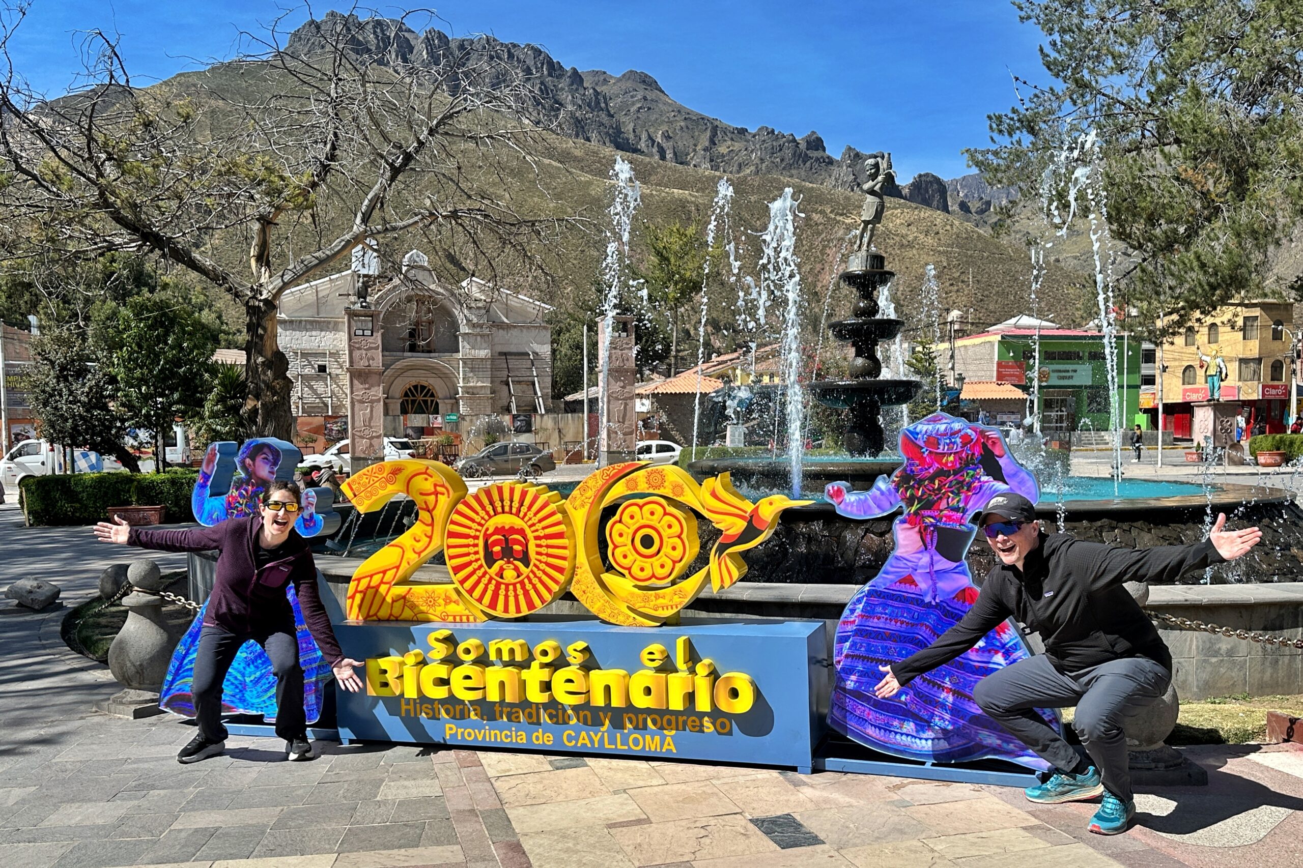
Caylloma Province Bicentennial was June 21, 2025
From Chivay, it was only another 15-20 minutes to our final destination for the day — Las Casitas: A Belmond Hotel. Upon arriving via the narrow switchback gravel driveway, we said farewell to Jorge and our driver (until Saturday), and were whisked off to the reception building via a golf cart that travelled maaaaybe 30 feet. Lol. This place is definitely our vacation from our vacation.
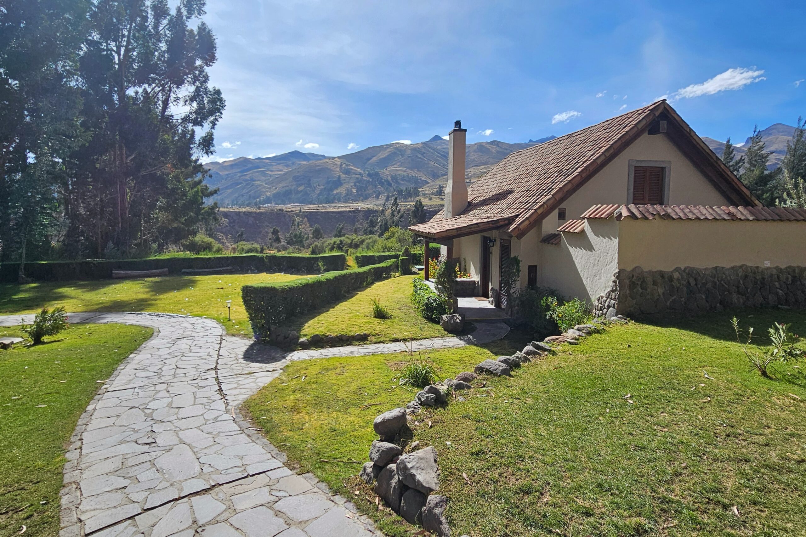
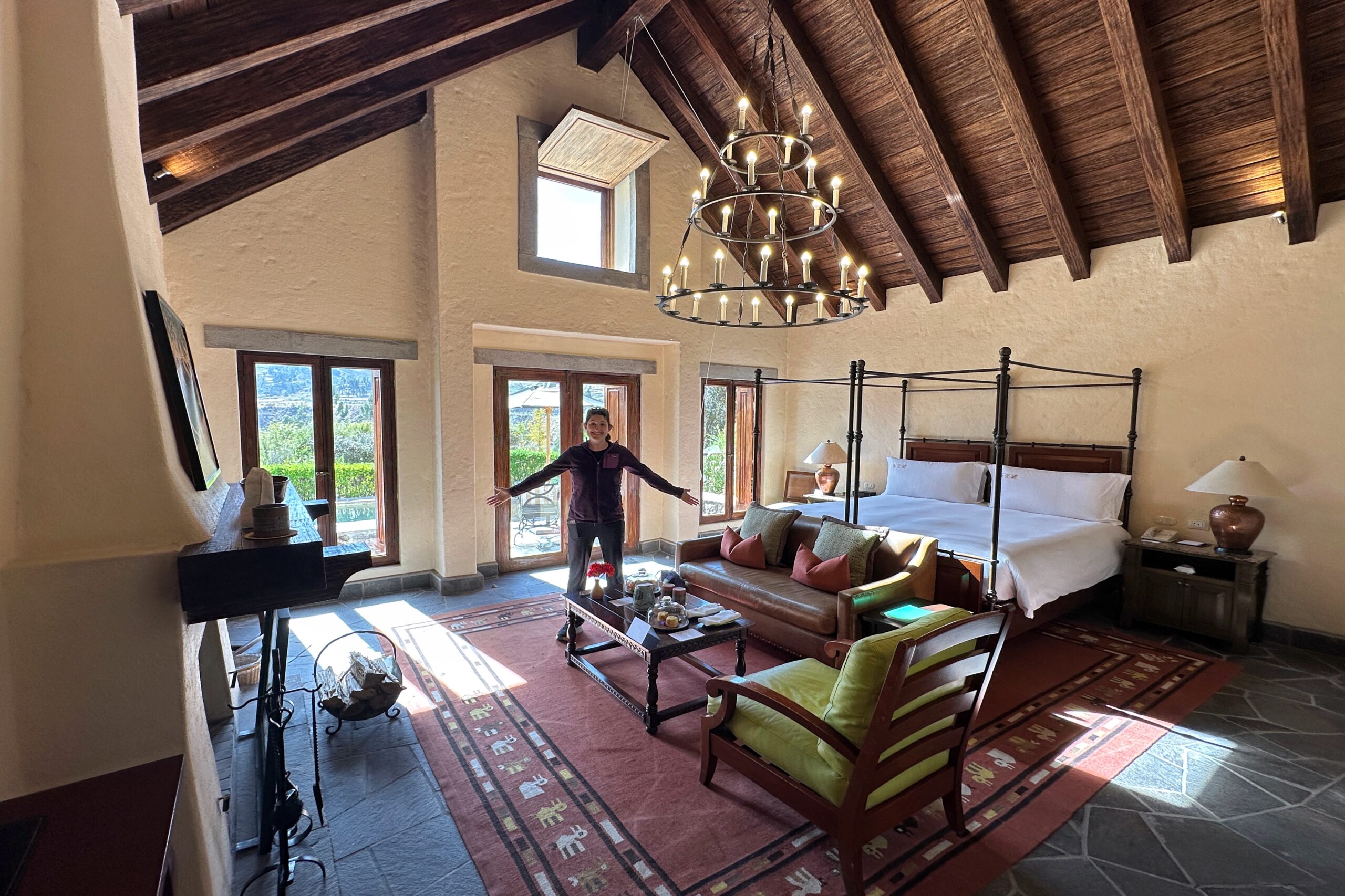
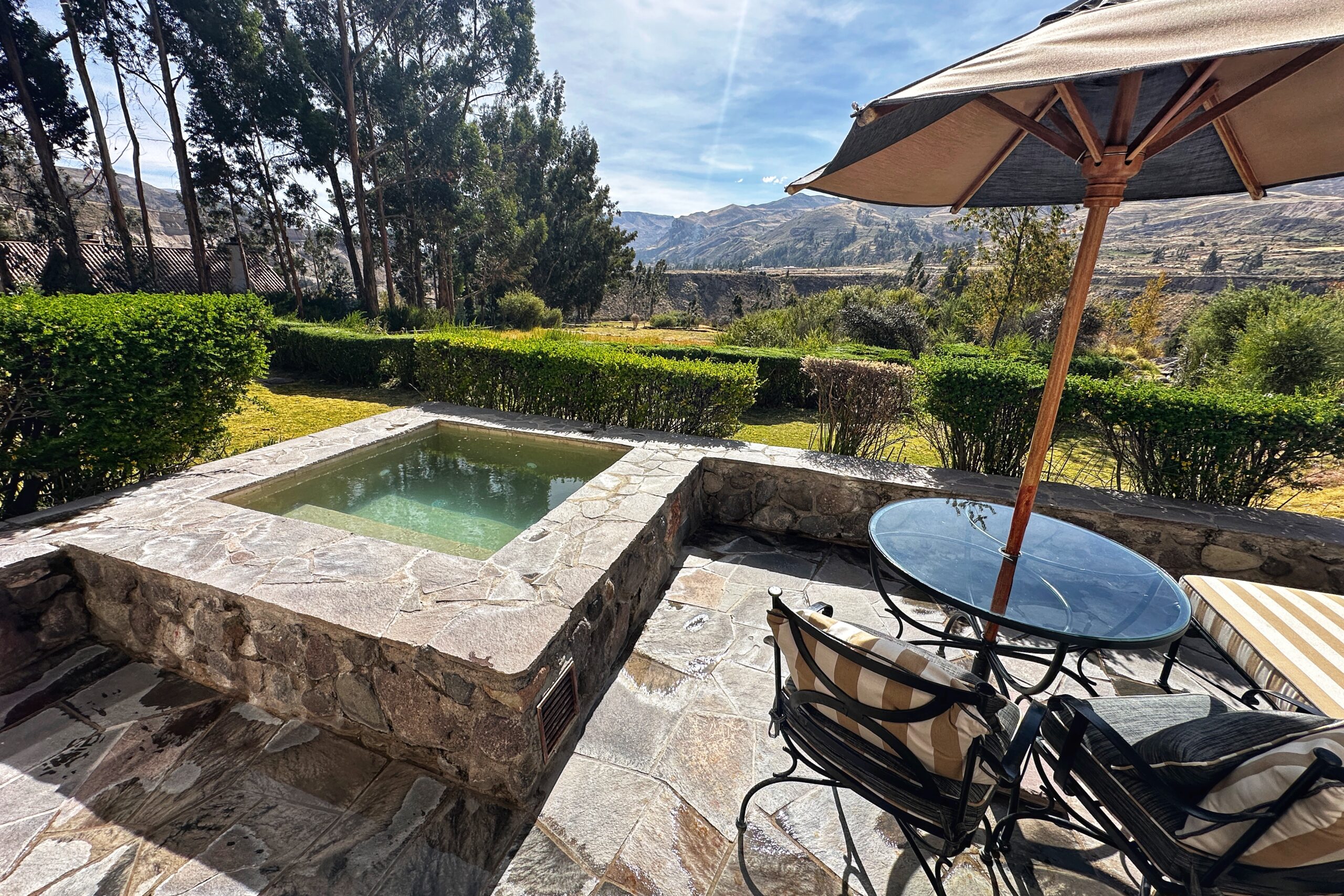
The hotel is called Las Casitas because each room is actually your own little house, complete with a fireplace, porch, plunge pool, and an entire bathroom wing. On the way to our Casita, we passed the pond where you can feed the fish, the pond where you can go fishing, and several grazing llamas and alpacas. We were shown about our new house and had the rest of the afternoon to relax with the complimentary minibar (again!).
La Casita
Vacation from vacation
The backyard
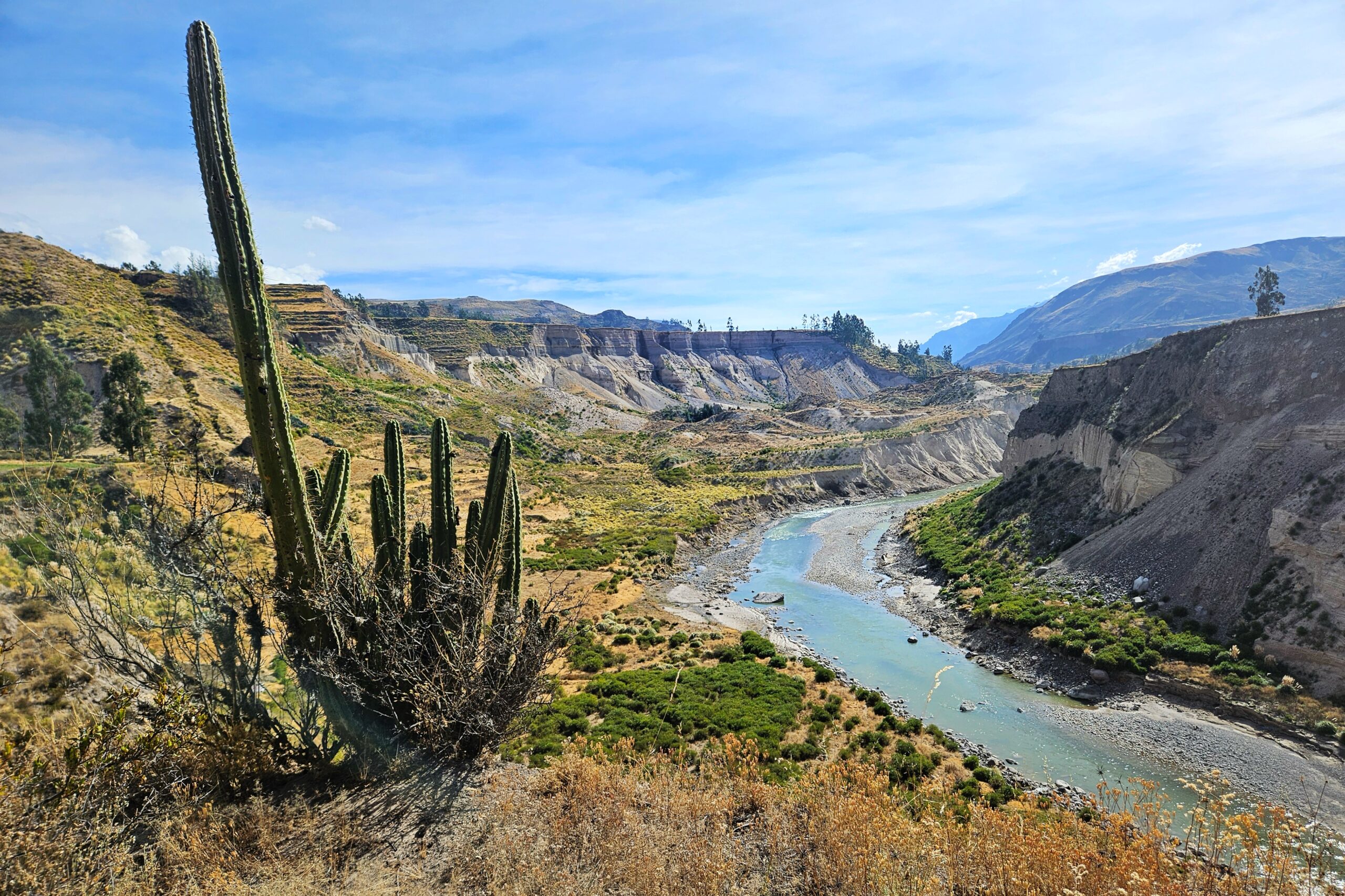
Taking it easy for the rest of the afternoon, Matt immediately dozed off for a nap. It’s June, so the locals act like they are freezing, but at 3600 meters with clear skies, napping in the midday sunshine is glorious. Meanwhile, Jo continued exploring the grounds — including the spa/pool, the working vegetable garden, and some walking trails that offered great views of the Rio Colca heading east into the Canyon. Later on, we both continued relaxing on the patio with our monoculars bird-watching. Very excited to unlock this new level of vacationing.
Rio Colca
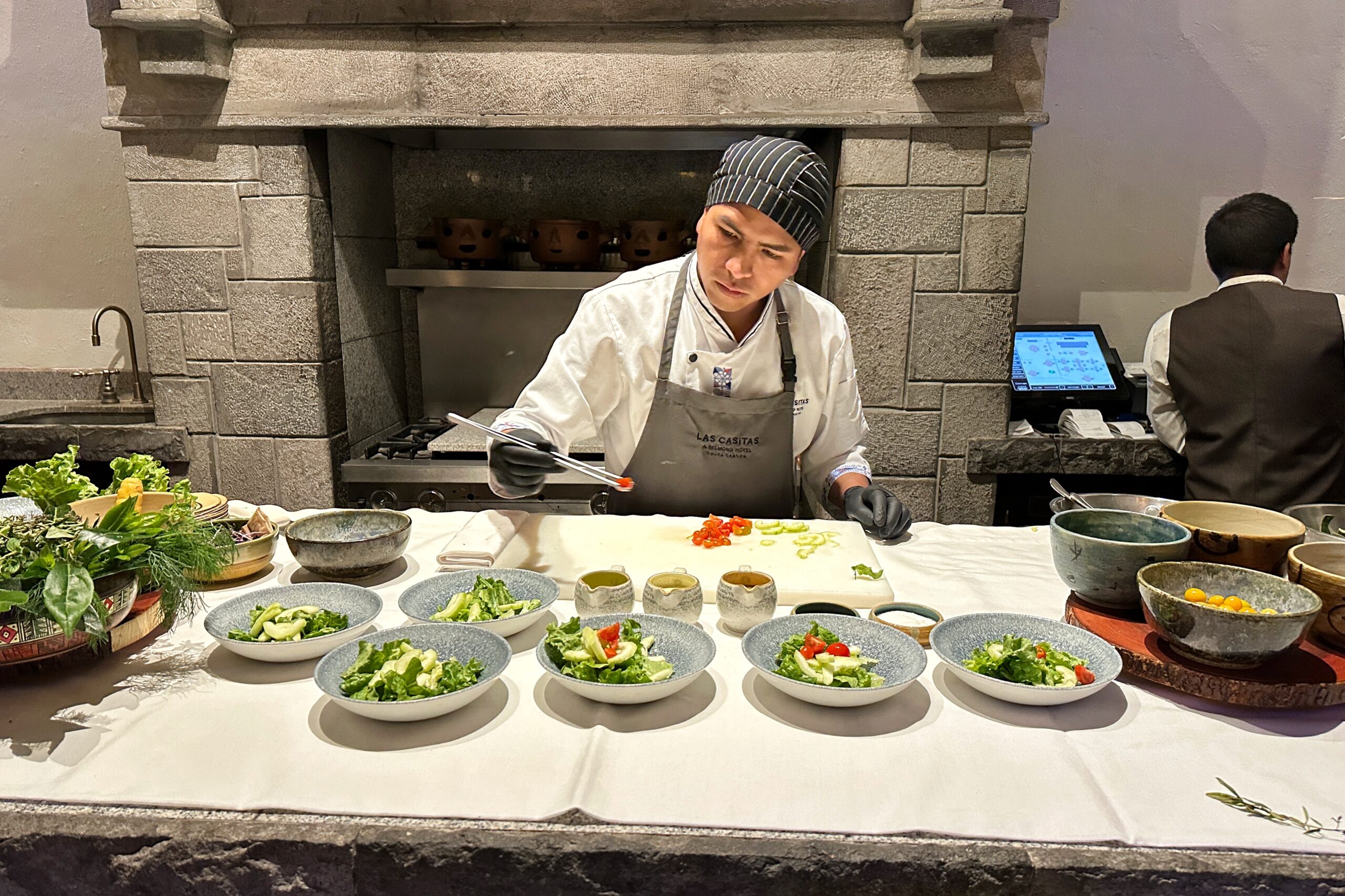
By 6PM, the sun had set, so we grabbed our house flashlight and made our way up to the restaurant. Prior to dinner there was a complimentary “cooking class” for guests, which was really just a salad preparation demonstration by Chef Mario. But that’s ok. Chef Mario constructed two incredible salads (wielding tongs with the precision of Mr. Miyagi) featuring fresh ingredients from the Las Casitas vegetable garden Jo was exploring earlier.
The first salad was lettuce, cucumber, and cherry tomatoes, as well as the herbs and a super delicious creamy lime dressing. The second salad was grilled eggplant and zucchini with a golden berry honey dressing. Both were amazing and we got the ingredient list to make the dressings at home. When Mario was done with the demonstration, we asked him what he recommended for dinner. He suggested the flame-broiled orange and pumpkin salad as a starter, and the slow-roasted braised lamb for the main course.
Super Mario salads
At dinner, Matt made sure to order those two dishes. Mario was spot-on. Both were great. Jo got trout and pineapple tartare in quinoa waffle cones (amazing) and rococo relleno (a traditional meat dish stuffed in a rococo pepper). It was so tasty and the right amount of spicy. We somehow managed to save room for dessert. Jo got the chocolate lava cake (obviously) and Matt once again asked for Mario’s recommendation. It was the carrot cake, and Mario proceeded to go three-for-three.
After dinner, we strolled back to our casita and quickly went to bed. Tomorrow’s adventure is horseback riding!